Ticker for October 10, 2022
MESONET TICKER ... MESONET TICKER ... MESONET TICKER ... MESONET TICKER ...
October 10, 2022 October 10, 2022 October 10, 2022 October 10, 2022
Ronald McDroughtald
Yeah, things are getting creepy all right. So much so that I even saw widespread
30s on the fantasy-cast! I know, right? Way too early for 30s, and somebody in
their 50s would know. Of course, 20s would be nice, but only if you're in your
60s, but it wasn't long ago that we were all in the 100s.
Wait, are we talking about age or temperatures?
Confused? Good, welcome to my world.
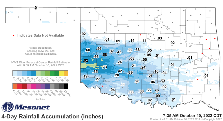
But hey, we've had some rain over the last few days. Not bad, not bad at all for
a select few.
Heck, it's raining right now for crying out loud! I've decided that's what I'm
gonna say from now on if it's raining whilst I'm Ticking.

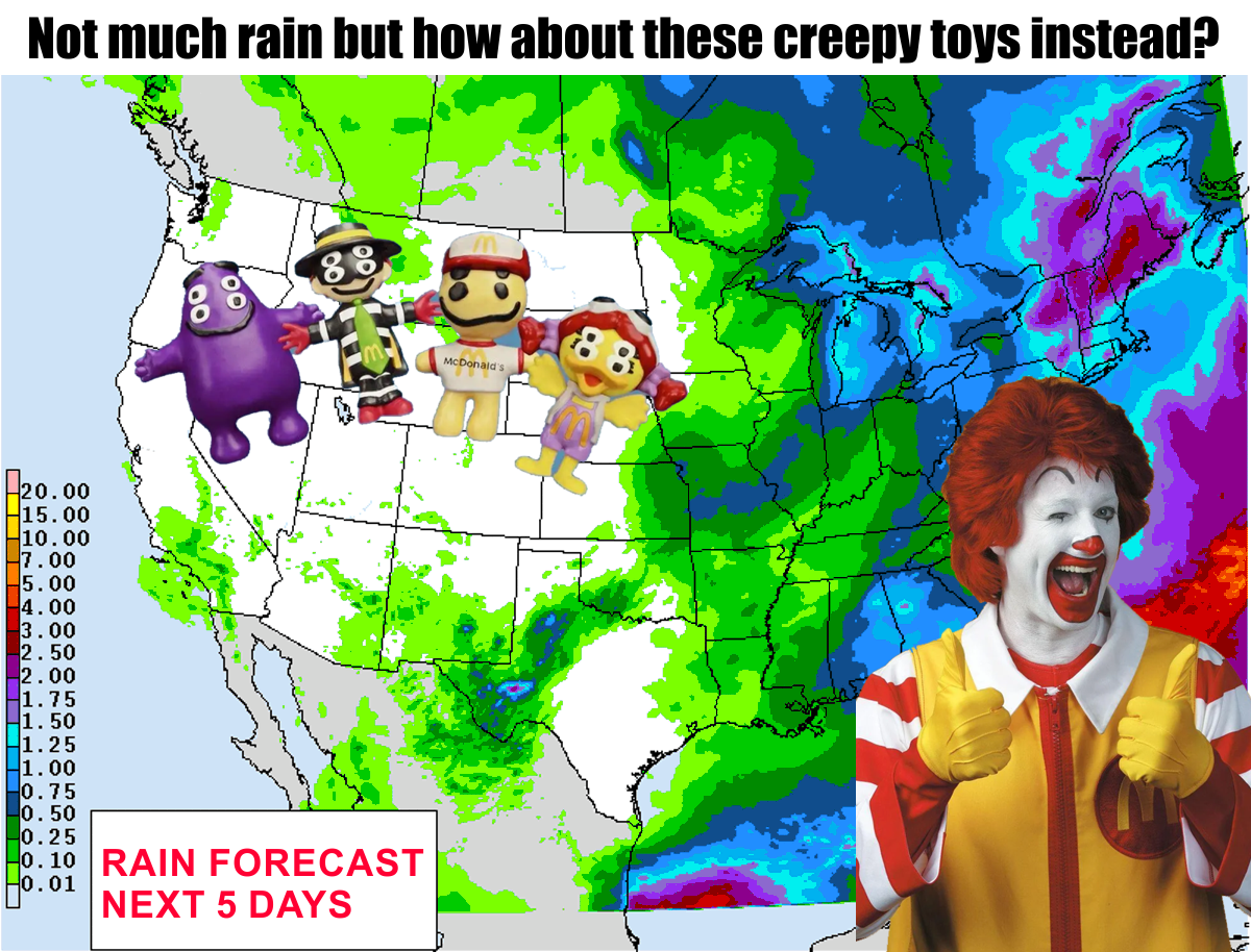
And more chances on the way! You can see some amounts above on our Ronald
McDonald terrorizing toys pic, but that's better than trying to pull a Ronald
McDonald Miller scam on us!
"Can't Buy Me Love" anyone?
Yeah, before he was McDreamy he was McNerdy, and a McManus knows his Mcs!
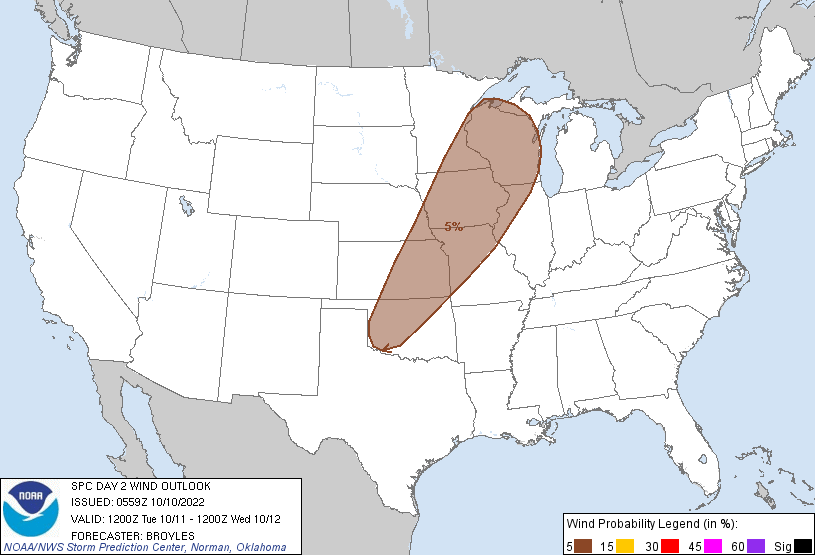
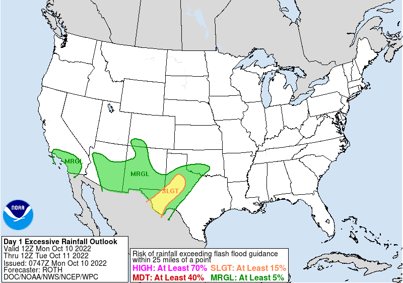
So those chances are pretty good across parts of Oklahoma today, and we will
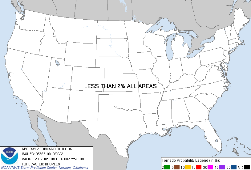
even have a chance of some hefty storms and heavy rainfall. Not widespread, I'm
thinking, but here and there if you're under the right storm. The severe storm
chances peak tomorrow, but not much to worry about.


We desperately need the rain. Despite what we've gotten over the last few days,
we're still moving forward from June 11 with our driest such (advancing) period
in the last 100 years at least.
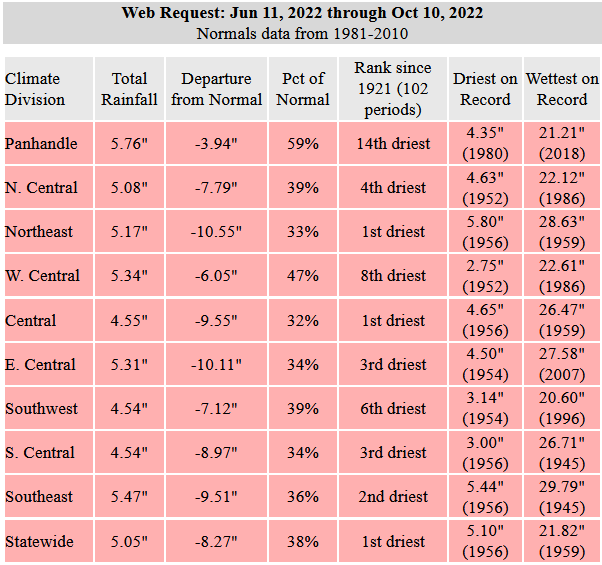
We're running out of time for relief during our secondary fall rainy season.
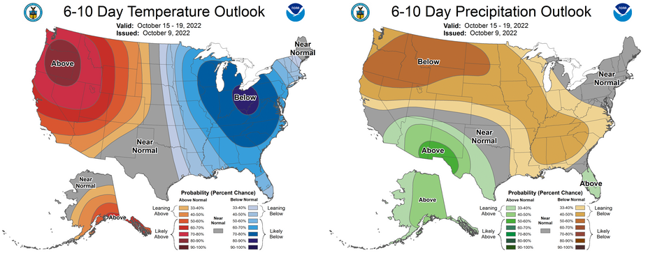
The pattern moving forward appears to show a big trough of low pressure over
the East, and a big ridge over the West. With counter-clockwise flow around that
low, and clockwise flow around the ridge, we'll be stuck with northwesterly
flow. You know what that means!
You don't? RATS! I don't either. Let me go look it up.
Okay, back. Yeah, that means period cold fronts but also no flow from the Gulf,
so DRY cold fronts.
I knew what it meant all along heh heh. Dammit Jim, I'm a Climatologist, not a
Synoptician! Wait, is your name Jim? Anyway...
Our big hope is that the cutoff low showing up across the Desert Southwest will
send us some rain chances, much like we're seeing now with a washed-out cutoff
low moving over us. But let's hope for good things over the next couple of days.
We'll worry about fantasy-cast stuff later.
Gary McManus
State Climatologist
Oklahoma Mesonet
Oklahoma Climatological Survey
gmcmanus@mesonet.org
October 10 in Mesonet History
| Record | Value | Station | Year |
|---|---|---|---|
| Maximum Temperature | 97°F | GRA2 | 2024 |
| Minimum Temperature | 21°F | BRIS | 2000 |
| Maximum Rainfall | 4.52″ | ANTL | 2004 |
Mesonet records begin in 1994.
Search by Date
If you're a bit off, don't worry, because just like horseshoes, “almost” counts on the Ticker website!