Ticker for October 9, 2015
MESONET TICKER ... MESONET TICKER ... MESONET TICKER ... MESONET TICKER ...
October 9, 2015 October 9, 2015 October 9, 2015 October 9, 2015
Sweaters? We don't need no stinking sweaters!
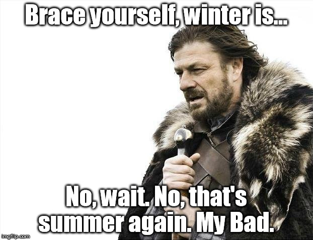
Sorry, but does this look like mid-October to you?

And get ready for more, because the heat, as they say, is on.
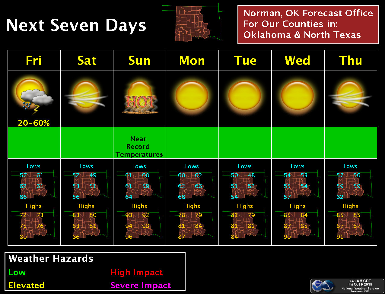
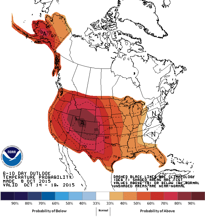
So that takes us out to Oct. 22 and it looks like warmer than normal weather
absolutely dominates through that period. Now keep in mind a pattern shift could
occur as we get deeper into that time frame...a buckle in the jet stream and a
dip down our way with some of that arctic air trapped up around the arctic circle.
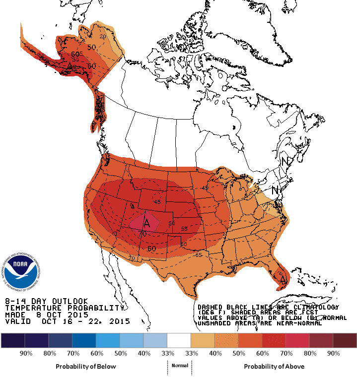
But if we look at modeled data even farther out, it's just not showing up. These
are a bit hard to look at, but for warmer than normal weather, as per usual, just
look for the oranges, reds, and even browns.

again, most of North America dominated by a ridge of high pressure and thus
warmer than normal weather. Probably not 90s like we'll see this weekend, but
much above seasonal norms. Again, unless a massive pattern change occurs, then
we're talking about first frosts and all that good (and by good, I mean bad)
stuff. And parts of the state are due for a freeze. Here are the average first
freeze and earliest first freeze maps, based upon the 1981-2010 normals.
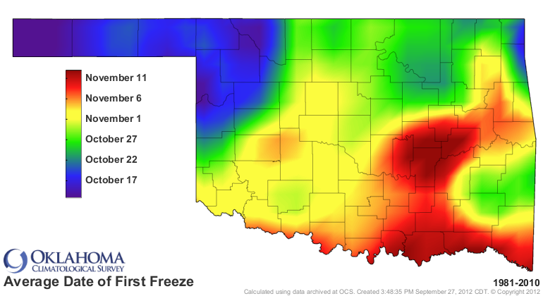
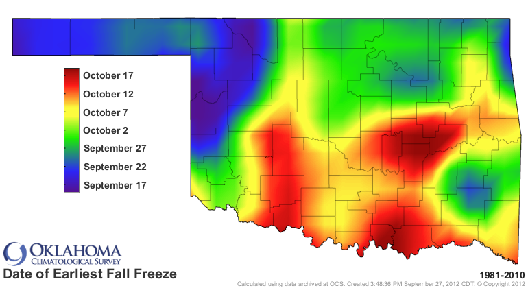
So the western Panhandle "normally" would have seen a freeze coming any day
now, but about a month or so away for the southeast. Not showing up at this
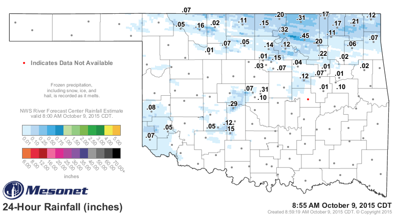
time, however. What about the rain? Well, it's raining now, and you should
enjoy it while it lasts, because there doesn't appear to be any major rain
chances on the horizon just yet.

That looks more impressive than it actually is, at least according to the
rainfall amounts thus far. But at least Osage County is getting a much needed
drink.
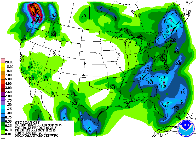
And what you see on this 7-day rainfall forecast is all from today through
tonight, basically. Other than that, death ridge city.
Chances of an inch or so of precip accumulating through the 24th, at least
according to our Canadian friends? Not good (and again, much of these chances
are predicated on what falls today.

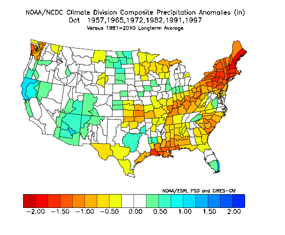
wondering what happened to El Nino. Again, that's later on for Oklahoma. Check
out this composite precipitation anomaly map for the U.S. based on the six
previous strong El Nino Octobers (1957, 1965, 1972, 1982, 1991, 1997).
Give it time. If (*****IF*****) it's gonna help, it'll be later rather than
sooner.
Gary McManus
State Climatologist
Oklahoma Mesonet
Oklahoma Climatological Survey
(405) 325-2253
gmcmanus@mesonet.org
October 9 in Mesonet History
| Record | Value | Station | Year |
|---|---|---|---|
| Maximum Temperature | 102°F | FREE | 2021 |
| Minimum Temperature | 16°F | ELRE | 2000 |
| Maximum Rainfall | 4.15 inches | WAUR | 1997 |
Mesonet records begin in 1994.
Search by Date
If you're a bit off, don't worry, because just like horseshoes, “almost” counts on the Ticker website!