Ticker for October 12, 2015
MESONET TICKER ... MESONET TICKER ... MESONET TICKER ... MESONET TICKER ...
October 12, 2015 October 12, 2015 October 12, 2015 October 12, 2015
Watch your butts today
Yeah, you heard me. No throwing your cigarette butts out the window (you should
never do that, obviously). But (same word, different spelling) if you do it
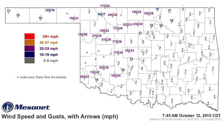
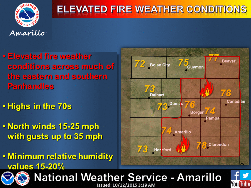
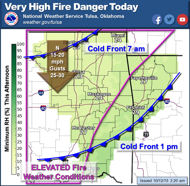
today, you could cause a fire. FIRE! Why? Well, we have a front moving through the
state as I type, and winds behind it are HOWLING from the N-NW at 15-25 mpg with
higher gusts.
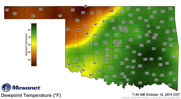
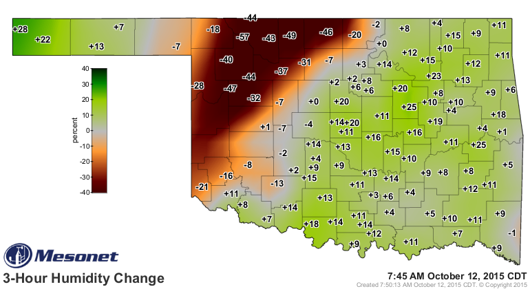
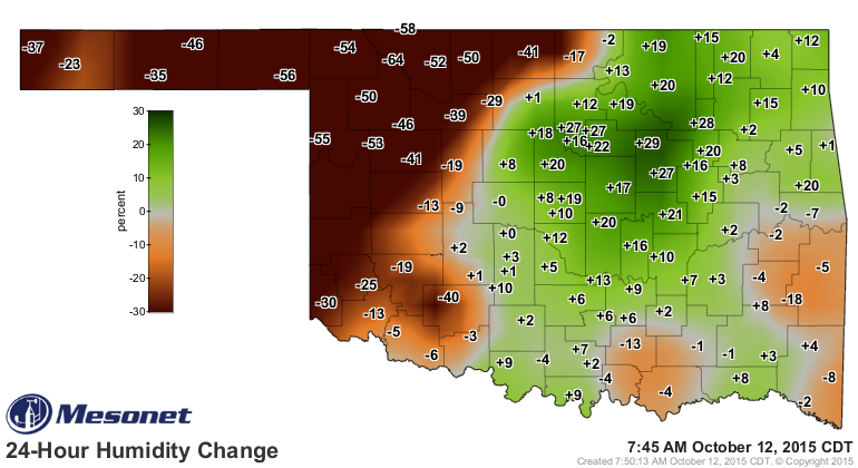
Relative humidity is expected to drop into the industrial strength Chapstick area
today, although it's already pretty dry behind the front.
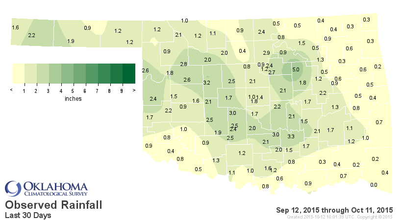
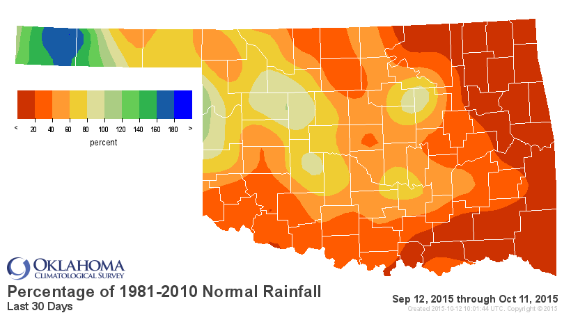
And all the rain lately
HAHAHAHAHAHAHAHA!!!
HAHAHAHAHAHA!!
HAHAHAHA
hahaha
oh
well, this is all you need to know about the rain.


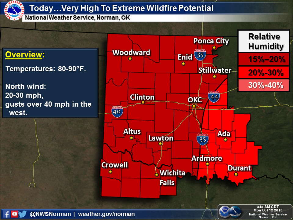
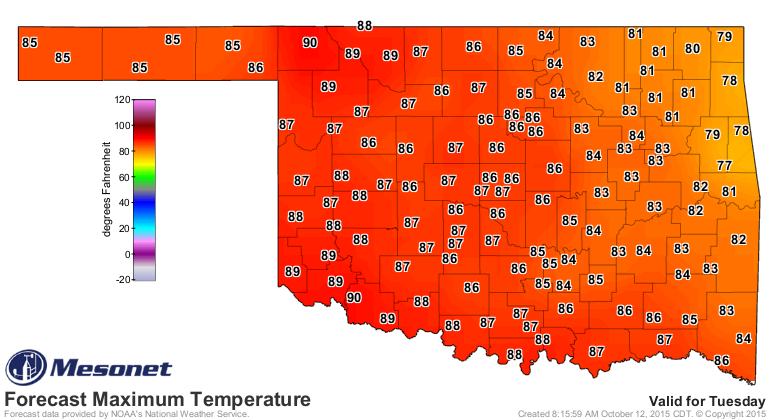
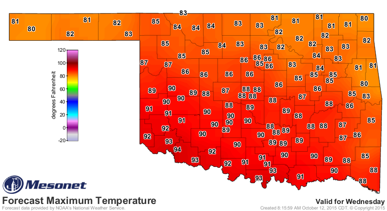
And let's not forget the heat. Yeah, October 12, otherwise known as "late
summer" in Oklahoma. Highs today despite the front will still warm up into the
80s and 90s.

And yesterday's highs were ridiculously hot for this time of year, reaching as
high as 97 degrees in SW OK. Temperatures were perilously close to records
yesterday.
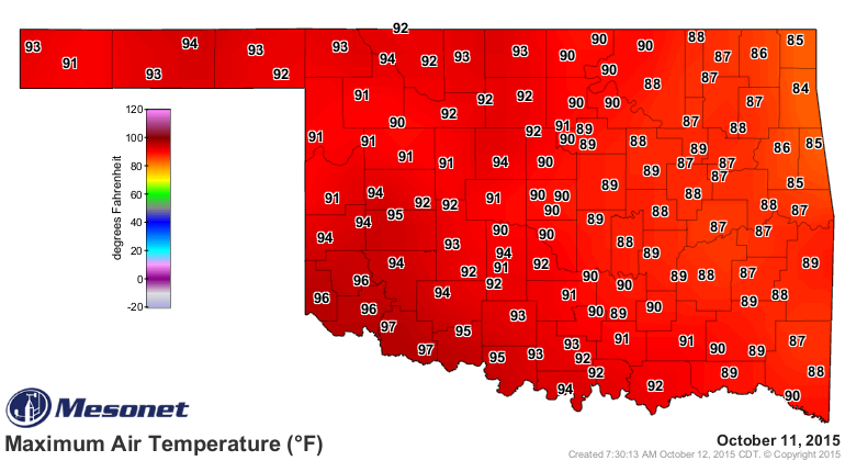
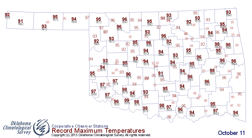
In fact, the 97 degrees you see at Tipton and Grandfield are tied for the 9th
highest ever recorded on Oct. 11 in the state of Oklahoma. Here are the few that
beat them, with the highs, location, then the year.
-***-
Warmest Maximums ...
1: 99 CHATTANOOGA 1979
2: 98 CLEVELAND 1 1931
3: 98 EUFAULA 6 SSW 1963
4: 98 HEALDTON 3 E 1979
5: 98 WAGONER 1963
6: 98 WALTERS 1979
7: 98 WAURIKA 1979
8: 98 WICHITA MTN WR 1979
-****-
All of this together spells high fire danger. The kind that can quickly get
out of control if the spark occurs.

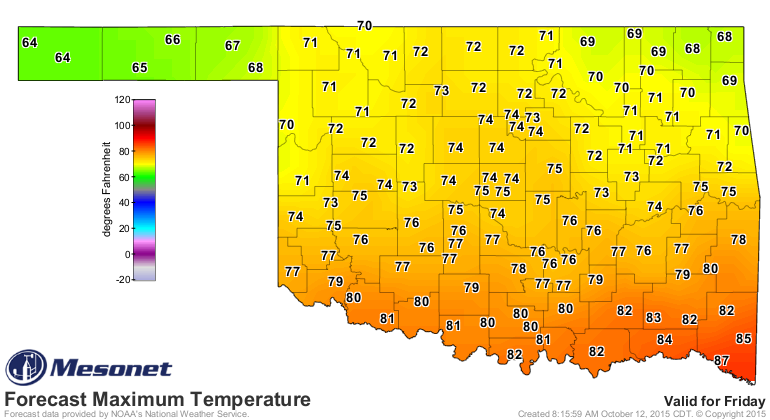
And the heat doesn't end there. Other than a few dips (and you know who you
are...especially if you throw your butts out the window!), the unusual heat
of fall 2015 will continue unabated for awhile.
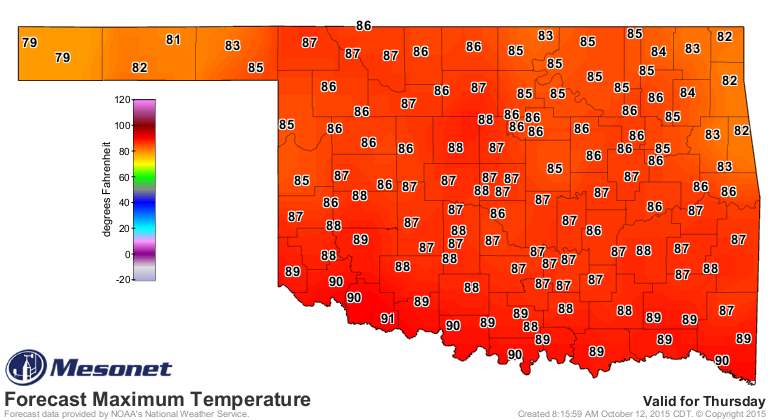
Another front on Friday, and then ANOTHER warm up.
Oct. 19-25 Temperature outlook
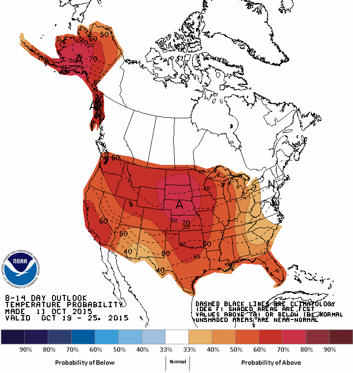
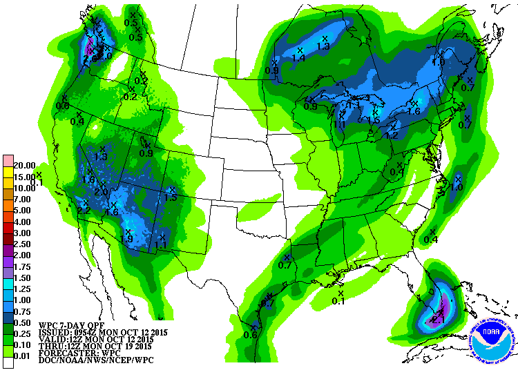
Not much chance of rain in the next week or so. We might get a small soaking
with that front later this week. You can also see that wayward upper-level low
pressure system is STILL meandering about the Desert Southwest, teasing us for
over a week now.
Enjoy the weather? I guess. It is nice out, but come on, we need the rain, and
we need some cooler weather. Do you really want to see kids sweating through
their Darth Vader costumes at the end of the month?
Turn around, don't drown, and also go back and pick up your cigarette butts!
Gary McManus
State Climatologist
Oklahoma Mesonet
Oklahoma Climatological Survey
(405) 325-2253
gmcmanus@mesonet.org
October 12 in Mesonet History
| Record | Value | Station | Year |
|---|---|---|---|
| Maximum Temperature | 99°F | MANG | 2024 |
| Minimum Temperature | 23°F | EVAX | 2019 |
| Maximum Rainfall | 2.92 inches | MIAM | 2016 |
Mesonet records begin in 1994.
Search by Date
If you're a bit off, don't worry, because just like horseshoes, “almost” counts on the Ticker website!