Ticker for January 9, 2024
MESONET TICKER ... MESONET TICKER ... MESONET TICKER ... MESONET TICKER ...
January 9, 2024 January 9, 2024 January 9, 2024 January 9, 2024
Ice Road Truckers
Okay, that'll just about cover winter for me, but we're just getting started. Did
ya spin out when you got out this morning (hopefully in your vehicle because
just spinning out by yourself would be rather weird)? Do you enjoy wind chills
in the single digits and teens?
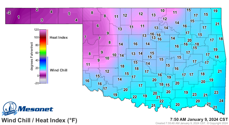
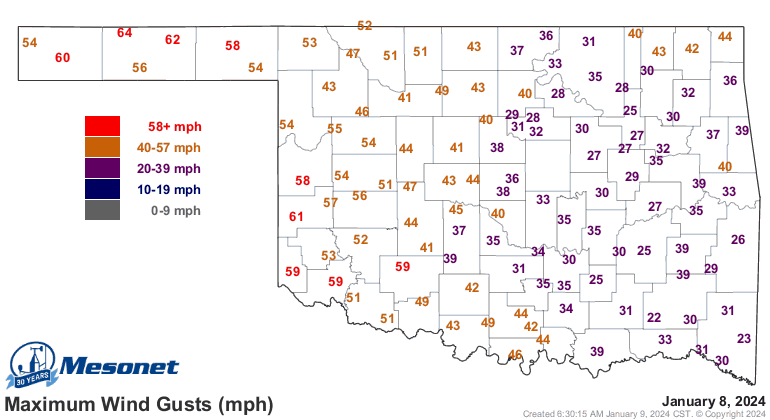
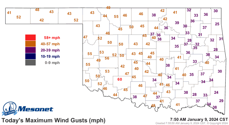
Did ya enjoy the snow blowing in the 40-60 mph winds?
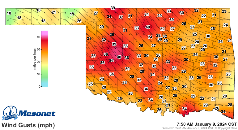
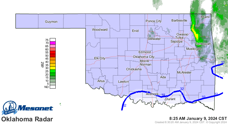
Heck, it's snowing right now for crying out loud!
Well where do we go from here? How about some of the coldest extended weather
since February 2021? No, it doesn't look like it will last as long, nor get
quite as cold, but we could possibly maybe end up from Monday (but maybe
Friday) through much of next week seeing temps below freezing and also dipping
well into the single digits and maybe lower. Grammar and tense be darned, I
hope that sentence--monstrosity that it is--conveys the sense of uncertainty
still remaining in the forecast models. Seems pretty certain we'll warm up
for a few days after today, then see a push of Arctic air on Friday, then
another reinforcing blast with COLD COLD COLD air around Monday. That latter
blast will possibly come with a major winter storm. Still iffy on that part,
but the cold cold COLD air looks much more certain.
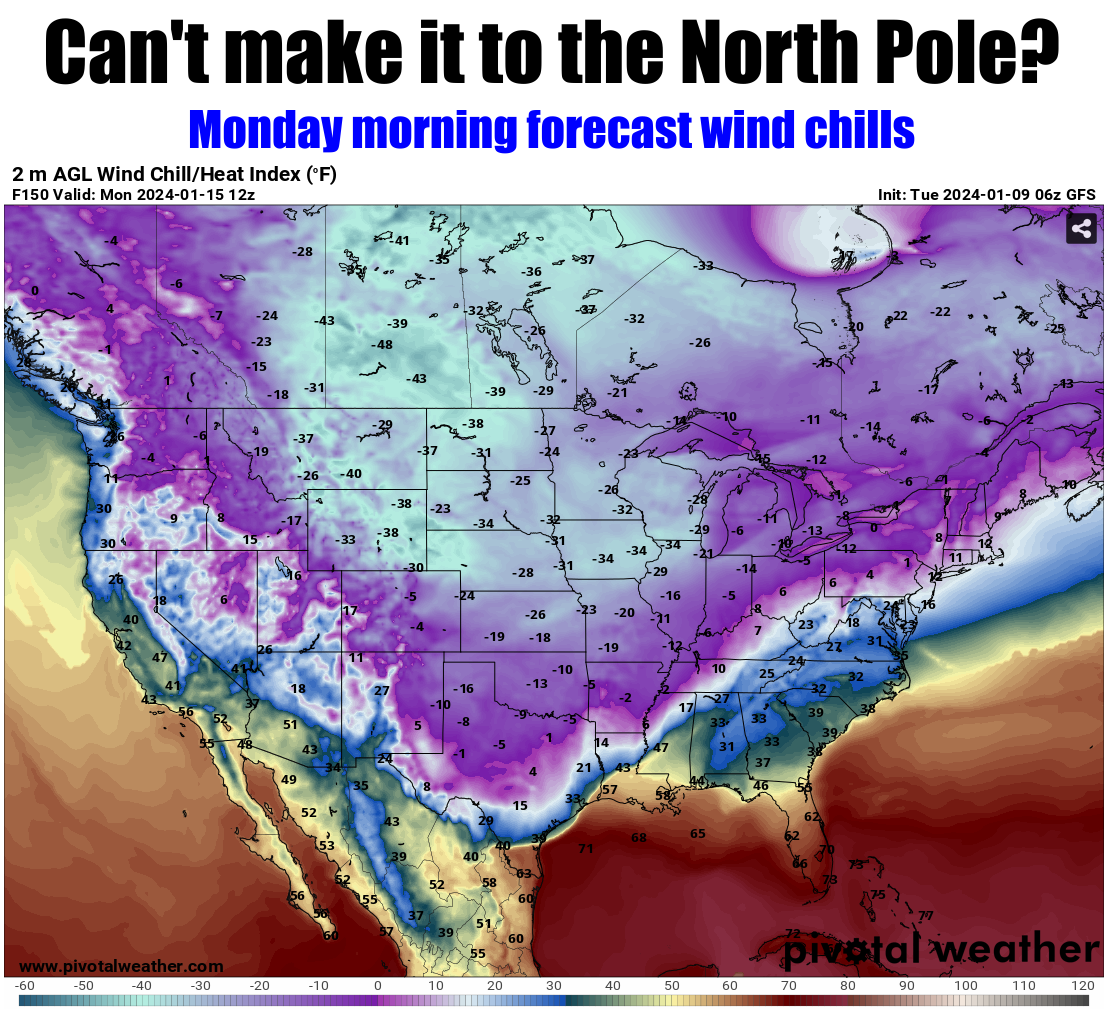
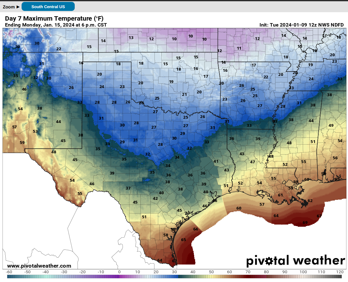
Check out the forecast lows and highs for Monday from the NWS, for example. And
remember, that's without the impact from the wind.

Some models bring the warm (relatively speaking) air back next Thursday, some
plow right through to the weekend. Things will shake out a bit better as we go
through the week, but at the least folks should be preparing for some of the
coldest weather we've seen in the state since Feb. 2021 that might stick around
for a few days, if not longer. February 2021-lite, I've been saying. Sure, we
have had some pretty cold days since then. Remember Dec. 23, 2022? Well I do.
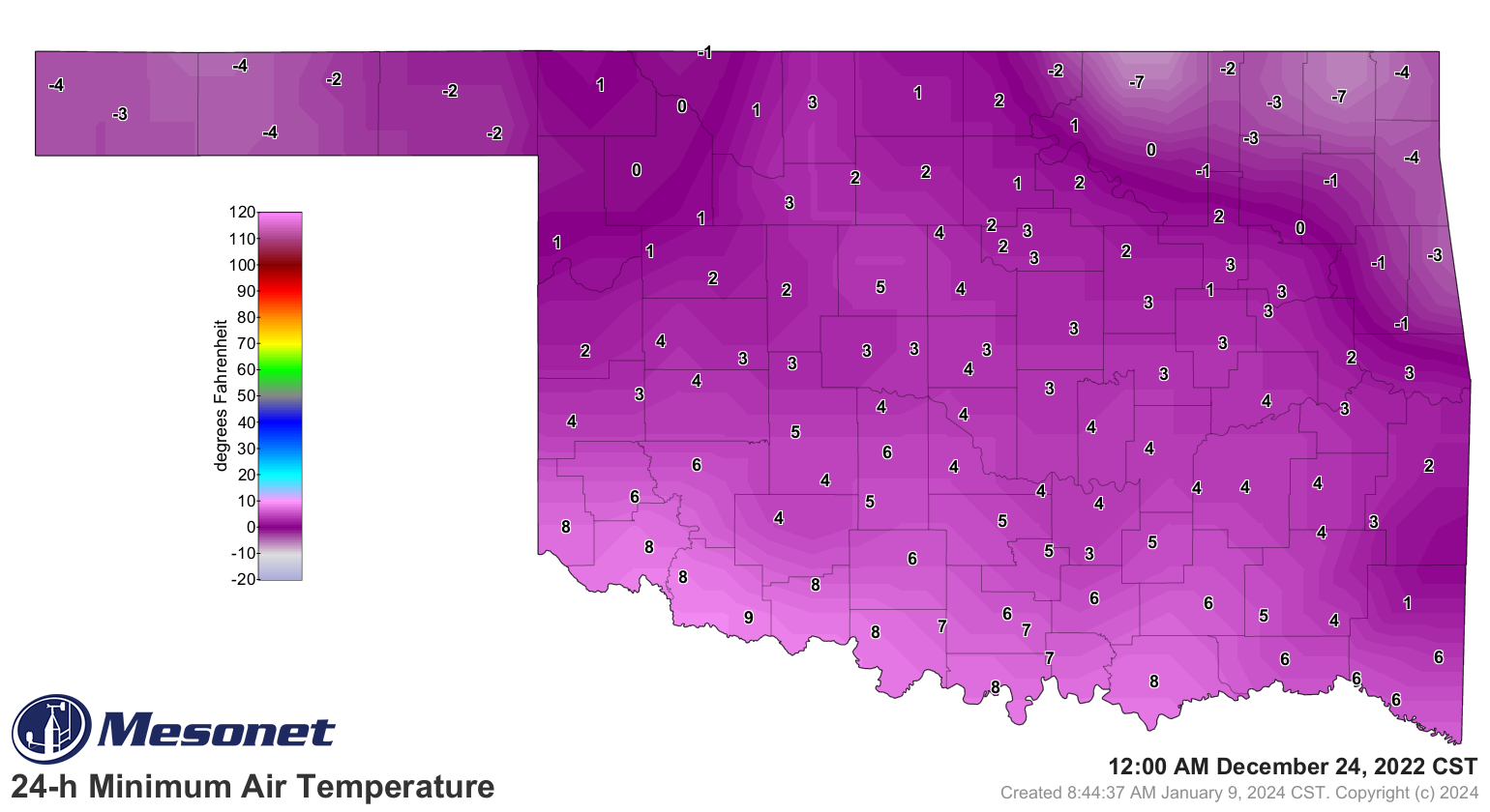
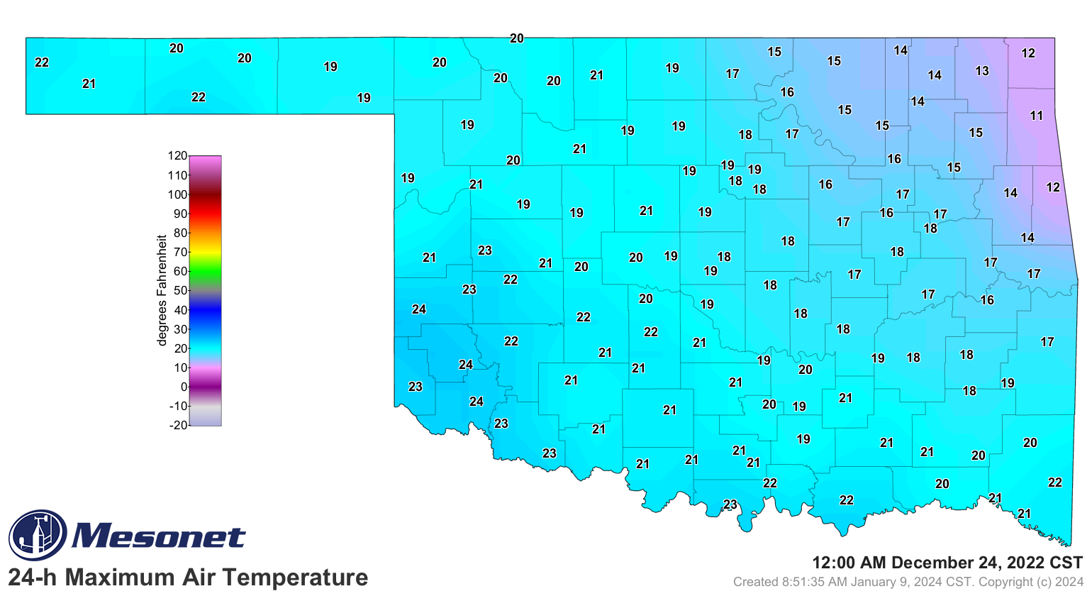
That's about the only cold air event that even comes close to Feb. 2021, and it
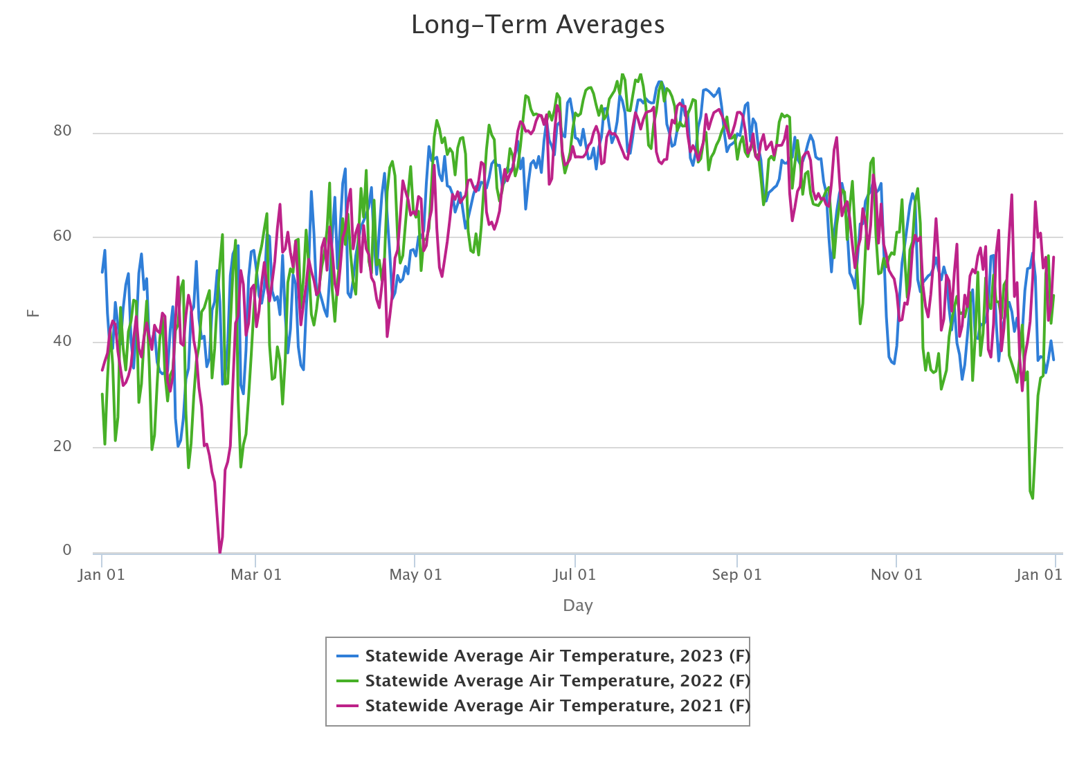
was fairly short-lived. Check out this graph with the statewide average temps
from 2021, 2022, and 2023 on it. Dec. 23, 2022, stands out, but is dwarfed by
Feb. 2021's nonsense.
Let's hope we are more Dec. 23, 2022-ish this go-round.
Gary McManus
State Climatologist
Oklahoma Mesonet
Oklahoma Climatological Survey
gmcmanus@mesonet.org
January 9 in Mesonet History
| Record | Value | Station | Year |
|---|---|---|---|
| Maximum Temperature | 81°F | ALTU | 2009 |
| Minimum Temperature | -4°F | JAYX | 2010 |
| Maximum Rainfall | 1.09″ | BROK | 2013 |
Mesonet records begin in 1994.
Search by Date
If you're a bit off, don't worry, because just like horseshoes, “almost” counts on the Ticker website!