Ticker for January 10, 2024
MESONET TICKER ... MESONET TICKER ... MESONET TICKER ... MESONET TICKER ...
January 10, 2024 January 10, 2024 January 10, 2024 January 10, 2024
February 2021-lite
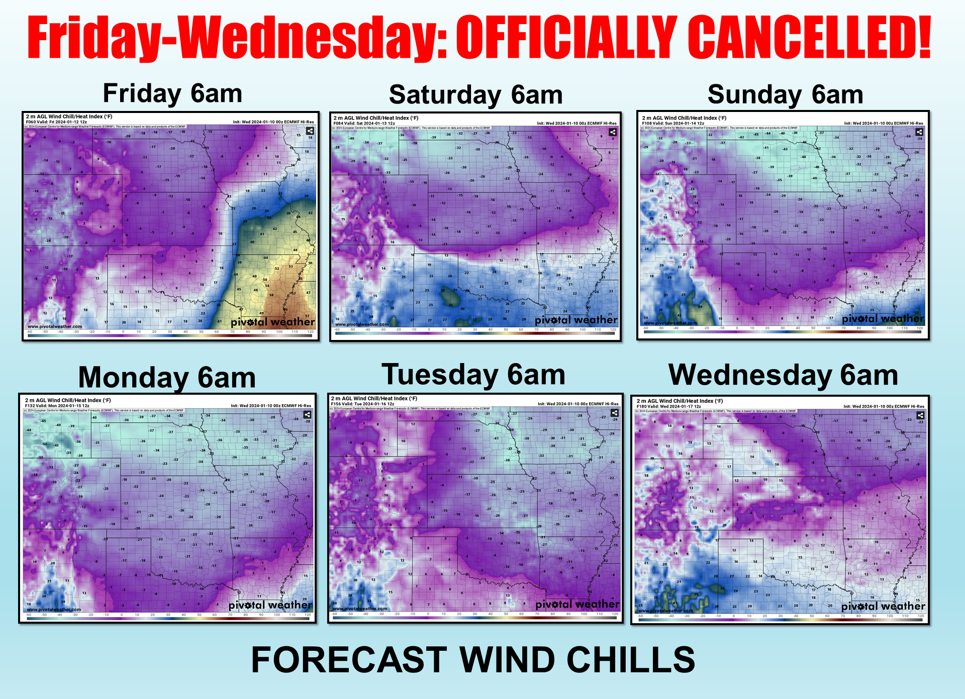
Want to see something really scary? Check this out.
I know, right? But ya wanna see something even MORE terrifying? Well check THIS
out!
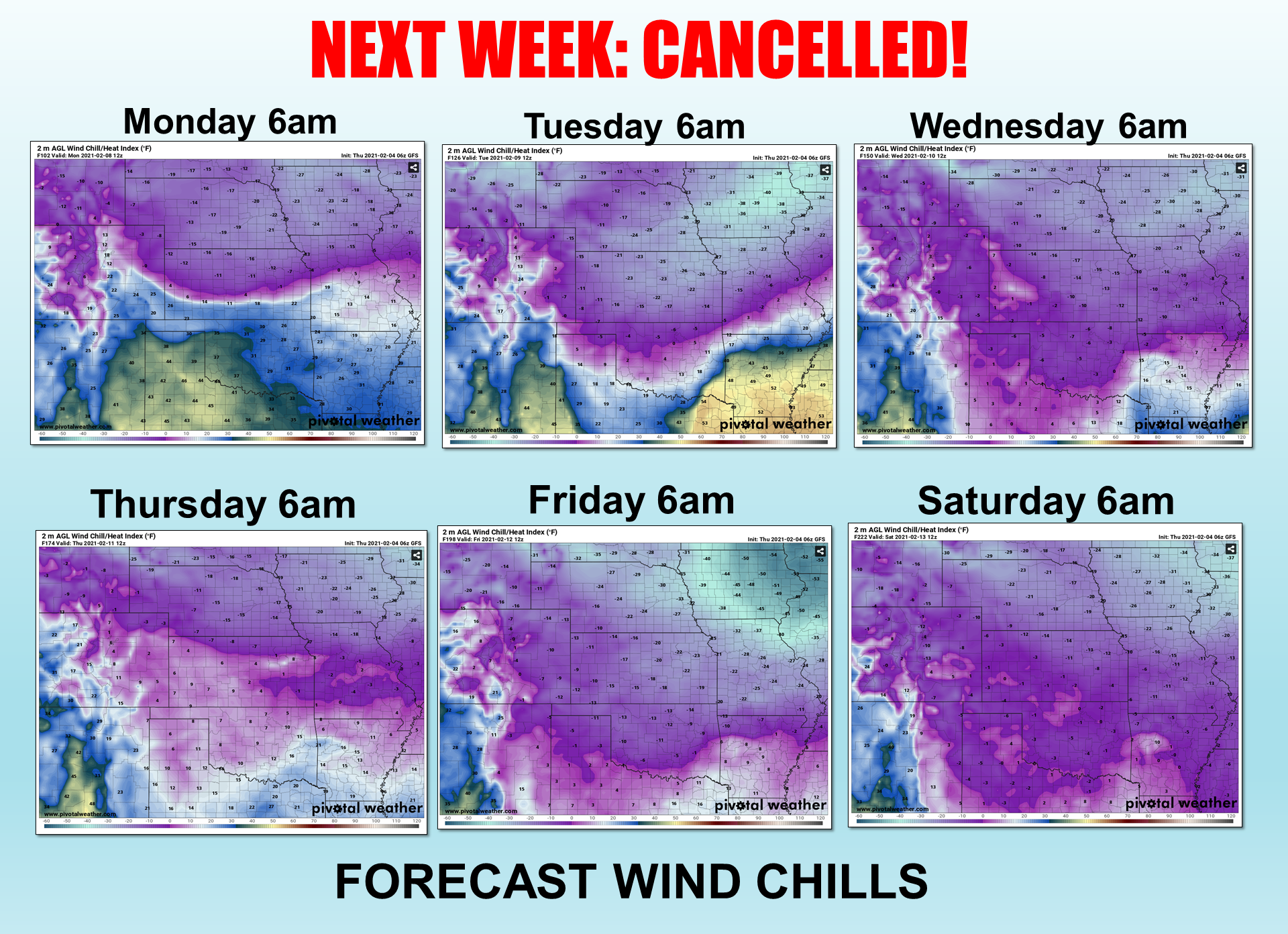
I KNOW, RIGHT? That was my preview of our February 2021 Deep Freeze event, and
darned if it didn't end up worse than that.
Oh by the way, I didn't have room to add on a 7th day from next week, so here it
is.

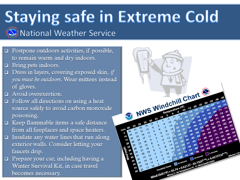
Now those are all wind chills, because the most deadly part of the cold snap
will be for those out in it, but we know from experience back in 2021 that
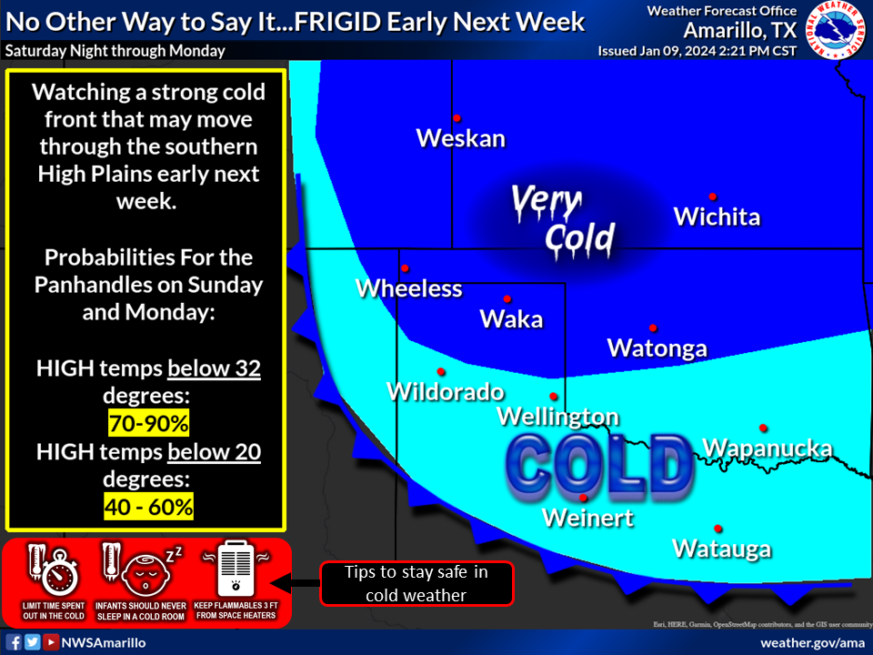
a lot of preparations are needed to get ready. Here's what our local NWS offices
have to say about it.

But Monday will be the most dangerous day, as shown here by the Norman NWS
office.

Here are the actual lows and highs forecast for Monday.
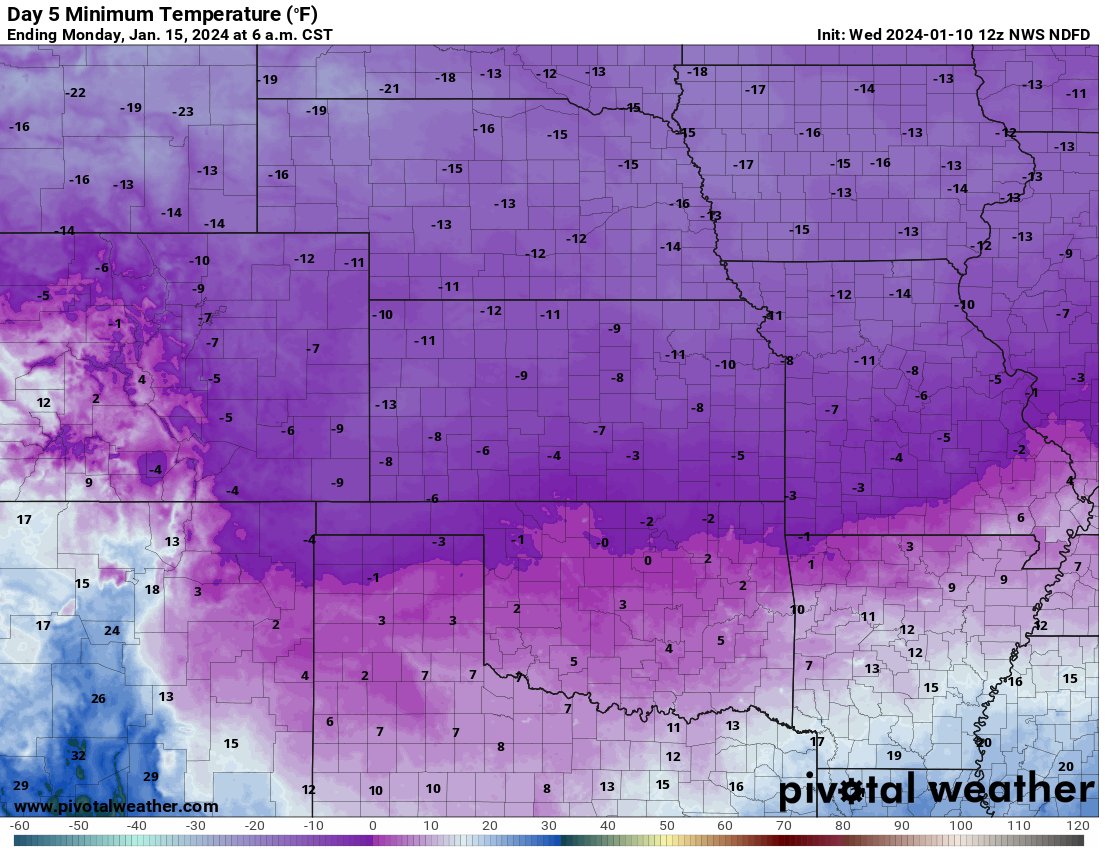
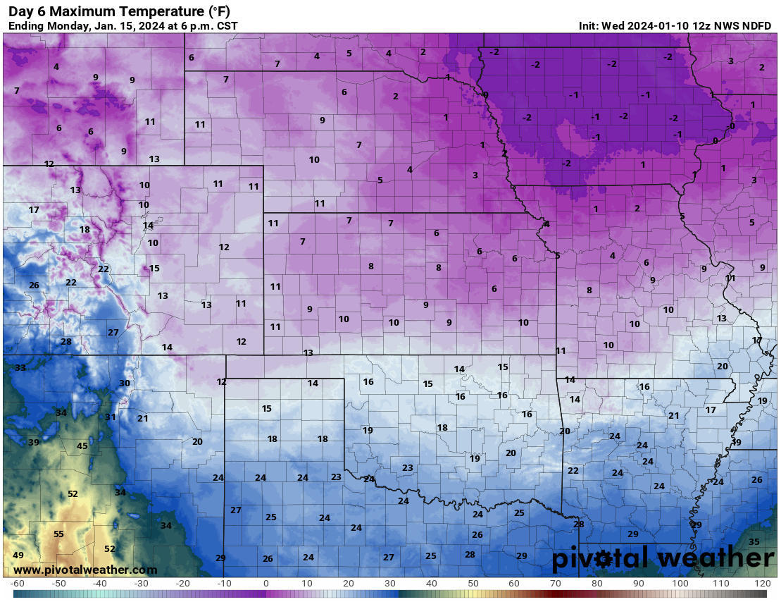
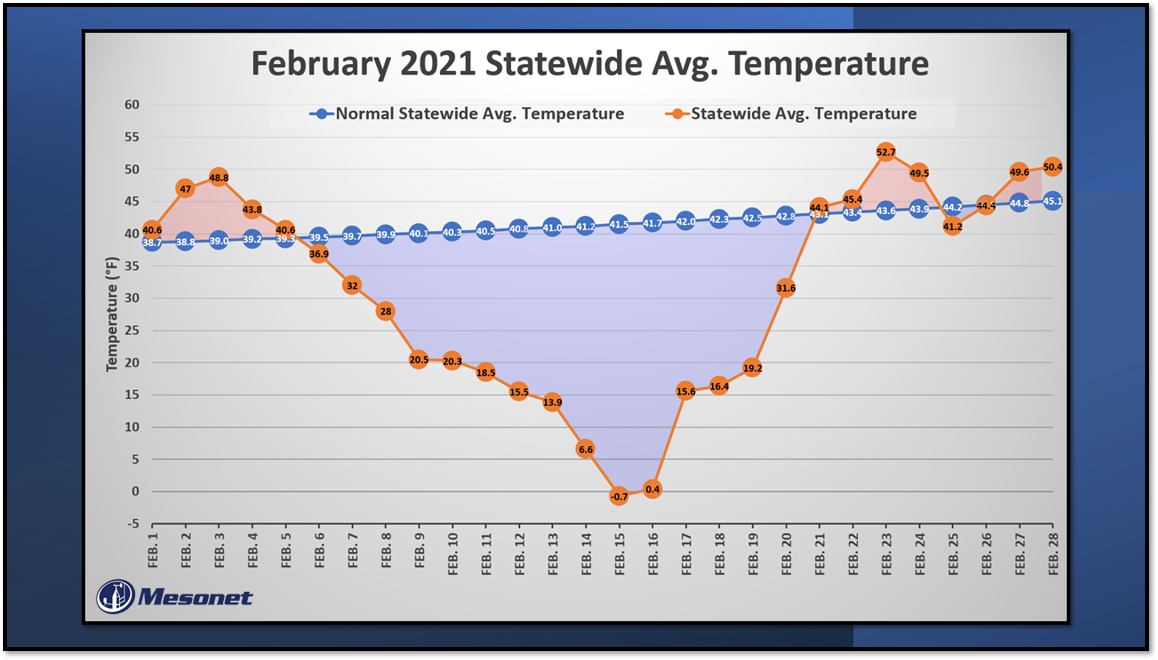
All in all, it won't be as bad as the February 2021 event (fingers crossed,
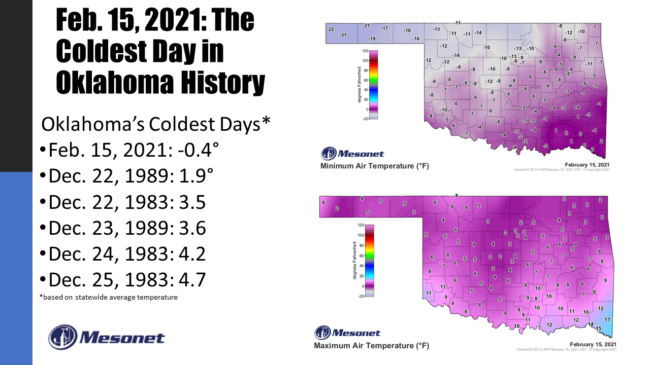
legs crossed, eyes crossed). I don't think we'll see the coldest day in
Oklahoma history, at least. Again, from February 2021.
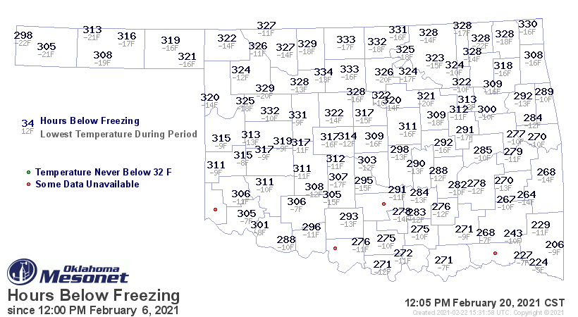
But we will see a good 4-5 days below freezing for parts of the state (i.e.,
northern Oklahoma, maybe expanding south). And 120 consecutive hours below
freezing is nothing to sneeze at. But it won't match February 2021, which saw
Lahoma go 334 consecutive hours below freezing.
SAY FEBRUARY 2021 AGAIN!
Well sorry, but it IS the latest event we have to compare it to, and at least
it should pale in comparison to that one. Hence, February 2021-lite. For our
final comparison, the absolute depth and duration of the cold will not come
close (cross anything ya got!).
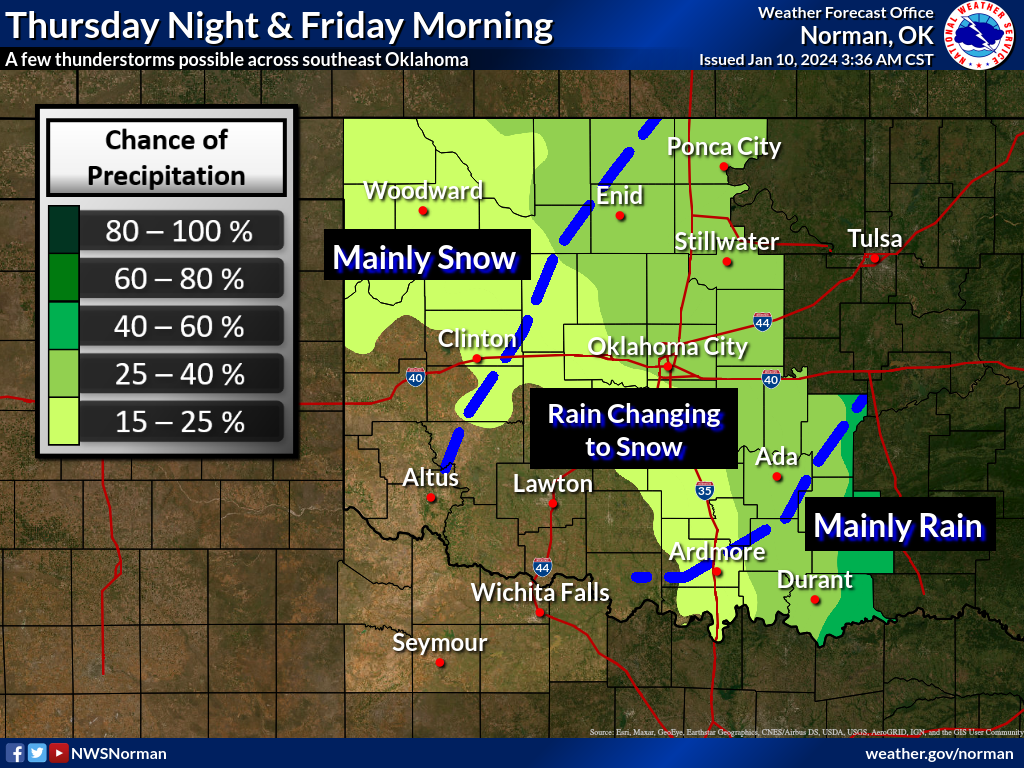
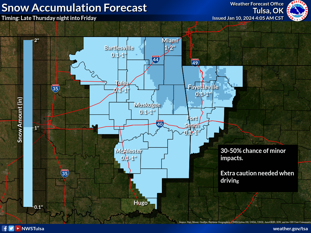
Snow could complicate things, and it certainly did back in February 2021. It
sort of acts like a deep freeze, keeping things ensconced in ice a lot longer
than what we would normally see. It reflects the suns rays back to space, and
helps lower temps at night, especially on a clear night. Thursday night into
Friday looks pretty weak as far as snowstorms go, with maybe an inch or two
up in far NE OK.
The bigger snow threat will come on Monday, which for parts of the state could
turn into a major snowfall (hey, Major Snowfall was my band's name in the
French Foreign Legion!) event. Right now, the model output is showing increased
odds of a 4-inches+ snow event possible across the NE half of the state, but
some individual runs are seeing up to a foot of snow. That can and probably
will change a lot in the next 5 days leading up to the event, but check this
out for fun.
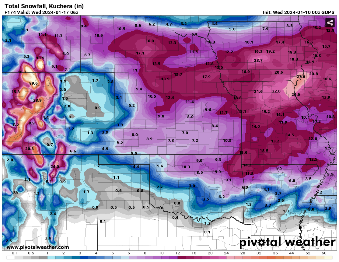
Oh yeah, I definitely chose the craziest model. Those Canadians are crrrrazyyy!
Gary McManus
State Climatologist
Oklahoma Mesonet
Oklahoma Climatological Survey
gmcmanus@mesonet.org
January 10 in Mesonet History
| Record | Value | Station | Year |
|---|---|---|---|
| Maximum Temperature | 84°F | BURN | 2023 |
| Minimum Temperature | -6°F | VINI | 2010 |
| Maximum Rainfall | 4.31″ | MADI | 2020 |
Mesonet records begin in 1994.
Search by Date
If you're a bit off, don't worry, because just like horseshoes, “almost” counts on the Ticker website!