MESONET TICKER ... MESONET TICKER ... MESONET TICKER ... MESONET TICKER ...
December 8, 2016 December 8, 2016 December 8, 2016 December 8, 2016
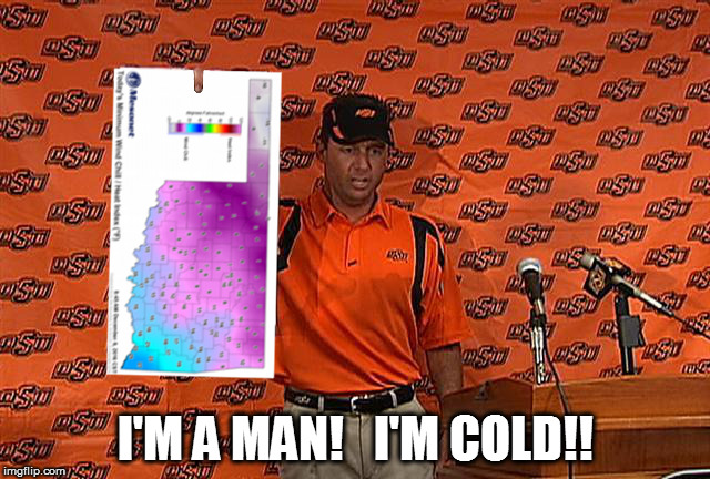
Call another play
http://ticker.mesonet.org/archive/20161208/gundy.jpg
I agree with Coach Gundy. I'm cold. And for once, I'm glad I'm not in the
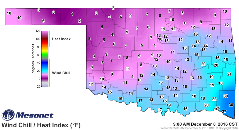
Panhandle. You can't read the figures on that map, probably, so here it is again
for your consumption...the minimum wind chills recorded by the Mesonet today.
http://ticker.mesonet.org/archive/20161208/todays-min-windchills.png
Minus 15 in the Panhandle? Are you kidding me? That's the lowest windchill we've
seen on the Mesonet since we hit -15 at Boise City back on Jan. 5, 2015! Heck,
the windchills now are still in the single digits across much of the NW half of
the state, and they're not much better over the rest.
http://ticker.mesonet.org/archive/20161208/current-windchills.png
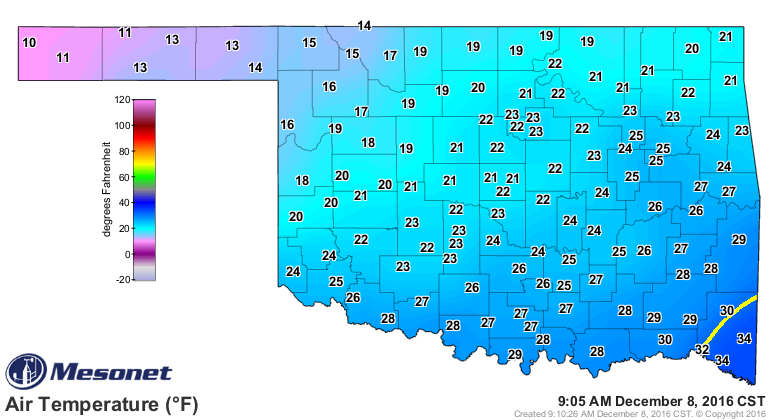
And if you're unlucky enough to be outside, but lucky enough to be out of the wind,
well sorry, you're still freezing your tail end off. Actual air temperatures are
down into the teens and 20s (we'll ignore far SE OK for now...they'll get theirs
soon)
http://ticker.mesonet.org/archive/20161208/current-temps.png
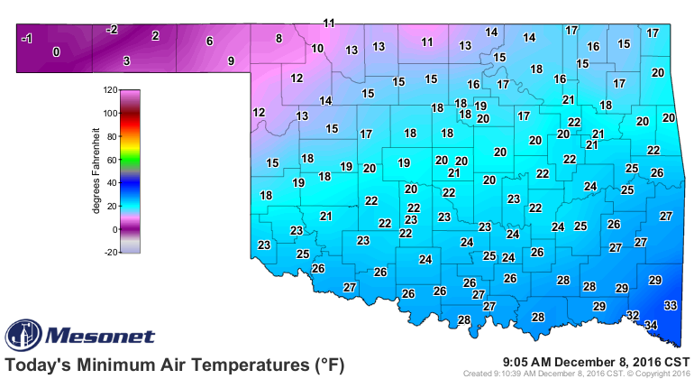
after also dropping to below zero in the Panhandle earlier this morning, with
teens and 20s to the SE of there. The -2 degrees recorded at Eva is the lowest
reading recorded by the Mesonet since Kenton dropped to -3 degrees way back on
Jan. 23, 2015.
http://ticker.mesonet.org/archive/20161208/todays-lows.png
It could be worse...go a bit to the NW and you get windchills down into the
minus teens and 20s.
http://ticker.mesonet.org/archive/20161208/current-US-windchills.png
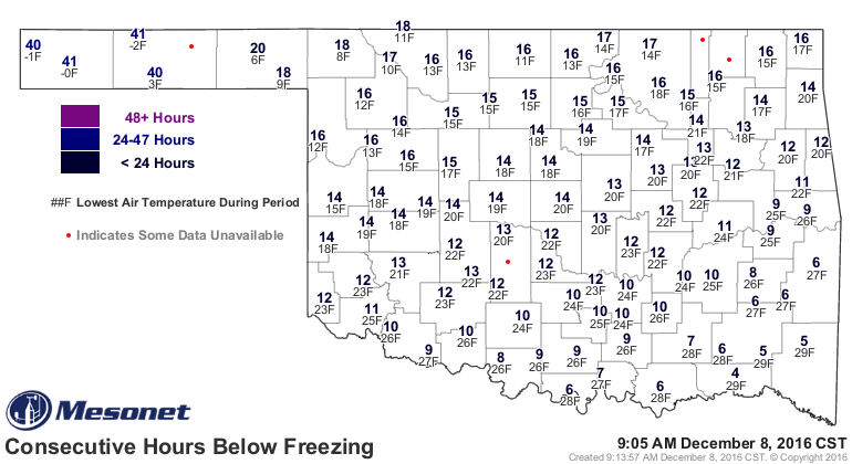
The Panhandle stations have been below freezing for over 40 hours now in some
cases, and the rest of us for a good 12 hours or so.
http://ticker.mesonet.org/archive/20161208/cumulative.freeze.consecutive.gif
It's a sad state of affairs considering the Panhandle was seeing temps in the
50s and 60s just three days ago. Take Eva, for instance, of -15 degrees windchill
fame from this morning. You can obviously see where things (the cold front) went
south for them on Monday.
http://ticker.mesonet.org/archive/20161208/last7days-EVA.png
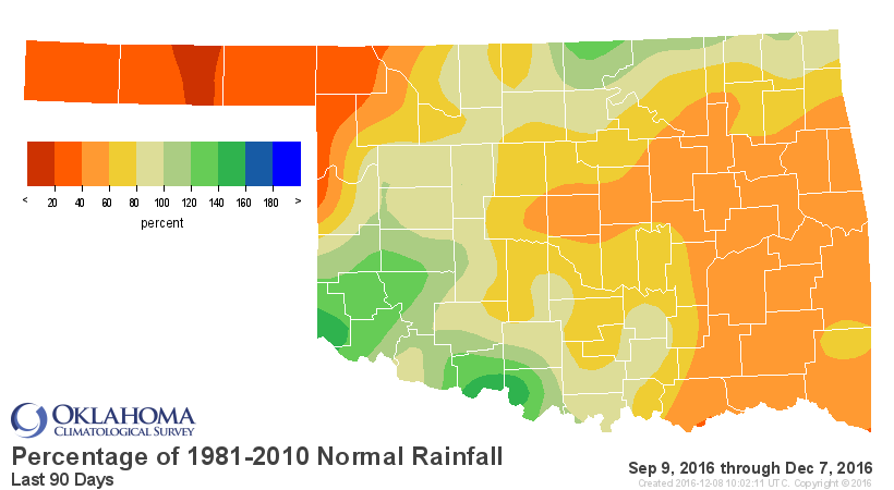
Also unfortunate (or fortunate, given the temperatures), this series of fronts
were also dry for the most part, so this
http://ticker.mesonet.org/archive/20161208/last30dayspct.png
http://ticker.mesonet.org/archive/20161208/last60dayspct.png
http://ticker.mesonet.org/archive/20161208/last90dayspct.png
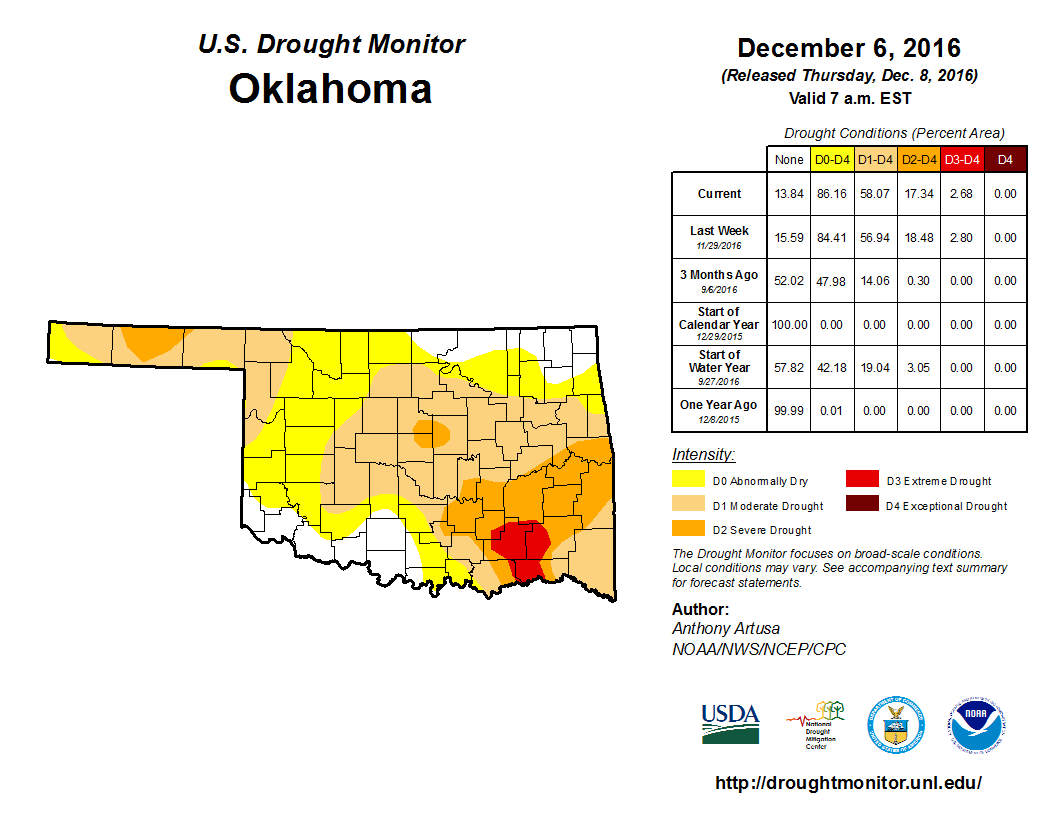
begets this.
http://ticker.mesonet.org/archive/20161208/20161206_OK_trd.png
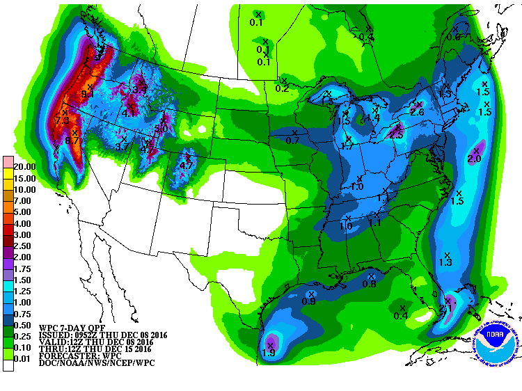
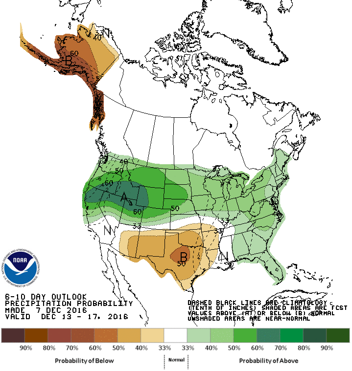
And unfortunately (again!), this
http://ticker.mesonet.org/archive/20161208/7day-precip-forecast.gif
http://ticker.mesonet.org/archive/20161208/dec13-17-precip-outlook.gif
http://ticker.mesonet.org/archive/20161208/dec15-21-precip-outlook.gif
begets us nowhere.
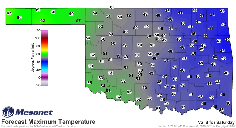
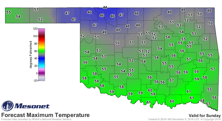
As far as temperatures go, never fear. By this weekend, we will (take it away,
Coach Switzer)
http://ticker.mesonet.org/archive/20161208/half-a-hundred.jpg
http://ticker.mesonet.org/archive/20161208/saturday-forecast-highs.png
http://ticker.mesonet.org/archive/20161208/sunday-forecast-highs.png
Rah Rah Rah, Sis Boom Bah...GOOOOOOOOOOOO SPRING!
Gary McManus
State Climatologist
Oklahoma Mesonet
Oklahoma Climatological Survey
(405) 325-2253
gmcmanus@mesonet.org
==================================================
The OCS/Mesonet Ticker
https://ticker.mesonet.org/
To subscribe or unsubscribe from the Ticker
or for questions about the Ticker or its content
Phone or Email the Ticker Manager at OCS
Phone: 405-325-2253 Email: ticker@mesonet.org
---------------------------------------------------
-C- Copyright 2024 Oklahoma Climatological Survey
===================================================
|


 Tweet
Tweet