Ticker for November 8, 2018
MESONET TICKER ... MESONET TICKER ... MESONET TICKER ... MESONET TICKER ...
November 8, 2018 November 8, 2018 November 8, 2018 November 8, 2018
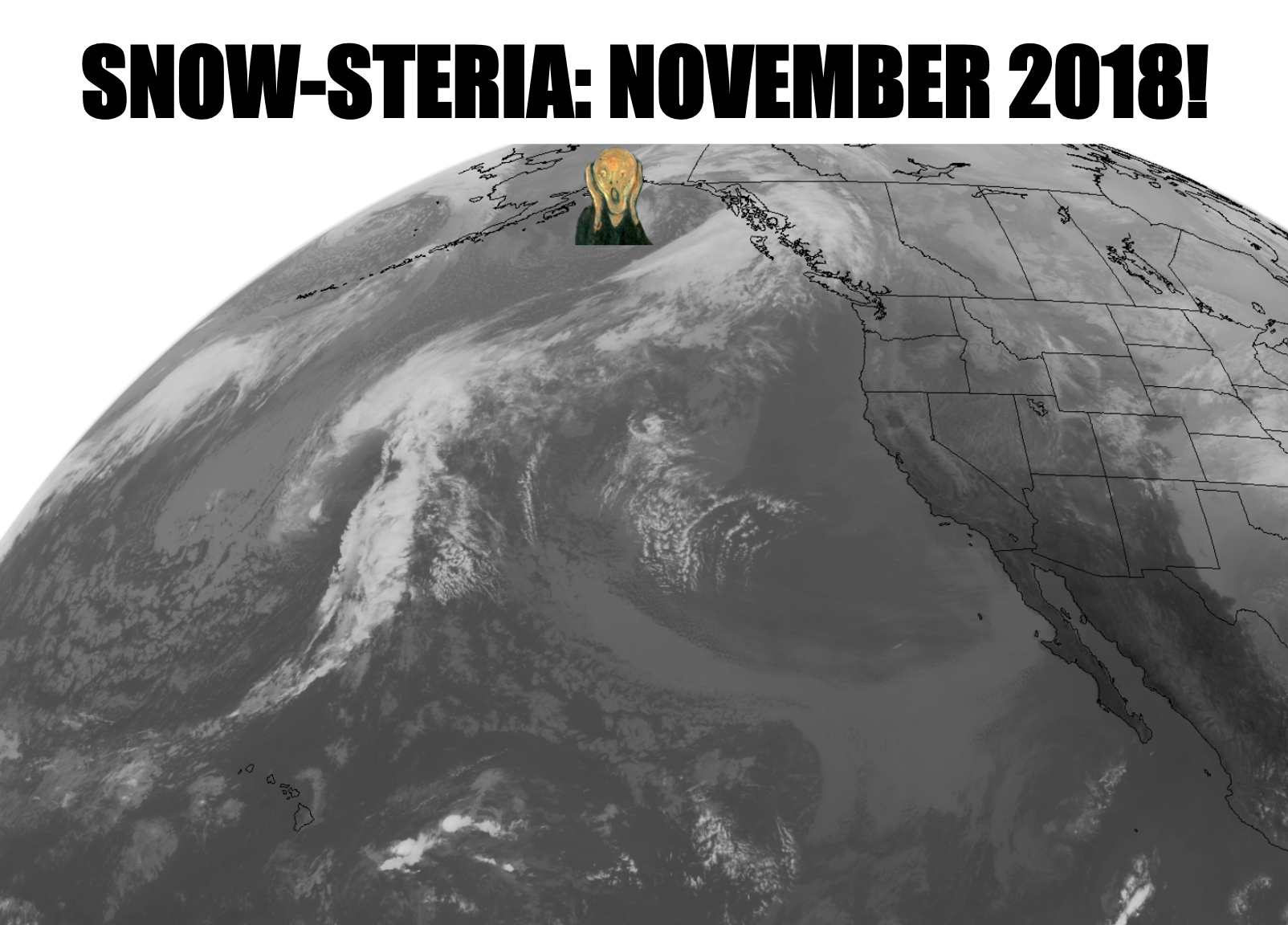
SNOW-STERIA: NOVEMBER 2018 EDITION!
SNOW'S BACK, we're glad. SNOW'S BACK, I'm mad. Let’s go! Yes, even Murtaugh and
Riggs (surely somebody else got the reference??) perked up at the latest hint of
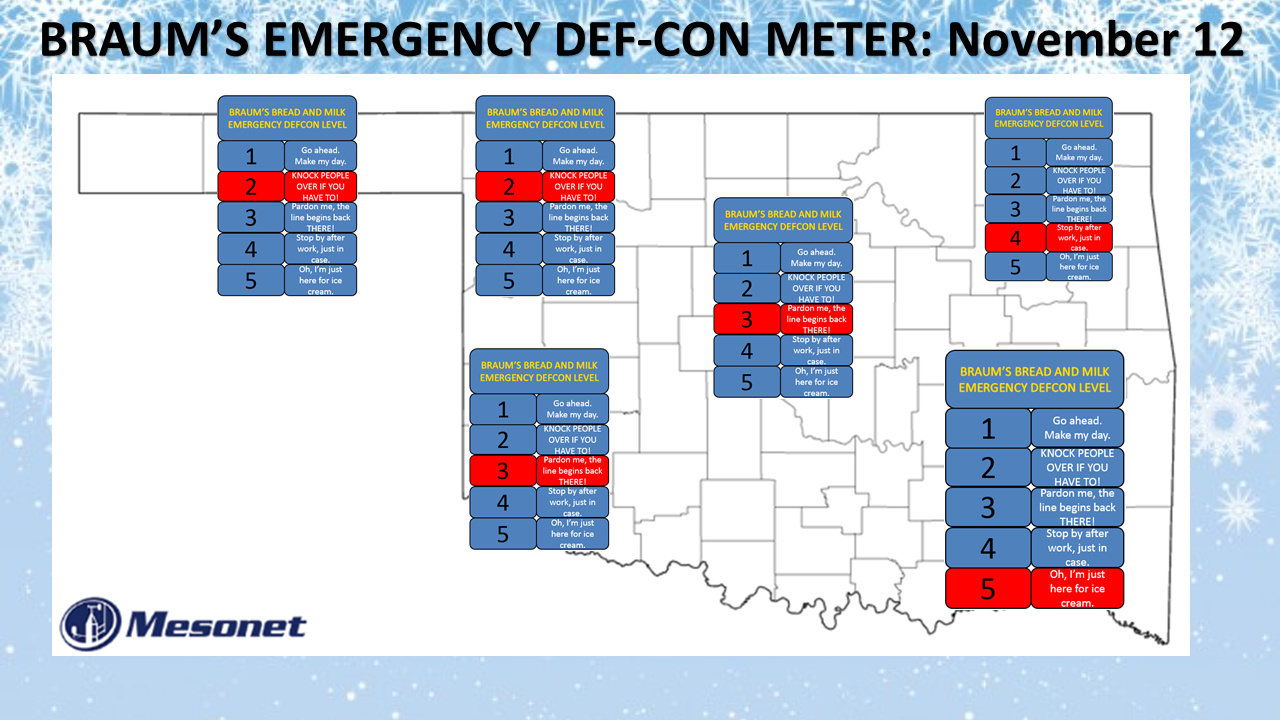
snow in the forecast. Keep in mind this is a *very provisional* EMERGENCY
BRAUM'S BREAD-AND-MILK DEF-CON METER release, since the storm is still positioned
out over the water in the Gulf of Alaska.
Lots of things can change in the forecast, and in fact the models are just now
barely starting to see some consistency in showing snow barreling into the center
part of the state. Looks better for the northwest, but there is even some hint of
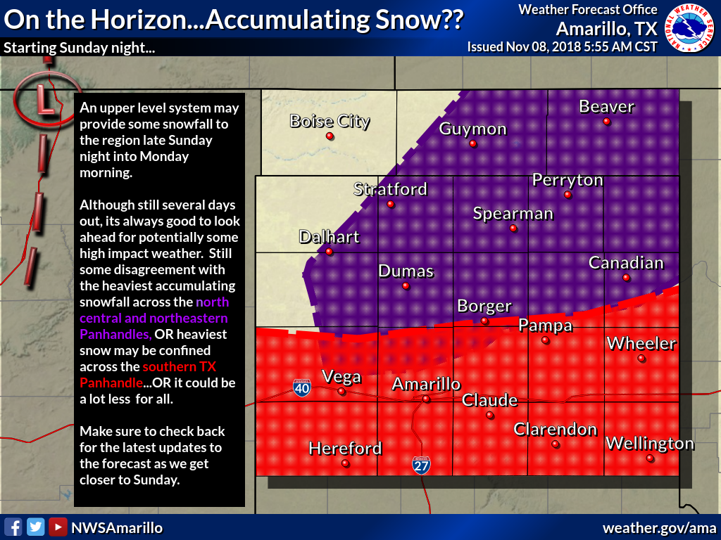
the better moisture being to the southwest. The Amarillo NWS office had a graphic
explaining some of this uncertainty.
Truth of the matter is, I think a lot of the snow forecasts you're seeing are
over-exuberance because we haven't seen a good snow in so long. But hey, why
not have a bit of fun with it? Live a little, slip a little, be disappointed a
lot...that's my winter weather forecast motto! But seriously, there is still
a lot of uncertainty. And with the storm system not even being over land where
it can be sampled better by weather instruments, the computer models *probably*
don't have their best handle on it. What can go wrong? Well, we've shown this
many times, but here's what can happen when you combine a poorly-sampled
atmosphere with computer modeled forecasts several days out.
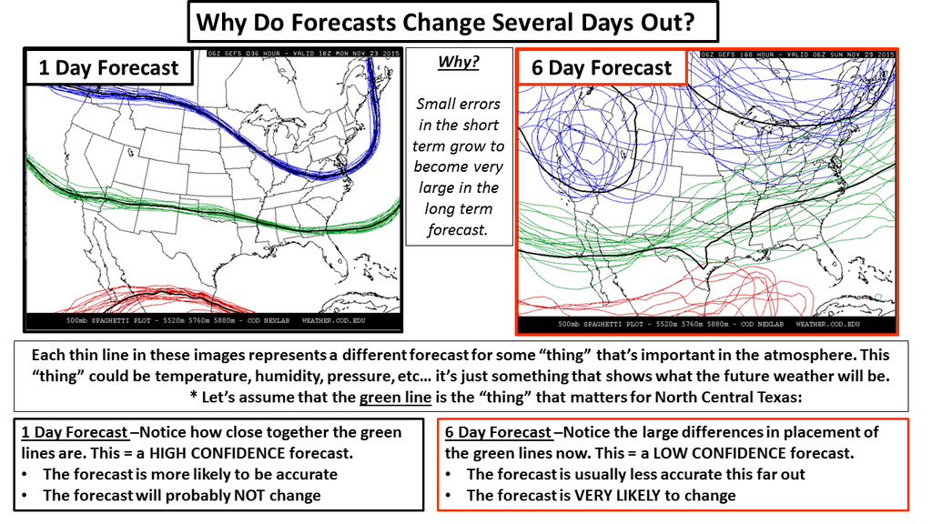
So whenever those forecast models are able to take in better data associated
with a storm system, then they start to come together into a "consensus," that's
when the forecast confidence begins to build. And remember, lots of factors
coming together over the state on Sunday and Monday will determine where folks
get snow that sticks, snow that melts as fast as it falls, or just a cold rain.
And don't forget, maybe they don't come together at all. Wasn't it just
yesterday that I said this:
Nothing big and REALLY exciting in the upcoming pattern,
however. Lots of "it's cold today!" interspersed with "wow, great weather
today, get out and enjoy it!"
Two things to keep in mind:
1. I'm an idiot.
3. This "boring" scenario could still happen!
(Yes, I'm boycotting the number "2" until it mends its ways)
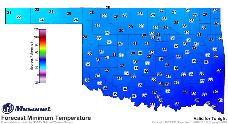
One thing we do know is that it's gonna get cold. We currently have a freeze
warning for the NW 2/3rds of the state, and a freeze watch for much of the
rest through Saturday morning.

Lows are going to plunge into the teens and 20s over much of the area, giving us
the coldest weather we've seen since last February.

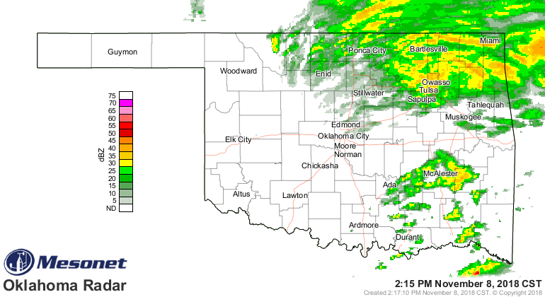
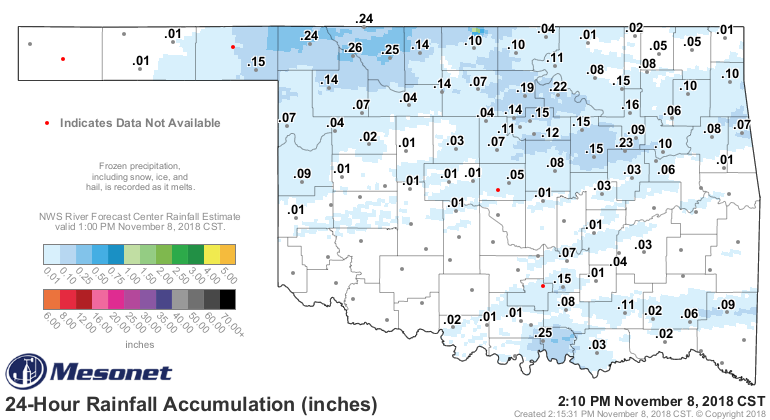
We would like to see some decent moisture from the rains currently moving
through the state, as well as into next week. So far, pretty light.
Believe it or not, we still have drought going strong (or moderate) up across
far NE OK.

As far as the possible snowstorm for early next week and its impacts? Well, still
lots of things to consider. Will there be ample moisture? Where will the
freezing line be if it does snow, and what will the ground temperatures be by
then? That has a big say in travel problems.
We have had some big snows in Oklahoma during November, though usually later in
the month and usually in the far northwest. Here are some of the bigger
snowstorms in OK history to hit during November. We've expanded the storms to
3-day periods to capture entire events.
-***-
Site Date Amount (inches)
Boise City Nov. 3-5, 1946 22
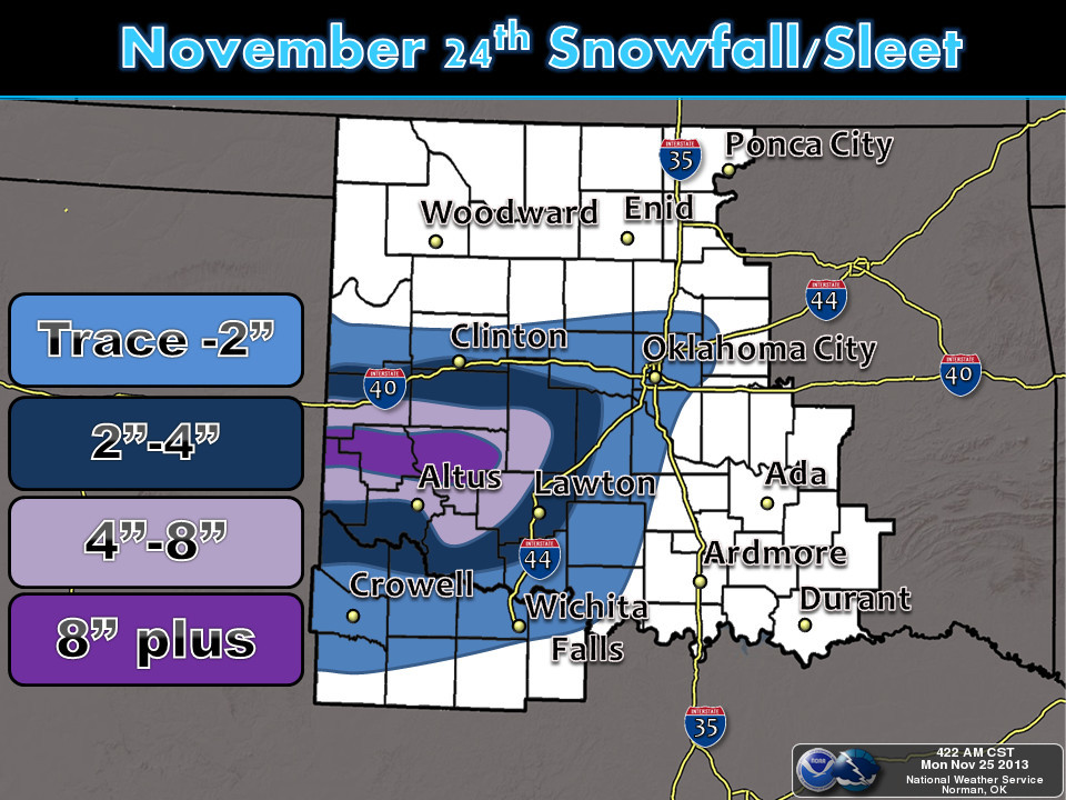
Gate Nov. 24-26, 1992 22
Roosevelt Nov. 24-26, 2013 20
Laverne Nov. 24-26, 1992 19
Carnegie Nov. 28-30, 2001 16
Buffalo Nov. 24-26, 2992 16
Arnett Nov. 18-20, 1972 15
-****-
So some pretty big snows have occurred later into November. I experienced that
Thanksgiving storm of 1992 personally as I tried to drive home to Buffalo for
Thanksgiving through 15-20 inches of snow, packed on top of freezing rain that
had fallen earlier in the day.
The Roosevelt storm in 2013 laid down heavy snow in southwestern OK, so it's not
just a NW OK thing!
Tulsa's biggest storm hit from Nov. 28-30, 2006, laying down 10.5 inches. OKC
got 6 inches in that Nov. 18-20 storm in 1972 for their highest.
Before we get too out of whack, this coming storm -- if it does snow -- won't
come close to those historic November storms. I think right now, the biggest
thing this storm system has going for it is OUR excitement. But hey, sometimes
forecasting snow in Oklahoma can make you look silly and ignorant, but it takes
guts. And sometimes guts is enough.
Gary McManus
State Climatologist
Oklahoma Mesonet
Oklahoma Climatological Survey
(405) 325-2253
gmcmanus@mesonet.org
November 8 in Mesonet History
| Record | Value | Station | Year |
|---|---|---|---|
| Maximum Temperature | 92°F | FREE | 2006 |
| Minimum Temperature | 19°F | BOIS | 2000 |
| Maximum Rainfall | 3.96″ | TALI | 2011 |
Mesonet records begin in 1994.
Search by Date
If you're a bit off, don't worry, because just like horseshoes, “almost” counts on the Ticker website!