Ticker for November 12, 2018
MESONET TICKER ... MESONET TICKER ... MESONET TICKER ... MESONET TICKER ...
November 12, 2018 November 12, 2018 November 12, 2018 November 12, 2018
Welcome to winter
Well the snow continues to fall across the northwestern half of the state, as the
current radar shows where that white stuff is starting to stick close to the I-44
corridor. The superimposed freezing line is a pretty good indicator of where you
can find accumulating snow. It doesn't look like much up to the northwest, but
there are still pockets of moderate-to-heavy snow in those darker green areas.

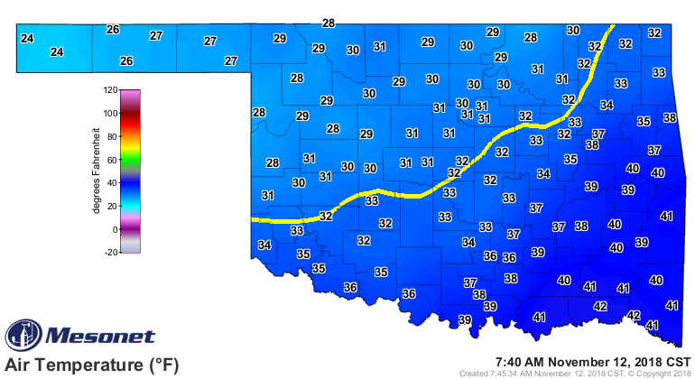
Or a better look here on the actual current air temperature map.
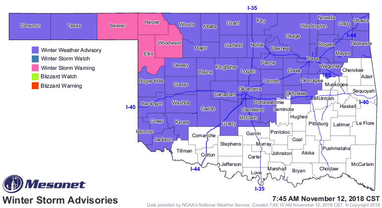
And we continue with a winter weather advisory for the NW half, and a winter
storm warning for Beaver, Harper, Ellis and Woodward counties. Several inches of
snow has fallen across the far northwest, dropping down to about an inch as you
go southeast.
Add in the wind and we go straight to REALLY REALLY COLD!
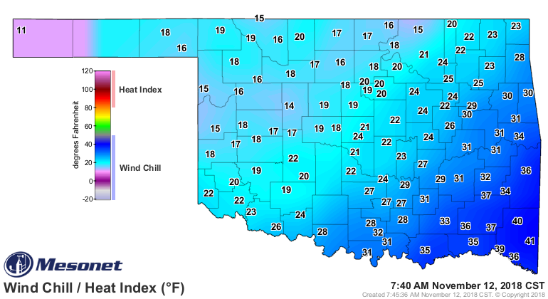
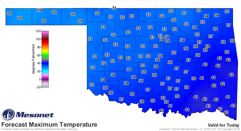
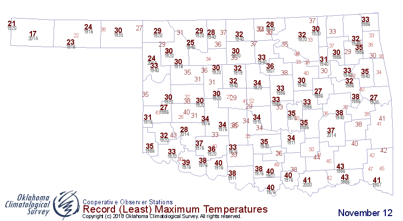
Heck, we might see record low maximum temperatures in some locations today!
That's how unusually cold it is.
The good news? After today a warm up to more seasonable weather. But a wild ride
until then!
Gary McManus
State Climatologist
Oklahoma Mesonet
Oklahoma Climatological Survey
(405) 325-2253
gmcmanus@mesonet.org
November 12 in Mesonet History
| Record | Value | Station | Year |
|---|---|---|---|
| Maximum Temperature | 86°F | BURN | 2005 |
| Minimum Temperature | -4°F | EVAX | 2019 |
| Maximum Rainfall | 2.72 inches | SEIL | 2010 |
Mesonet records begin in 1994.
Search by Date
If you're a bit off, don't worry, because just like horseshoes, “almost” counts on the Ticker website!