MESONET TICKER ... MESONET TICKER ... MESONET TICKER ... MESONET TICKER ...
October 8, 2018 October 8, 2018 October 8, 2018 October 8, 2018
White flag
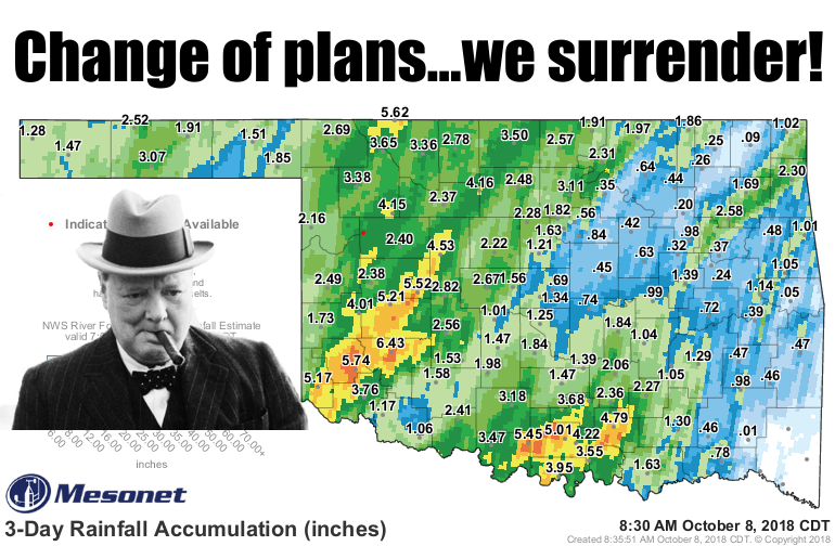
http://ticker.mesonet.org/archive/20181008/3day-rain-totals.png
The fields and streets are now lakes and rivers, the hills have become islands...I
guess we still have the air. But Mother Nature has had her way for over two
months now. Maybe it's time to throw up the old white flag? I guess there are
still a few strongholds of dry defense holding on. The northeast, particularly in
southern Osage and Washington counties, and a bit to there east, far western OK
along the Texas border with Roger Mills and Beckham counties, and a bit of the
Panhandle, at least when you look at the 60-day maps.
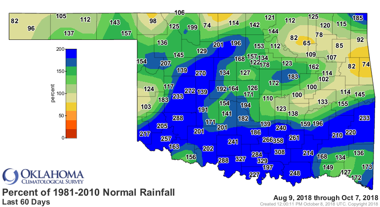
http://ticker.mesonet.org/archive/20181008/60day-rain-totals.png
http://ticker.mesonet.org/archive/20181008/60days.norm_dep.png
http://ticker.mesonet.org/archive/20181008/60days.norm_pct.png
The northeast is the worst of those areas. Some are even above normal over that
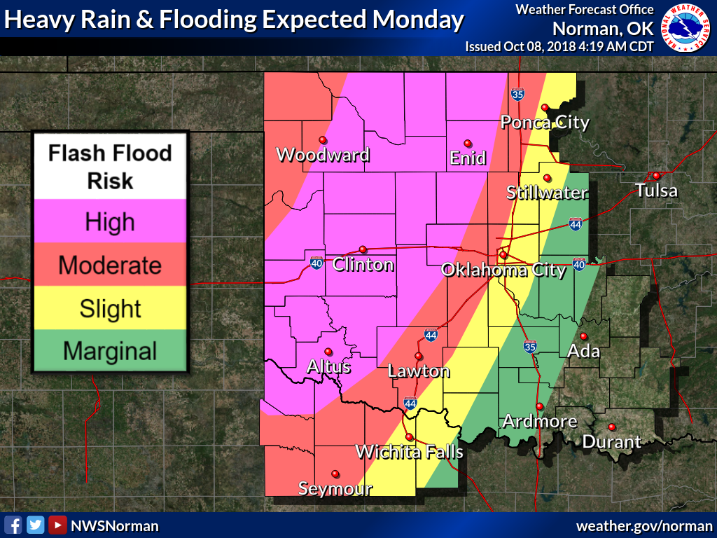
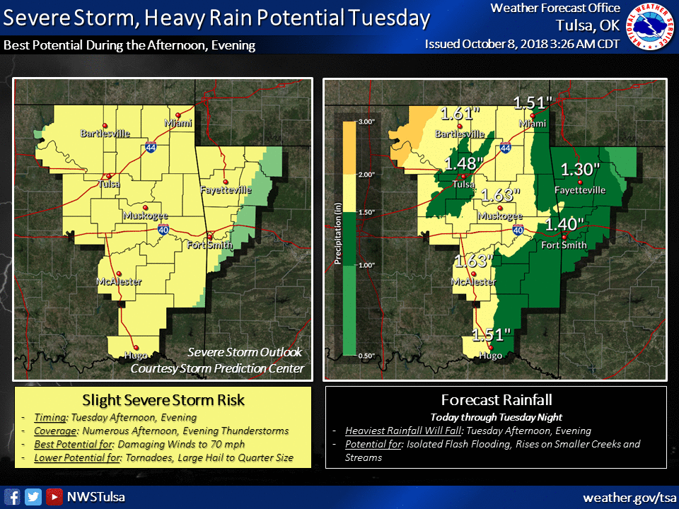
time frame. But here's the kicker...it ain't over. We have flooding rains
possible over the next couple of days as that large upper-level trough moves to
the east and out of our area, finally. And possibly some severe weather to go
with it.
http://ticker.mesonet.org/archive/20181008/nws-norman-flood-monday.png
http://ticker.mesonet.org/archive/20181008/nws-norman-flood-tuesday.png
http://ticker.mesonet.org/archive/20181008/nws-tulsa-rain-storms.png
So in addition to the flooding going on currently, more could be on the way.
http://ticker.mesonet.org/archive/20181008/latest.oklahoma.flood.gif
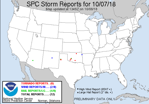
There were several tornadoes reported yesterday, including the one in Fairfax
up in Osage County that did significant damage.
http://ticker.mesonet.org/archive/20181008/yesterday-storm-reports.png
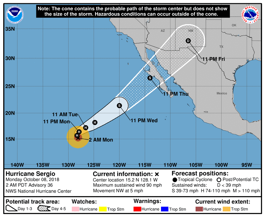
Here's kicker #2...a menace is prowling the pacific, possibly headed this way.
Hurricane Sergio, has made a NE turn and is headed straight towards the Gulf
of California and then the Southern Plains.
http://ticker.mesonet.org/archive/20181008/sergio-track.png
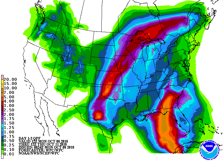
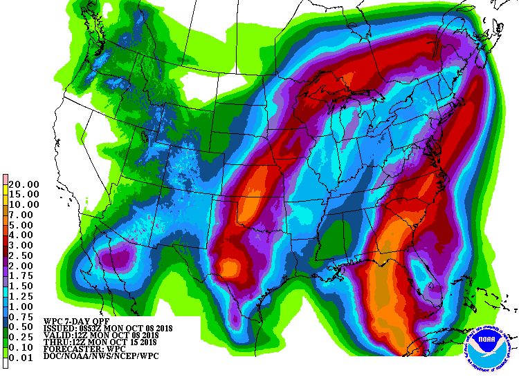
IF Sergio's remnants move our way, and IF there is a front around the vicinity,
and IF there is enough return moisture from the Gulf of Mexico...things could
get very interesting around here this weekend. The colors on the forecast map
could flare up again after the current storm moves through.
http://ticker.mesonet.org/archive/20181008/3-day-rain-forecast.gif
http://ticker.mesonet.org/archive/20181008/7day-rain-forecast.gif
Gary McManus
State Climatologist
Oklahoma Mesonet
Oklahoma Climatological Survey
(405) 325-2253
gmcmanus@mesonet.org
==================================================
The OCS/Mesonet Ticker
https://ticker.mesonet.org/
To subscribe or unsubscribe from the Ticker
or for questions about the Ticker or its content
Phone or Email the Ticker Manager at OCS
Phone: 405-325-2253 Email: ticker@mesonet.org
---------------------------------------------------
-C- Copyright 2024 Oklahoma Climatological Survey
===================================================
|


 Tweet
Tweet