MESONET TICKER ... MESONET TICKER ... MESONET TICKER ... MESONET TICKER ...
August 8, 2024 August 8, 2024 August 8, 2024 August 8, 2024
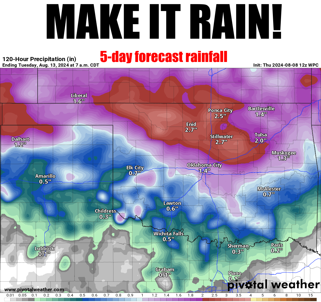
WOOOO!
https://ticker.mesonet.org/archive/20240808/5day-rain-forecast.png
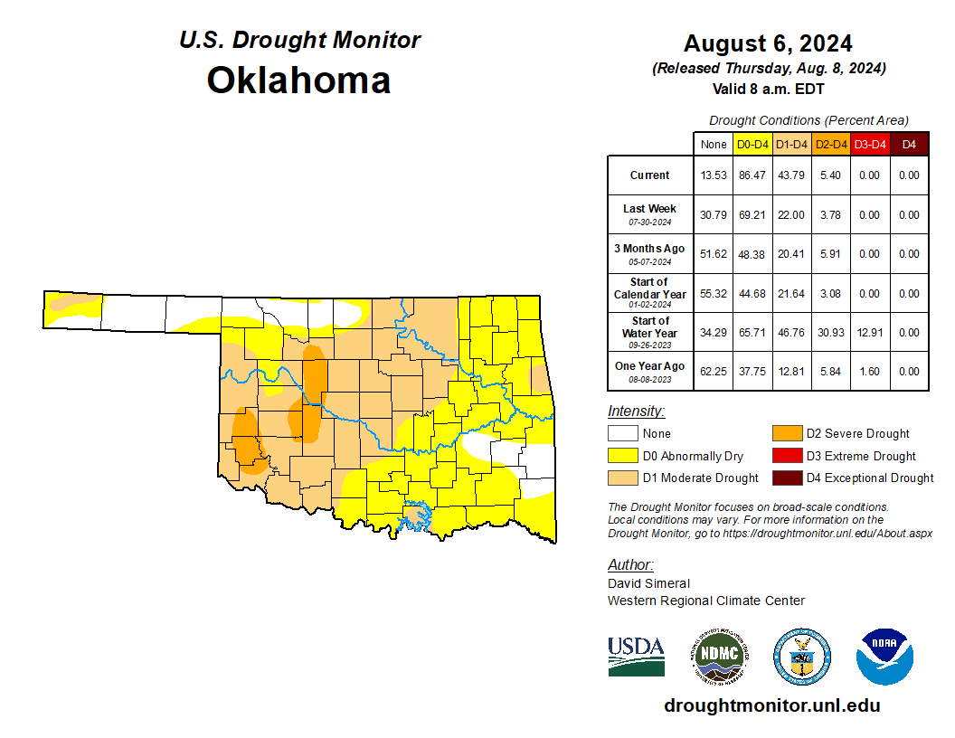
I was GONNA do a Ric Flair meme, but all the pics I could find scared me, and I'm
already scared from (looking in a mirror? NO!) this week's U.S. Drought Monitor
map, which saw drought DOUBLE in one week.
https://ticker.mesonet.org/archive/20240808/20240806_ok_trd.png
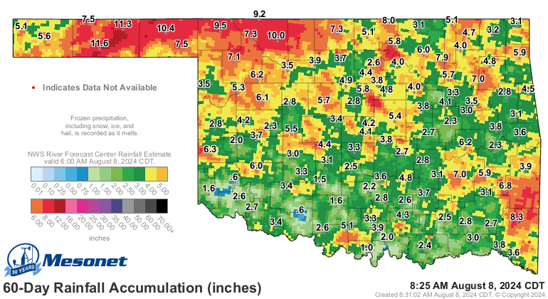
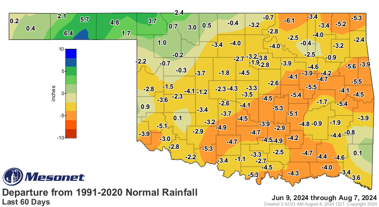
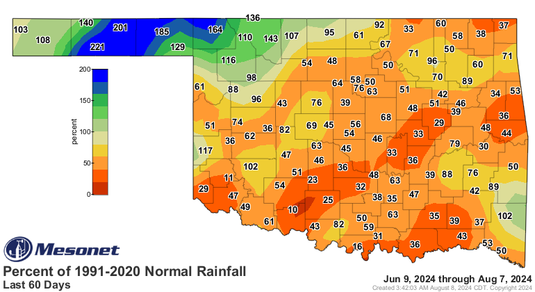
And when you look at the 60-day rainfall maps, it's easy to see why.
https://ticker.mesonet.org/archive/20240808/60day-rain-totals.png
https://ticker.mesonet.org/archive/20240808/del60day_rain.current.png
https://ticker.mesonet.org/archive/20240808/pct60day_rain.current.png
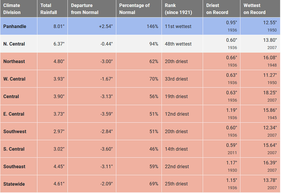
Hey, when the Panhandle leads the state in rainfall for ANY 60-day period, you
know things have gotten a bit odd. And the stats bear that out.
https://ticker.mesonet.org/archive/20240808/60day-stats.png
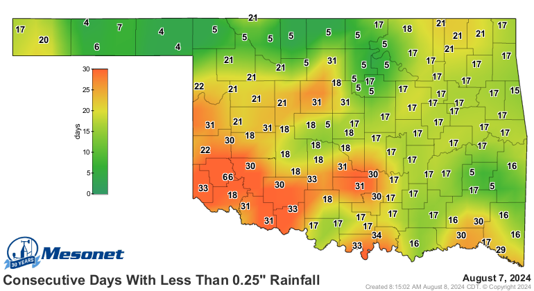
So it's not exactly shocking that we have another resurgence of flash drought,
our third time this year. Every time it gets interrupted, we have another long
run of little rainfall to kick it back into gear.
https://ticker.mesonet.org/archive/20240808/mesonet.rainfall.quarterinch.png
So IF we get that type of rainfall, it won't cure things altogether, especially
those areas expected to get less than an inch, but it will maybe halt the flash
drought's widescale intensification and spread. And with our much talked about
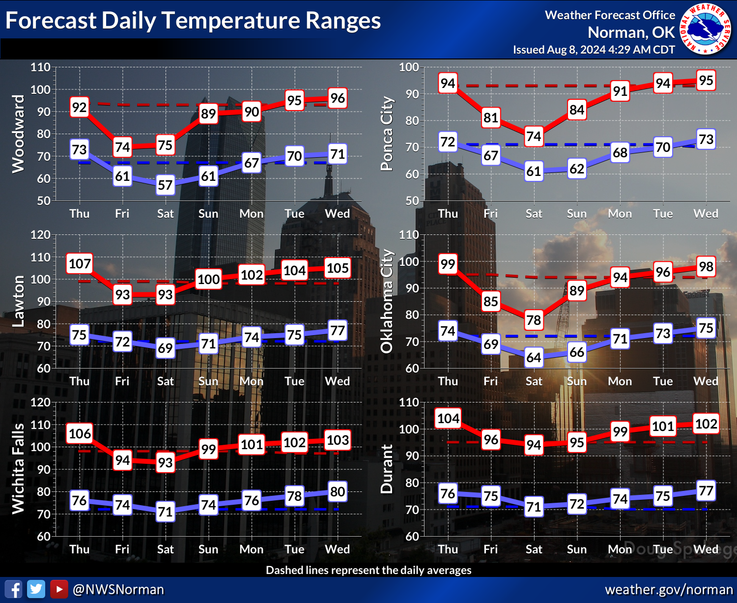
cold front finally entering the state today, the lower temperatures for a few
days will help.
https://ticker.mesonet.org/archive/20240808/nws-norman-7day-temps.png
Now it's not gonna last forever, but we will eventually get on the downward
temperature slide climatologically. That is inevitable, as much as we all joke
about summer lasting until October. That will also help. But the key ingredient
is rain. And what we should see starting later today and then through the
weekend will be key.
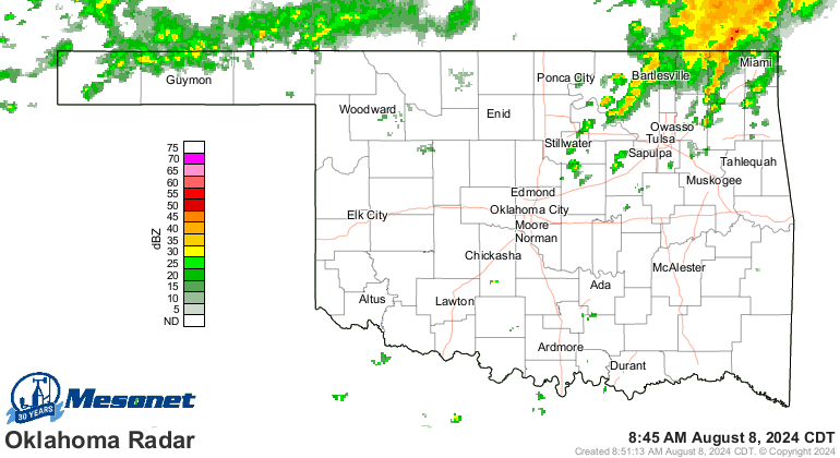
Heck, it's raining right now for crying out loud!
https://ticker.mesonet.org/archive/20240808/current-radar.png
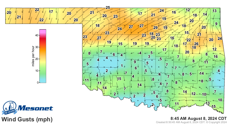
Heck part 2, it's cold fronting right now for crying out even louder!
https://ticker.mesonet.org/archive/20240808/current-winds.png
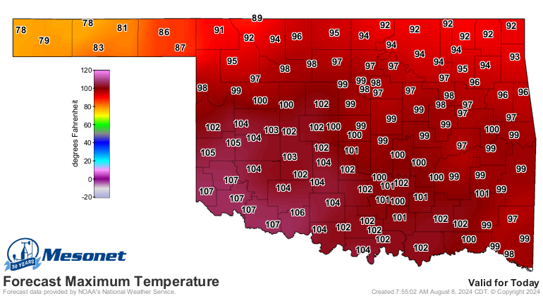
Still, another hot day left for much of the state. Sorry!
https://ticker.mesonet.org/archive/20240808/latest.oklahoma.heat.gif
https://ticker.mesonet.org/archive/20240808/todays-highs.png
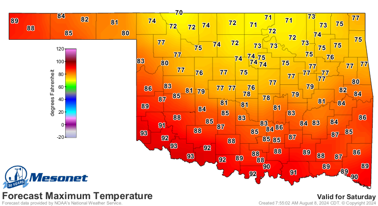
Just find your happy place until Friday. Or even better...Saturday.
https://ticker.mesonet.org/archive/20240808/saturdays-highs.png
WOOOO!
Gary McManus
State Climatologist
Oklahoma Mesonet
Oklahoma Climatological Survey
gmcmanus@mesonet.org
==================================================
The OCS/Mesonet Ticker
https://ticker.mesonet.org/
To subscribe or unsubscribe from the Ticker
or for questions about the Ticker or its content
Phone or Email the Ticker Manager at OCS
Phone: 405-325-2253 Email: ticker@mesonet.org
---------------------------------------------------
-C- Copyright 2024 Oklahoma Climatological Survey
===================================================
|


 Tweet
Tweet