MESONET TICKER ... MESONET TICKER ... MESONET TICKER ... MESONET TICKER ...
July 8, 2024 July 8, 2024 July 8, 2024 July 8, 2024
Reversal of fortune
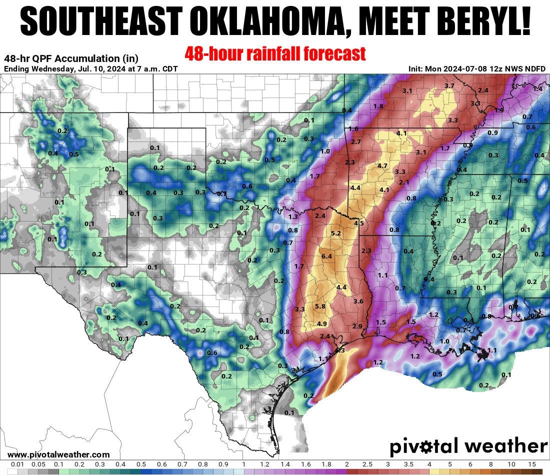
https://ticker.mesonet.org/archive/20240708/48hour-rain-forecast.png
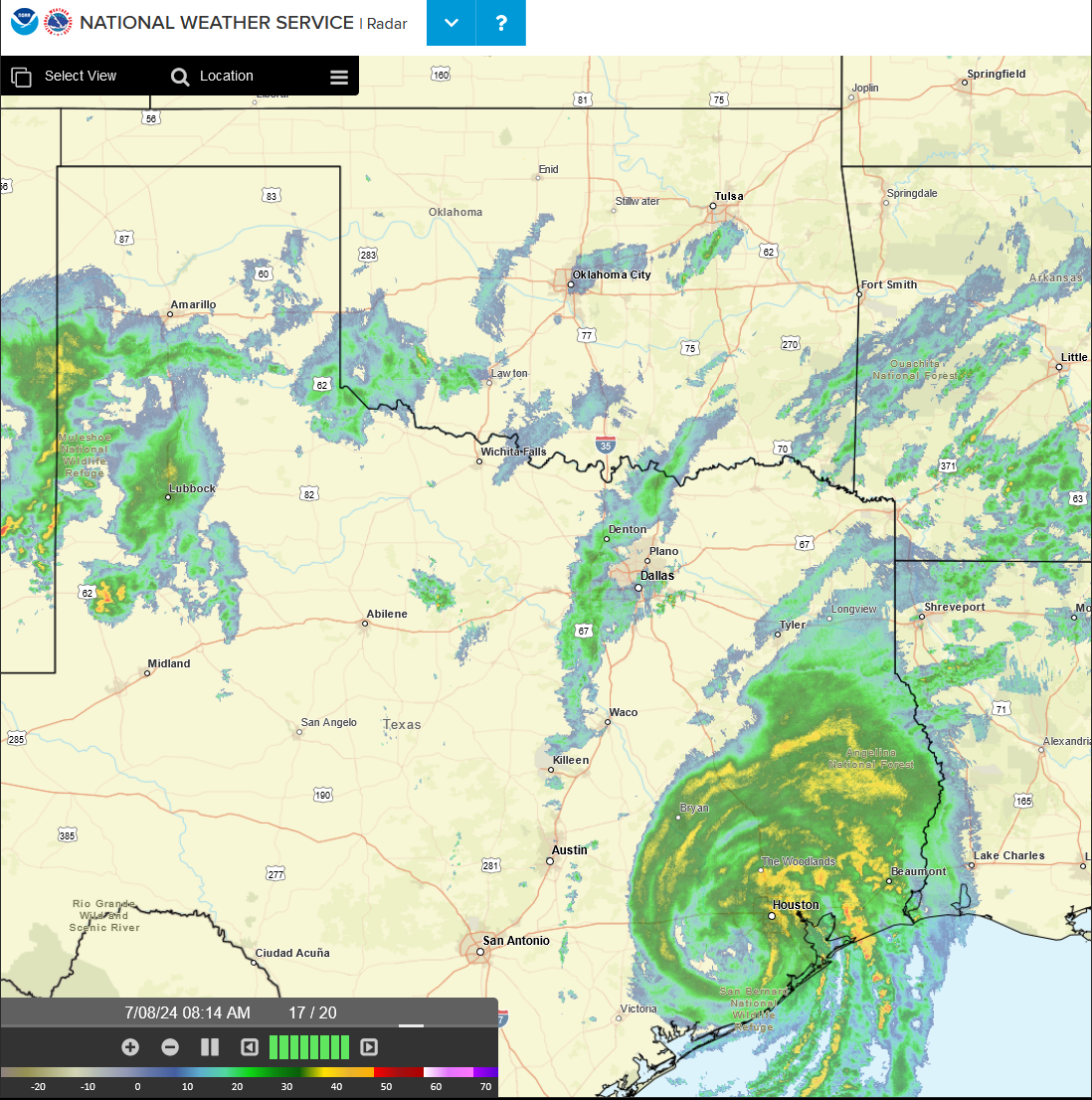
https://ticker.mesonet.org/archive/20240708/beryl.png
No, I will not blame you for your eyes being drawn to the 800-pound hurricane
taking up nearly the entire Texas Gulf Coast. I have the same problem when I look
in a mirror and see a glare coming back at me from above my forehead! It's
acceptable. But the Cat-1 storm (when it hit Texas) has already knocked out power
to about a million people, and it's headed towards SE Oklahoma. It will probably
go just to their southeast, so southeast of southeast Oklahoma, but it should
still provide ample rainfall to just about the last part of the state that needed
a good dose. Up to 4-6 inches are being forecast, but that could go up a bit in
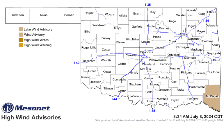
localized areas, and there's also a wind advisory for a bit of that spin left.
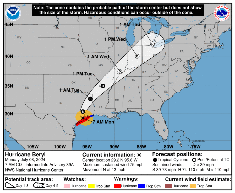
https://ticker.mesonet.org/archive/20240708/beryl-track.png
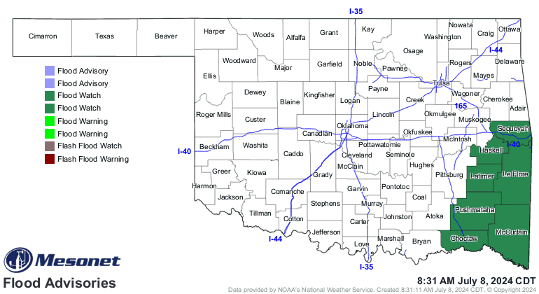
https://ticker.mesonet.org/archive/20240708/latest.oklahoma.flood.gif
https://ticker.mesonet.org/archive/20240708/latest.oklahoma.winds.gif
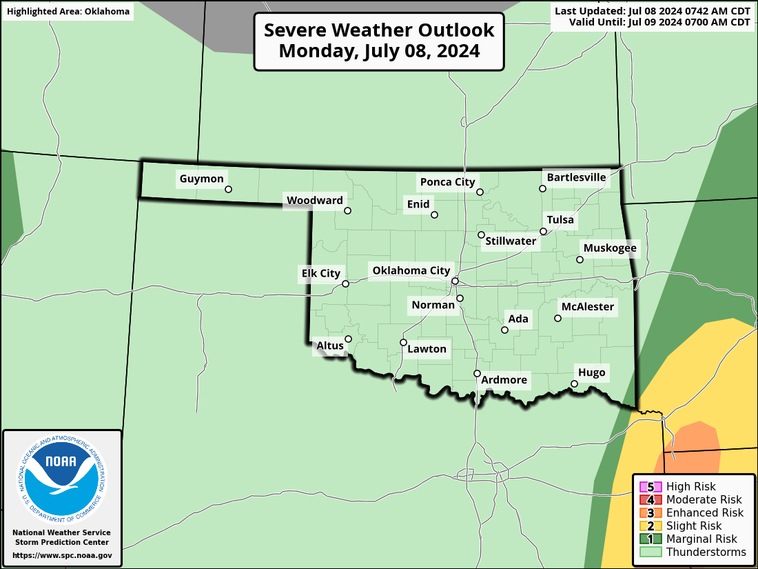
Thankfully, other than the flooding threat, the severe weather threat will stay
with the upper-right quadrant of the circulation.
https://ticker.mesonet.org/archive/20240708/OK_swody1.png
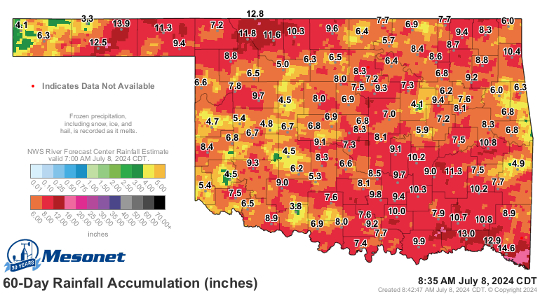
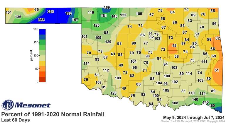
The rainfall from Beryl will complete a magnificent reversal (hey, Magnificent
Reversal was my band's name in 8th grade!) of fortune for a state that was
headed for some serious drought with flash drought spreading over the last 60
days. Now, the maps look quite a bit nicer for Oklahoma.
https://ticker.mesonet.org/archive/20240708/OK_swody1.png
https://ticker.mesonet.org/archive/20240708/60day-rainfall.png
https://ticker.mesonet.org/archive/20240708/pct60day_rain.current.png
Now I know you're probably saying to yourself "but Gary, surely you can see all
those deficits on those 60-day maps?" First off, your name's not Gary, and my
name's not Shirley. And B, you are correct, but they're a darned sight better
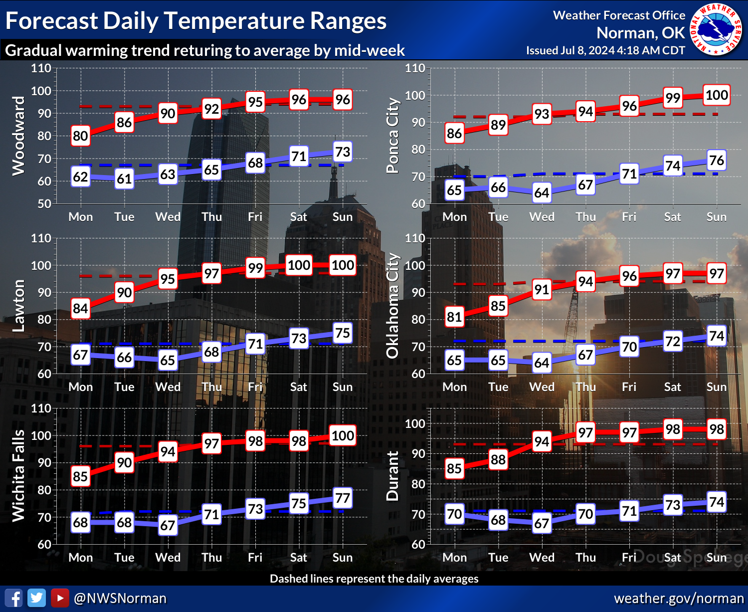
than what they were. And it's just in the nick of time as well, because summer
comes roaring back this week and beyond!
https://ticker.mesonet.org/archive/20240708/nws-norman-7day-temps.png
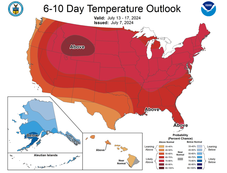
https://ticker.mesonet.org/archive/20240708/july13-17-temp-outlook.png
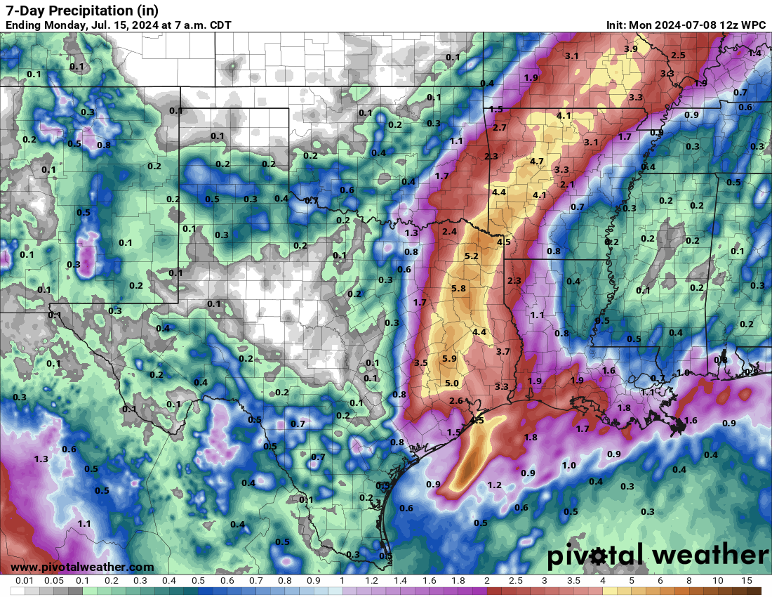
And you'll notice the 7-day rain forecast map looks nearly identical to the 48-
hour map.
https://ticker.mesonet.org/archive/20240708/7day-forecast.png
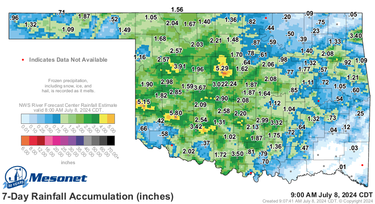
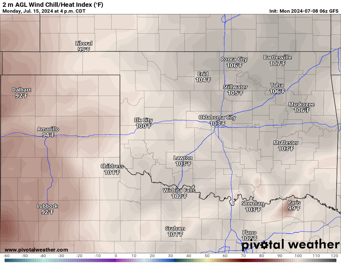
Hey, we all know the score during summer in Oklahoma. This type of map:
https://ticker.mesonet.org/archive/20240708/7day-rainfall.png
Will lead to this type of map:
https://ticker.mesonet.org/archive/20240708/next-monday-heat.index.png
That's a lot better than it could have been, though.
Gary McManus
State Climatologist
Oklahoma Mesonet
Oklahoma Climate Survey
gmcmanus@ou.edu
==================================================
The OCS/Mesonet Ticker
https://ticker.mesonet.org/
To subscribe or unsubscribe from the Ticker
or for questions about the Ticker or its content
Phone or Email the Ticker Manager at OCS
Phone: 405-325-2253 Email: ticker@mesonet.org
---------------------------------------------------
-C- Copyright 2024 Oklahoma Climatological Survey
===================================================
|


 Tweet
Tweet