Ticker for June 8, 2011
MESONET TICKER ... MESONET TICKER ... MESONET TICKER ... MESONET TICKER ...
June 8, 2011 June 8, 2011 June 8, 2011 June 8, 2011
A Smoky Oklahoma (thankfully not at ground level)
Lots of folks are commenting on the red sun and dusty-looking air. That's
actually smoke suspended high in the air from wildfires burning in Arizona, New
Mexico and northern Mexico.
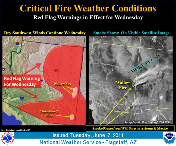
You can see the smoke plumes from these fires quite well on this visible
satellite loop from yesterday. Notice how the smoke drifts over Oklahoma.
http://bit.ly/jd9D6V
Red flag fire warnings extend from northwestern Oklahoma all the way out into
central Arizona, a consequence of the continuing drought conditions covering
the area.
You can keep track of fire conditions in Oklahoma using our OK-FIRE website.
Fire dangers are quite high fin western Oklahoma, again a consequence of the
drought and the lack of green vegetation that normally diminishes fire danger
this time of year.
http://okfire.mesonet.org/
******************************************************************************
Tornado count continues to go up.
The Oklahoma tornado count for this year continues to go up, as tracked by the
NWS offices and tallied by Oklahoma tornado guru Doug Speheger. There have now
been 92 tornadoes identified by the NWS offices, and there are still more than
a dozen possible tornadoes waiting to be investigated. That places 2011 in sixth
place for number of tornadoes in a year since 1950, tied with 1983. With those
other possible tornadoes out there still to be investigated and almost seven
more months in the year, that number will most assuredly go up, and could even
threaten second or third place. Remember last year took third place with 102
twisters.
1999 145
1957 107
2010 102
1982 101
1960 98
2011 92 (preliminary)
1983 92
1998 83
1961 82
1995 79
******************************************************************************
Records watch continues
Much of western Oklahoma either neared or exceeded their record high minimum
temperatures this morning, much like the last several days. Notice the
western Panhandle was blessedly cool thanks to a cold front. Those 80-degree
lows in Logan County look pretty nasty though.
Actuals: 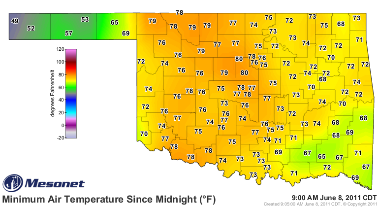
Records: 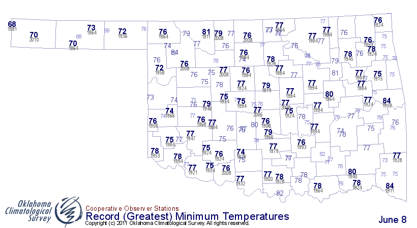
Keep watching today for record highs. Here's your primer.
Records: 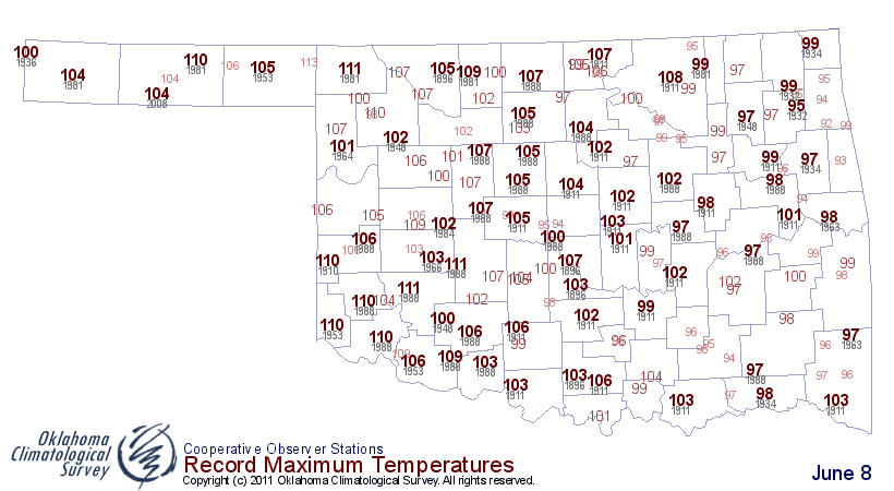
Gary McManus
Associate State Climatologist
Oklahoma Climatological Survey
(405) 325-2253
gmcmanus@mesonet.org
June 8 in Mesonet History
| Record | Value | Station | Year |
|---|---|---|---|
| Maximum Temperature | 107°F | FREE | 2011 |
| Minimum Temperature | 38°F | BOIS | 2007 |
| Maximum Rainfall | 5.42″ | ALVA | 1995 |
Mesonet records begin in 1994.
Search by Date
If you're a bit off, don't worry, because just like horseshoes, “almost” counts on the Ticker website!