Ticker for June 7, 2011
MESONET TICKER ... MESONET TICKER ... MESONET TICKER ... MESONET TICKER ...
June 7, 2011 June 7, 2011 June 7, 2011 June 7, 2011
The Drums of Dol
Oklahoma continues to flirt with record high temperatures, both the maximum and
minimum categories.The historical record high temperature map for today and the
actual highs today from the Mesonet show that much of western Oklahoma came
close to their eclipsing those records. Also compare today's highs to the
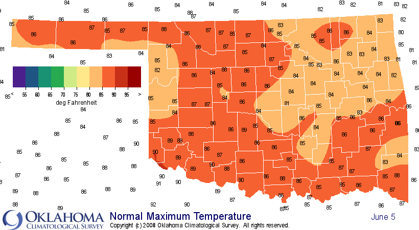
normal high temperature map and you can see those temperatures are running
10-15 degrees above normal. Now, 10-15 degrees above normal is great in
January or February, but you don't want to see that anytime from about June-
September.
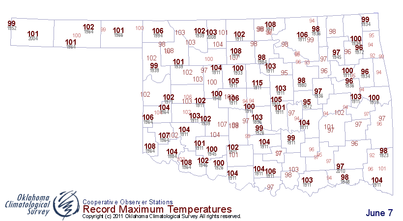
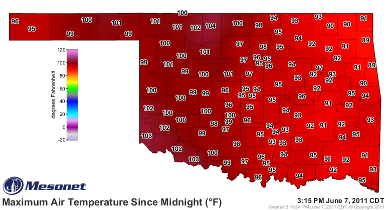
Cherokee at least busted out a record with a high of 104 degrees, topping the
record of 103 degrees set way back in 2008. What goes up must come down, except
my weight apparently, but the nighttime temperatures aren't playing nice.
Once again, check out the historical records for highest minimum temperatures
vs. the actual low temperatures from the Mesonet.
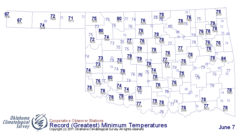
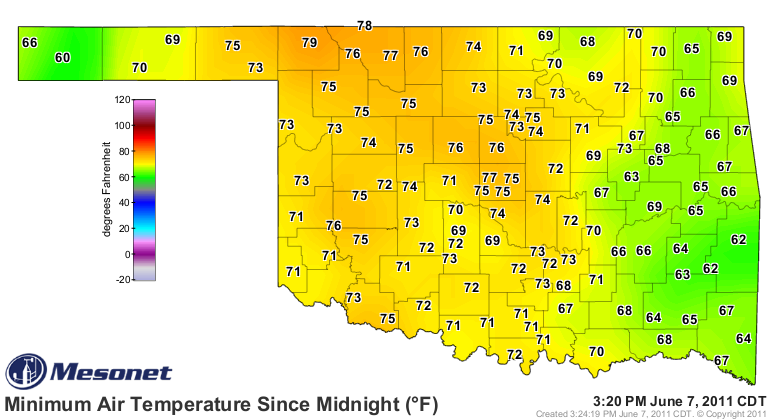
Buffalo only dropped down to 79 degrees last night, besting their previous
record high minimum temperature from 1939 by 4 degrees. Some of the best people
come from Buffalo, by the way ... and so do I. Beaver also broke their
record, but they're not as cool as Buffalo, so I won't mention them. I'll bet
that win in football back in the day isn't looking so great now, is it Beaver!
Summer's just getting started, folks. Just try and think cool. Here's some
help:

Gary McManus
Associate State Climatologist
Oklahoma Climatological Survey
(405) 325-2253
gmcmanus@mesonet.org
June 7 in Mesonet History
| Record | Value | Station | Year |
|---|---|---|---|
| Maximum Temperature | 105°F | ALTU | 2011 |
| Minimum Temperature | 45°F | PRYO | 1998 |
| Maximum Rainfall | 4.27 inches | HINT | 2022 |
Mesonet records begin in 1994.
Search by Date
If you're a bit off, don't worry, because just like horseshoes, “almost” counts on the Ticker website!