MESONET TICKER ... MESONET TICKER ... MESONET TICKER ... MESONET TICKER ...
May 8, 2024 May 8, 2024 May 8, 2024 May 8, 2024
Tornadology
https://ticker.mesonet.org/archive/20240508/OK_swody1_TORN.png
I don't know much about history, other than we never gave up when the Germans
bombed Pearl Harbor. I did try and start a new academic program about the
history of snakes in Oklahoma. I called it "Hissssstory 101." Never did get off
the ground.
I do know, however, the history of tornadoes. Hosetory?
Anyway, NWS Tulsa has rated the Barnsdall twister as an EF4:
"Public Information Statement
National Weather Service Tulsa OK
918 PM CDT Tue May 7 2024
...Preliminary Storm Survey Results for the May 6th Tornadoes...
Today, NWS Tulsa meteorologists surveyed tornado damage in Osage
County that occurred from a supercell thunderstorm Monday evening,
including the town of Barnsdall and the city of Bartlesville. Based
on our survey so far and review of radar data, we believe this is
likely one single tornado that began southeast of Hominy. The
tornado crossed Highway 20, snapping numerous trees and breaking
metal power poles. We were able to transect the path several times
between Highway 20 and Barnsdall. Significant tree damage was found
in several locations. The tornado then moved into Barnsdall, causing
severe damage to the wax plant on the southeast side of town, and
then severely damaged or destroyed numerous homes on the east side of
town. Several homes and a well-built, metal-framed building
suggested estimated wind speed in the 150 to 165 mph range, and one
home suggested estimated wind speed of 165 to 175 mph, which is in
the EF-4 category. Numerous trees were snubbed in the area of some of
the higher end damage, which was supportive of these wind speed
estimates.
Significant tree damage continued northeast of Barnsdall, a few homes
were damaged and outbuildings were destroyed between Barnsdall and
Bartlesville. The tornado moved across the southern portion of
Bartlesville, and then across the eastern side of town. Lots of
trees were snapped or uprooted, and numerous homes and businesses
were damaged in town. A squall line merged with the tornadic
supercell, and ultimately ended the tornado process on the northeast
side of Bartlesville. Radar data suggested that the merger may have
produced an additional tornado near Dewey, but no damage was found
in that area when we investigated it today."
Some interesting facts about that EF4:
* It's the second "Violent" (EF4 or EF5) tornado in the state this year after
the Marietta strike on April 27.
* It's the first year since 2013 that Oklahoma has seen multiple Violent tornadoes.
That year was the year of the Norman/McCloud EF4 on May 19, and the infamous
May 20 Moore EF5, and also the last official EF5 tornado the world has seen.
* It's the first Violent tornado in NWS Tulsa's area of responsibility since the
deadly mile-wide Picher tornado of May 10, 2008, that killed 6 in Picher before
crossing into Missouri. The tornado resulted in 21 deaths and 200 injuries
altogether.
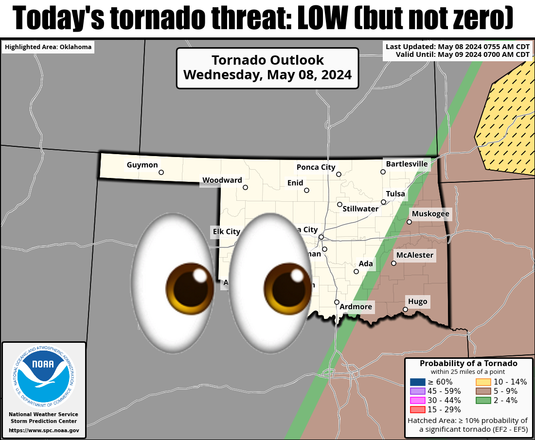
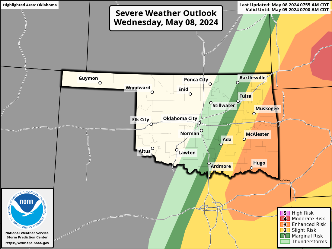
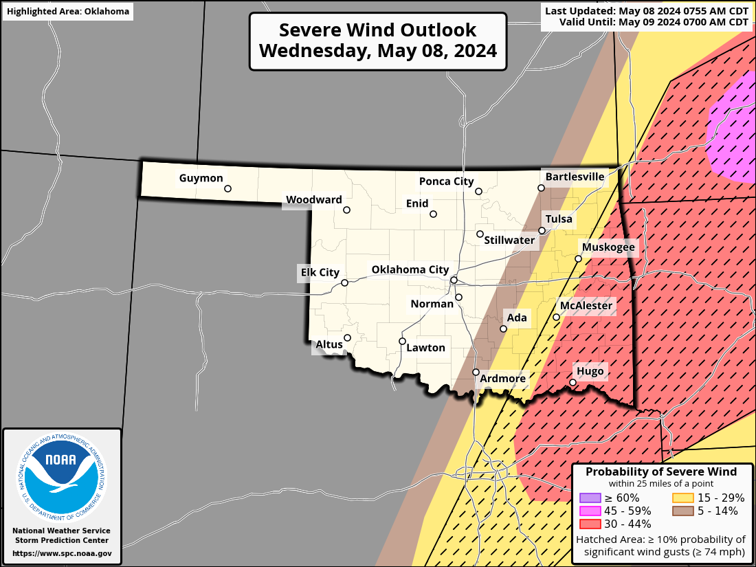
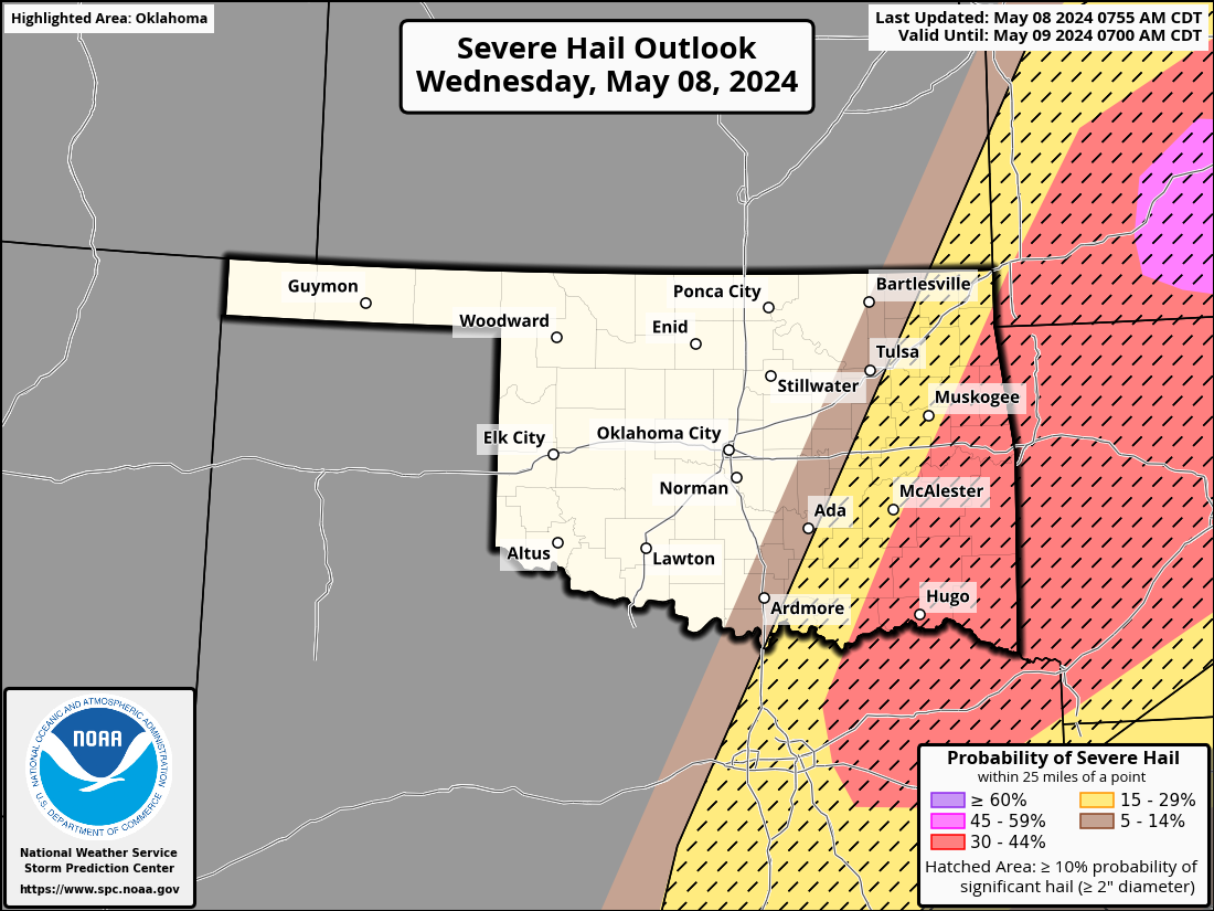
Today's threat is the infamous "low-but-not-zero" category, meaning you know
to be prepared but hope for the best, with all modes of severe weather possible.
https://ticker.mesonet.org/archive/20240508/OK_swody1.png
https://ticker.mesonet.org/archive/20240508/OK_swody1_WIND.png
https://ticker.mesonet.org/archive/20240508/OK_swody1_HAIL.png
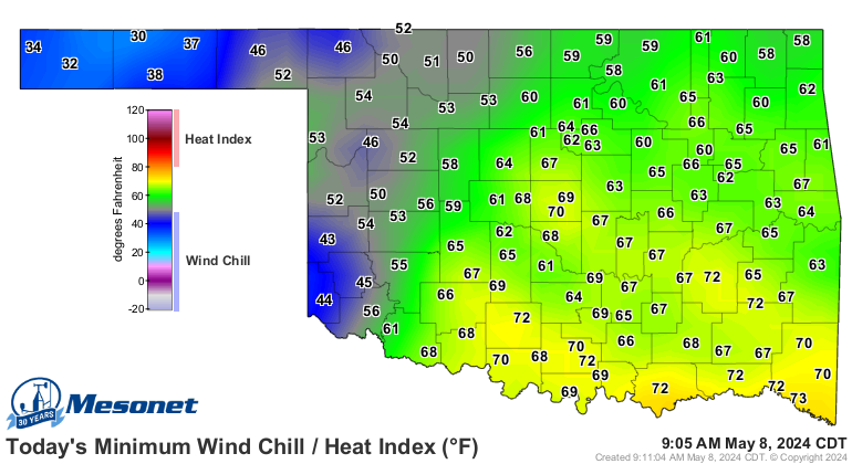
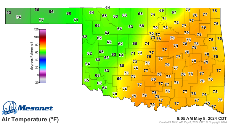
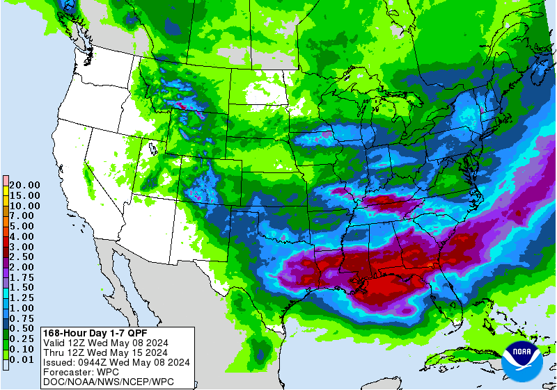
The front that is associated with this storm system dropped wind chills down below
freezing, for crying out loud! They've recovered (I wouldn't have), and we're
headed for several days of typical spring temperatures and rainfall through the
weekend. Rainfall amounts look right about "okay" for this time of year, but we're
really hoping those NW OK rains come through.
https://ticker.mesonet.org/archive/20240508/todays-low-wind.chills.png
https://ticker.mesonet.org/archive/20240508/current.TAIR.grad.png
https://ticker.mesonet.org/archive/20240508/7day-rain-forecast.gif
Okay, you know the drill (calm down, dentists...not THAT drill!)...folks across
eastern OK, stay weather aware. Tune into your local NWS office's social media
and NOAA Weather Radio feeds, and your favorite local media feeds, and stay safe!
Gary McManus
State Climatologist
Oklahoma Mesonet
Oklahoma Climatological Survey
gmcmanus@mesonet.org
==================================================
The OCS/Mesonet Ticker
https://ticker.mesonet.org/
To subscribe or unsubscribe from the Ticker
or for questions about the Ticker or its content
Phone or Email the Ticker Manager at OCS
Phone: 405-325-2253 Email: ticker@mesonet.org
---------------------------------------------------
-C- Copyright 2024 Oklahoma Climatological Survey
===================================================
|


 Tweet
Tweet