MESONET TICKER ... MESONET TICKER ... MESONET TICKER ... MESONET TICKER ...
September 7, 2012 September 7, 2012 September 7, 2012 September 7, 2012
Outrage from the north!
I've been hearing a bunch about an affront approaching the state from the north
today. I say we band together and protest! In this day and age, Colorado and
Kansas have no right to send insults our way. Back in the day, Alfalfa "Bill"
Murray would ... ohhhh, wait. I'm being told it's "a front." Well, that's a
different story altogether. I think everybody has been waiting for this cool-
down with great anticipation ever since the heat returned full-force to the
state last week. Fortunately for us Okies, there is not a better place in the
world to observe a frontal passage... all thanks to the Oklahoma Mesonet. You can
track that front's advance every 5 minutes. In fact, it appears the front is
through Cimarron County already on its way to the southeast. Winds are already
gusting to over 40 mph out there.
You can check out the wind maps here:
http://www.mesonet.org/index.php/weather/category/wind
Watch the temperatures plummet here (An awesome way to watch a front's progress
is the 3-hour temperature change map!):
http://www.mesonet.org/index.php/weather/category/air_temperature
And you can see just how the front changes your weather on our meteograms for
each of the 120 Mesonet stations (change it to whatever station is closest to
you).
http://www.mesonet.org/index.php/weather/meteogram/
I've also heard that you can go outside and check out the weather changes for
yourself. This cutting edge newfangled approach will expose you to all sorts
of natural hazards, like wind, sunshine, and possibly even rainfall, so take
all precautions necessary.
Wildfire potential will be very high today thanks to that wind and the low
relative humidity and heat ahead of the front.
http://ticker.mesonet.org/archive/20120907/nws-firedanger.jpg
So we have a wind advisory for the northwestern three-quarters of the state with
the possibility of winds gusting to over 45 mph, an excessive heat warning for
Choctaw County, and a heat advisory for the rest of the southeast. All in a
fall day in Oklahoma. What else is new?
http://ticker.mesonet.org/archive/20120907/nws-norman-map.png
http://ticker.mesonet.org/archive/20120907/nws-tulsa-map.png
Unfortunately, it appears our rain chances have dwindled somewhat in the
forecasts. Northeastern Oklahoma has the best chance for appreciable rain (but
any rain is appreciated!).
http://ticker.mesonet.org/archive/20120907/5-day-rain.gif
-------------------------------------------------------------------------------
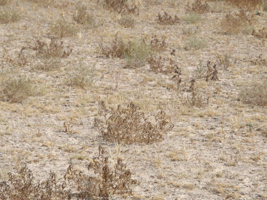
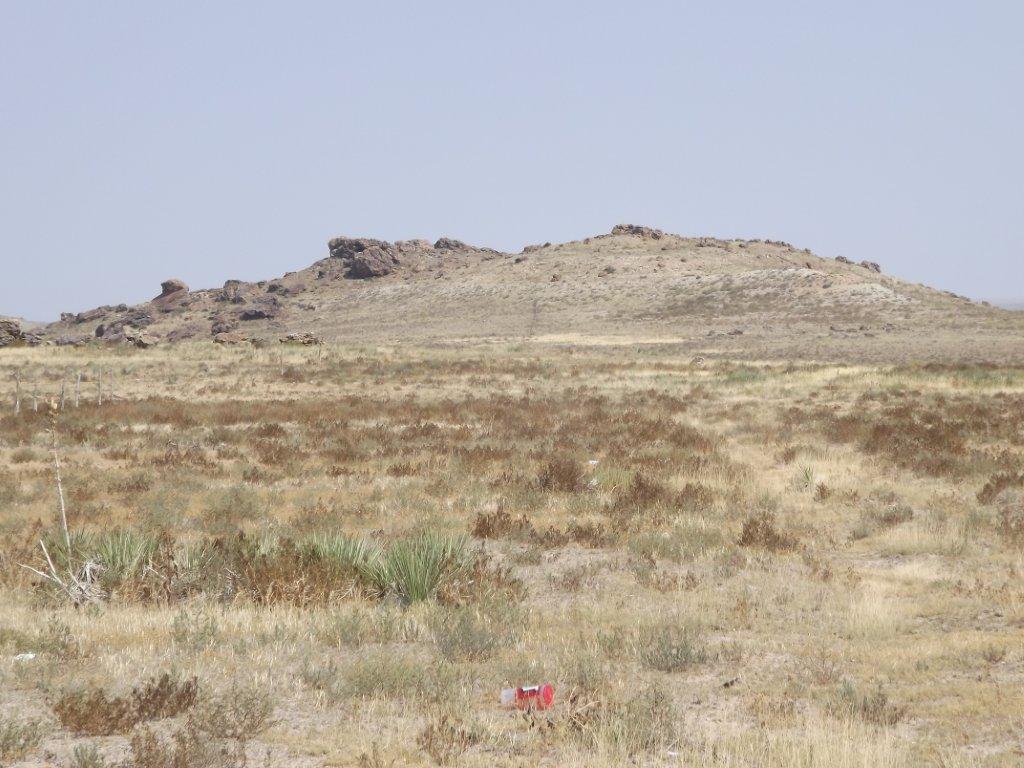
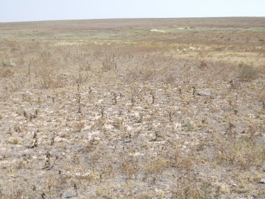
Speaking of drought (seriously, have we ever stopped in the last two years?),
here are a few pictures sent to us from faithful readers of some of the
conditions our state is facing. First up, the conditions in Cimarron County
in the far western Panhandle. These pictures spurred us towards downgrading the
drought conditions out there form severe/extreme to extreme/exceptional. I know
it's usually dry out there, but this is pretty bad when you see the conditions
of the native grasses. These were taken by Bob James north of Boise City.
http://ticker.mesonet.org/archive/20120907/cimarron-1.jpg
http://ticker.mesonet.org/archive/20120907/cimarron-2.jpg
http://ticker.mesonet.org/archive/20120907/cimarron-3.jpg
http://ticker.mesonet.org/archive/20120907/cimarron-4.jpg
http://ticker.mesonet.org/archive/20120907/cimarron-5.jpg
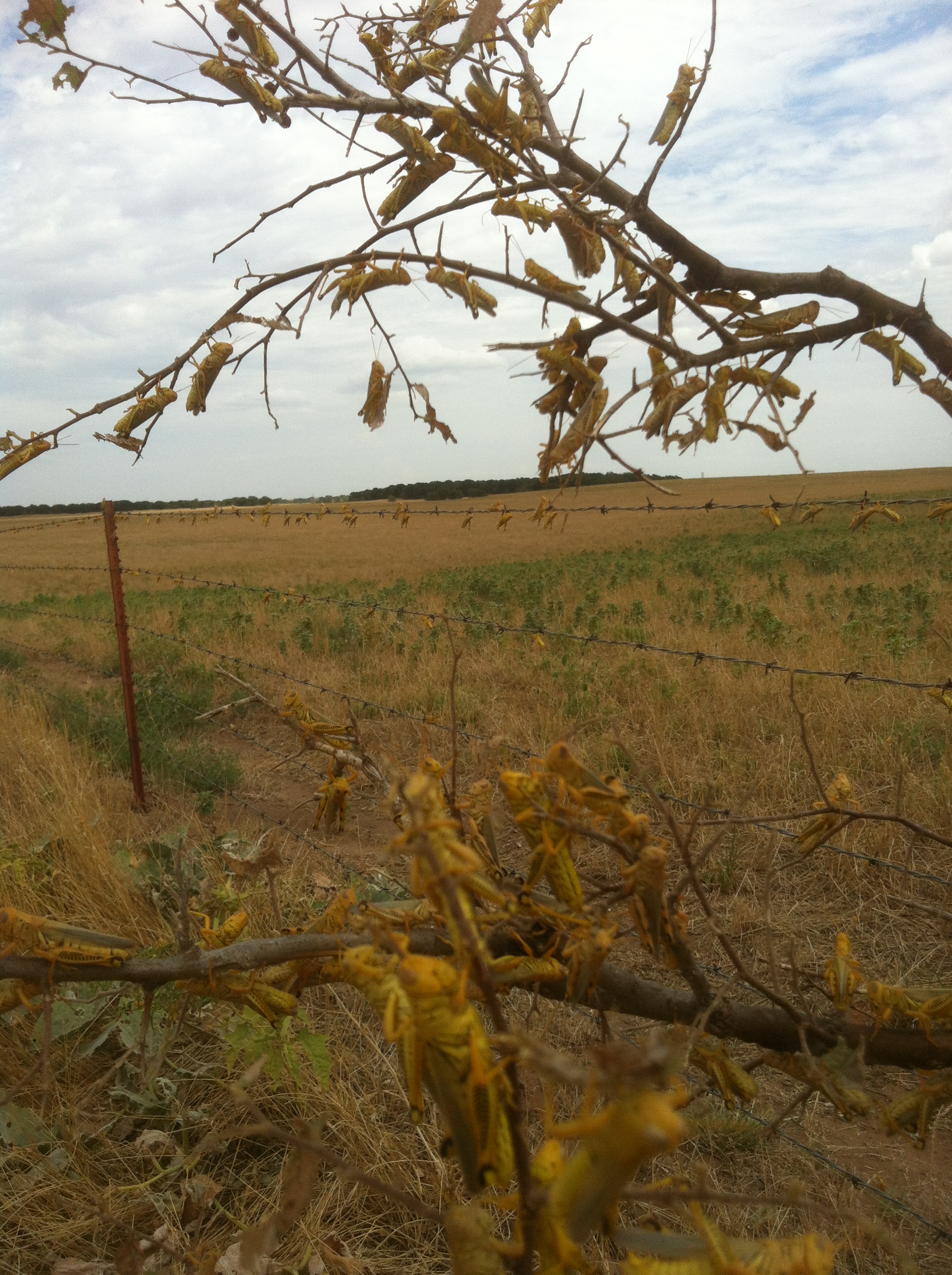
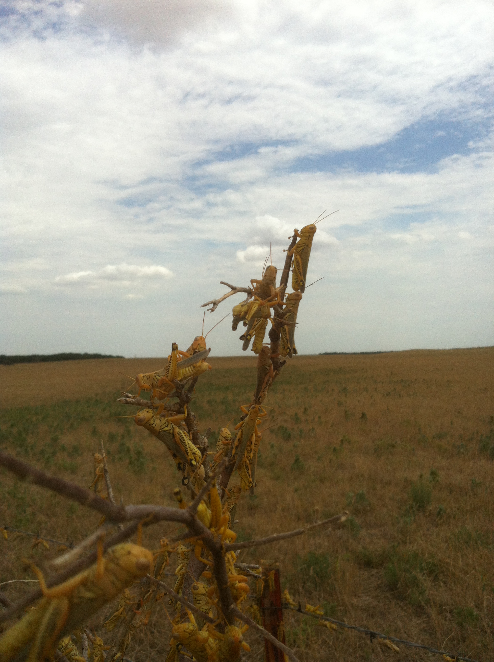
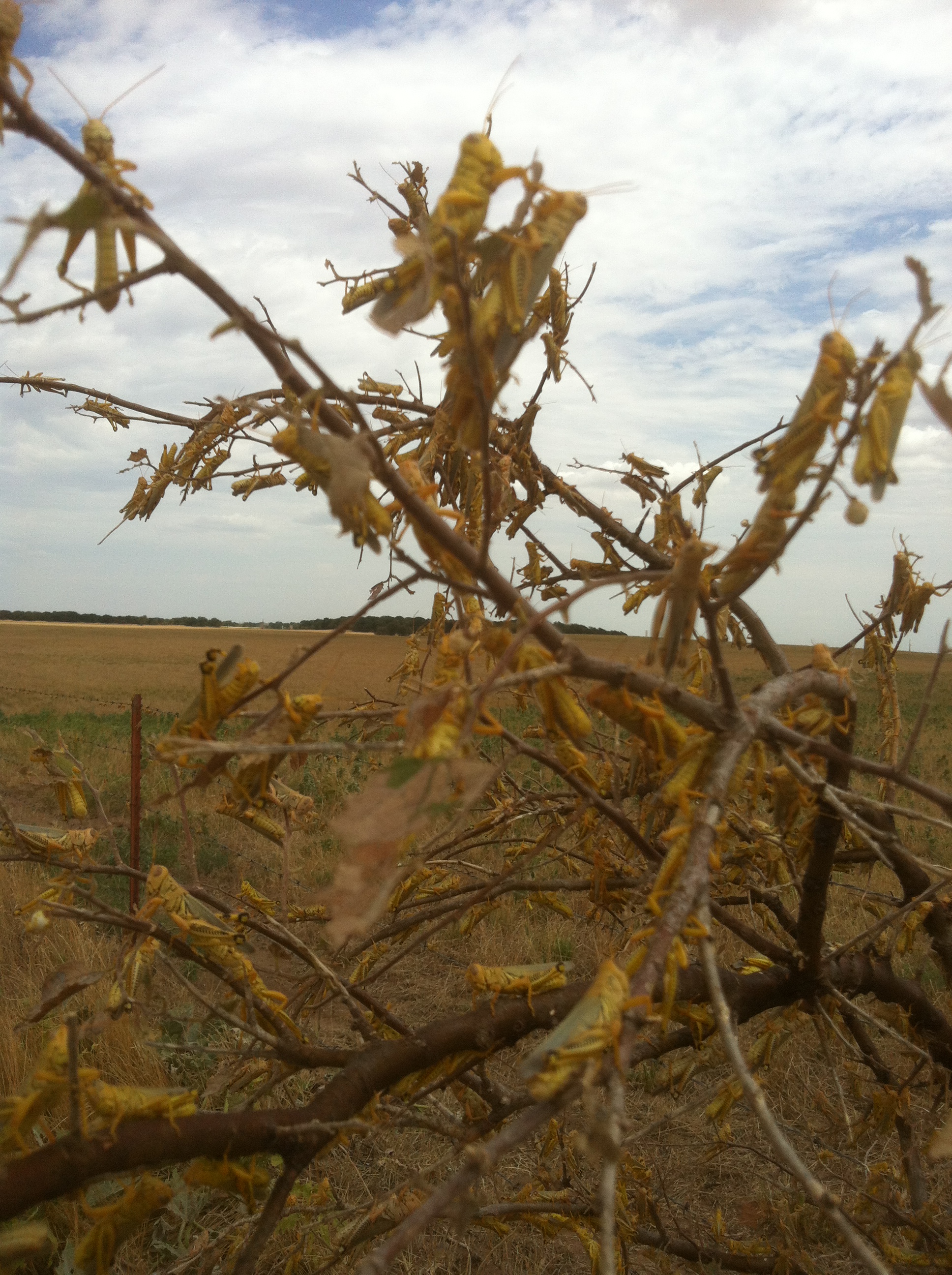
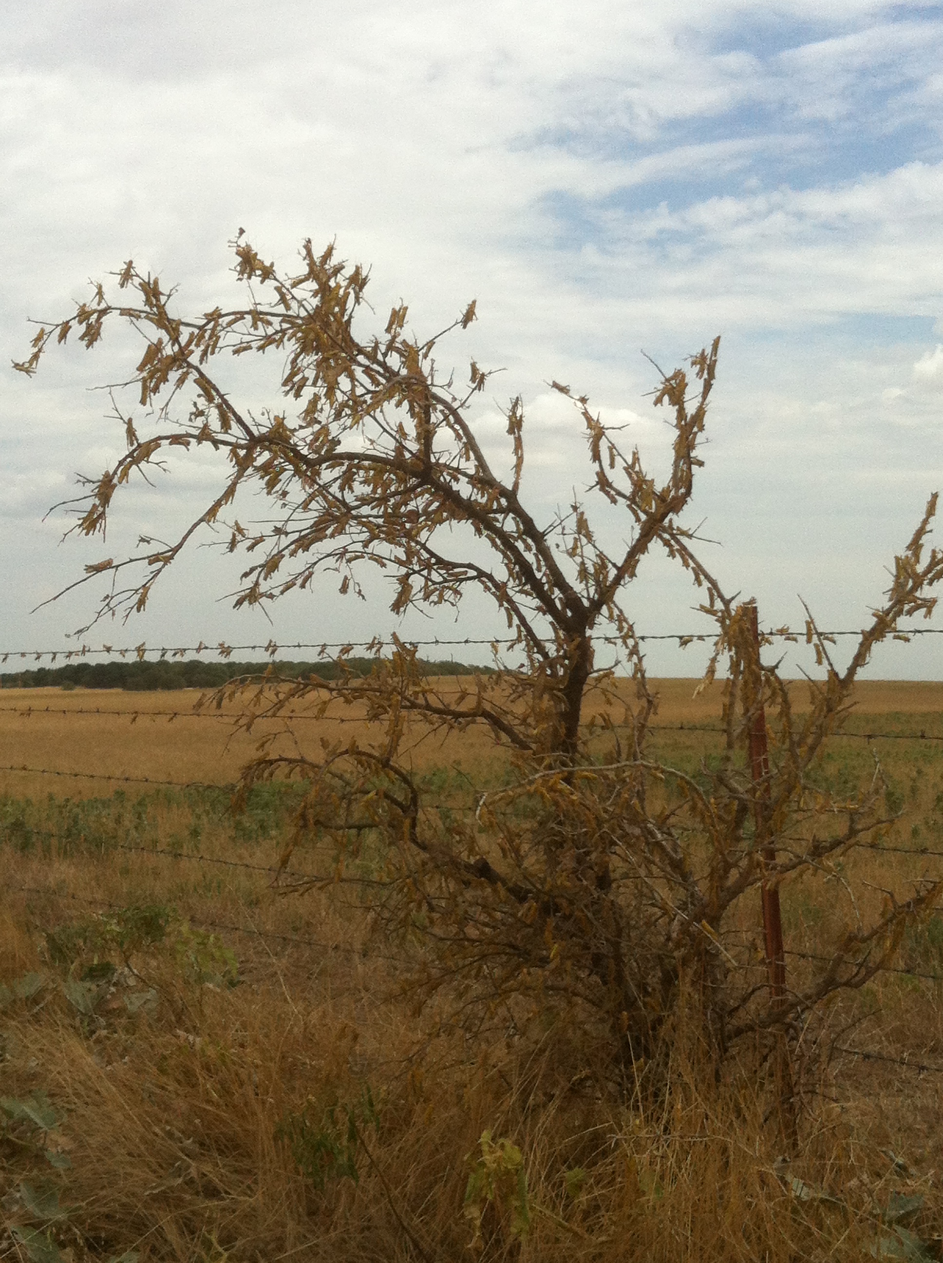
This next set was sent to us from Darrin Baily of El Reno. This is a great
pictorial set of the grasshopper invasion across western Oklahoma. In this case,
Canadian County.
http://ticker.mesonet.org/archive/20120907/grasshopper1.jpg
http://ticker.mesonet.org/archive/20120907/grasshopper2.jpg
http://ticker.mesonet.org/archive/20120907/grasshopper3.jpg
http://ticker.mesonet.org/archive/20120907/grasshopper4.jpg
http://ticker.mesonet.org/archive/20120907/grasshopper5.jpg
http://ticker.mesonet.org/archive/20120907/grasshopper6.jpg
http://ticker.mesonet.org/archive/20120907/grasshopper7.jpg
Ugh! Those pictures actually are an outrage, if not Biblical in nature! I
expect the fiery hail any time now.
Gary McManus
Associate State Climatologist
Oklahoma Climatological Survey
(405) 325-2253
gmcmanus@mesonet.org
==================================================
The OCS/Mesonet Ticker
https://ticker.mesonet.org/
To subscribe or unsubscribe from the Ticker
or for questions about the Ticker or its content
Phone or Email the Ticker Manager at OCS
Phone: 405-325-2253 Email: ticker@mesonet.org
---------------------------------------------------
-C- Copyright 2024 Oklahoma Climatological Survey
===================================================
|


 Tweet
Tweet