MESONET TICKER ... MESONET TICKER ... MESONET TICKER ... MESONET TICKER ...
June 7, 2024 June 7, 2024 June 7, 2024 June 7, 2024
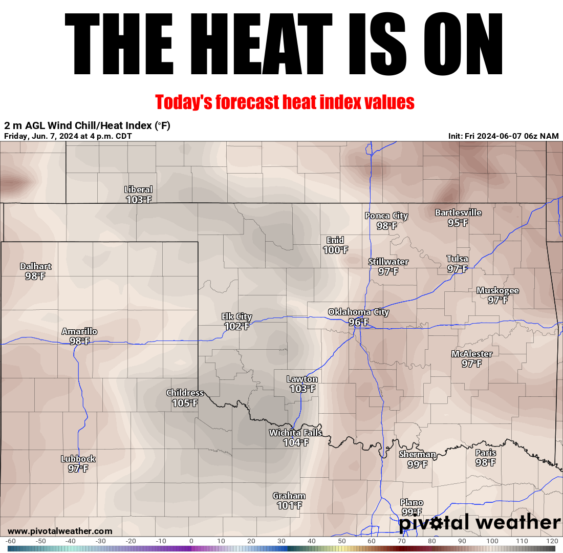
The H is O
https://ticker.mesonet.org/archive/20240607/todays-heat.index.png
Oh, you know things are getting bad when the color scheme on your temperature
maps start to turn those HOT colors, like dark red, or even white. Colors can be
deceiving, of course. I mean, can you tell the difference between the filling of
a Cherry Pop-Tart vs. a Strawberry Pop-Tart?
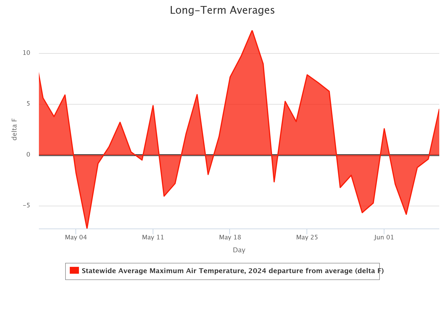
HA! Amature (don't feel bad, I'm an amateur at speling). But you don't need no
stinking maps to know we went from a prolonged "cool" period lately right to
summer. Not COOL cool, but like "close to normal" cool over the last couple of
weeks.
https://ticker.mesonet.org/archive/20240607/max-temps-depart-may1-june6.png
That's okay, I've been not COOL cool for most of my life (there was that time when
I set the world record for eating Whoppers...ahhh, the memories!). And we've all
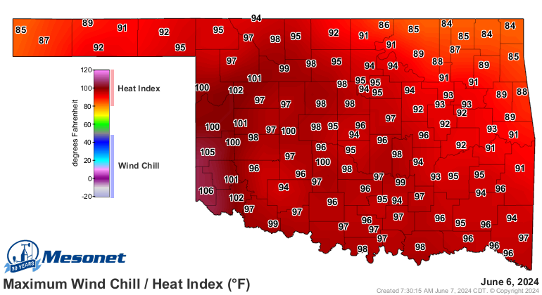
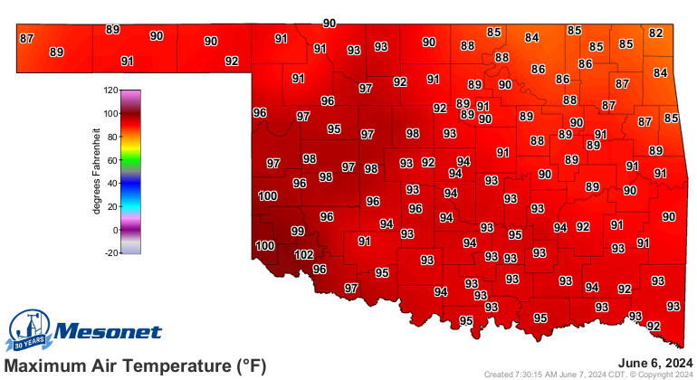
been not COOL cool for the last few days, like yesterday.
https://ticker.mesonet.org/archive/20240607/yesterday.TAPP.max.grad.png
https://ticker.mesonet.org/archive/20240607/yesterday.TAIR.max.grad.png
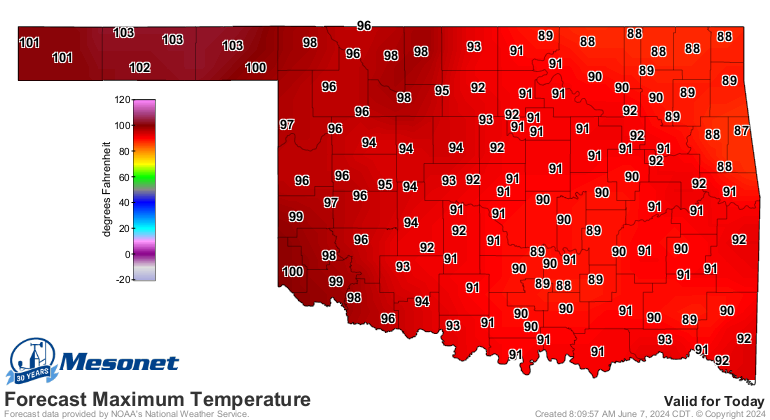
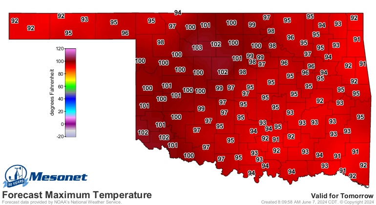
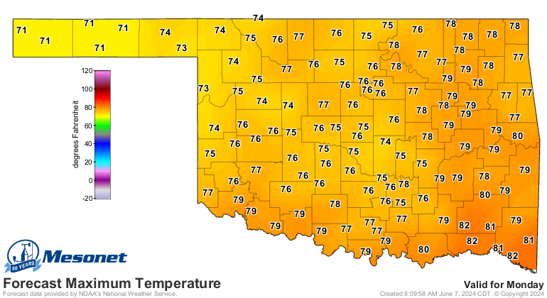
And like you see in that top map, we're gonna be hot again today, and again
tomorrow.
https://ticker.mesonet.org/archive/20240607/todays-highs.png
https://ticker.mesonet.org/archive/20240607/saturday-highs.png
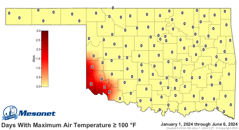
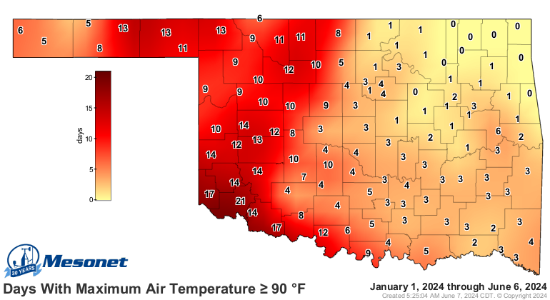
For the year thus far, even though we had the fifth-warmest spring on record
in the state, our temperature extremes have been in the "not bad" category (I've
been "not bad"...oh never mind) for now on the 100s map, but a bit more "bad"
if you look on the 90s map.
https://ticker.mesonet.org/archive/20240607/tmax.ge100.png
https://ticker.mesonet.org/archive/20240607/tmax.ge90.png
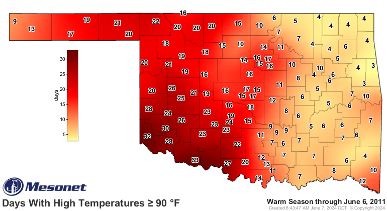
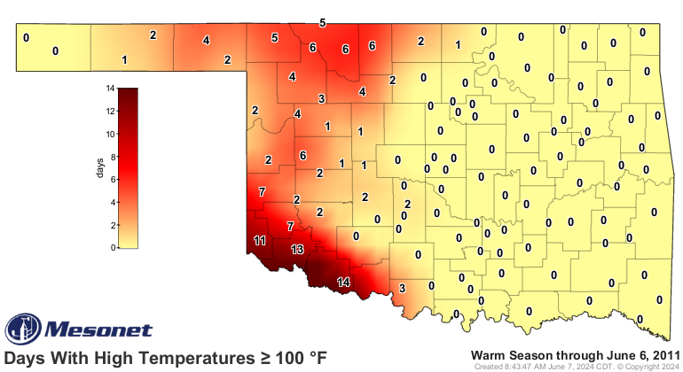
Here's how we looked at this point in 2011, the hottest summer in Oklahoma
history (and in actuality, the hottest summer for ANY state on record back to
1895).
https://ticker.mesonet.org/archive/20240607/tmax_ge90.20110606.png
https://ticker.mesonet.org/archive/20240607/tmax_ge100.20110606.png
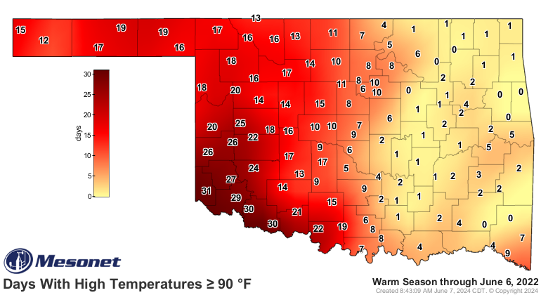
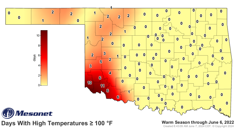
And here's how we looked at this point in 2022, which became the hottest summer
in the state since 2011.
https://ticker.mesonet.org/archive/20240607/tmax_ge90.20220606.png
https://ticker.mesonet.org/archive/20240607/tmax_ge100.20220606.png
So we're just a bit behind the extreme heat of those early summers for the most
part, but way behind in the EXTREME heat. And for those weirdos that actually
like their summer temps non-scorching, we will see quite the cold front early
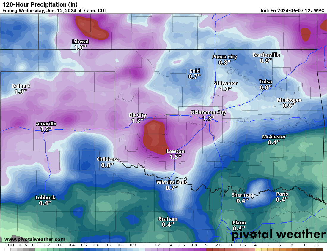
next week, along with some pretty good rain chances.
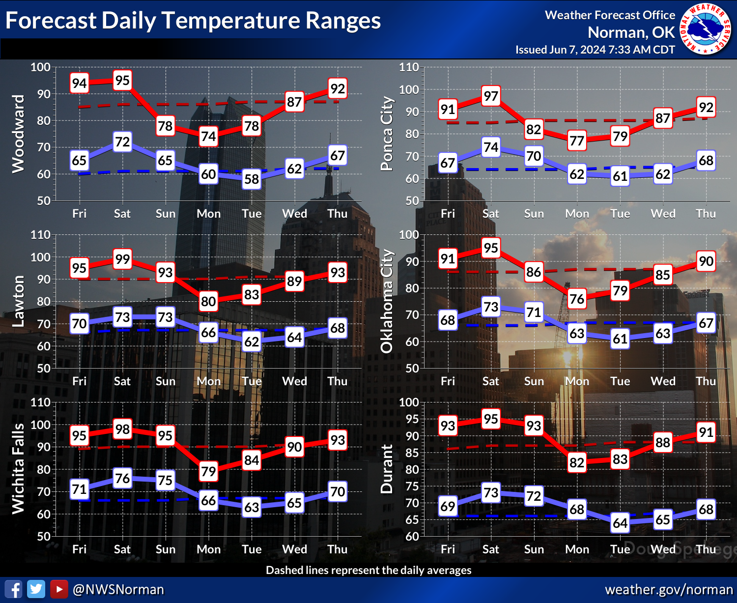
https://ticker.mesonet.org/archive/20240607/monday-highs.png
https://ticker.mesonet.org/archive/20240607/nws-norman-7day-temps.png
https://ticker.mesonet.org/archive/20240607/5day-rain-forecast.png
Rain in early June begets high heat indexes in mid-June, and high heat indexes
in mid-June beget high air temperatures in late June (after evaporation), and
high air temperatures in late June beget...who knows what.
Gary McManus
State Climatologist
Oklahoma Mesonet
Oklahoma Climatological Survey
gmcmanus@ou.edu
==================================================
The OCS/Mesonet Ticker
https://ticker.mesonet.org/
To subscribe or unsubscribe from the Ticker
or for questions about the Ticker or its content
Phone or Email the Ticker Manager at OCS
Phone: 405-325-2253 Email: ticker@mesonet.org
---------------------------------------------------
-C- Copyright 2024 Oklahoma Climatological Survey
===================================================
|


 Tweet
Tweet