MESONET TICKER ... MESONET TICKER ... MESONET TICKER ... MESONET TICKER ...
May 7, 2024 May 7, 2024 May 7, 2024 May 7, 2024
The power of one
https://ticker.mesonet.org/archive/20240507/yesterday.png
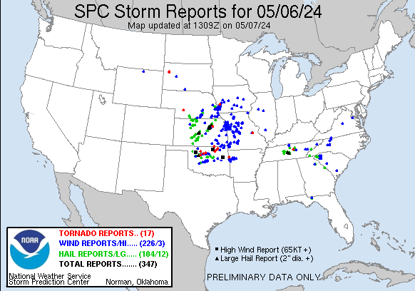
Well that about covers high risk outlook events for the year, I hope. To me it
went about as expected, with one or two big tornadoes, and of course Barnsdall up
in Osage County is paying the price for a direct hit. Bartlesville to a bit of a
lesser degree from the same long-tracked tornado, probably. And it only takes ONE
tornado to make the day a disaster, even though we can acknowledge it could have
been a lot worse than the dozen or so tornadoes that did touch down. Then there
was the 80 mph windstorm that blew through Moore and OKC, doing damage. All those
things are preliminary reports, of course.
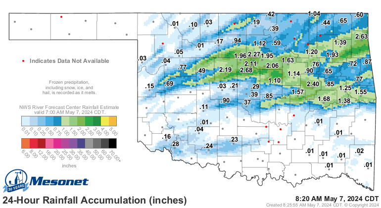
Not preliminary is the rain that fell, and it also tells the story of where those
supercells roamed across the countryside across the northern half of the state,
mostly.
https://ticker.mesonet.org/archive/20240507/rainrfc.24hr.png
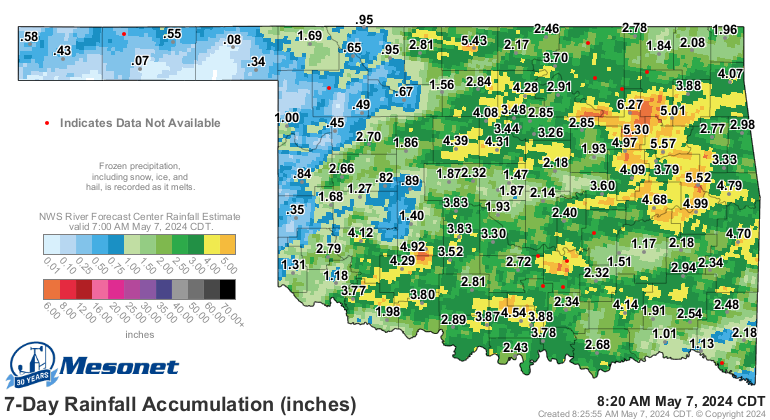
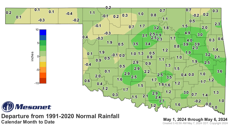
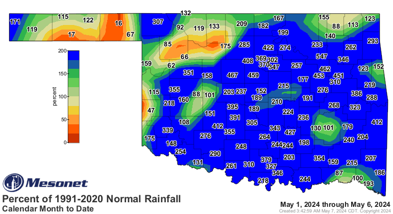
May itself has been pretty magnanimous (English to Okie translation: generous)
with it's moisture offerings, slapping that flash drought upside the head before
it could spread even further.
https://ticker.mesonet.org/archive/20240507/7day-rain-total.png
https://ticker.mesonet.org/archive/20240507/delmonth_rain.current.png
https://ticker.mesonet.org/archive/20240507/pctmonth_rain.current.png
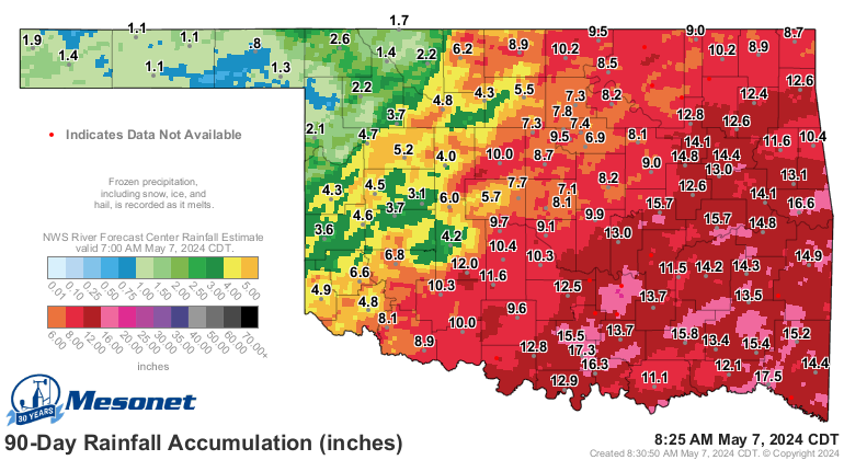
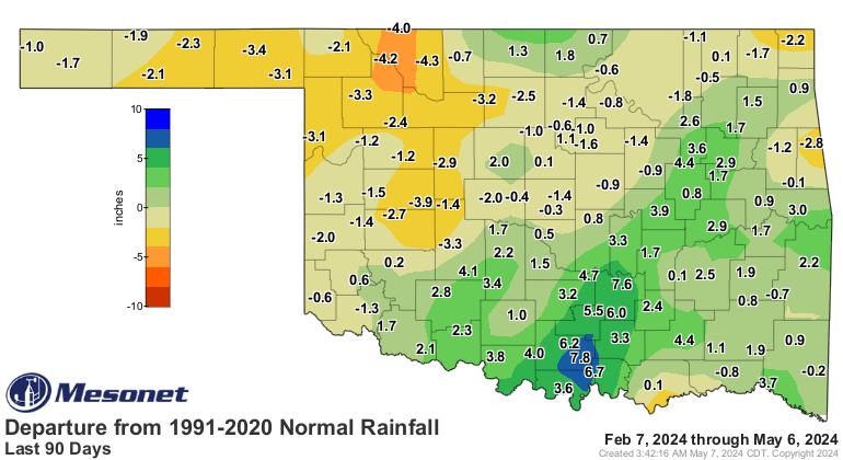
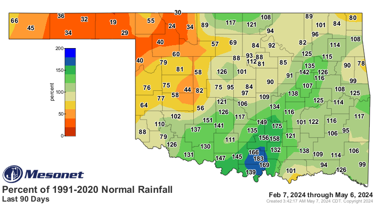
Still, the drought area pops across NW OK when you see the longer-term maps.
https://ticker.mesonet.org/archive/20240507/90day-rain-totals.png
https://ticker.mesonet.org/archive/20240507/del90day_rain.current.png
https://ticker.mesonet.org/archive/20240507/pct90day_rain.current.png
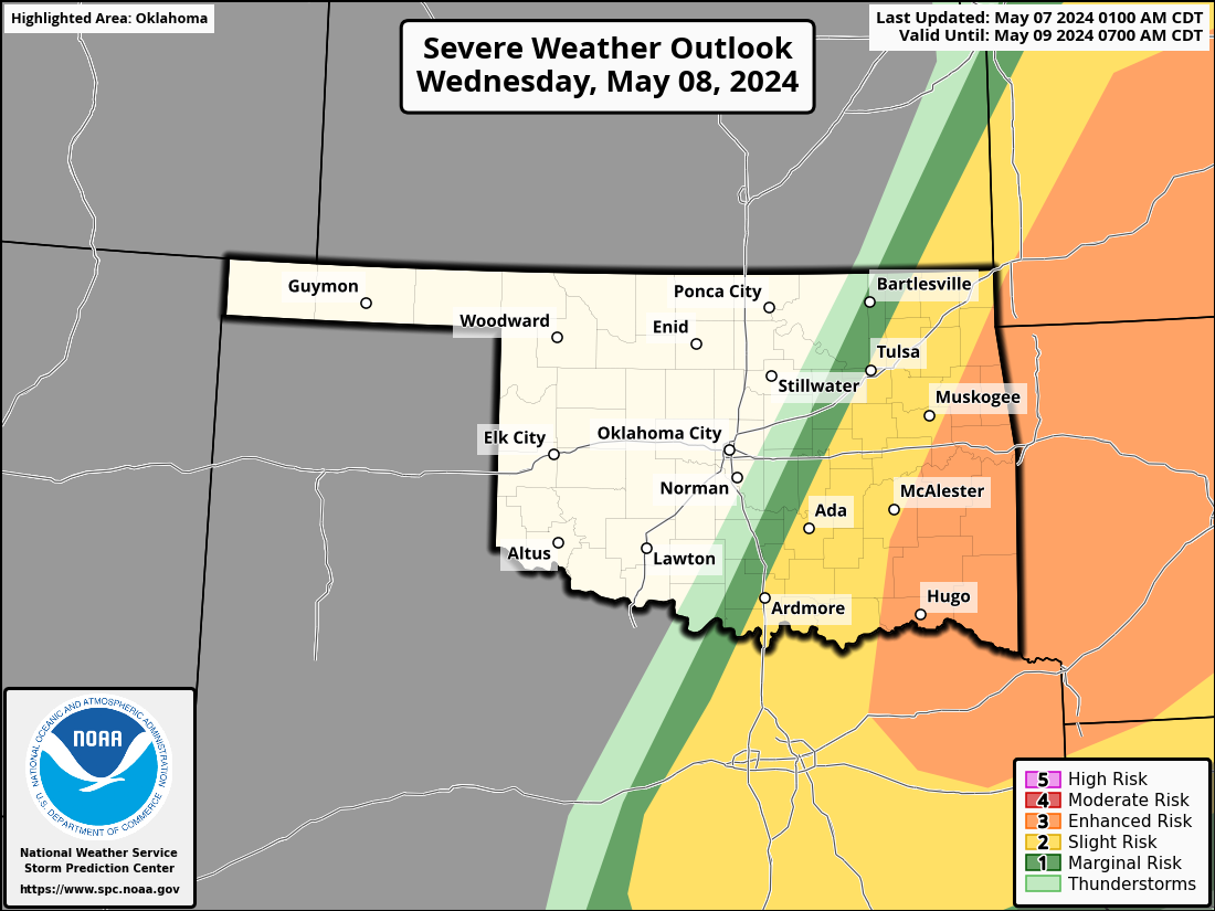
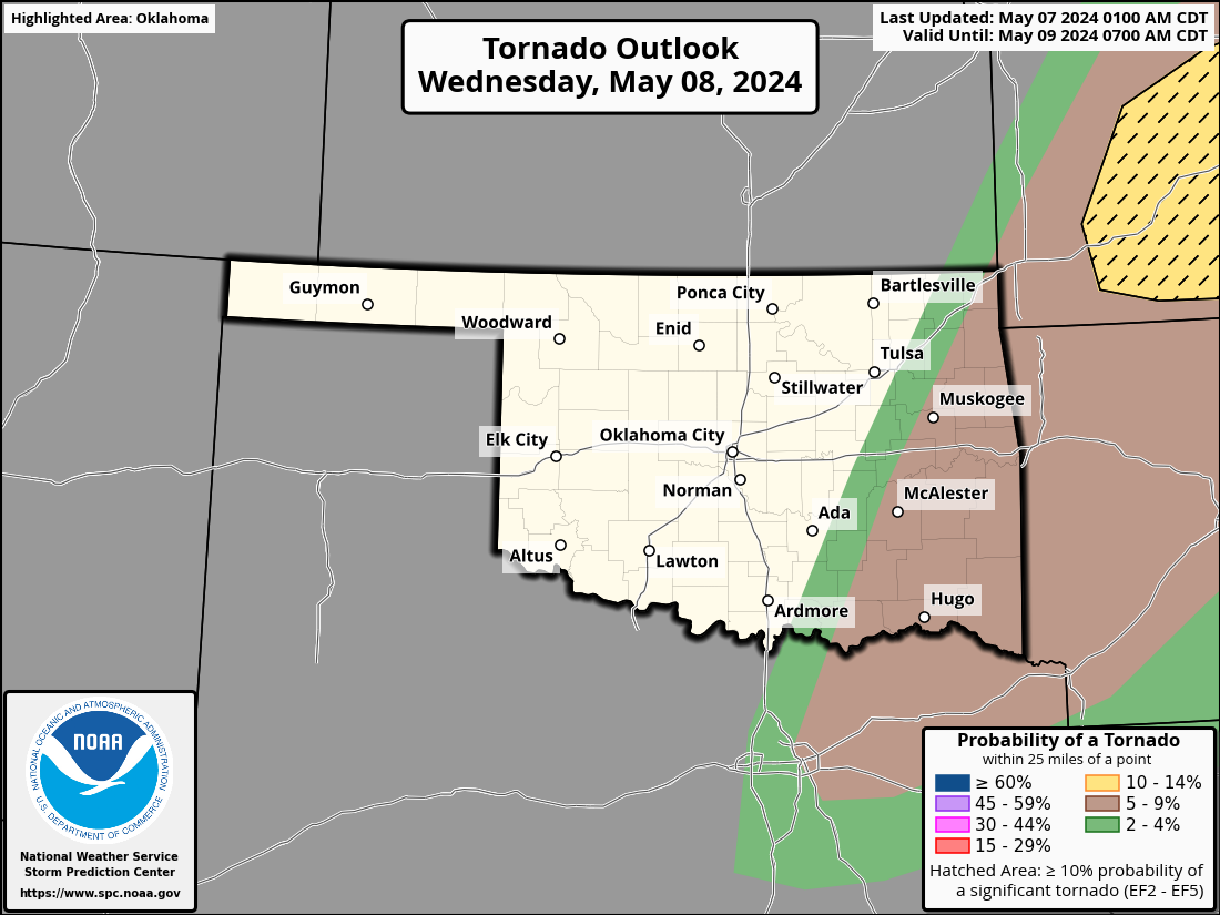
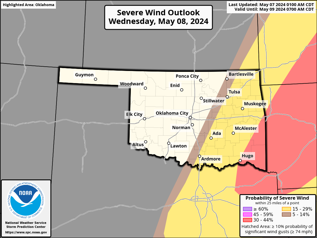
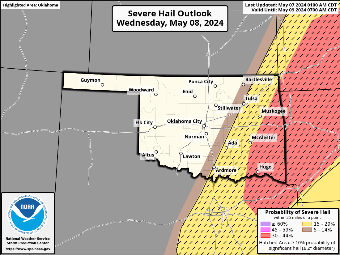
We will have chances for storms over the next couple of days, but not really
expecting the high-end stuff for most of us. There is a chance for some severe
weather down across SE up through NE OK on Wednesday, however.
https://ticker.mesonet.org/archive/20240507/OK_swody2.png
https://ticker.mesonet.org/archive/20240507/OK_swody2_TORN.png
https://ticker.mesonet.org/archive/20240507/OK_swody2_WIND.png
https://ticker.mesonet.org/archive/20240507/OK_swody2_HAIL.png
Springtime in Oklahoma! Probably have a hurricane next.
Gary McManus
State Climatologist
Oklahoma Mesonet
Oklahoma Climatological Survey
gmcmanus@mesonet.org
==================================================
The OCS/Mesonet Ticker
https://ticker.mesonet.org/
To subscribe or unsubscribe from the Ticker
or for questions about the Ticker or its content
Phone or Email the Ticker Manager at OCS
Phone: 405-325-2253 Email: ticker@mesonet.org
---------------------------------------------------
-C- Copyright 2024 Oklahoma Climatological Survey
===================================================
|


 Tweet
Tweet