MESONET TICKER ... MESONET TICKER ... MESONET TICKER ... MESONET TICKER ...
October 6, 2015 October 6, 2015 October 6, 2015 October 6, 2015
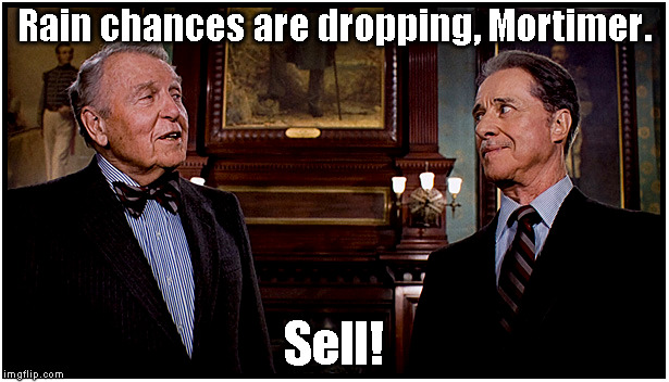
Rain rain, going away
http://ticker.mesonet.org/archive/20151006/sell.jpg
We have an upper-level low to the west of us that wants to take a Mexican vacation,
and a front coming through that's begging for a glass of water. Together, that
means that our rain chances are taking the old nosedive into Flash Drought Lake.
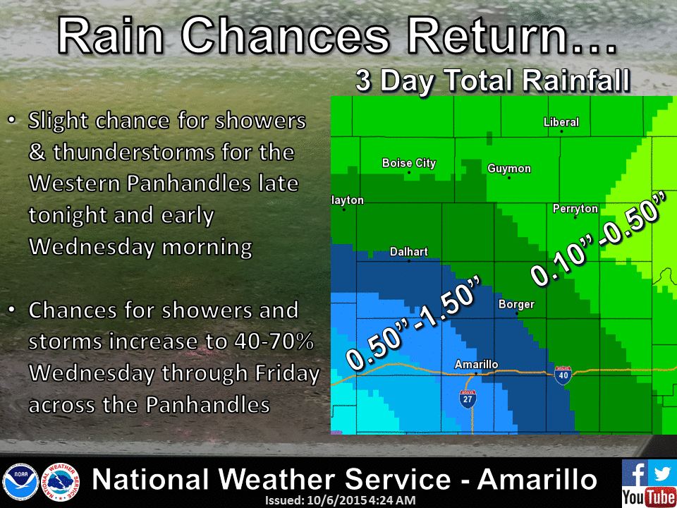
http://ticker.mesonet.org/archive/20151006/nws-amarillo-rain.gif
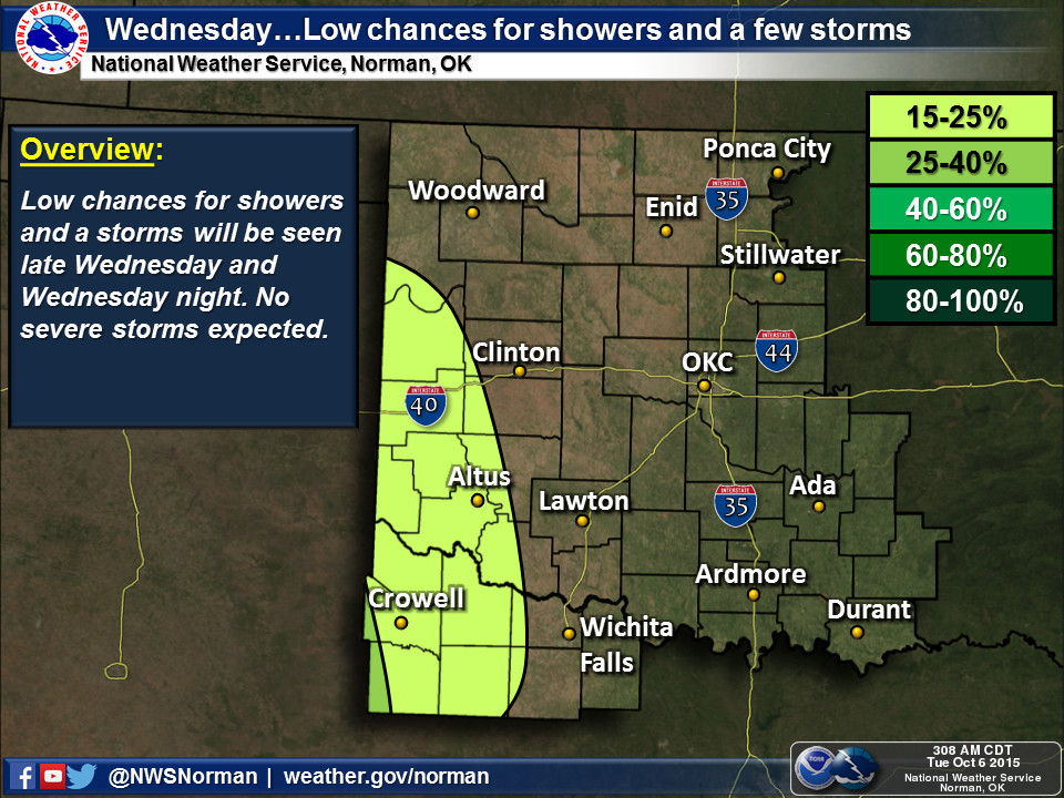
http://ticker.mesonet.org/archive/20151006/nws-norman-rain1.jpg
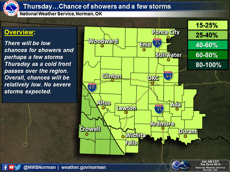
http://ticker.mesonet.org/archive/20151006/nws-norman-rain2.jpg
http://ticker.mesonet.org/archive/20151006/nws-norman-rain3.jpg
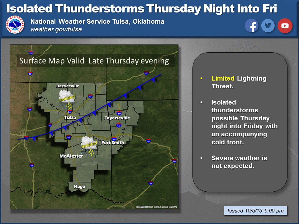
http://ticker.mesonet.org/archive/20151006/tulsa-nws-rain.png
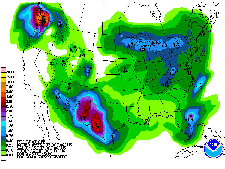
So the chances are there, a bit lower than previously advertised, and the same
story holds for the amounts.
http://ticker.mesonet.org/archive/20151006/7day-rain-forecast.gif
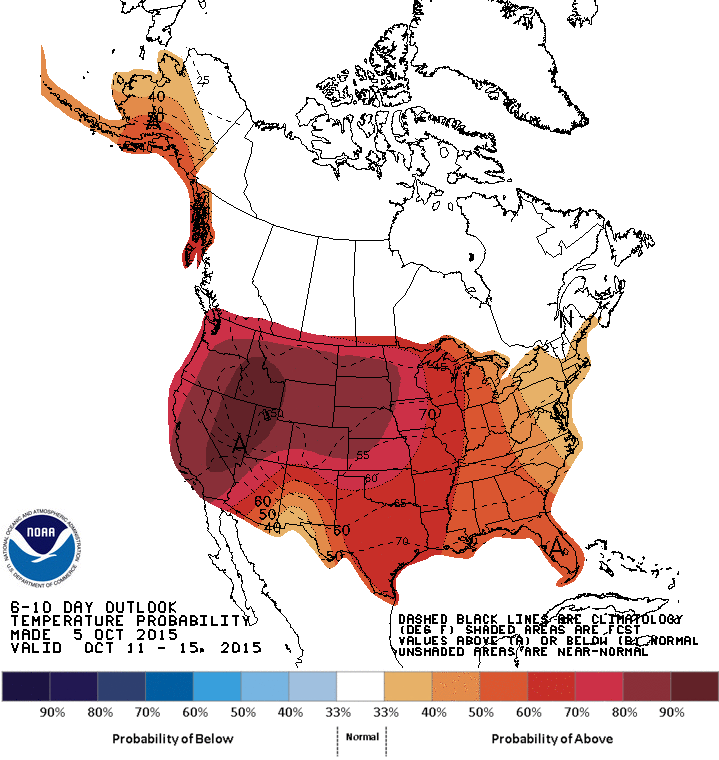
On top of that, we have a possible return to summer in the forecast for early
next week with highs in the 80s and even some low 90s.
http://ticker.mesonet.org/archive/20151006/nws-norman-7day.jpg
This means flash drought will be enhanced rather than relieved. The impacts
continue to show up in our soil moisture data from the Mesonet, and we have our
first burn ban for the state implemented in McCurtain County.
http://www.mesonet.org/index.php/weather/category/soil_moisture
http://ticker.mesonet.org/archive/20151006/BurnBanMap100515.png
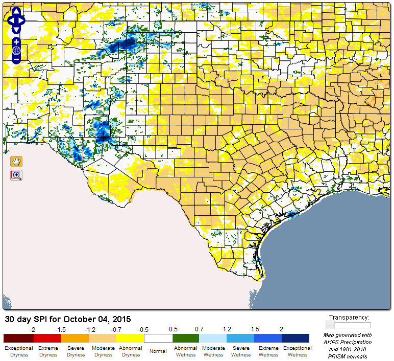
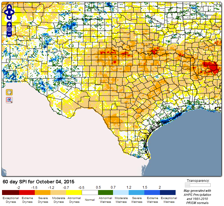
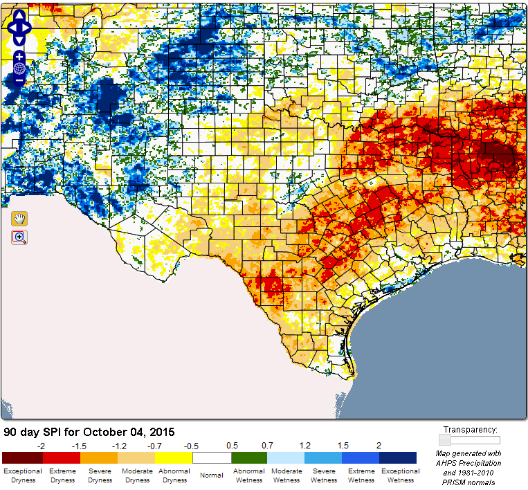
And the various drought indices we look at are all showing the flash drought
development, especially in the 60-day time frame.
http://ticker.mesonet.org/archive/20151006/30day-SPI.png
http://ticker.mesonet.org/archive/20151006/60day-SPI.png
http://ticker.mesonet.org/archive/20151006/90day-SPI.png
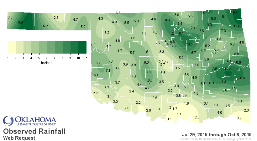
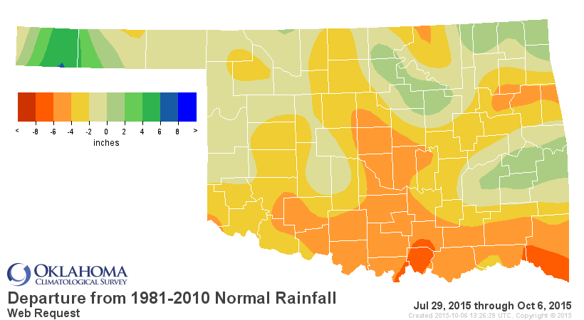
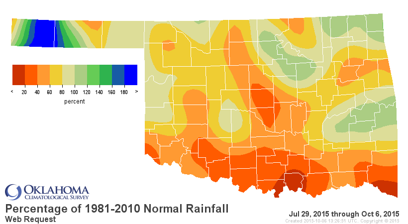
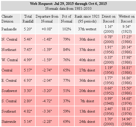
And the dry weather can be traced back to July 29. For that ~70 day period,
we're down more than 5 inches in some places...the 7th driest such period on
record since at least 1921 for SC Oklahoma.
http://ticker.mesonet.org/archive/20151006/july29-oct6-totals.png
http://ticker.mesonet.org/archive/20151006/july29-oct6-depart-normal.png
http://ticker.mesonet.org/archive/20151006/july29-oct6-pct-normal.png
http://ticker.mesonet.org/archive/20151006/july29-oct6-stats.png
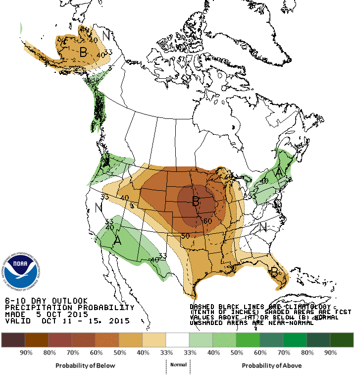
I wish we had better news. Don't pack the shorts away just yet, and keep your
snowcone coupons handy. Next week looks very early September-ish.
http://ticker.mesonet.org/archive/20151006/oct11-15-precip-outlook.gif
http://ticker.mesonet.org/archive/20151006/oct11-15-temp-outlook.gif
Gary McManus
State Climatologist
Oklahoma Mesonet
Oklahoma Climatological Survey
(405) 325-2253
gmcmanus@mesonet.org
==================================================
The OCS/Mesonet Ticker
https://ticker.mesonet.org/
To subscribe or unsubscribe from the Ticker
or for questions about the Ticker or its content
Phone or Email the Ticker Manager at OCS
Phone: 405-325-2253 Email: ticker@mesonet.org
---------------------------------------------------
-C- Copyright 2024 Oklahoma Climatological Survey
===================================================
|


 Tweet
Tweet