Ticker for December 5, 2018
MESONET TICKER ... MESONET TICKER ... MESONET TICKER ... MESONET TICKER ...
December 5, 2018 December 5, 2018 December 5, 2018 December 5, 2018
Want fries with that?
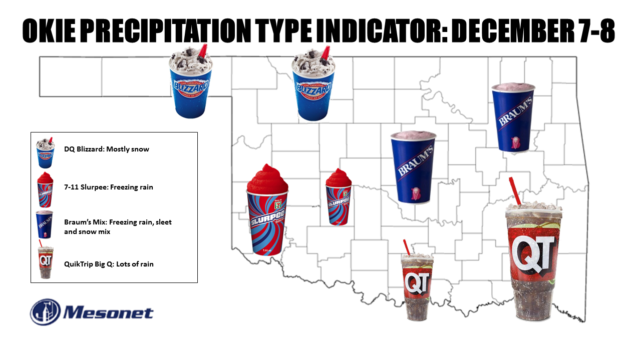
Hey, this is just an approximation of the winter precipitation type you might
see in your area. At least the most dominant one, or the one that will cause you
the most impacts. In truth, mostly everybody will see a bit of everything, except
maybe the southeast where temperatures could stay above freezing through the
whole event. And even those folks could be a *bit* of snow at the tail end (and
we all know just how painful that can be). And sorry to those we left out.
McDonald's McFlurry...too much moisture with the storm. Flurries would be a good
wish at this point. Wendy's Frosty? Well, it will be frosty AFTER the storm, but
they do make a good, uhhhh, Frosty. Southern Oklahoma should have probably gotten
a Big Gulp, but we wanted to give eastern Oklahoma their QuikTrip fix this storm.
At any rate, we do have a classic setup still materializing across the region with
a large upper-level storm approaching from the west, a cold front zooming down
from the north, and lots of moisture poised to our south for fuel as it mixes over
the state (RATS!!! That could have been my Braum's Mix). So as we look at the
graphics from our friends at the NWS, here's the one that worries me the most.

No no no, not that one! I'm not flying anywhere, and I don't see Col. Stewart
around here (watch the movie, you'll thank me). THIS ONE!

ICE! I hate ice. I hope that one doesn't come true. Nothing worse than ice.
Except maybe snow on ice. Well, that scenario looks likely as well. Here are the
suite of this winter storm's graphics from the local NWS offices, giving their
thoughts of this storm from a long LONG 48 hours out.
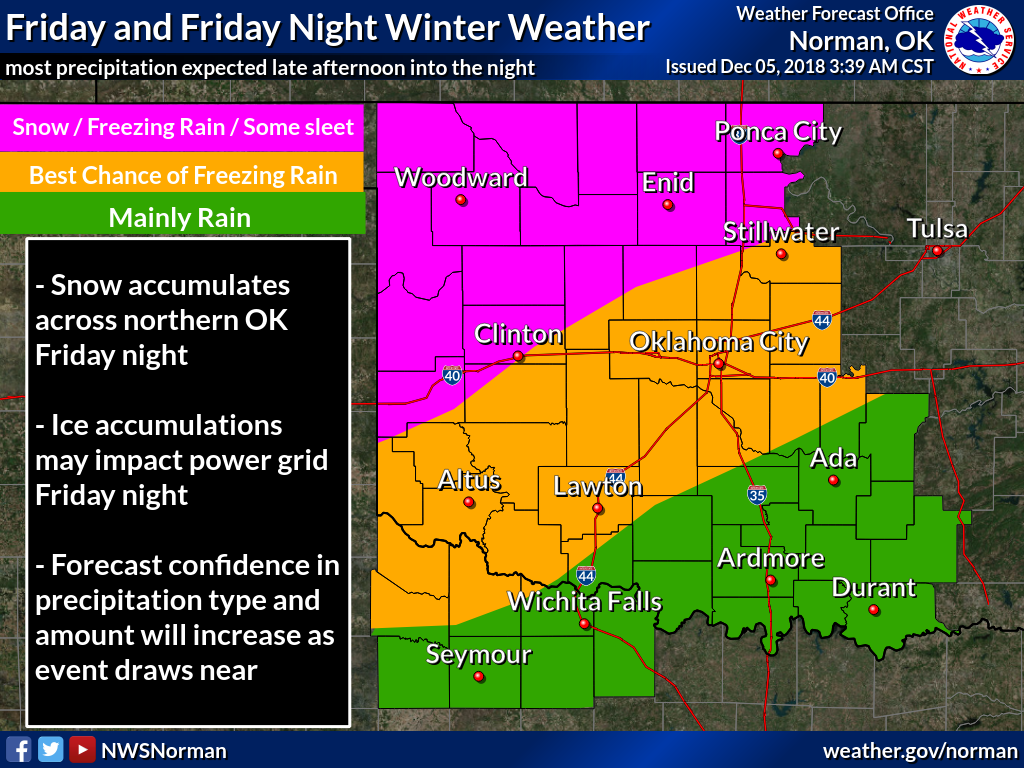
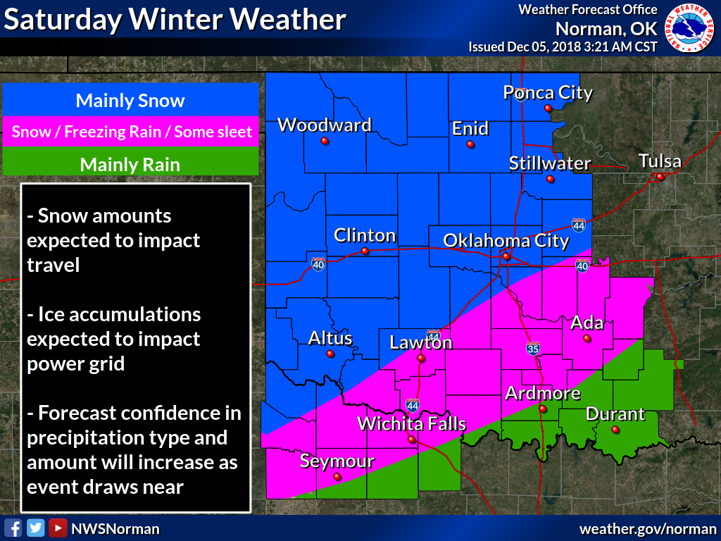
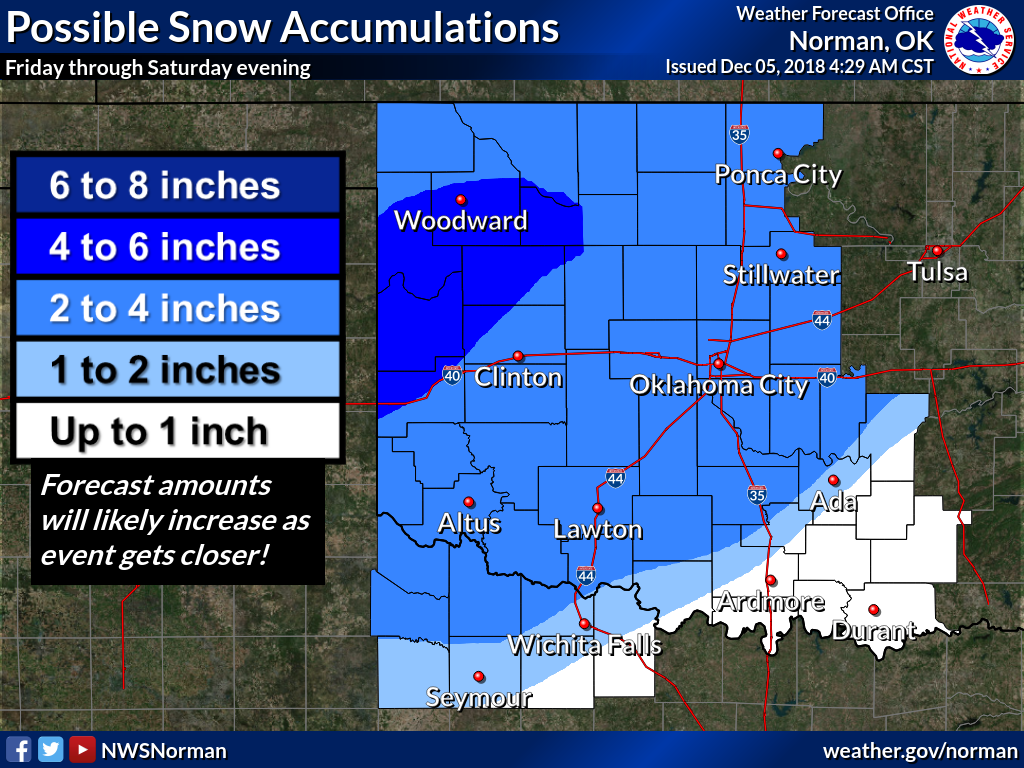
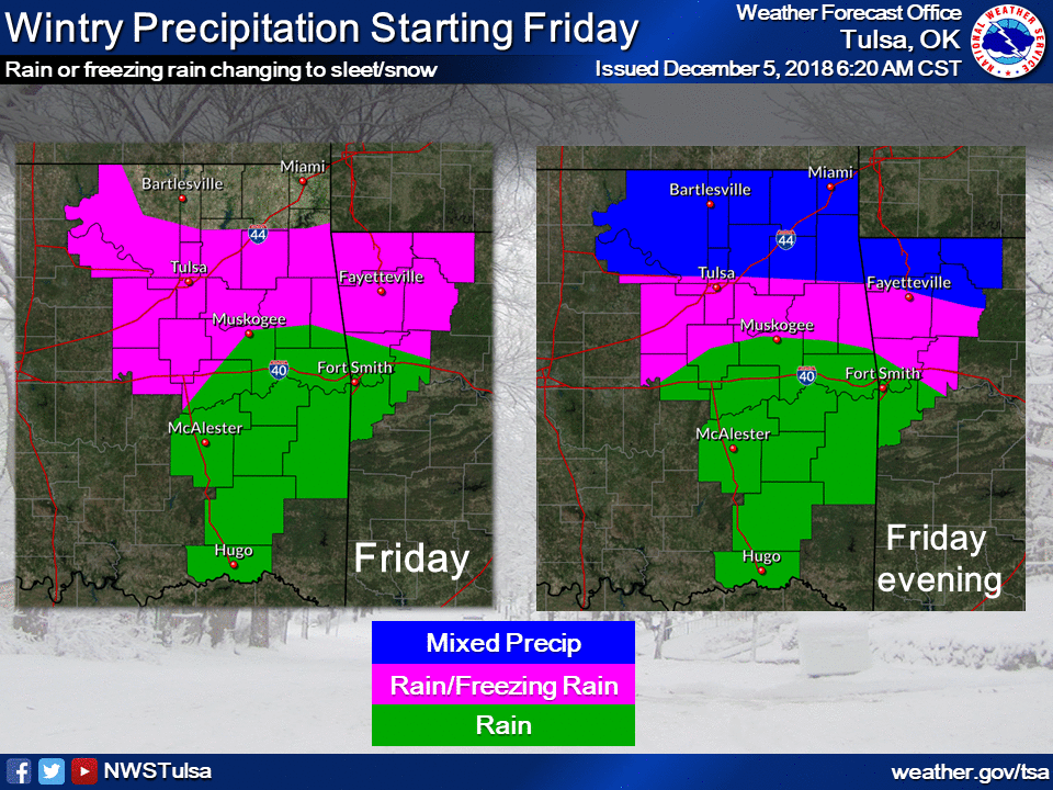
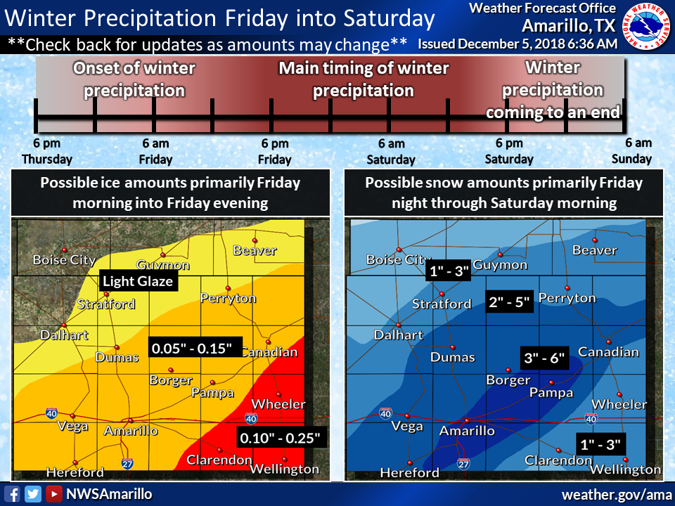
And as I said, this storm has a lot of moisture to work with.
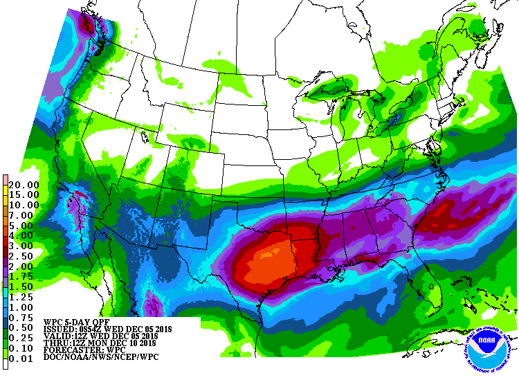
That's all enough for the local NWS offices to start issuing Winter Storm
Watches.
NO! Focus! Besides, you couldn't afford that watch anyway. THIS winter watch.
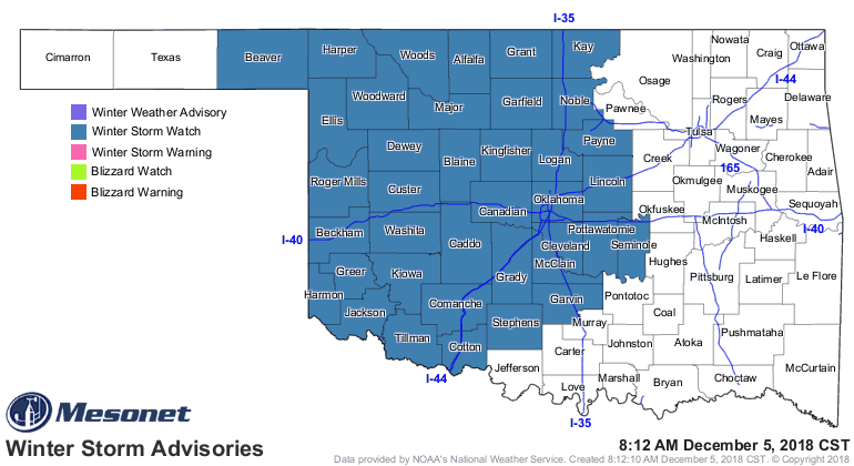
Now for some GOOD news. This forecast can and probably will change as the storm
gets closer, the computer models get a better handle on it, and the forecasters
are able to pinpoint the impacts and their locations better. And that will
continue right up to and through the event. So maybe those impacts you're seeing
now will lessen over time.
Now for some BAD news. This forecast can and probably will change as the storm
gets closer, the computer models get a better handle on it, and the forecasters
are able to pinpoint the impacts and their locations better. And that will
continue right up to and through the event. So maybe those impacts you're seeing
now will GET WORSE over time.
And here's a primer on the difficulties of forecasting winter precipitation
types.
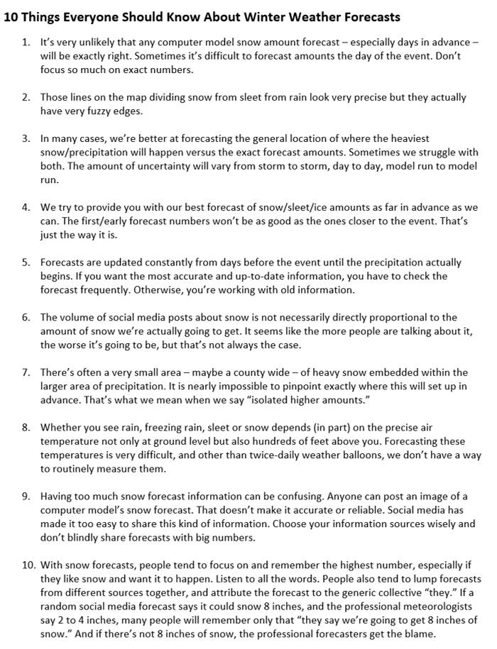
The main thing to remember here is to prepare for a very big, wet storm system
that will have a varying amount of cold air to work with (more in the NW, less
in the SE...I know, shocker). Precipitation types and amounts for individual
locations are still up in the air, pardon the pun, so keep your eyes and ears
trained to your favorite NWS or media (or both) weather source to stay weather
aware this weekend. Especially if you have to travel.
It's gonna be a good weekend to stay indoors.
Hmmmm, I wonder if they serve McFlurry's this early....
Gary McManus
State Climatologist
Oklahoma Mesonet
Oklahoma Climatological Survey
(405) 325-2253
gmcmanus@mesonet.org
December 5 in Mesonet History
| Record | Value | Station | Year |
|---|---|---|---|
| Maximum Temperature | 84°F | MANG | 2021 |
| Minimum Temperature | 0°F | KENT | 2013 |
| Maximum Rainfall | 1.55 inches | BIXB | 2021 |
Mesonet records begin in 1994.
Search by Date
If you're a bit off, don't worry, because just like horseshoes, “almost” counts on the Ticker website!