Ticker for November 5, 2020
MESONET TICKER ... MESONET TICKER ... MESONET TICKER ... MESONET TICKER ...
November 5, 2020 November 5, 2020 November 5, 2020 November 5, 2020
Change up
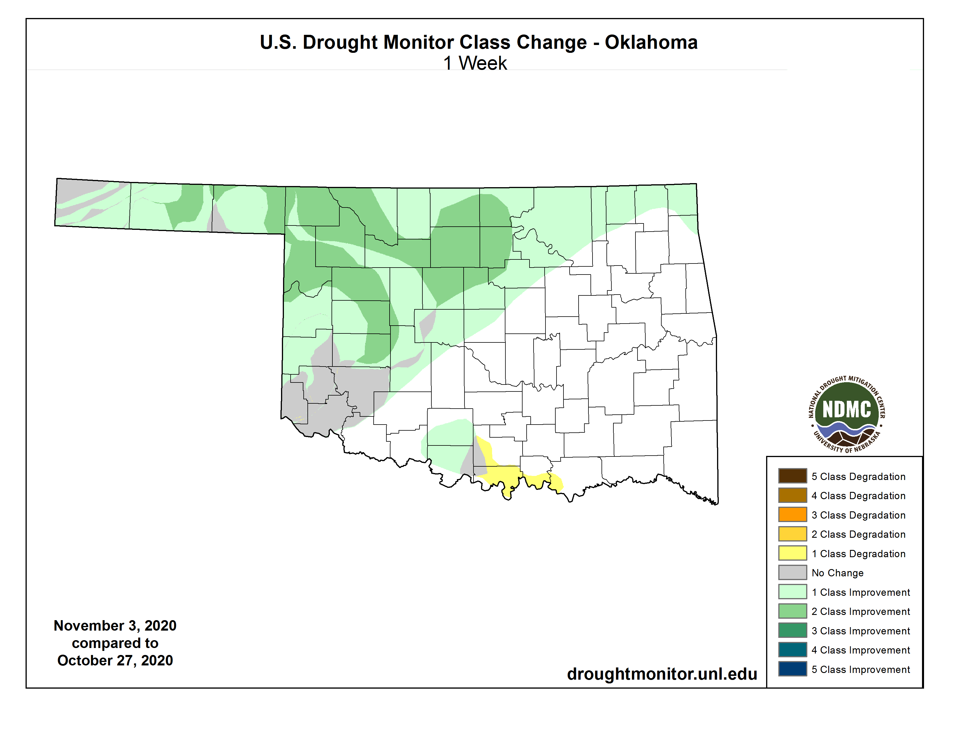
Nice looking map. Could have been a BIT better in the far southwest and the
far western Panhandle, but we'll take it. All this great improvement is a result
of the powerful winter storm that thrashed the state last week. One of the great
things about winter storms is. Yeah, that was on purpose. Let me try again. One
of the least NASTY things about winter storms is the precipitation that falls
tends to sit on the surface and melt, allowing it to slowly percolate into the
soils. That's opposed to those hard rains we get around here, where you tend to
have a lot of runoff. So there's a trade off of sorts. Want to fill your pond?
Ask for a nice hard rain that will runoff directly into the pond and help fill it
up. Want to replenish the moisture in the soils? Ask for a gentle-to-moderate slow
rain that will soak into the ground. Or a winter storm, if you are so inclined.
Let me just say that not too many FRIGGING POWER LINES are knocked down due to
slow rains.
Now that begs the question, is a slow rain or a hard rain gonna fall? We'll go
with the hard rain, because it's Oklahoma but also because that's the way Bob
Dylan wrote it.
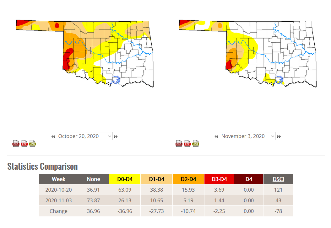
The improvements leave us with a much nicer Drought Monitor map.
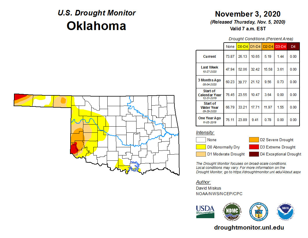
The 10.65% of the state left in drought is a 28% improvement from the map just
two weeks ago, when much of the northwestern half of the state was headed
towards full-on drought.
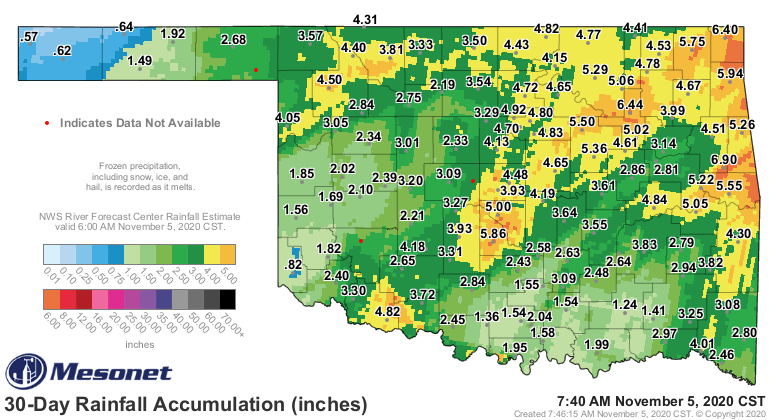
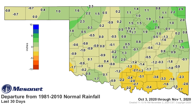
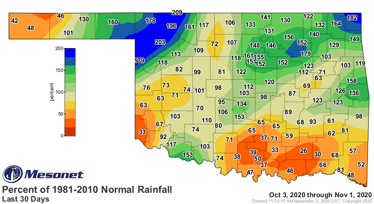
The single big storm left our 30-day rainfall maps looking much nicer as well.
The dry areas still show up quite distinctly, however.
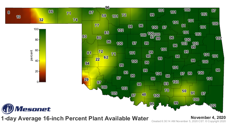
The 16-inch percent plant available water map shows where those soils have
improved dramatically as well.
Next chance or rain comes early next week with another cold front. Right now
it doesn't look like a major player for our remaining drought areas.
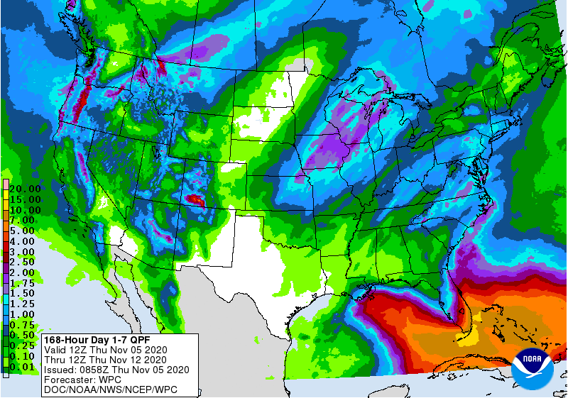
Otherwise, nothing big showing up on the horizon. Like we said the other day,
sometimes boring is good!
Gary McManus
State Climatologist
Oklahoma Mesonet
Oklahoma Climatological Survey
(405) 325-2253
gmcmanus@mesonet.org
November 5 in Mesonet History
| Record | Value | Station | Year |
|---|---|---|---|
| Maximum Temperature | 91°F | BURN | 2017 |
| Minimum Temperature | 20°F | BEAV | 2010 |
| Maximum Rainfall | 4.60 inches | IDAB | 2000 |
Mesonet records begin in 1994.
Search by Date
If you're a bit off, don't worry, because just like horseshoes, “almost” counts on the Ticker website!