Ticker for October 5, 2023
MESONET TICKER ... MESONET TICKER ... MESONET TICKER ... MESONET TICKER ...
October 5, 2023 October 5, 2023 October 5, 2023 October 5, 2023
And so it begins
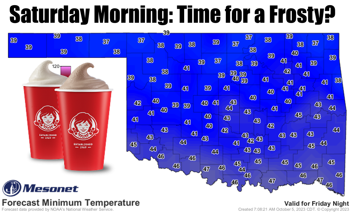
By the way, I'm glad to see the vanilla Frostys back at Wendy's, following that
summer sojourn into just strawberry and chocolate. But even Wendy's can't escape
the pumpkin spice insanity.

Et tu (and three and four), Wendy's?
Anyway, look at those low temperatures. That'll freeze your pumpkins (and we
all know just how painful that can be). That'll be the coldest weather we've
seen in the state since May 3, when Nowata dropped to 32 degrees, which is also
the last freeze we've seen in the state. Ugh, not looking forward to talking
about freezes again. Can't we just stick to Frostys?
How about that rain though?
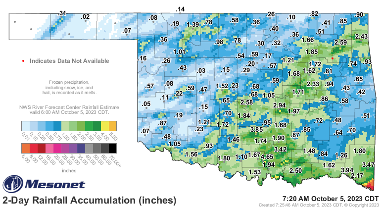
Not great for everybody, but awesome for a lot. Not a drought-buster for most,
but a drought delayer for many. Not a great writer, but I am not a great
writer. WAIT! Back to weather...at least parts of south central Oklahoma finally
got some significant rainfall, although far SW OK missed out AGAIN. If you look
at that map in conjunction with this week's U.S. Drought Monitor released this
morning, you can see some areas with possible improvements.

And just in the nick of time, too. Sure, and the time of Nick if that suits ya.

Nick of time...oh yeah, look at the total amount of drought (D1-D4) as compared
to last week's map: 46.76% last week to 45.30% this week. Yay, right? But then
look at the "at least severe drought" (D2-D4) percentages: 30.93% last week
to 32.40% this week? Say what? And then at least extreme drought (D3-D4): 12.91%
to 14.34%.
What devilry is this? Well, the change map gives us a better look.
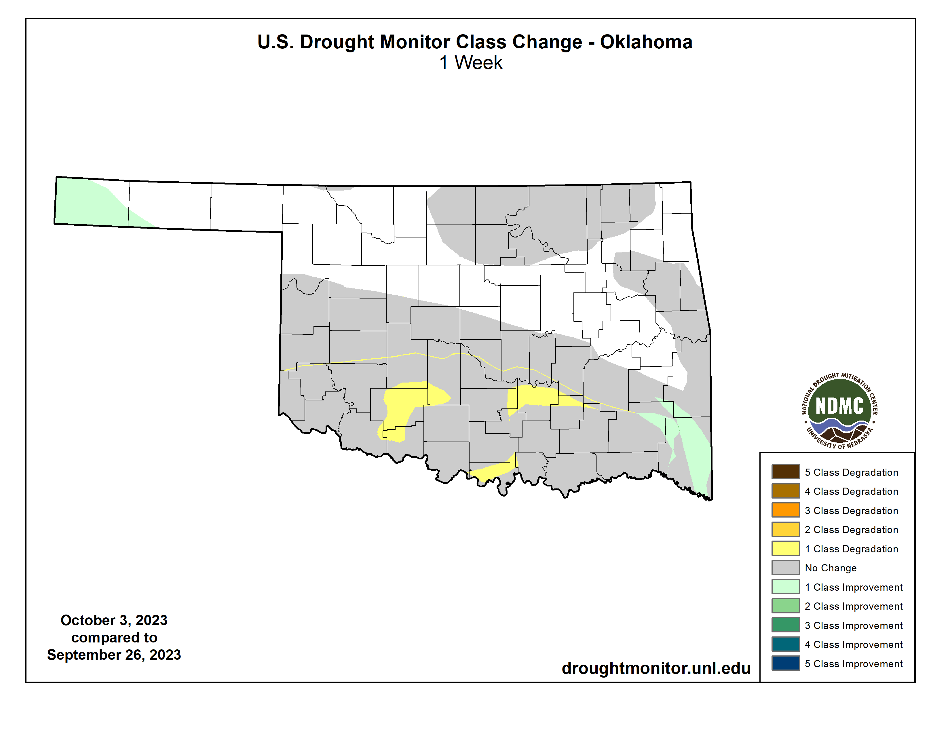
So some improvements again from last week in the far SE and the western Panhandle,
but worse down across south central and SW OK where areas of "bad" drought
worsened.
Our next chance of rain comes later next week and is just now starting to show
up on the forecast maps. Of course, a ways away, so this could all go *POOF*
and go away. Don't believe me? Ask my scalp!

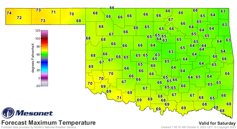
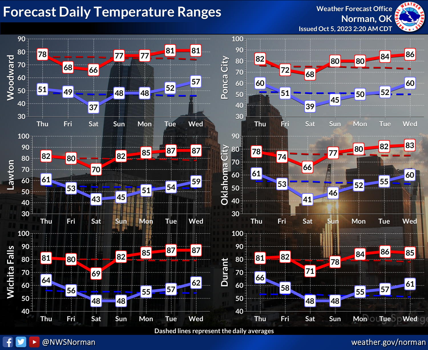
Back to those temperatures, I think we might see a frost here and there across
northern OK on Saturday morning with clear skies and a reinforcing shot of cold,
dry air the day before. Winds will be very light, and so in those low lying
areas, we could see temperatures get down into that 35-36 degrees range that
is magical for frost. Heck (no, not raining), I wouldn't be shocked to see it
all around the state, nor would I be shocked if somebody drops to the freezing
mark, albeit briefly (Albeit Briefly was my band's name in parochial school!).
Temperatures are squarely in fall territory for the next few days, including
that FALL winter Saturday.
Enjoy it whilst you can't (because you really CAN'T enjoy cold weather...FACT!),
above normal temps are back next week.
However, remember our climatologog...climateolog...climatogolo...climate lesson
we talked about a few weeks back. Sure, the above normal temperatures will come
back, they always do here in Oklahoma. But as the "normal" goes downward in
a death spiral to winter, so do the above normal temperatures, following that
"normal" curve downward (but still above it) thanks to shorter days, lower sun
angle, etc.
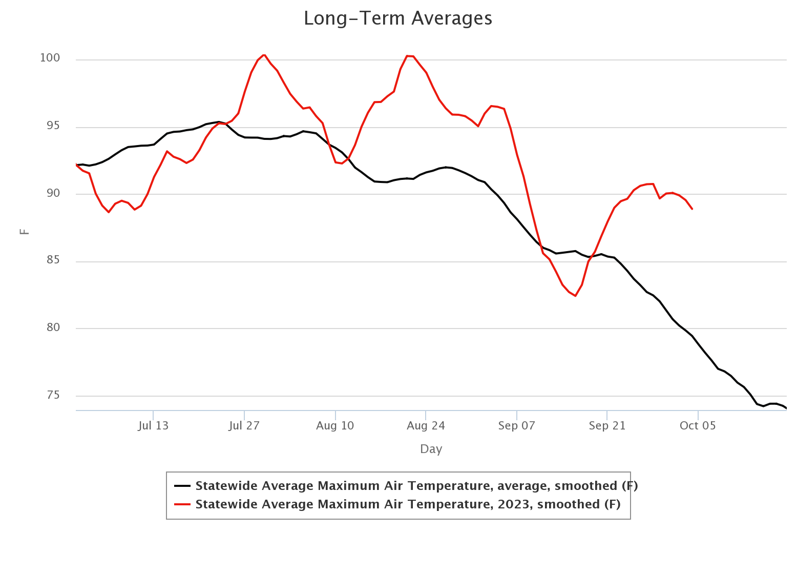
But we are getting into the time of year when many people enjoy those above
normal temperatures, at least for short periods of time.
Gary McManus
State Climatologist
Oklahoma Mesonet
Oklahoma Climatological Survey
gmcmanus@mesonet.org
October 5 in Mesonet History
| Record | Value | Station | Year |
|---|---|---|---|
| Maximum Temperature | 96°F | HOOK | 2018 |
| Minimum Temperature | 31°F | KENT | 2016 |
| Maximum Rainfall | 5.92 inches | PRYO | 1998 |
Mesonet records begin in 1994.
Search by Date
If you're a bit off, don't worry, because just like horseshoes, “almost” counts on the Ticker website!