MESONET TICKER ... MESONET TICKER ... MESONET TICKER ... MESONET TICKER ...
September 5, 2024 September 5, 2024 September 5, 2024 September 5, 2024
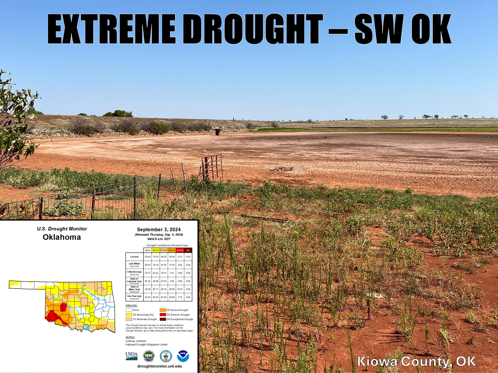
Extremely Extreme
https://ticker.mesonet.org/archive/20240905/SW-OK-drought.png
"Ravaged" is the word. No, this ain't no romance novel...there'll be no Fabio
memes. That hair though!! Sigh. Wait, back to the topic at hand. Drought continues
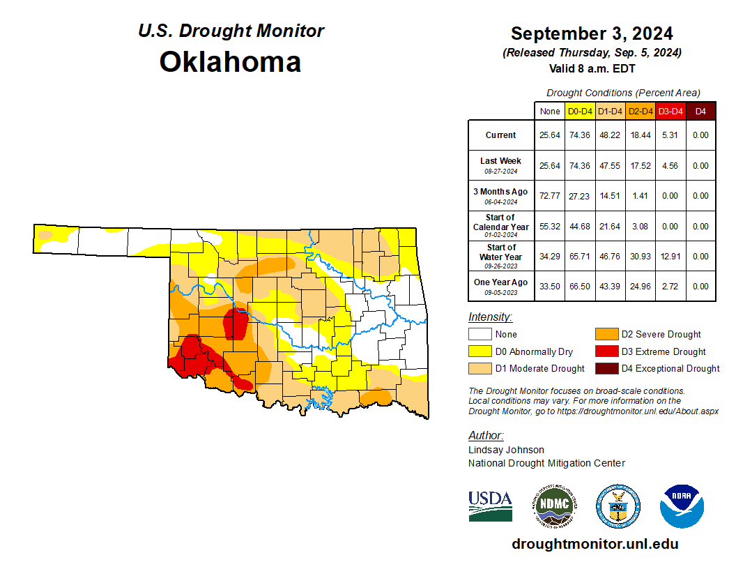
to intensify in the state, especially in SW OK where extreme drought (D3) now
covers 47% of that climate division, the highest coverage since Oct. 24 of last
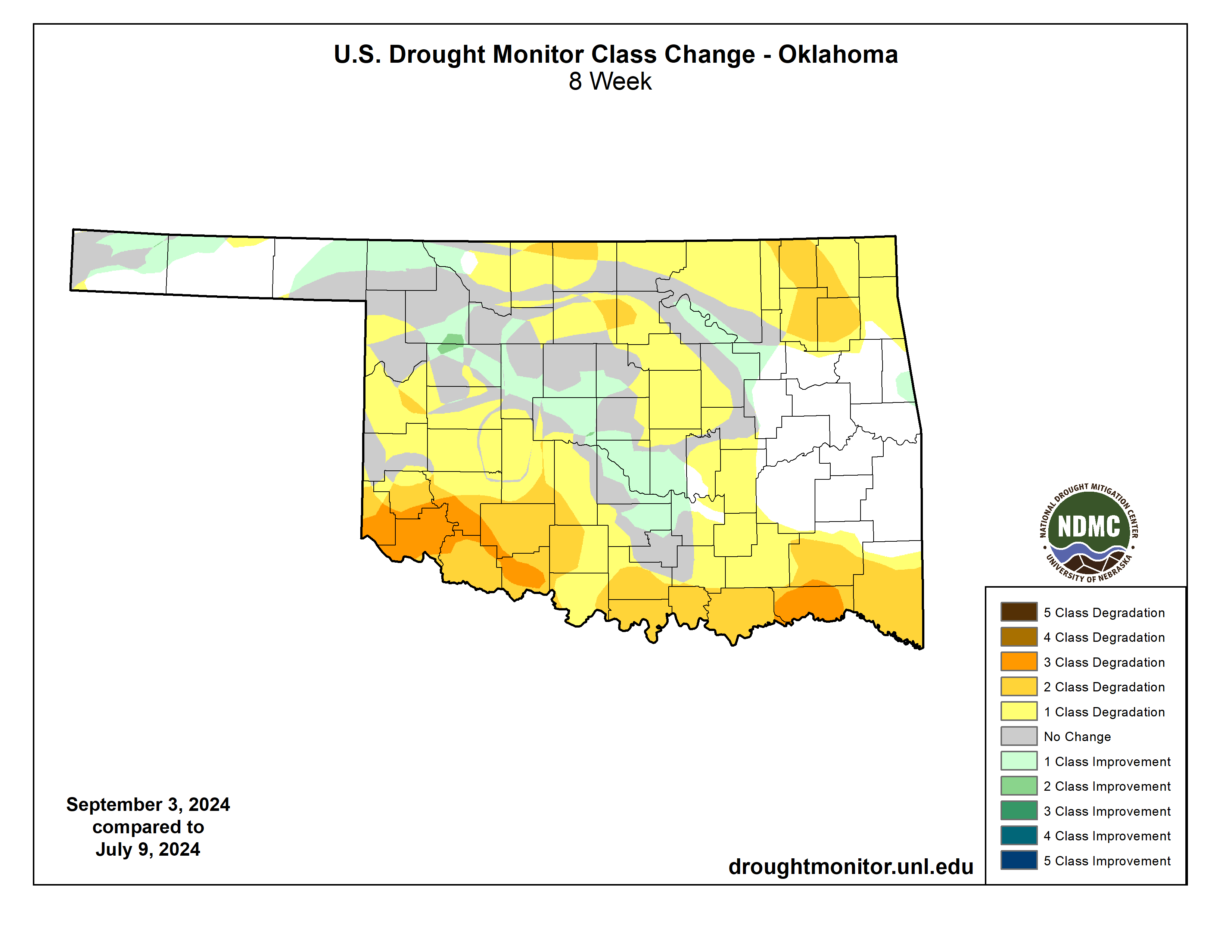
year. Conditions have worsened over the last 2 months, and those changes aren't
confined to just SW OK.
https://ticker.mesonet.org/archive/20240905/20240903_ok_trd.png
https://ticker.mesonet.org/archive/20240905/8week-change-DM.png
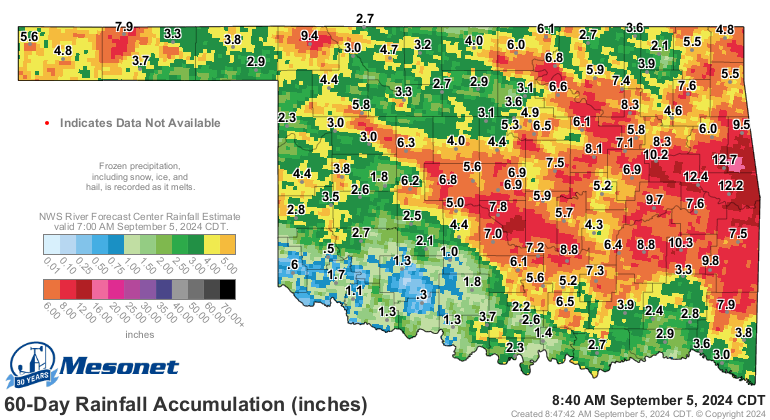
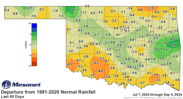
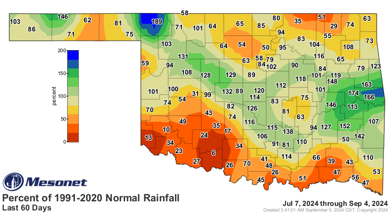
The improvements have been concentrated in those strips of heavier rainfall we've
seen over the last month or so, but the 60-day rainfall maps show the story.
https://ticker.mesonet.org/archive/20240905/60day-rain-totals.png
https://ticker.mesonet.org/archive/20240905/del60day_rain.current.png
https://ticker.mesonet.org/archive/20240905/pct60day_rain.current.png
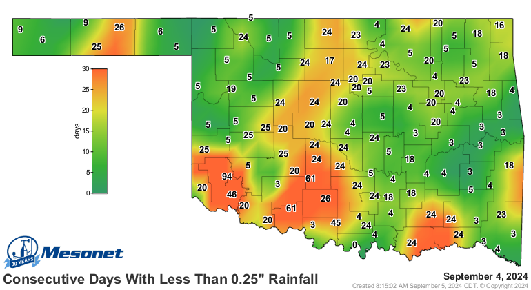
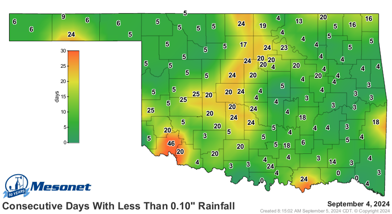
Heck (no, it's not raining right now...I wish!), Mangum has gone 94 consecutive
days without at least a quarter-inch of rain in a single day!
https://ticker.mesonet.org/archive/20240905/mesonet.rainfall.quarterinch.png
https://ticker.mesonet.org/archive/20240905/mesonet.rainfall.tenthinch.png
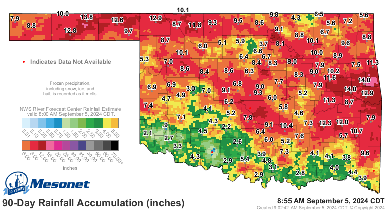
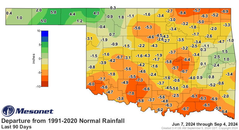
94 days?!? Are you kidding me Private Pyle...errr, I mean Mangum?? That's 0.9
inches over the last 90 days, which looks worse than even those 60-day maps.
Wait, Walters with 0.8 inches?
ARE YOU KIDDING ME, WALTERS?!?
https://ticker.mesonet.org/archive/20240905/90day-rain-totals.png
https://ticker.mesonet.org/archive/20240905/del90day_rain.current.png
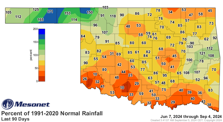
https://ticker.mesonet.org/archive/20240905/pct90day_rain.current.png
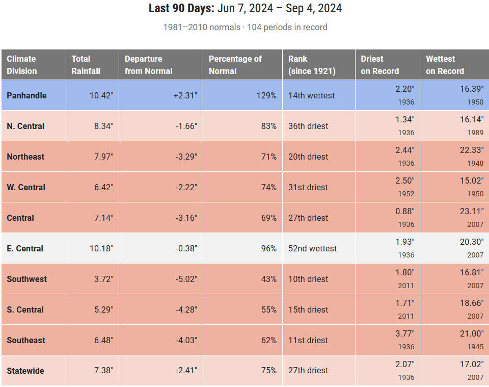
https://ticker.mesonet.org/archive/20240905/90day-stats.png
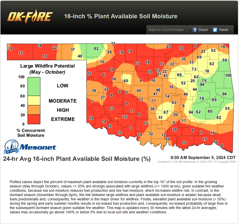
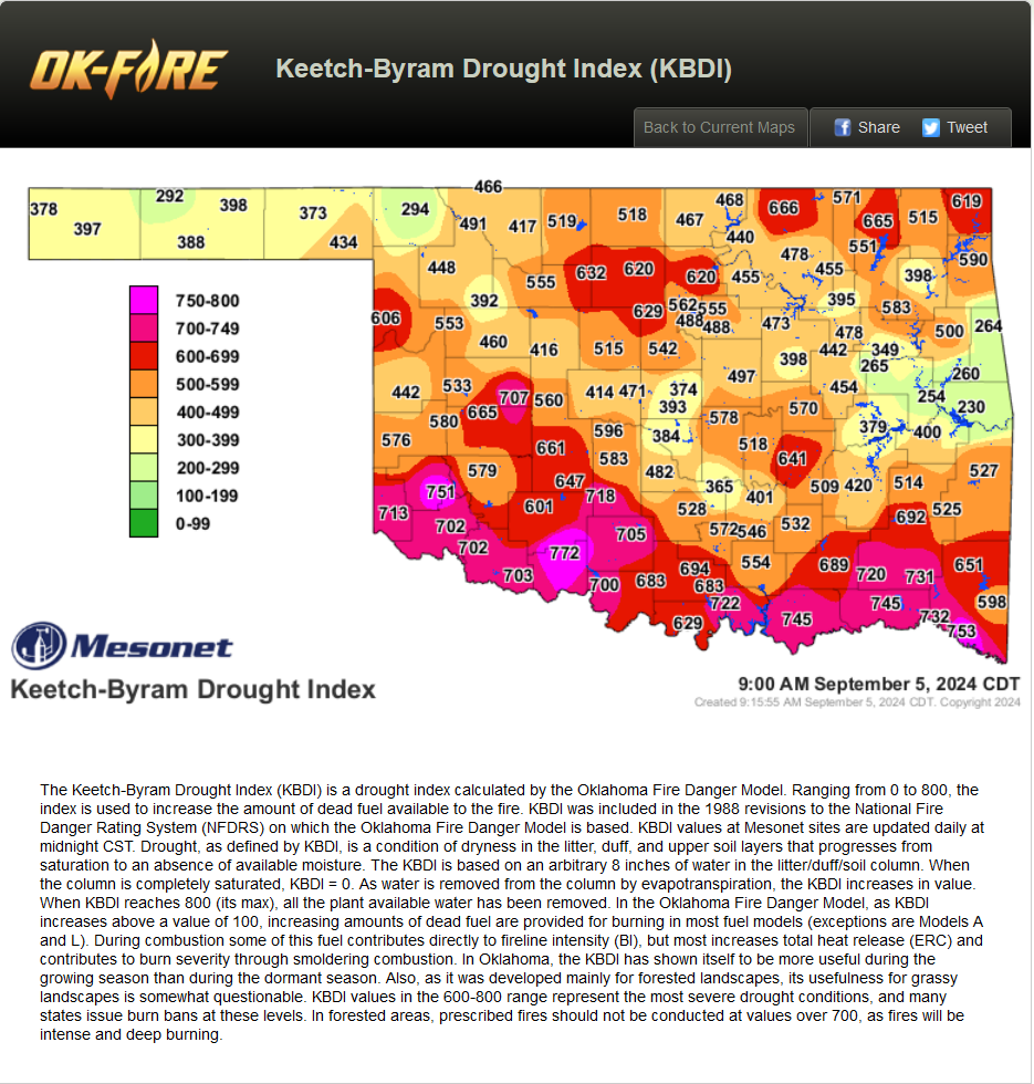
We're on the cusp of seeing that Exceptional-D4 drought reintroduced to the
state if'n we're not careful. And we're becoming a powder keg. Should we start
getting those dry fall cold fronts with the low humidity and strong SW to NW
winds...watch out.
https://ticker.mesonet.org/archive/20240905/16inch-PAW-fire.danger.png
https://ticker.mesonet.org/archive/20240905/KBDI-fire.danger.png
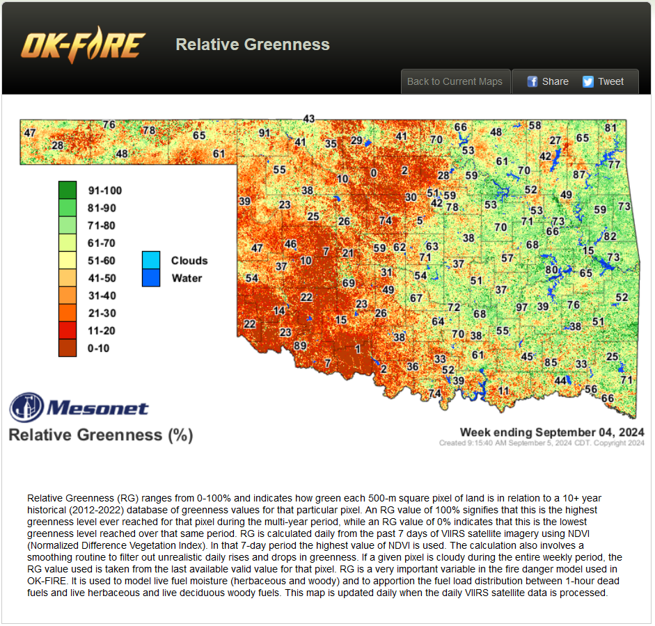
How about looking down from space? Easy to see from OK-FIRE's relative greenness
map that our vegetation is going backwards a bit early this year, acting like
it's fall already when the growing season is still going strong.
https://ticker.mesonet.org/archive/20240905/relative-greenness.png
https://ticker.mesonet.org/archive/20240905/qdri_20240901_OK_text.png
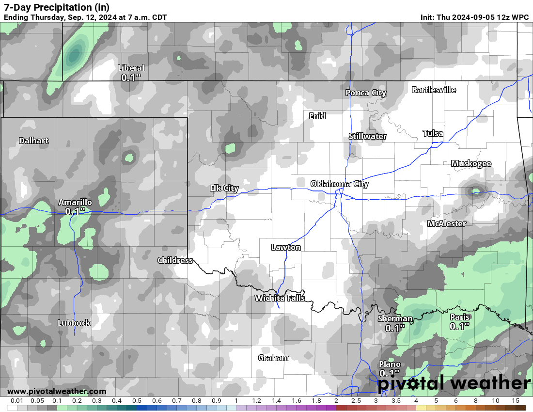
What about those rain prospects?
Rain?? ARE YOU KIDD...never mind. Let's just look at the bad news and get it
over with.
https://ticker.mesonet.org/archive/20240905/7day-rain-forecast.png
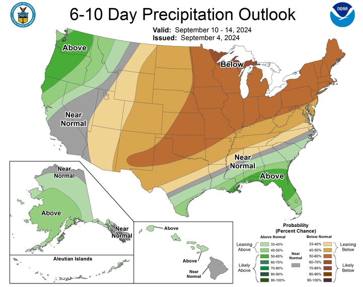
https://ticker.mesonet.org/archive/20240905/sept10-14-precip-outlook.png
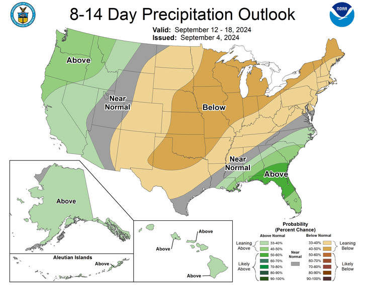
https://ticker.mesonet.org/archive/20240905/sept12-18-precip-outlook.png
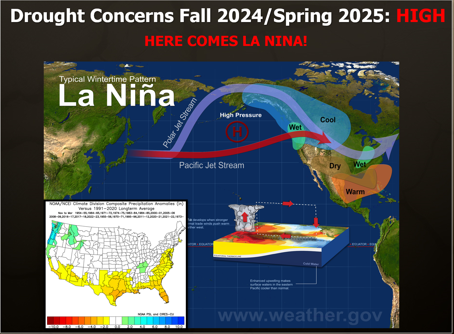
Yeah, that's not encouraging at all. With the late-to-the-party La Nina possibly
still in the mix for later this fall and winter, that would not be good news
either as that ocean-atmospheric coupling phenomenon from the Equatorial Pacific
waters off the West Coast of South America tends to bring us drier than normal
conditions during the cool season.
https://ticker.mesonet.org/archive/20240530/drought-concerns.png
We should get the latest ENSO forecast next week, so we'll have a better idea
on prospects for that La Nina possibility.
Until we get rain, though, best to practice those conservation techniques and
keep wildfire danger in mind as you go about your day.
Gary McManus
State Climatologist
Oklahoma Mesonet
Oklahoma Climate Survey
gmcmanus@ou.edu
==================================================
The OCS/Mesonet Ticker
https://ticker.mesonet.org/
To subscribe or unsubscribe from the Ticker
or for questions about the Ticker or its content
Phone or Email the Ticker Manager at OCS
Phone: 405-325-2253 Email: ticker@mesonet.org
---------------------------------------------------
-C- Copyright 2024 Oklahoma Climatological Survey
===================================================
|


 Tweet
Tweet