MESONET TICKER ... MESONET TICKER ... MESONET TICKER ... MESONET TICKER ...
September 3, 2020 September 3, 2020 September 3, 2020 September 3, 2020
MUSH!
http://ticker.mesonet.org/archive/20200903/wednesday-sept9-7am.windchill.png
Neighbor, how long's it been since you've had a big, thick, steaming bowl of
Wolf Brand Chili? Really? Well how about you make your own, then, if you don't
like Wolf Brand Chili? You know you could have turned the AC down to 68 and had
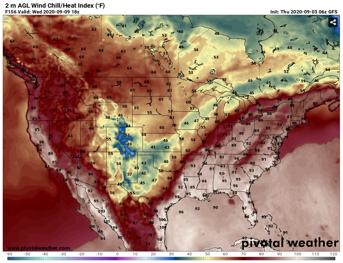
some, right? Enough excuses. It does appear we're going to get our first really
good COLD cold front of the fall sometime next week in the Wednesday-Thursday
time frame. The above selected model output gives us an idea. I made it a wind
chill forecast because WE MIGHT HAVE WIND CHILLS! You have to have a temperature
of 50 degrees at the most to have wind chills. Correct me if I'm wrong, check my
math, but that would mean we'd be seeing temps in the 40s. And the wind chills
there are depicted in the 30s in the NW.
Lest you think this is just a NW OK thing, check out the wind chill forecast
model output for 1pm next Wednesday.
http://ticker.mesonet.org/archive/20200903/wednesday-sept9-1pm.windchill.png
Darn, let me be the first to say it: I'm preemptively tired of the cold weather!
Might (not) won't last long, but it will be a good (bad) change of pace I
guess (know). And we could be in for more rain as well. A reinforcing shot of
rain in the southwest would start to chip away at that drought in that area,
after being mired in horrible conditions for the entire summer.
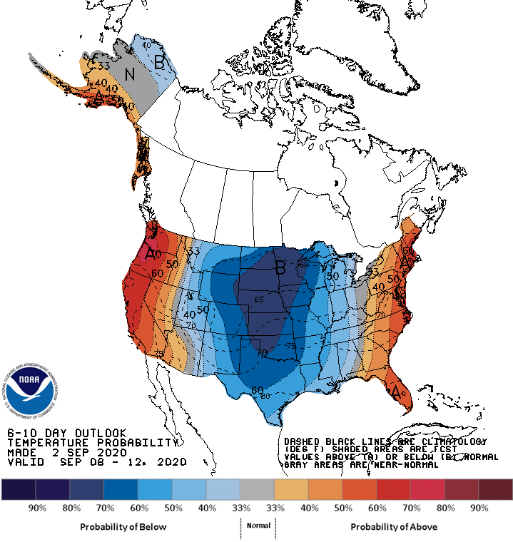
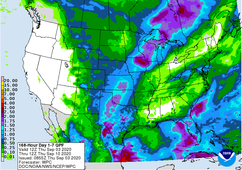
http://ticker.mesonet.org/archive/20200903/sept8-12-temp-outlook.gif
http://ticker.mesonet.org/archive/20200903/sept8-12-precip-outlook.gif
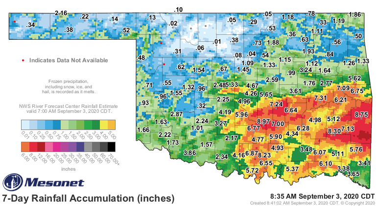
Speaking of drought, check out the latest Drought Monitor. You might have
expected some more improvements across the southwest, where 1-2 inches fell.
http://ticker.mesonet.org/archive/20200903/7day-rain-totals.png
http://ticker.mesonet.org/archive/20200903/20200901_OK_trd.png
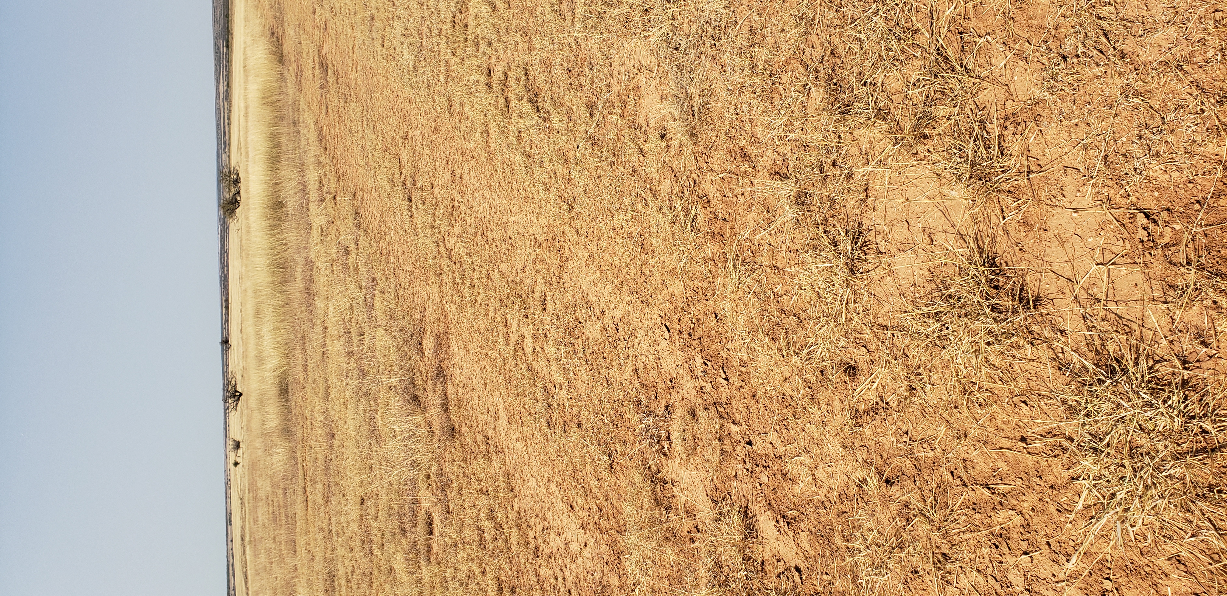
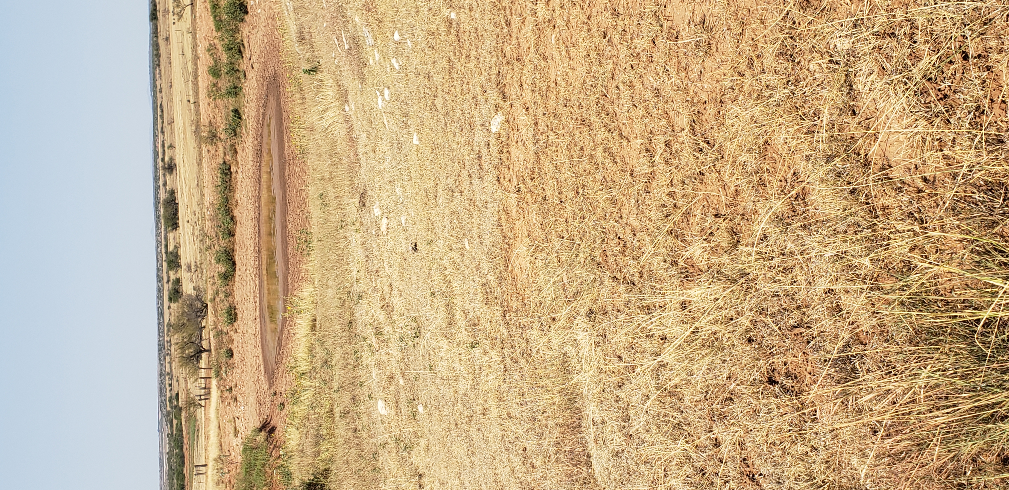
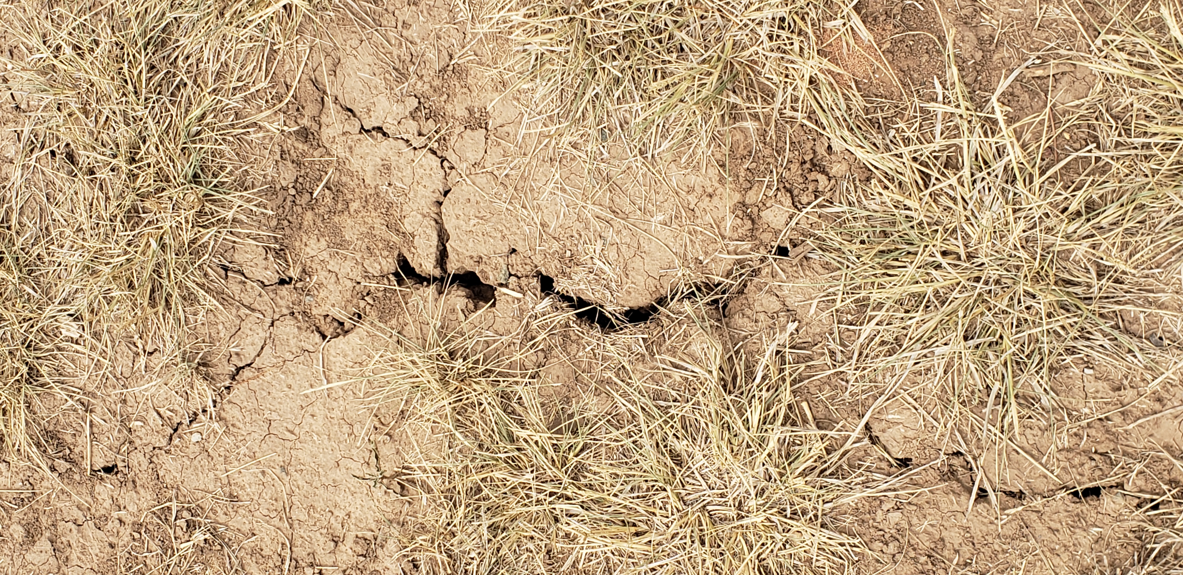
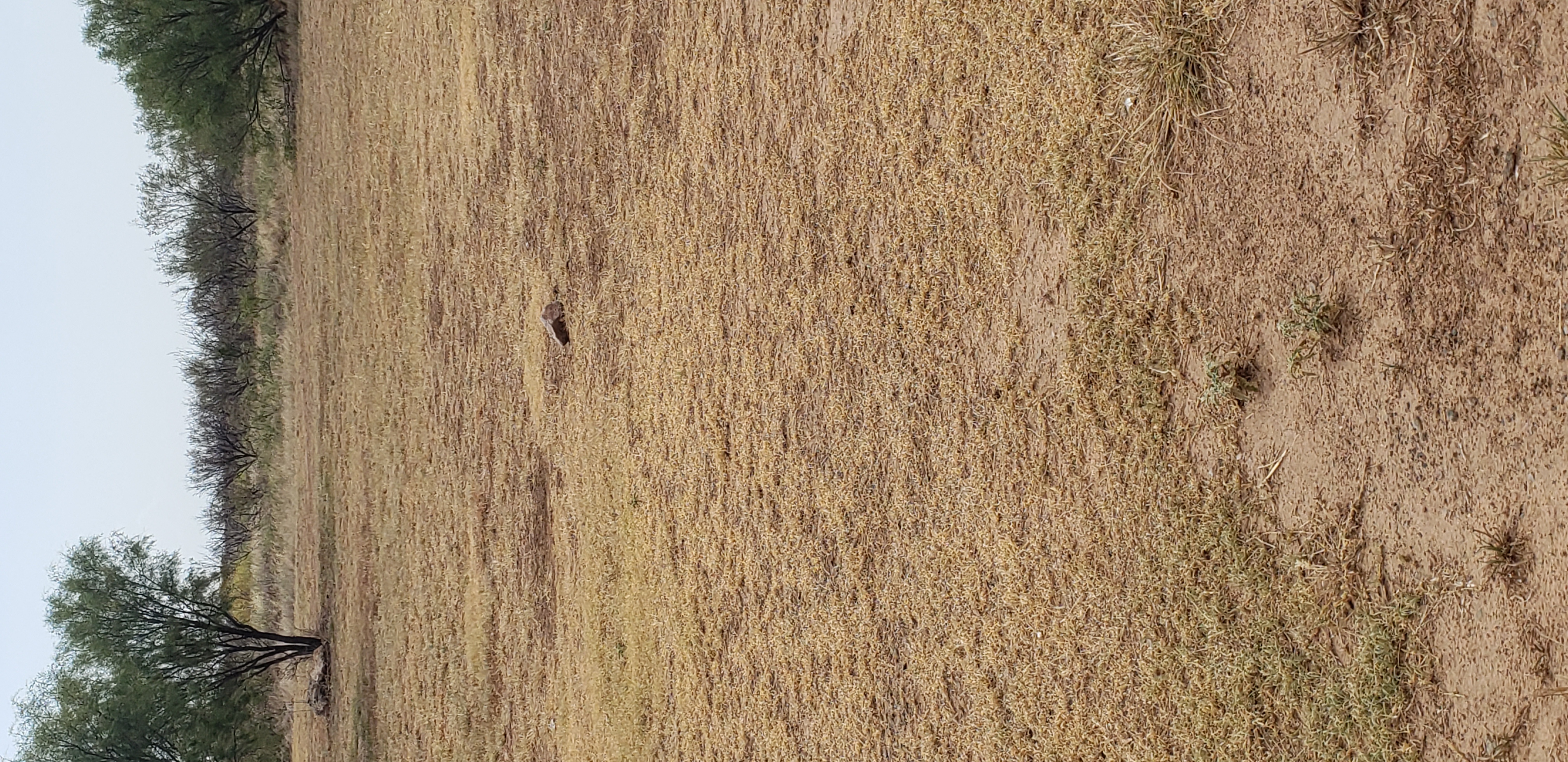
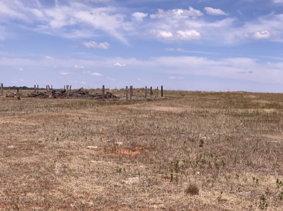
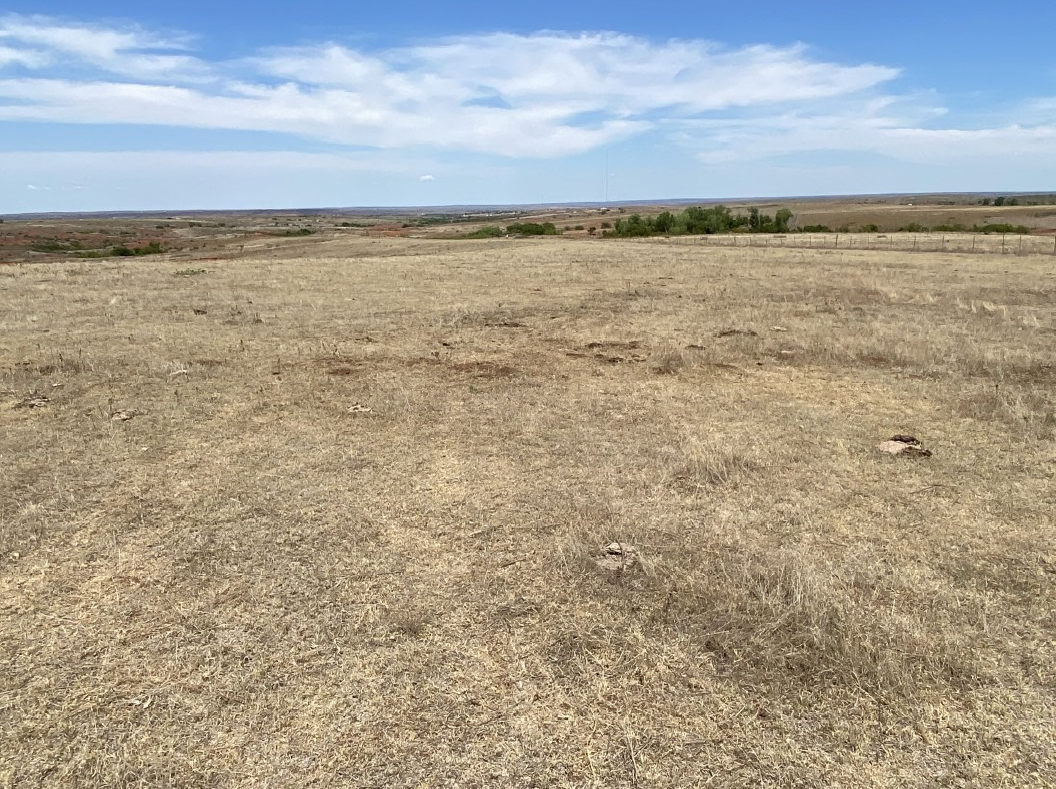
The real question is this...can you improve situations like this, which is
considered "extreme" drought, with 1-2 inches of rain? At least enough to bump
it down a notch in severity?
http://ticker.mesonet.org/archive/20200903/jackson.county.1.jpg
http://ticker.mesonet.org/archive/20200903/jackson.county.2.jpg
http://ticker.mesonet.org/archive/20200903/jackson.county.3.jpg
http://ticker.mesonet.org/archive/20200903/jackson.county.4.jpg
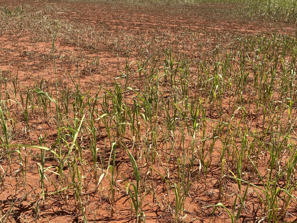
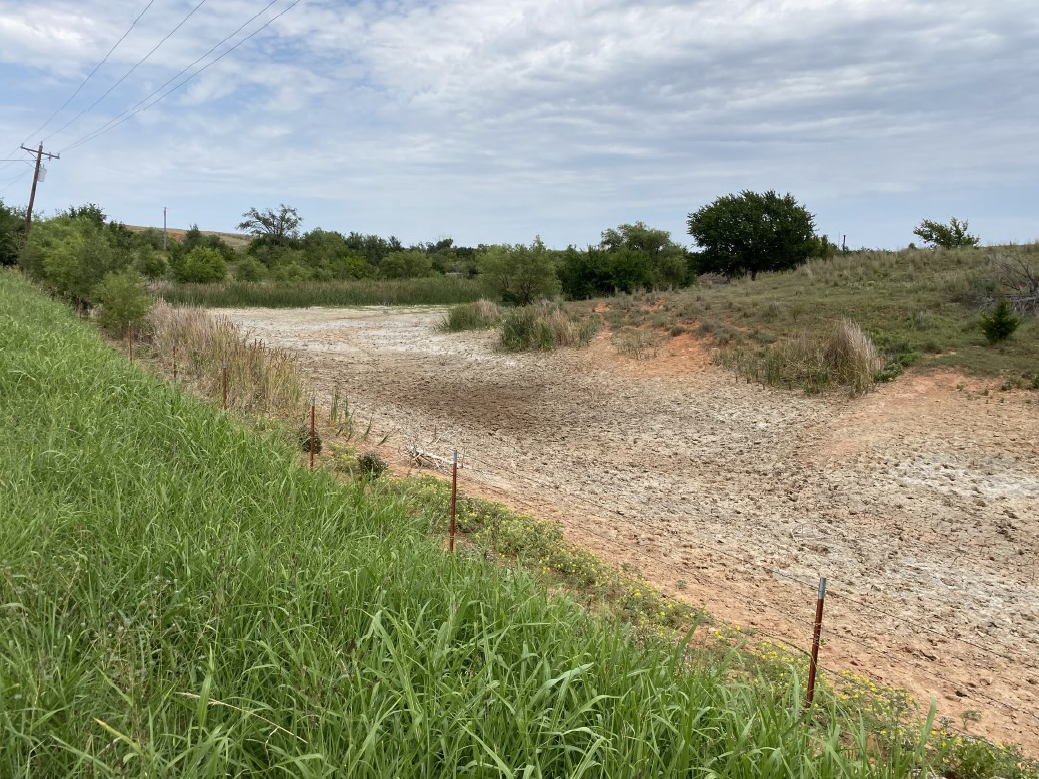
http://ticker.mesonet.org/archive/20200903/roger.mills.county1.png
http://ticker.mesonet.org/archive/20200903/roger.mills.county.2.png
http://ticker.mesonet.org/archive/20200903/roger.mills.county3.png
http://ticker.mesonet.org/archive/20200903/roger.mills.county4.png
http://ticker.mesonet.org/archive/20200903/roger.mills.county5.png
I say no. We will see if they get reinforcing rainfall in the next week where
we can continue improvements to the west. I know one thing, though...western
Oklahoma isn't supposed to look like it's winter in late August!
This would definitely help.
http://ticker.mesonet.org/archive/20200903/7day-rain-forecast.gif
By the way, I hear that chili is made in New York City.
NEW YORK CITY?
Well, sure, they just import everything in and make it there. Big deal. Get over
it.
Gary McManus
State Climatologist
Oklahoma Mesonet
Oklahoma Climatological Survey
(405) 325-2253
gmcmanus@mesonet.org
==================================================
The OCS/Mesonet Ticker
https://ticker.mesonet.org/
To subscribe or unsubscribe from the Ticker
or for questions about the Ticker or its content
Phone or Email the Ticker Manager at OCS
Phone: 405-325-2253 Email: ticker@mesonet.org
---------------------------------------------------
-C- Copyright 2024 Oklahoma Climatological Survey
===================================================
|


 Tweet
Tweet