MESONET TICKER ... MESONET TICKER ... MESONET TICKER ... MESONET TICKER ...
July 3, 2024 July 3, 2024 July 3, 2024 July 3, 2024
Real tomato ketchup Eddie?
https://ticker.mesonet.org/archive/20240703/july8-12-temp-outlook.png
You're darned tootin' (Taco bell...again?) we're taking credit for our coming
cool down, starting Friday! Oh, today and tomorrow?
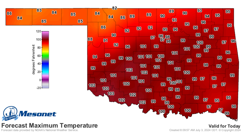
https://ticker.mesonet.org/archive/20240703/todays-highs.png
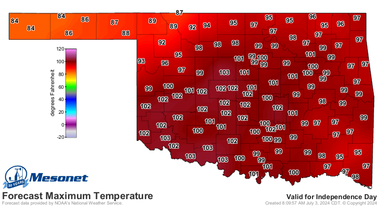
https://ticker.mesonet.org/archive/20240703/july4-highs.png
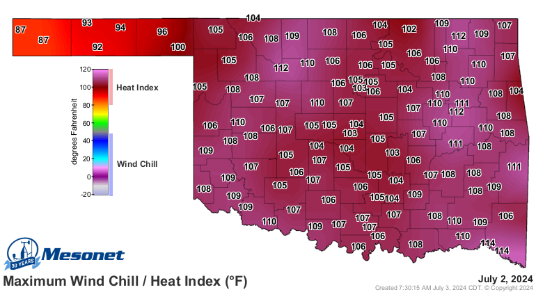
That's those clodhoppers down in Texas' fault (blaming Texas is always safe). So
for most of us, two more blazing hot days in this current heat wave that's about
3 weeks long with heat index values once again up in the 105-115 range. The NW
third or so of the state is still behind that stationary front, so bully for them.
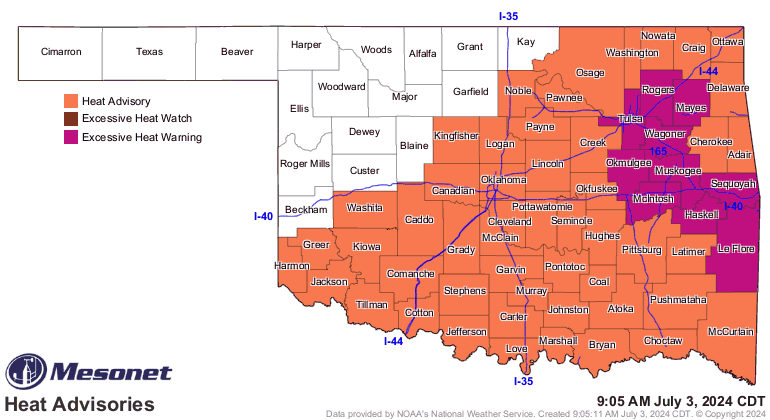
https://ticker.mesonet.org/archive/20240703/latest.oklahoma.heat.gif
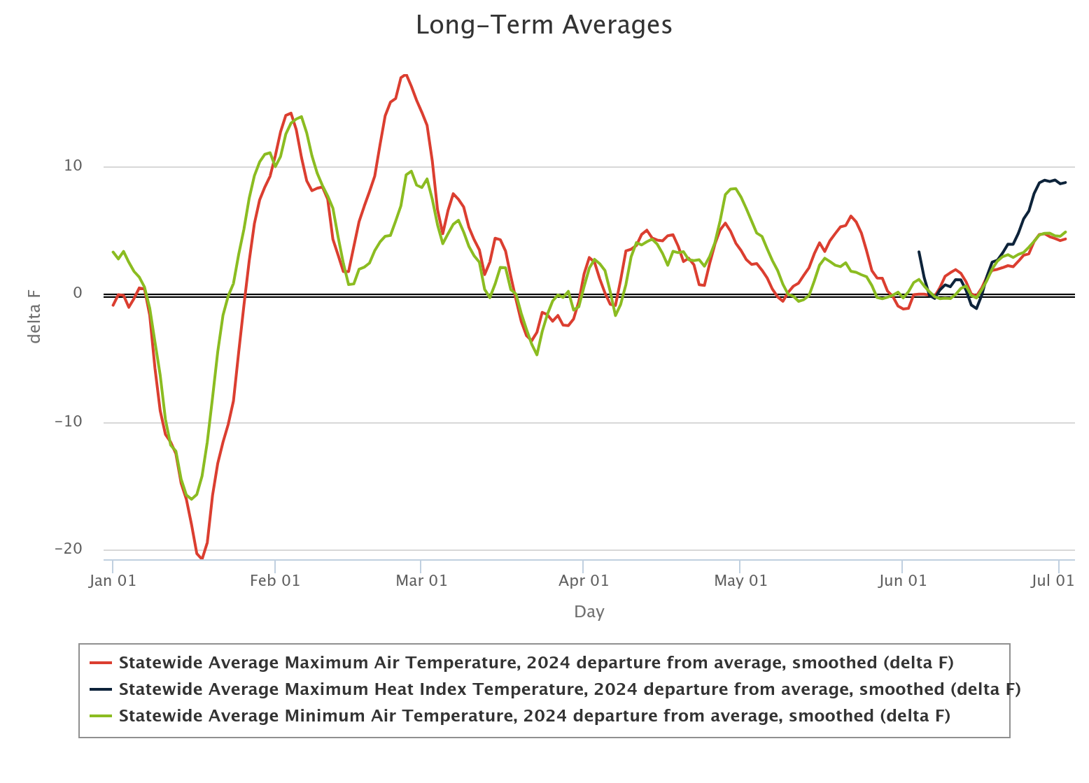
Like I said...about 2 weeks, but it's been warmer than normal more often than not
all the way back to mid-January, following our brush with brutal winter temps.
Check out this graph of statewide avg. highs (red), lows (green), and heat index
(black) departures from the Mesonet long-term average.
https://ticker.mesonet.org/archive/20240703/2024-statwide-avg-temps-depart.png
Being warm in February and March is "fine," meaning it causes some problems,
like increased wildfire danger, but as far as the comfortableness factor, it's
a good thing. But when you see those highs soar above the average line in June
and July, that's decidedly "un-fine!" Add to that the heat index going
exponential, greatly outpacing the actual air temps, and you have the makings
of a miserable heat wave. For example, a day like yesterday.
https://ticker.mesonet.org/archive/20240703/yesterdays-heat-index.png
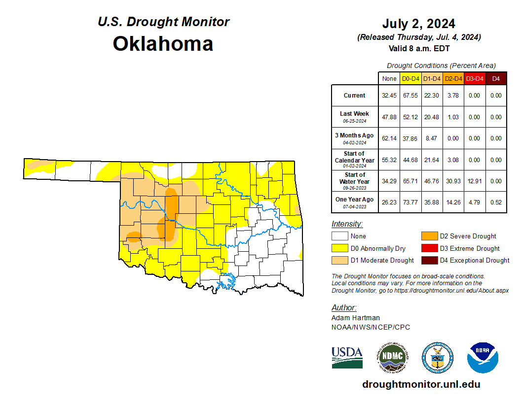
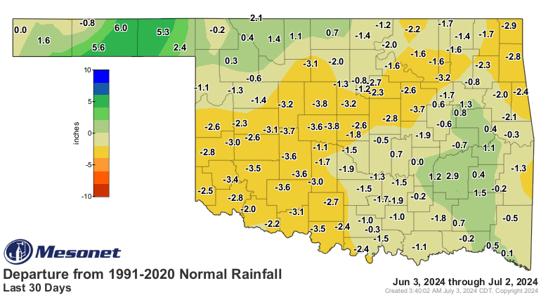
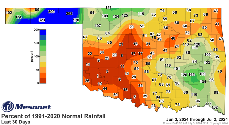
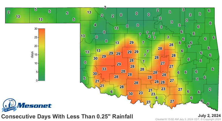
All that heat is also why flash drought is exploding across much of the state,
or on its way to exploding, at least.
https://ticker.mesonet.org/archive/20240703/20240702_ok_trd.png
While only 22% of the state is currently in drought, another 45% is in "Abnormally
Dry" conditions (the yellow D0 area on the map). While D0 doesn't signify drought
itself, it does show areas either coming in or out of drought. Now up in NW OK,
much of that area's yellow indicates coming OUT of drought. But most of it is
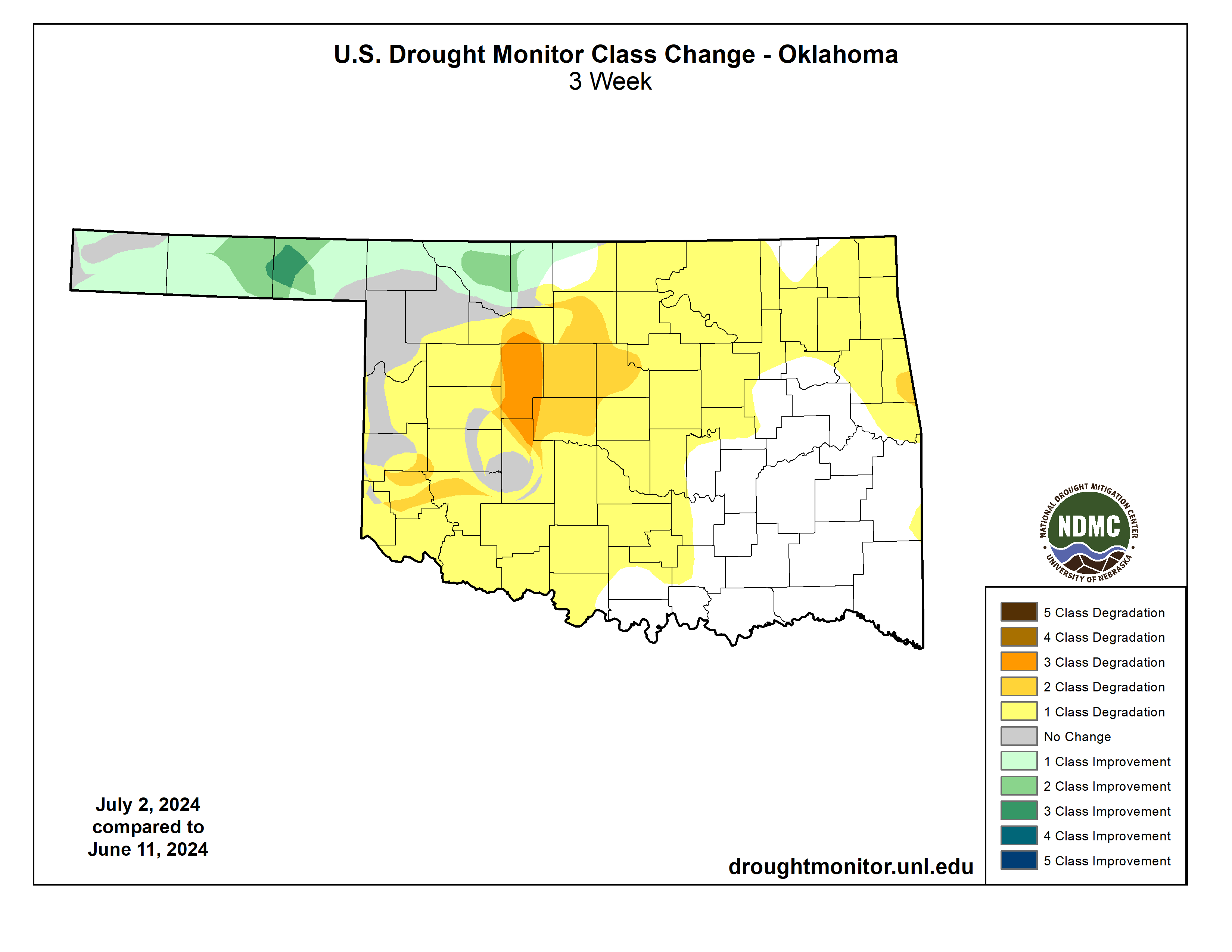
areas destined for drought soon without significant precipitation. Look at the
change in just the last 3 weeks!
https://ticker.mesonet.org/archive/20240703/current_OK_chng_3W.png
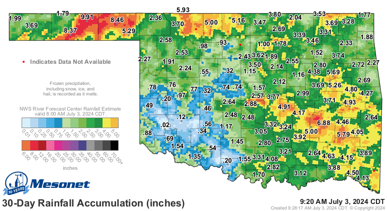
These maps show the problem all to well.
https://ticker.mesonet.org/archive/20240703/rainrfc.720hr.png
https://ticker.mesonet.org/archive/20240703/del30day_rain.current.png
https://ticker.mesonet.org/archive/20240703/pct30day_rain.current.png
https://ticker.mesonet.org/archive/20240703/mesonet.rainfall.quarterinch.png
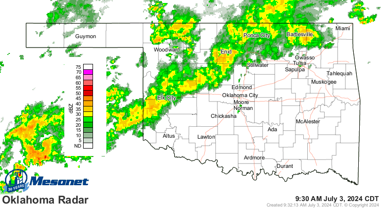
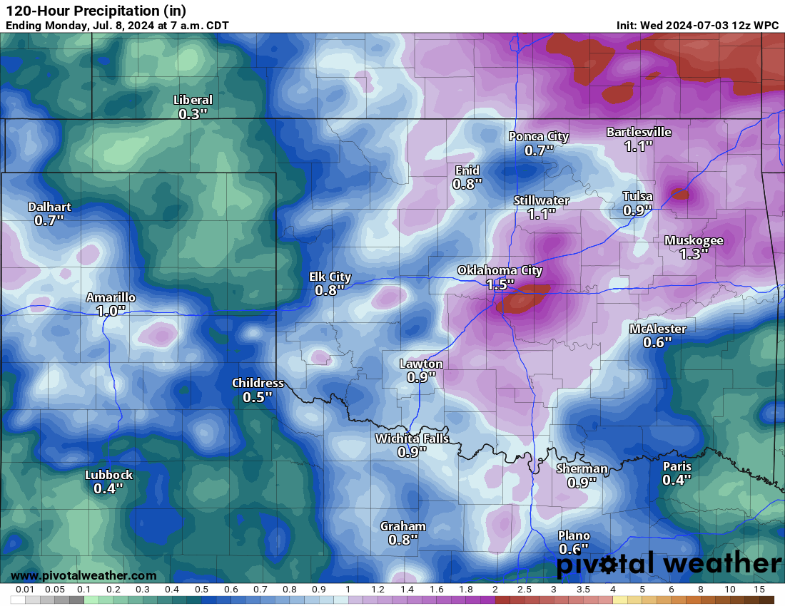
Well, here's hope. While we will see storms the next two nights (heck, it's
raining right now for crying out loud!)
https://ticker.mesonet.org/archive/20240703/Oklahoma.MosaicBREF.png
those storms will at least bring some relief with good rains here and there
(sorry if it's here while you're there, or you're there while it's here).
https://ticker.mesonet.org/archive/20240703/5day-rain-forecast.png
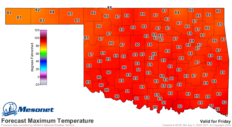
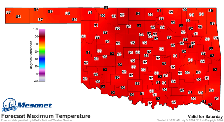
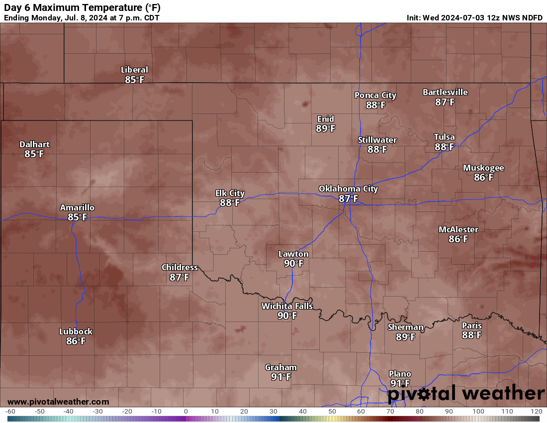
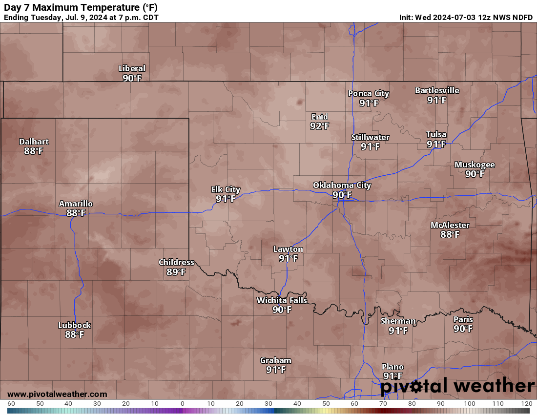
And, almost of equal importance, our temperatures are gonna drop back to normal
or lower for awhile starting on Friday.
https://ticker.mesonet.org/archive/20240703/friday-forecast-highs.png
https://ticker.mesonet.org/archive/20240703/sat-highs.png
https://ticker.mesonet.org/archive/20240703/monday-highs.png
https://ticker.mesonet.org/archive/20240703/tuesday-highs.png
Need rain, need cool...need lots of both.
Gary McManus
State Climatologist
Oklahoma Mesonet
Oklahoma Climate Survey
gmcmanus@ou.edu
==================================================
The OCS/Mesonet Ticker
https://ticker.mesonet.org/
To subscribe or unsubscribe from the Ticker
or for questions about the Ticker or its content
Phone or Email the Ticker Manager at OCS
Phone: 405-325-2253 Email: ticker@mesonet.org
---------------------------------------------------
-C- Copyright 2024 Oklahoma Climatological Survey
===================================================
|


 Tweet
Tweet