Ticker for July 3, 2023
MESONET TICKER ... MESONET TICKER ... MESONET TICKER ... MESONET TICKER ...
July 3, 2023 July 3, 2023 July 3, 2023 July 3, 2023
POP!
AMERICA...HECK YEAH!!! To the 3 people reading this on what many are probably
taking as a 4- or 5-day weekend, I salute you! Oh, I'm counting myself, of
course. Normally I don't read what I write...I find it very derivative and
redundant, as well as superfluous and bombastic. Other than that, my self-esteem
is fine!
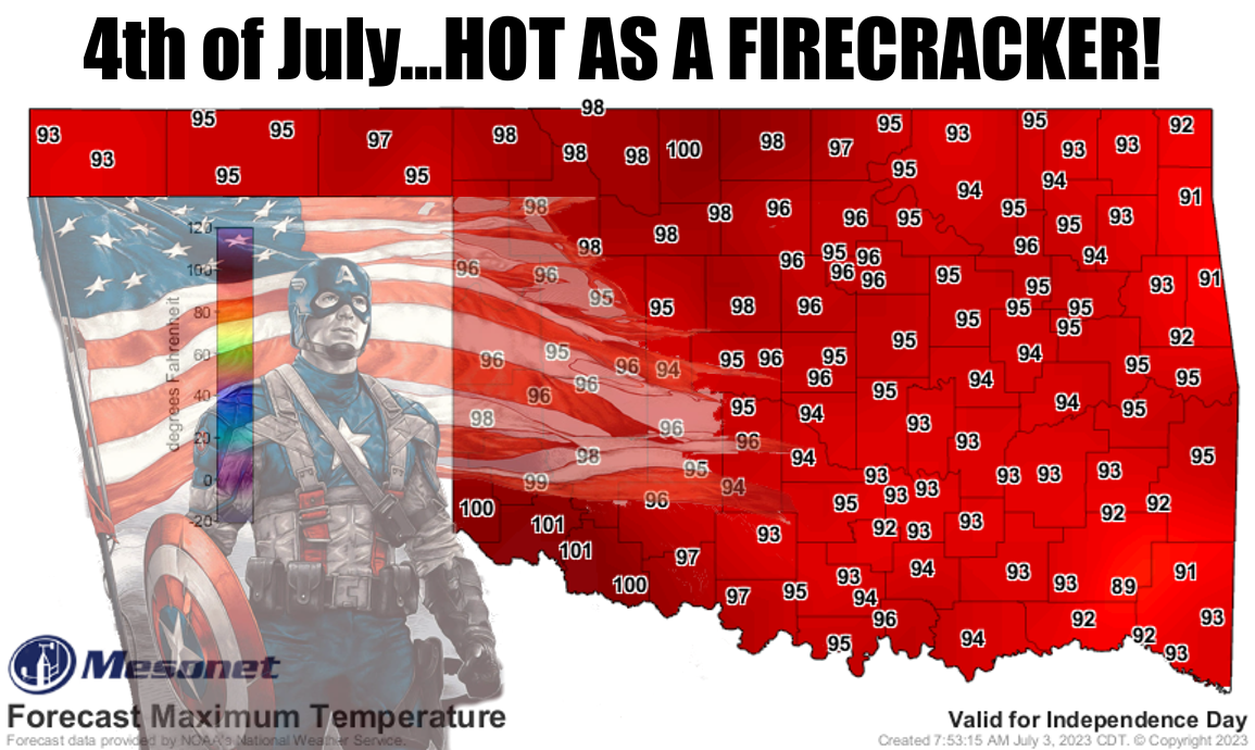
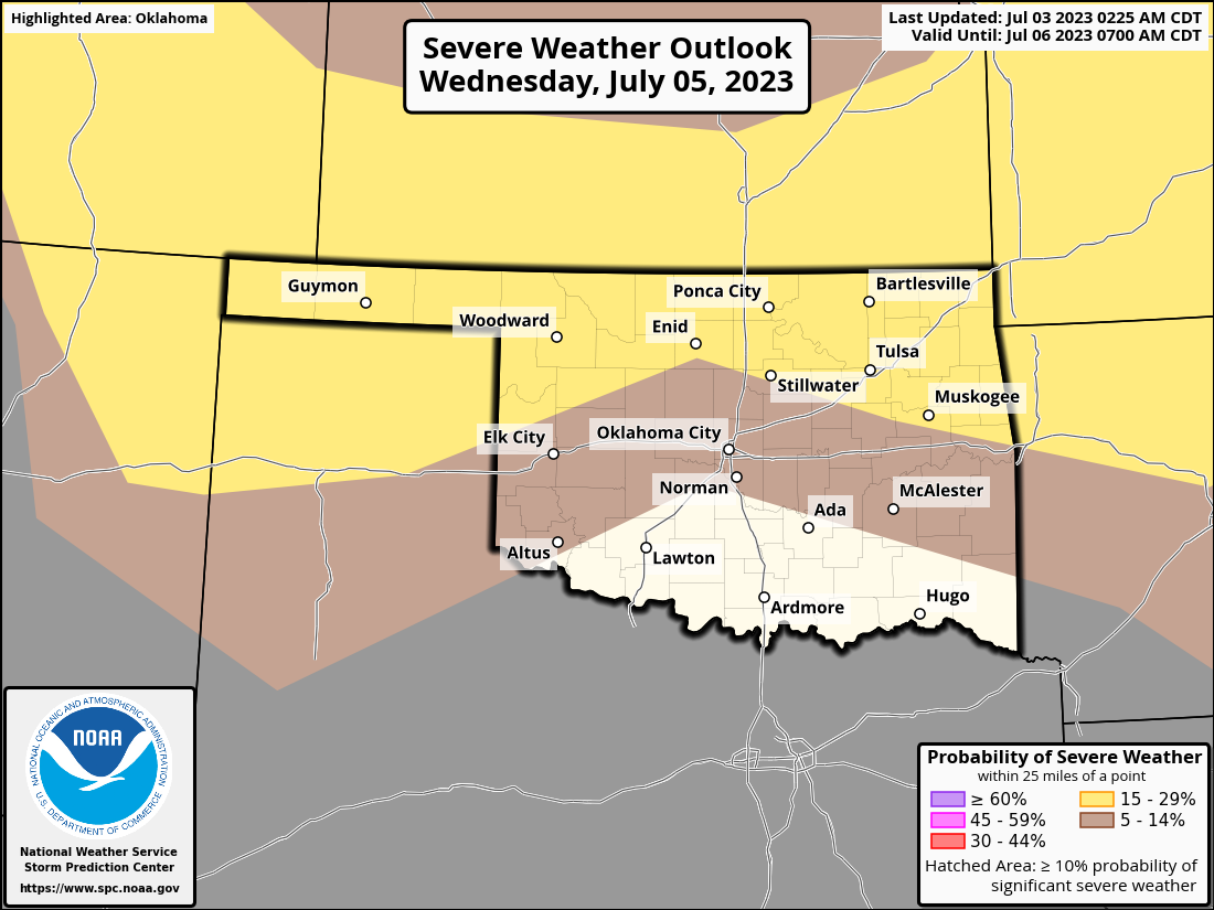
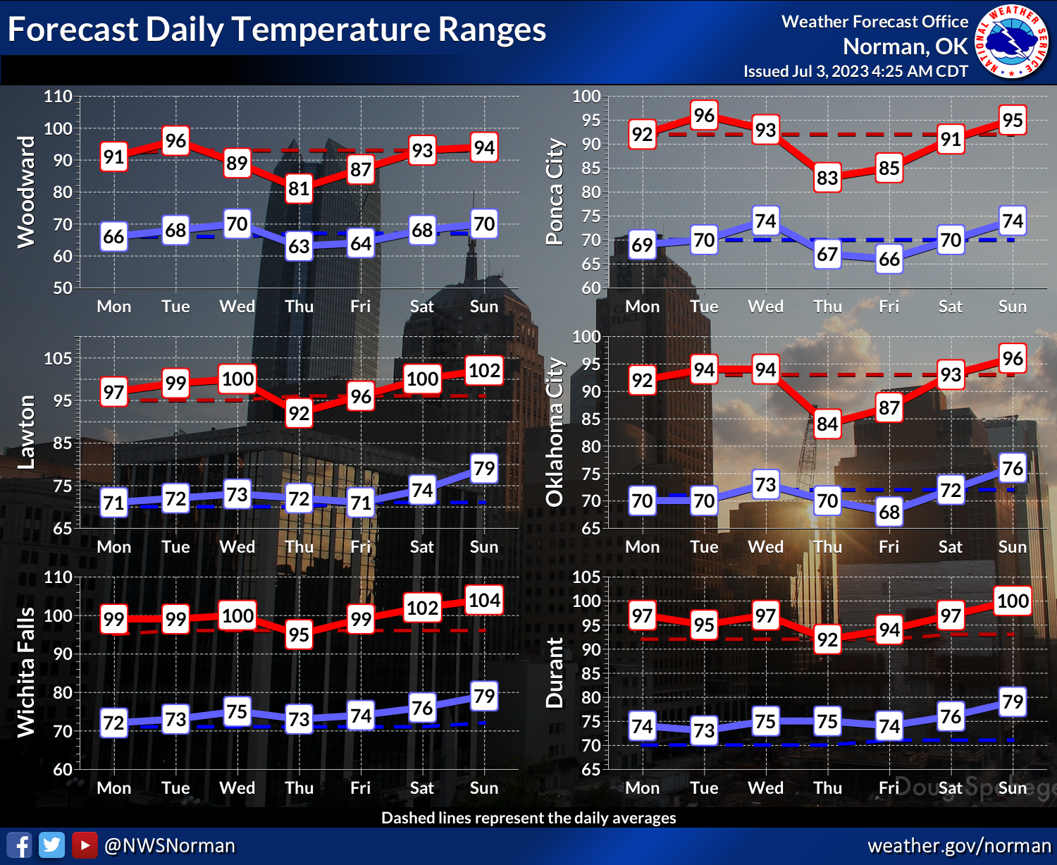
Well here's the forecast in general...storms are gonna be possible throughout
the week, but especially on Wednesday as we see a rather substantial July
cold front.

That will cool us down from another hot couple of days to come.
Rain chances with those storms will be substantial at times across northern
Oklahoma, as will the possible rain totals.
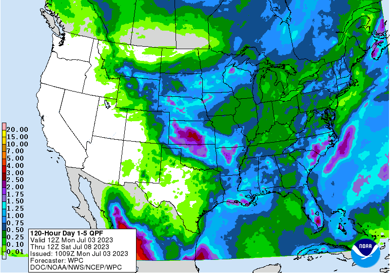
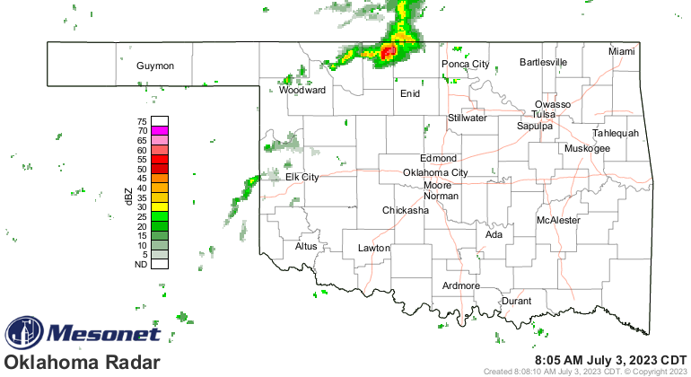
Heck, it's raining up there right now for crying out loud!
Now stick around and take a look back at June's tornadoes, possible derechos,
and all around good time...even as we hope your fingers stick around tomorrow
popping those fireworks.
----------------------------------------------------------------------------------
Springtime Severe Weather Extends Through June
July 3, 2023
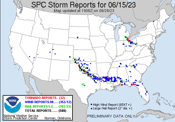
June took up the slack for May’s relatively tame severe weather output—at least
by Oklahoma’s standards—with 10 tornadoes and two possible derechos that left
over half of a million Oklahomans without power. While storms threatened the
state throughout the month, the most intense severe weather was concentrated
within just a few days from June 15–18 thanks to two powerful storms systems,
both aided by an unusually strong jet stream overhead. The first disturbance
kicked off several rounds of storms that impacted the southeastern half of the
state and the Panhandle on the 15th. The storms dropped golf ball to grapefruit
size hail from the eastern Panhandle to south central Oklahoma. At least four
tornadoes were confirmed on the 15th, including a strong EF2 twister that
damaged numerous homes on its 4.1-mile path from Stephens County to Jefferson
County. Widespread damage was reported indicative of straight-line winds
gusting to over 80 mph along a broad path from northwestern through south
central Oklahoma. The Oklahoma Mesonet site at Norman recorded a wind gust of
84 mph that evening. Roofs, power lines and poles, and trees suffered
significant damage due to the storms.
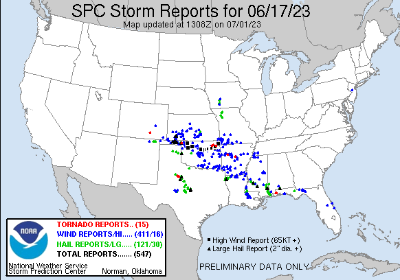
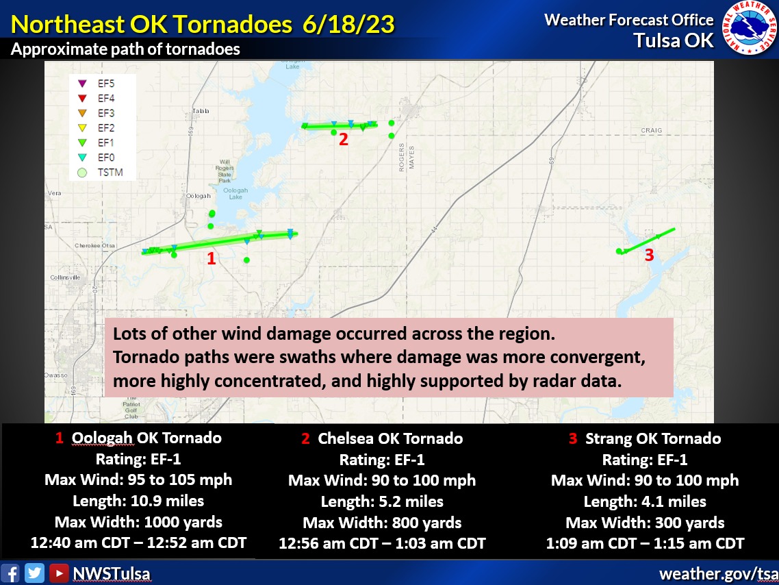
A very similar storm system struck Oklahoma just a couple of days later on the
17th, but this time bringing large hail, tornadoes, and severe straight line
winds to the northern half of the state. The Tulsa area bore the brunt of the
storms’ fury with reported wind gusts of over 100 mph late on the 17th into the
early morning hours on the 18th. The winds devastated the power grid in the
area and left nearly 200,000 homes and businesses without power, prompting
power utility officials to declare the outages “the most significant
restoration event” in the area since a catastrophic 2007 ice storm. At least
four tornadoes were spawned by the storms along their paths across northern
Oklahoma. The straight-line winds and tornadoes on June 17-18 alone left more
than 350,000 Oklahomans without power, some for over a week in stifling heat. A
preliminary total of 10 tornadoes was confirmed by National Weather Service
personnel, bringing the state’s 2023 total to 62 through the first six months
of the year. Oklahoma averages just over 57 tornadoes per year based on data
from 1950 through 2022.
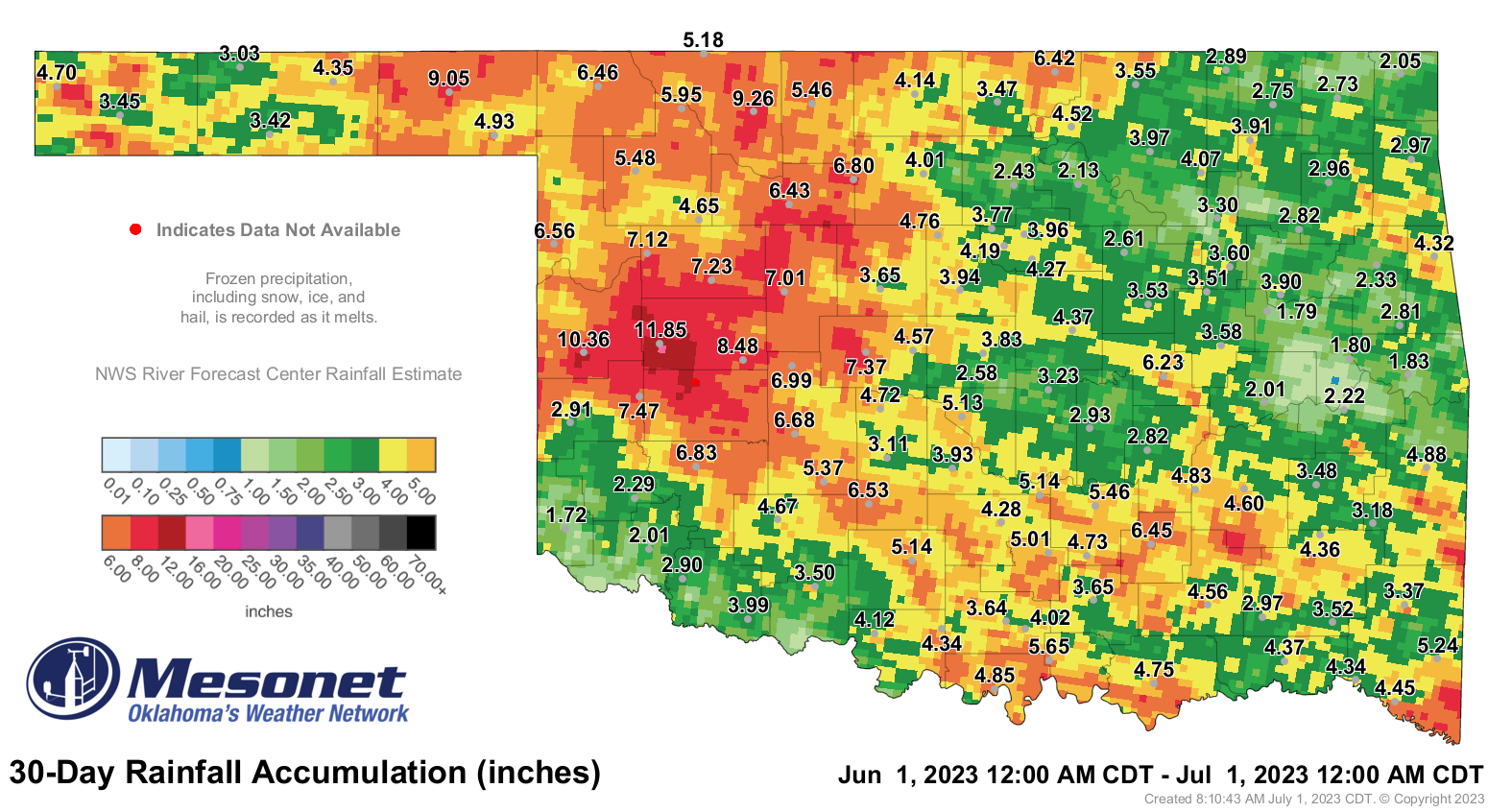
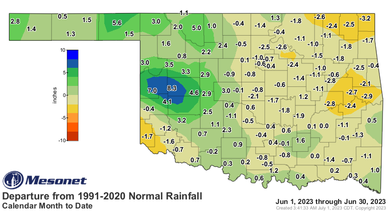
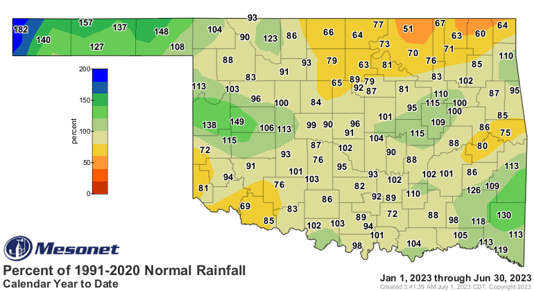
The statewide average rainfall total was 4.58 inches, 0.32 inches above normal
and ranked as the 44th wettest June since records began in 1895. As is usually
the case, the rainfall fortunes varied widely across the state. West central
Oklahoma and the Panhandle both experienced large average surpluses of 4.09
inches and 2.18 inches, respectively. In an unusual feat for Oklahoma, the west
central site at Butler led the state’s totals with 11.85 inches, and it’s close
neighbor Bessie was second with 11.45 inches. Another west central site,
Cheyenne, came in a close third with 10.36 inches. Continuing with that theme,
19 of the 20 highest June Mesonet totals came from western Oklahoma—only
Centrahoma’s 6.45 inches could make the list from the eastern half of the state.
In contrast, east central and northeastern Oklahoma experienced their 33rd and
39th driest Junes on record, respectively. Hollis had the lowest total with
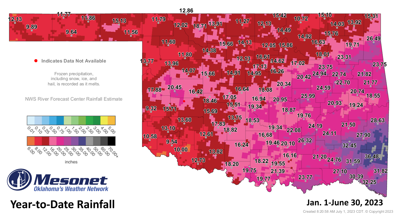
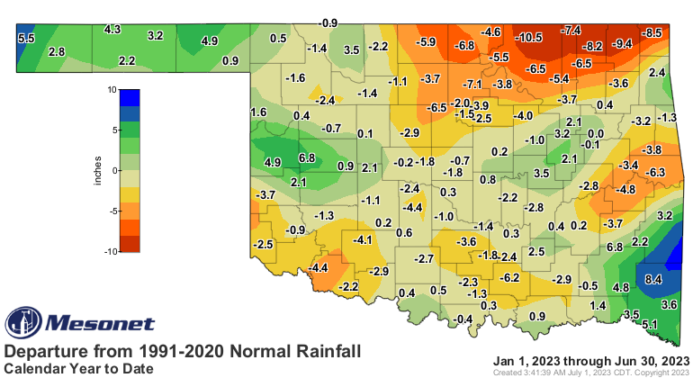
1.72 inches. The first 6 months of the year ended as the 59th wettest on record
at 17.99 inches, 0.83 inches below normal.

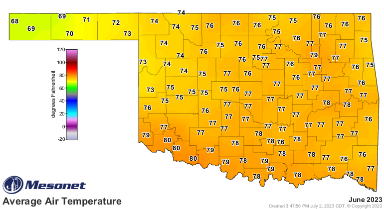
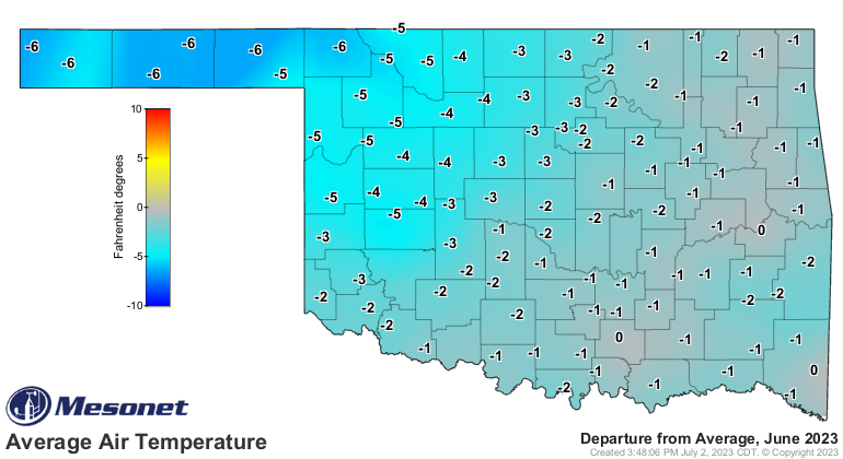
The statewide average temperature was 76.2 degrees, 1.1 degrees below normal
and ranked as the 44th coolest June since records began in 1895. Temperatures
were seasonable through most the month until the final week. A persistent heat
dome that had camped across Texas crept north, engulfing Oklahoma and bringing
extreme heat with it. Altus hit 113 degrees on the 28th, the highest temperature
in the state since July 19, 2022. Heat index values soared into the 110s,
topping out at 120 degrees at Grandfield on the 19th and again on the 27th, and
Ringling on the 28th. The first 6 month of the year finished at 56.9 degrees,
0.6 degrees above normal and ranked as the 28th warmest January-June on record.
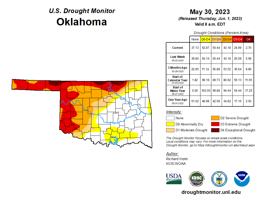
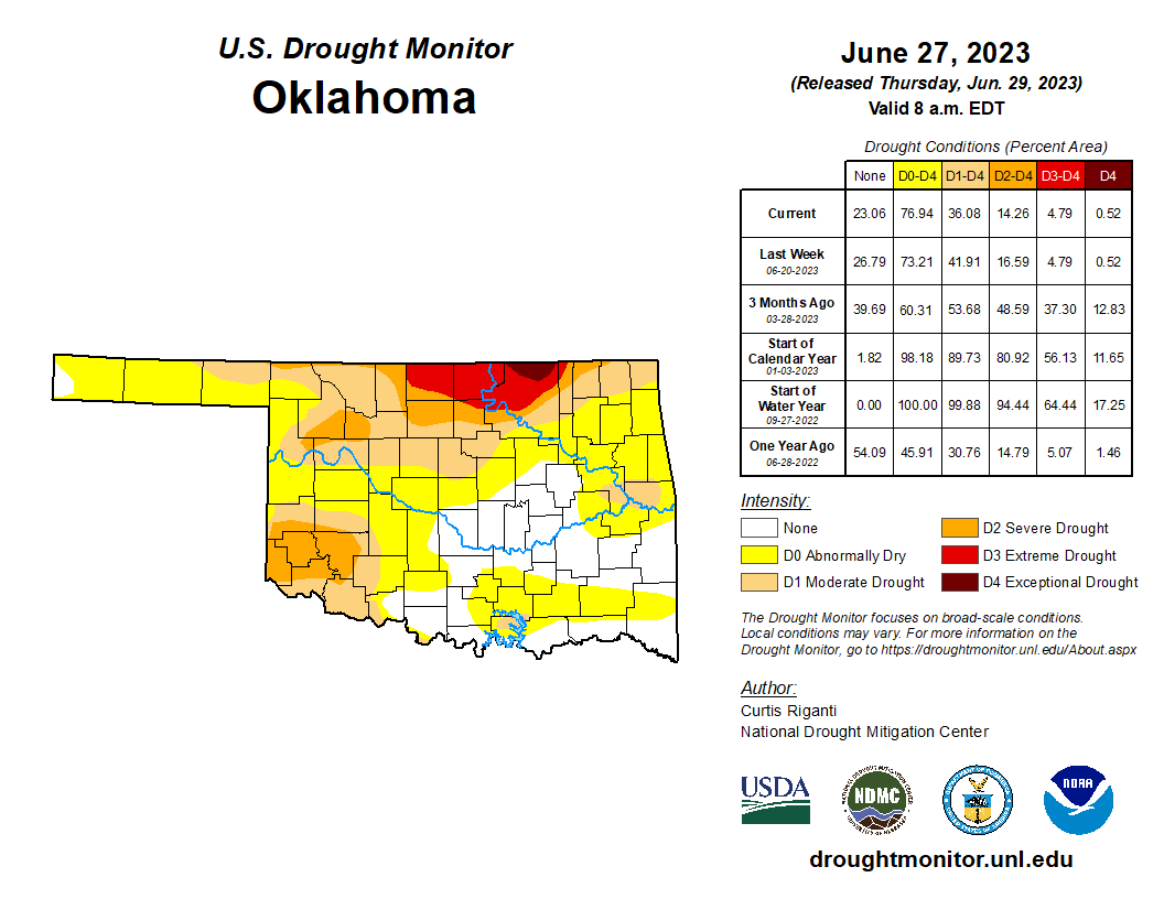
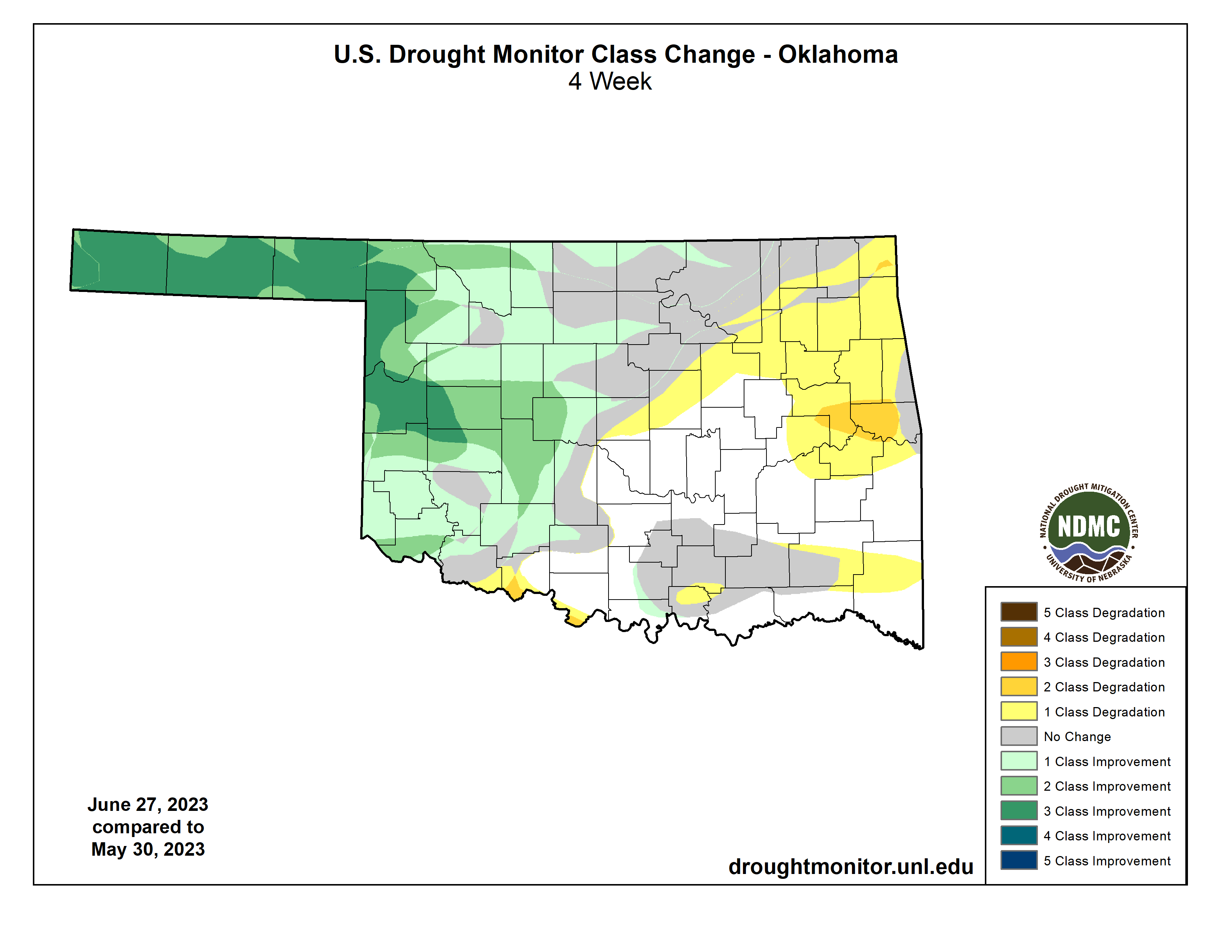
The prolific June rains across western Oklahoma reduced drought from 50% of the
state at the end of May to 36% of the state at the end of June according to the
U.S. Drought Monitor, and the amount of drought considered at least severe
dropped from 43% to 14% over that same period. New drought areas in south
central and east central Oklahoma had emerged by the end of the month, however.
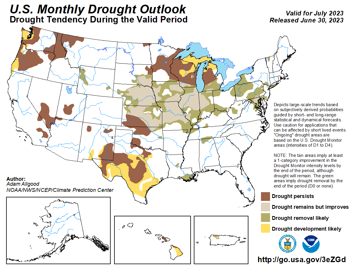
The July drought outlook from the Climate Prediction Center considered
additional development unlikely, and more improvements possible across north
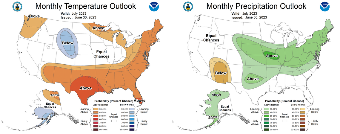
central and eastern Oklahoma by the end of the month. CPC’s July temperature
and precipitation outlooks showed increased odds of warmer- and wetter-than-
normal conditions across the entire state.
###
Gary McManus
State Climatologist
Oklahoma Mesonet
Oklahoma Climatological Survey
gmcmanus@mesonet.org
July 3 in Mesonet History
| Record | Value | Station | Year |
|---|---|---|---|
| Maximum Temperature | 106°F | KIN2 | 2011 |
| Minimum Temperature | 49°F | VINI | 2014 |
| Maximum Rainfall | 6.39 inches | NOWA | 2016 |
Mesonet records begin in 1994.
Search by Date
If you're a bit off, don't worry, because just like horseshoes, “almost” counts on the Ticker website!