MESONET TICKER ... MESONET TICKER ... MESONET TICKER ... MESONET TICKER ...
November 2, 2022 November 2, 2022 November 2, 2022 November 2, 2022
Twisted
https://ticker.mesonet.org/archive/20221102/day2probotlk_0600_torn.png
Some folks may be saying to themselves "But Gary, why do you show the tornado risk
map when its so low?"
QUIT CALLING YOURSELF GARY IF YOUR NAME ISN'T GARY! And it's "it's", not "its"!
If you're going to be delusional, lern to spel.
Any anyway, you don't want to be Gary.
"Most unpopular baby boy names of 2022"
Kobe, Jeffrey, Nigel, Ashton, Graham, Stuart, Chad, Gary, Bill
Welcome to the party, Bill.
Anyway, back to the delusions...I mean weather. I figure if we get folks to
sit up and take notice because of tornadoes, then they'll be prepared for just
about anything.
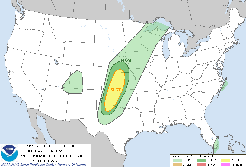
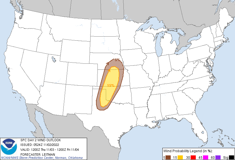
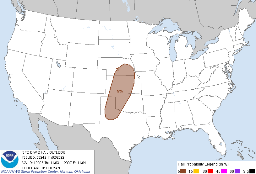
Wind is probably the biggest hazard we'll be looking at, although all modes
of severe weather are possible.
https://ticker.mesonet.org/archive/20221102/day2otlk_0600.gif
https://ticker.mesonet.org/archive/20221102/day2probotlk_0600_wind.gif
https://ticker.mesonet.org/archive/20221102/day2probotlk_0600_hail.gif
Likely late into the night on Thursday, storms will form in the eastern
Panhandles and start marching east.
As we go into early Friday, the risk continues.
https://ticker.mesonet.org/archive/20221102/day3otlk_0730.gif
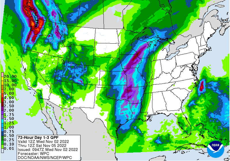
So possibly two rounds of storms, ahead of the front along the dryline, then
along the front as it gets farther east. The system has sped up a bit, so less
rain that what we were originally looking at.
https://ticker.mesonet.org/archive/20221102/3day-rain-forecast.gif
Already starting to see those southerly winds increase and the moisture stream
north from the Gulf, which is key to the whole deal.
https://ticker.mesonet.org/archive/20221102/current-winds.png
https://ticker.mesonet.org/archive/20221102/current-dewpoints.png
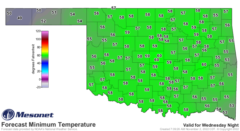
The southerly winds and moist air will be keeping our morning lows warm enough
to be on the unusual side.
https://ticker.mesonet.org/archive/20221102/thursday-forecast-lows.png
https://ticker.mesonet.org/archive/20221102/friday-morning-lows.png
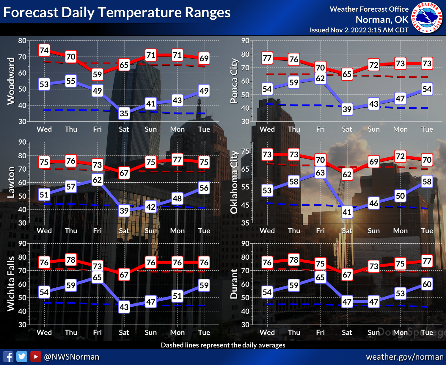
Other than a brief blip following the cold front, we're gonna stay as we have
much of 2022...on the warmer than normal side.
https://ticker.mesonet.org/archive/20221102/nws-norman-7day-temps.png
But don't look now.
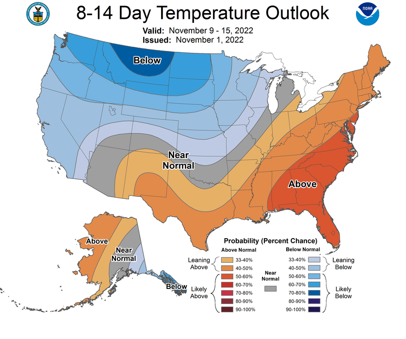
Okay, now look. We're seeing signs in the larger pattern of our first actual
winter-ish type of air from the north coming later next week, like next
weekend or so.
https://ticker.mesonet.org/archive/20221102/nov9-15-temp-outlook.png
This would be lows in the 20s and highs in the 40s type of stuff. And a bit of
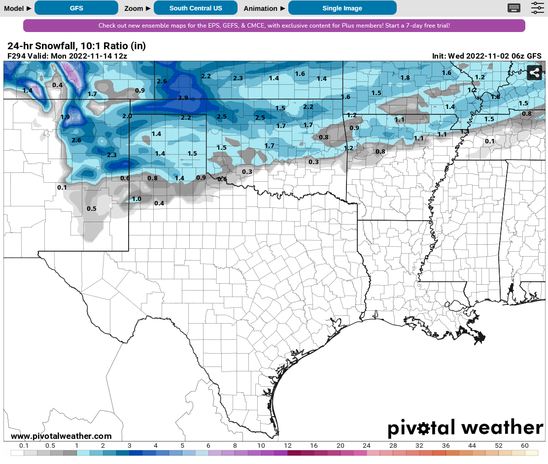
snow across northern OK is starting to show up in the fantasy-cast territory.
https://ticker.mesonet.org/archive/20221102/fantasy-snow.png
Hey, it's 2022. Anything could happen!
Gary McManus
State Climatologist
Oklahoma Mesonet
Oklahoma Climatological Survey
gmcmanus@mesonet.org
==================================================
The OCS/Mesonet Ticker
https://ticker.mesonet.org/
To subscribe or unsubscribe from the Ticker
or for questions about the Ticker or its content
Phone or Email the Ticker Manager at OCS
Phone: 405-325-2253 Email: ticker@mesonet.org
---------------------------------------------------
-C- Copyright 2024 Oklahoma Climatological Survey
===================================================
|


 Tweet
Tweet