Ticker for October 2, 2018
MESONET TICKER ... MESONET TICKER ... MESONET TICKER ... MESONET TICKER ...
October 2, 2018 October 2, 2018 October 2, 2018 October 2, 2018
Here we go again!
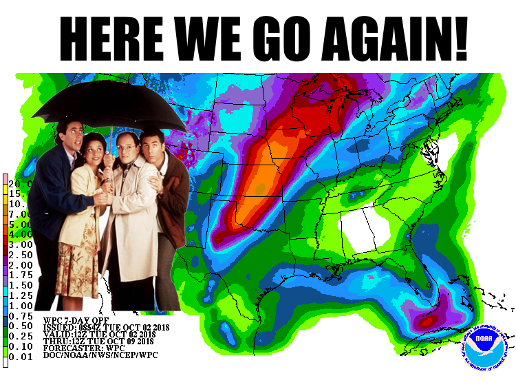
Yes, parts of the state need rain. Parts of the state don't. Does Mother Nature
care? Apparently not. The forecast *right now* shows another heavy rain event
coming to our neck of the woods. The last biggie started out this way as well,
but eventually shifted farther to the south and east. This may be western
Oklahoma's best chance they've seen in awhile. Still a lot to consider, and lots
of changes can happen, but hopefully by this time next week southwestern OK
and maybe NE OK can get a good dose of drought-killing moisture. This is all
thanks to a large upper-level trough approaching the West Coast that will
eventually move our way. Until then, it will continue to send out small impulses
that give northern and western OK increased chances for rain through the weekend,
with possible expanded chances early next week with the main storm system.
Here are a few graphics from our local NWS friends to make things a bit more
clear.
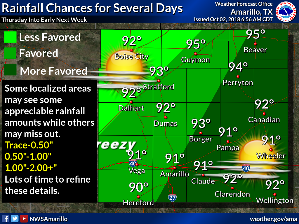
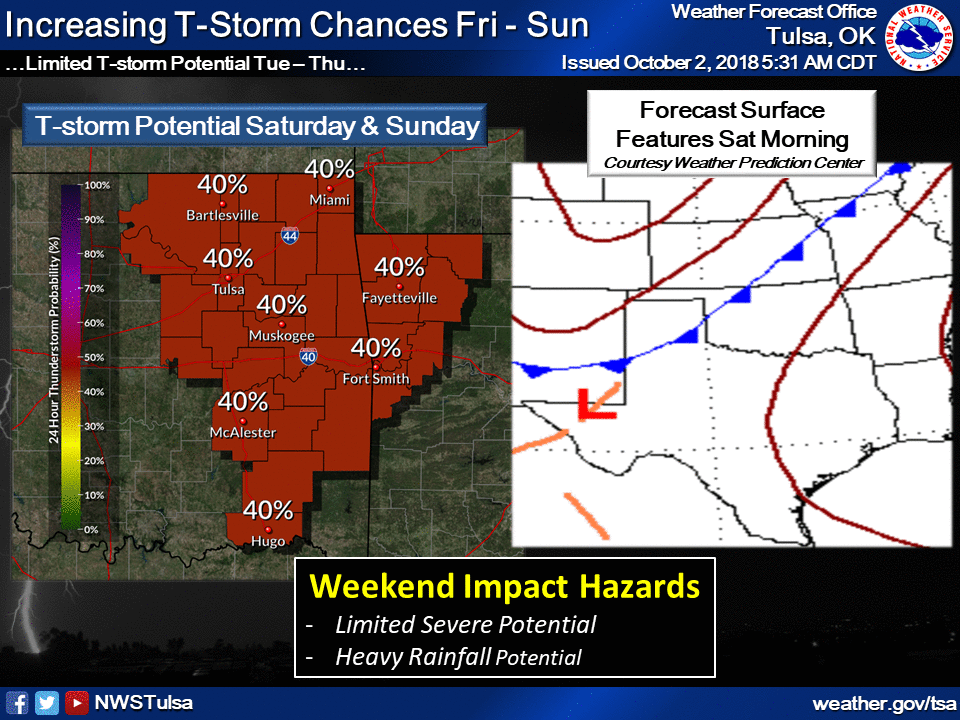
Remember, this can all change. As you see in Tulsa's graphic, the placement of
that front for focusing the rain/storm potential makes all the difference. Just
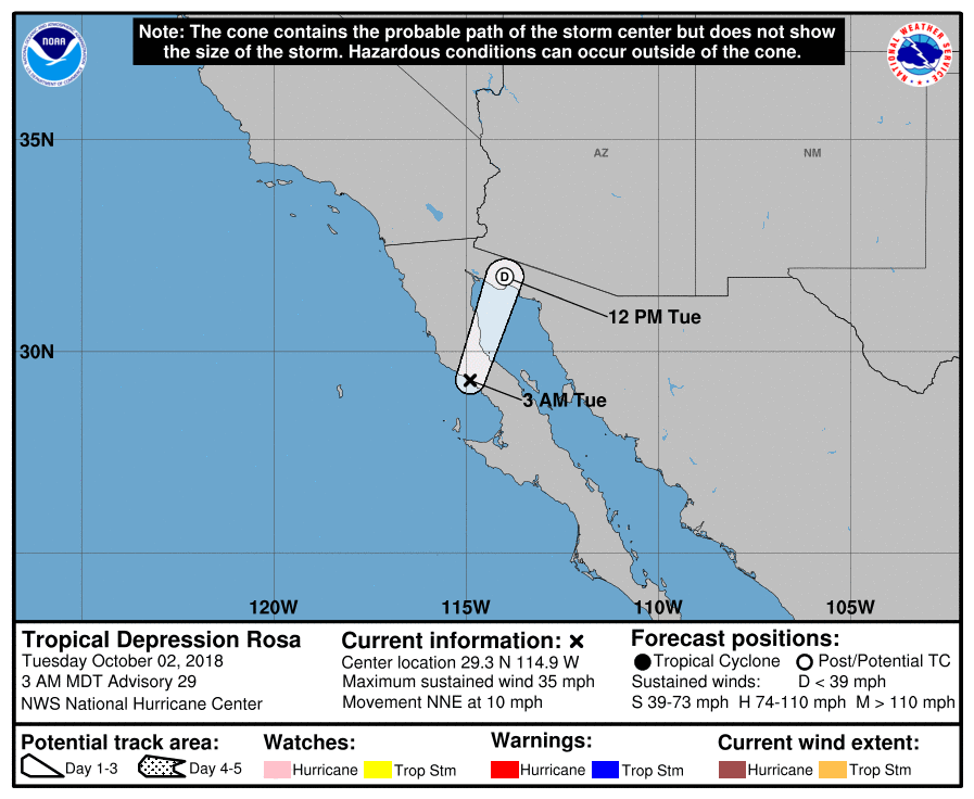
ask Fittstown. And just as with the storm system that inundated south central
Oklahoma, there could be some influence from the remnants of pacific hurricane
Rosa across the far western areas of the state. Doesn't look like the timing
or track is going to be as detrimental as that of the remnants that aided
our previous floodmaker. This scenario will have a bigger impact on the Desert
Southwest and then to our northwest.
How about something better...DESSERT Southwest!

Okay, let's get back on track.
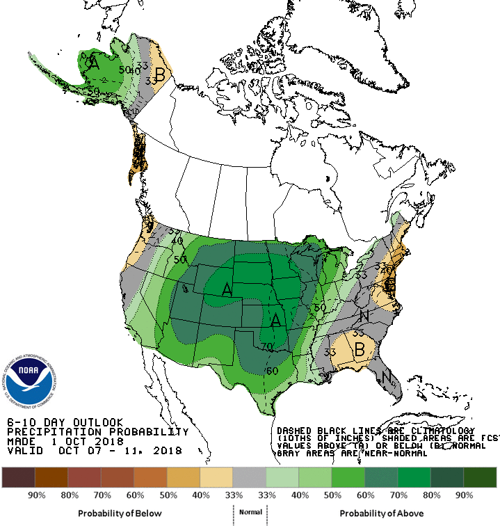
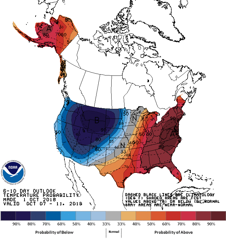
We can also see the influence of that large trough to our west on the CPC
outlooks for early next week, with GREATLY increased odds of above normal
precip and below normal temperatures headed our way.
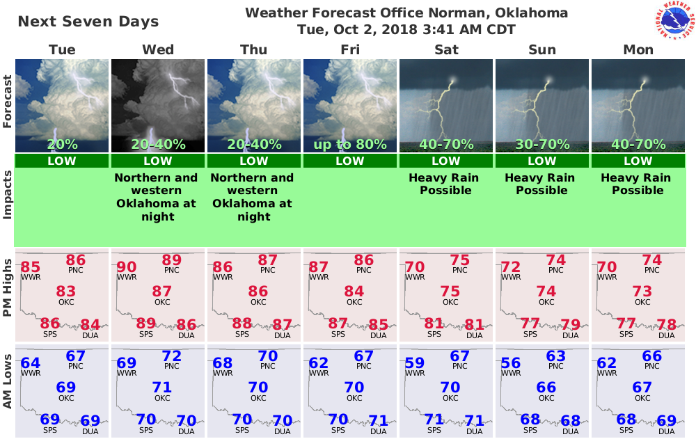
Once that big trough finally moves through, it could drag a substantial cold
front through the state with it sometime late next week, perhaps. Until the rain
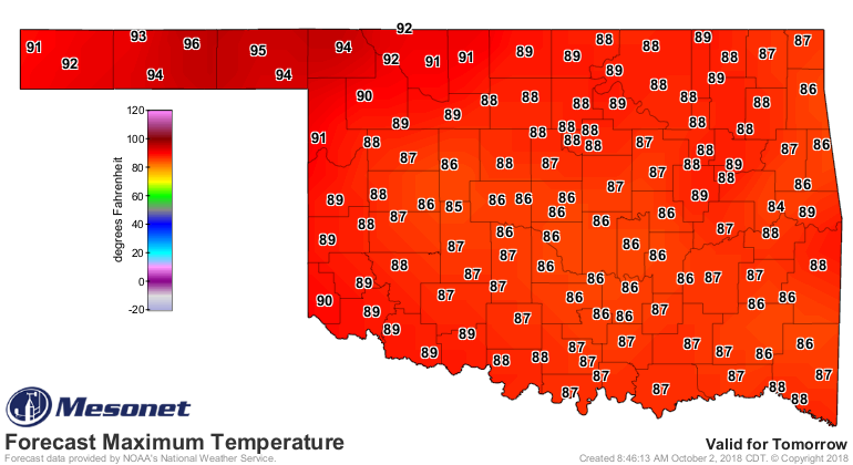
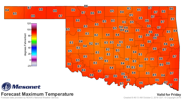
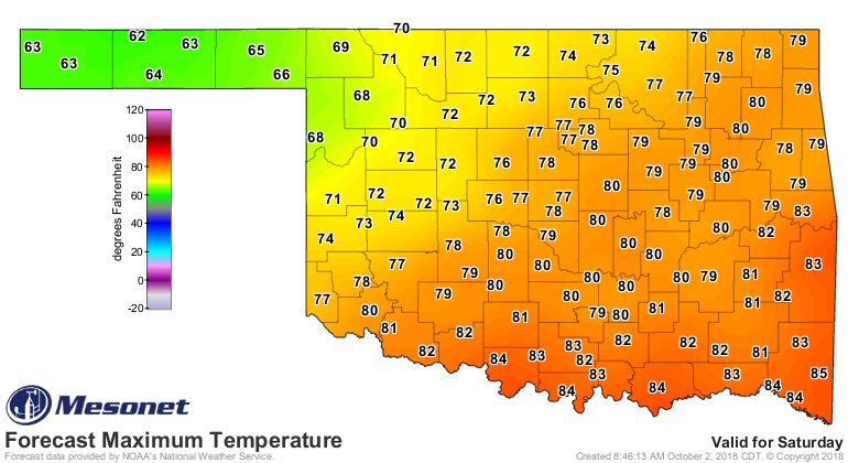
and clouds arrive this weekend, we have a few more hot days left. You can see
a hot Wednesday, then a front intruding into NW OK on Thursday, then the
front has retreated on Friday, then moved in AGAIN on Saturday.

Yep, here we go again. Just be thankful it wasn't here *I* go again, or you'd
have gotten a Whitesnake meme (shudder).

Gary McManus
State Climatologist
Oklahoma Mesonet
Oklahoma Climatological Survey
(405) 325-2253
gmcmanus@mesonet.org
October 2 in Mesonet History
| Record | Value | Station | Year |
|---|---|---|---|
| Maximum Temperature | 103°F | TIPT | 2000 |
| Minimum Temperature | 28°F | BOIS | 2009 |
| Maximum Rainfall | 4.76 inches | CHER | 2002 |
Mesonet records begin in 1994.
Search by Date
If you're a bit off, don't worry, because just like horseshoes, “almost” counts on the Ticker website!