Ticker for October 4, 2018
MESONET TICKER ... MESONET TICKER ... MESONET TICKER ... MESONET TICKER ...
October 4, 2018 October 4, 2018 October 4, 2018 October 4, 2018
Even Stevens
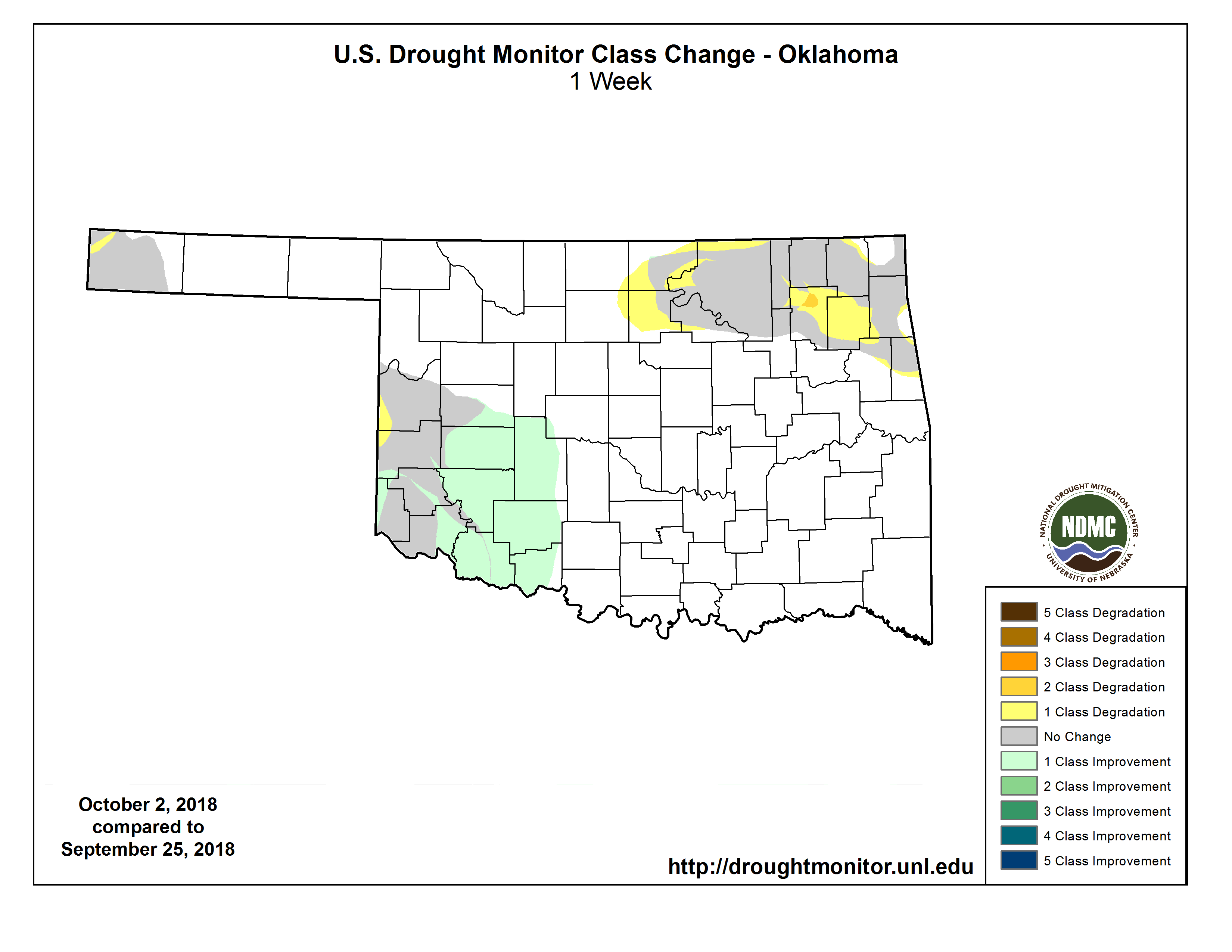
So we finally have drought on the run across southwestern Oklahoma, thanks to
the ginormous rains of the last two months, when northeastern Oklahoma decides
to become the current problem child.
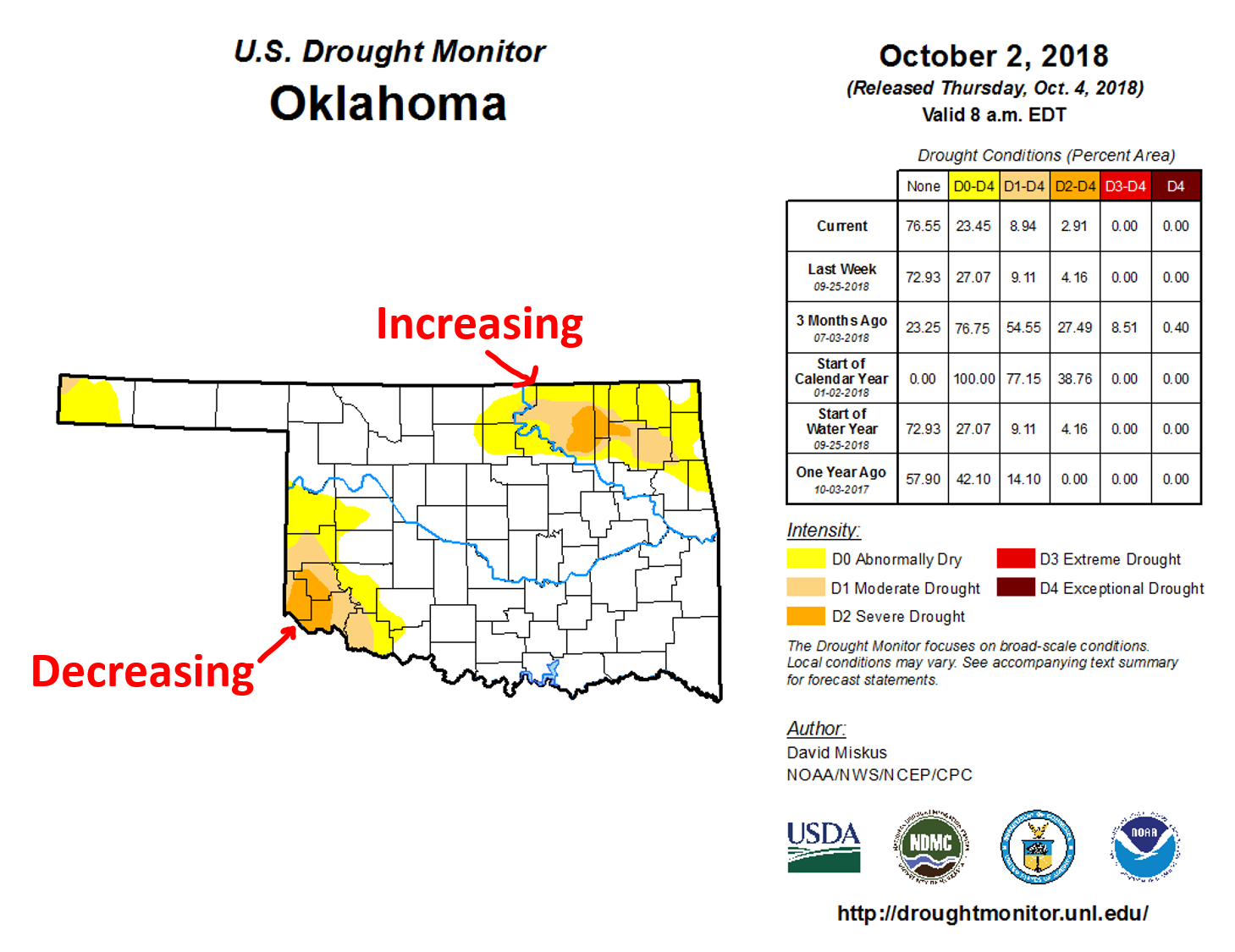
While the amount of drought in the state remained virtually unchanged (9.11% last
week, 8.94% this week), the decrease in the SW was replaced by an increase in the
NE. A near even exchange.
Now I think we're still set up in a pretty nice situation for drought removal
over the next week, but NOT so pretty if you're worried about flooding, especially
over western Oklahoma. The scenario remains the same as far as I can ascertain...
we have that large upper-level trough dominating the western half of the country
and the eastern half under a ridge of high pressure. With us stuck in between,
we should continue to see abundant moisture flow on southerly winds from the
Gulf of Mexico. As small storm systems rotate through the larger flow pattern,
we'll see rain chances now and again. Then the biggie moves through early next
week and we get inundated.
Heck, we have a cold front sagging into northern Oklahoma right now, causing
showers and storms AND some decent rains very close to our problem drought
area in the NE Oklahoma.
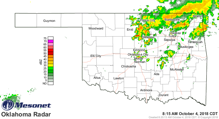

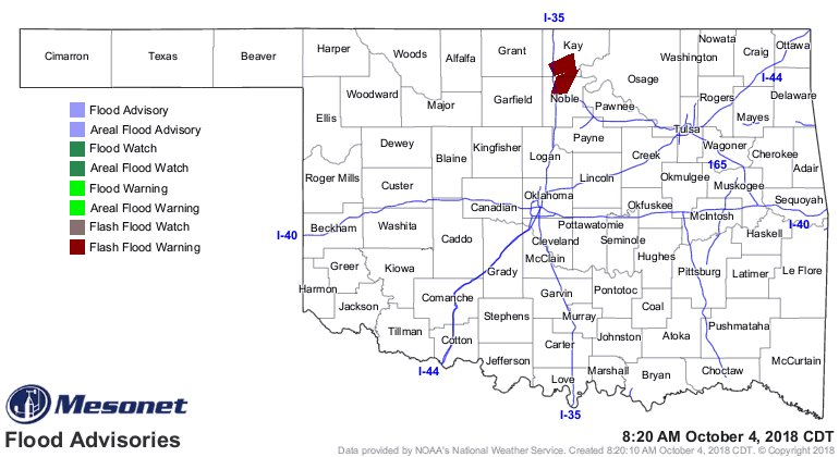
There's even a flood warning for Kay and Noble counties.
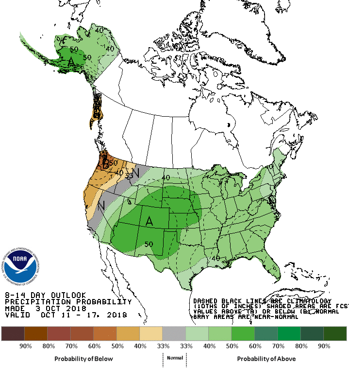
So if you look at the CPC 6-10 day outlooks, you can definitely see the
influence of that large trough and moisture from the Gulf.
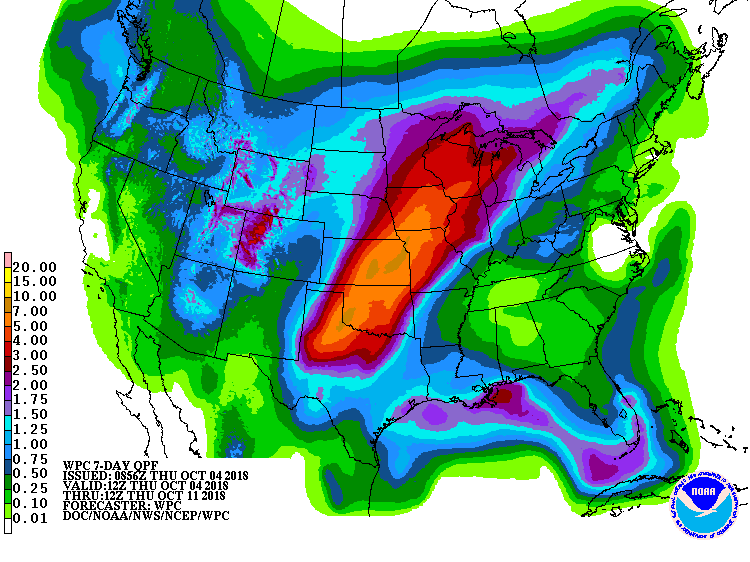
I really do think we'll see widespread relief across all the remaining drought
areas over the next week or so. The 7-day rain forecast certainly looks
favorable for that!
Gary McManus
State Climatologist
Oklahoma Mesonet
Oklahoma Climatological Survey
(405) 325-2253
gmcmanus@mesonet.org
October 4 in Mesonet History
| Record | Value | Station | Year |
|---|---|---|---|
| Maximum Temperature | 99°F | WALT | 2000 |
| Minimum Temperature | 29°F | OILT | 2010 |
| Maximum Rainfall | 7.72 inches | PAWN | 2017 |
Mesonet records begin in 1994.
Search by Date
If you're a bit off, don't worry, because just like horseshoes, “almost” counts on the Ticker website!