Ticker for December 1, 2016
MESONET TICKER ... MESONET TICKER ... MESONET TICKER ... MESONET TICKER ...
December 1, 2016 December 1, 2016 December 1, 2016 December 1, 2016
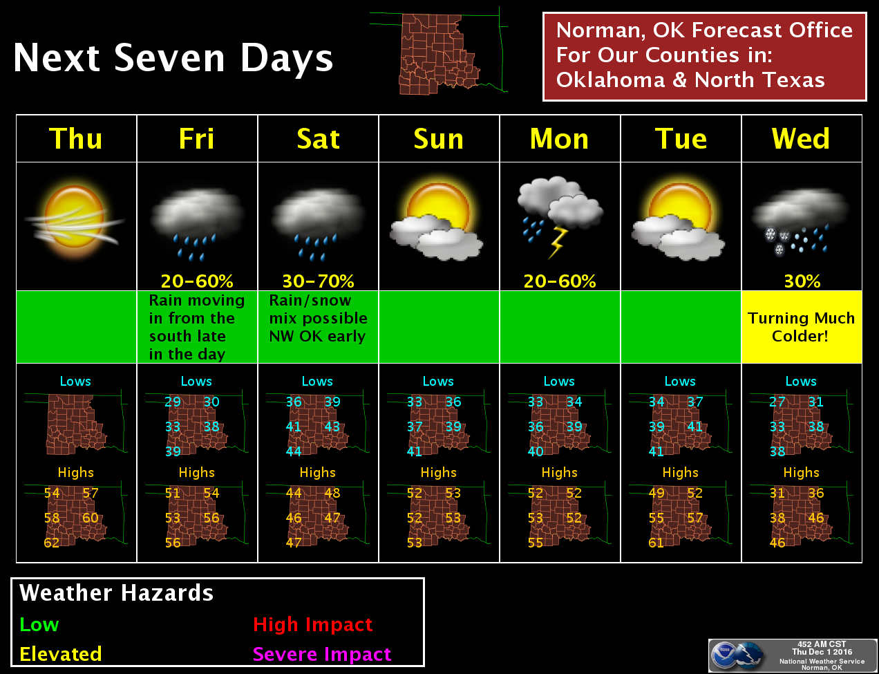
November summary and chance of a cold, cold rain!
Yes, winter is scheduled to come barreling through the state late next Tuesday
or early Wednesday. Yes, it's very upsetting, but we've avoided it long enough
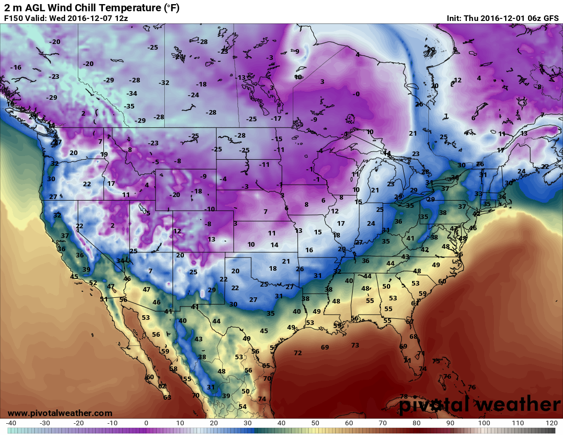
I reckon (read November's toasty summary below!). Here's the GFS forecast
model's view of wind chills around 6am next Wednesday. Still a long, LONG time
away forecast-wise, but when cold air gets on the move, it's tough to slow down.
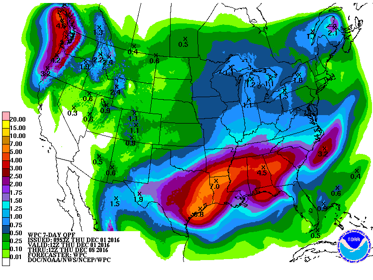
Before we get there, however, we're gonna get several days of a cold rain, with
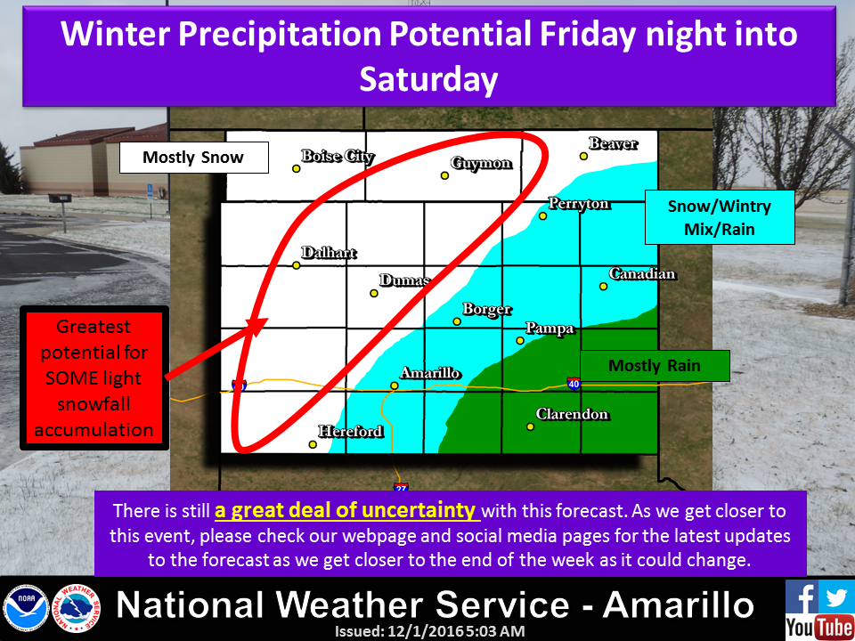
a few flakes thrown in here and there. As per usual, the Panhandle will have
the great chance for accumulating snows.
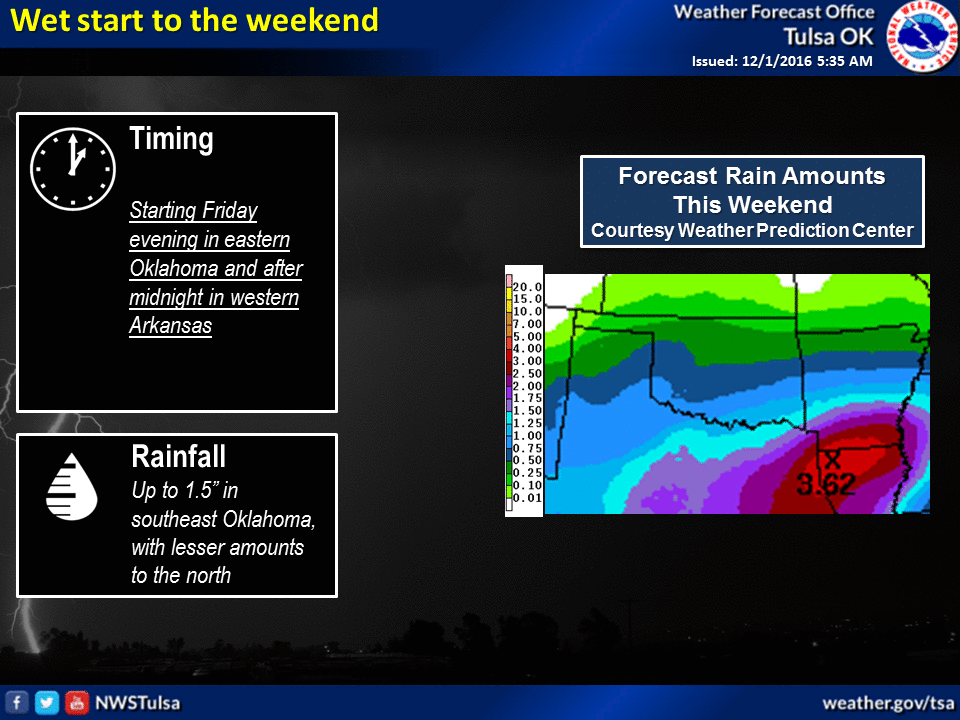
However, we do need the rain, somewhat desperately in some places (READ THE
NOVEMBER SUMMARY BELOW!). And so these 7-day rainfall totals would be nicer if
they were a tad higher to the NW, but we'll take what we can get. The SE should
get a good soaking again.
And now, onto the summary of November's weather. A near-historic warm month,
autumn and 2016 continued...as did drought.
-------------------------------------------------------------------------------
Mother Nature did little during November to sooth those areas in Oklahoma most
impacted by drought. Significant rains were scattered and temperatures were well
above normal ? as was the Oklahoma wind. All those factors contributed to drought
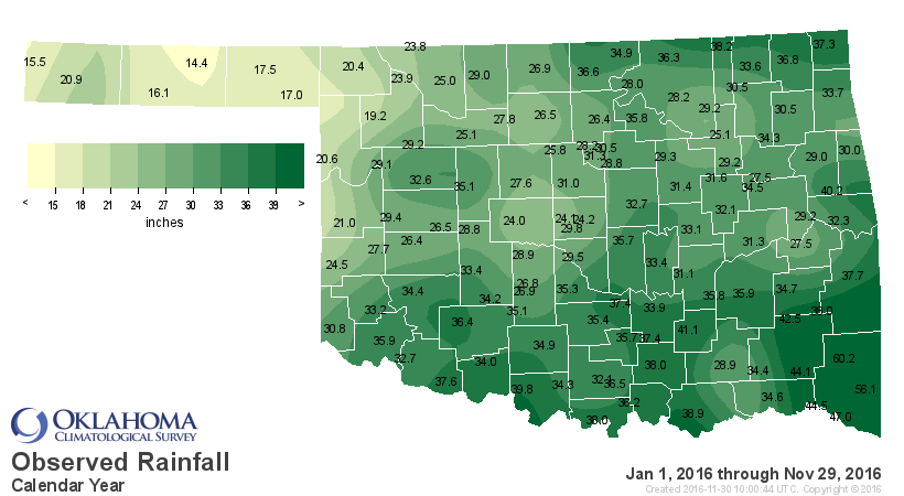
intensification. According to preliminary data from the Oklahoma Mesonet, the
statewide average rainfall total was 1.23 inches, 1.28 inches below normal and
ranked as the 41st driest November since records began in 1895. The four sites in
McCurtain County led the state with more than 4 inches of rain, the only Mesonet
stations out of 119 to eclipse that mark. Valliant led the way with 4.93 inches.
Southwestern Oklahoma also saw significant moisture with more than 2 inches
across Greer, Kiowa and Comanche counties. Hooker and Goodwell brought up the
rear with 0.04 inches and 0.02 inches, respectively. Sixty-three of those 119
stations recorded less than an inch of rain for the month.


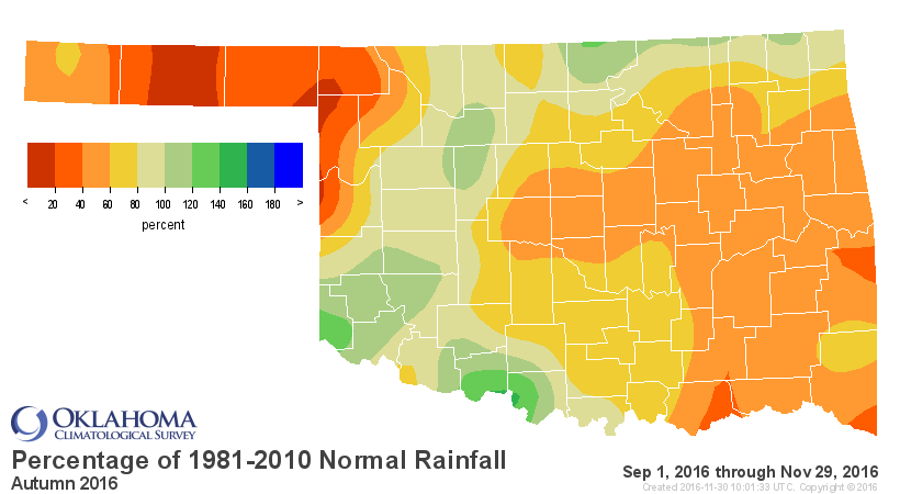
November brought climatological autumn to a close and as expected, it finished
much drier than normal. The September-November statewide average of 6.44 inches
was more than 3 inches below normal to rank as the 36th driest fall on record.
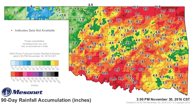

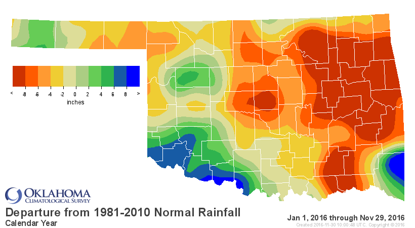
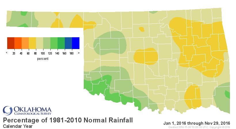
The January-November period was extremely dry from much of eastern into central
Oklahoma. The east central region was more than 10 inches below normal to rank
as the 24th driest on record, while southwestern Oklahoma enjoyed a surplus of
more than 3 inches and a ranking of 27th wettest. Statewide, the average fell
more than 4 inches below normal to rank the year thus far as the 53rd driest on
record.
The statewide average temperature was 5.3 degrees above normal at 54.6 degrees
to rank as the third warmest November on record.
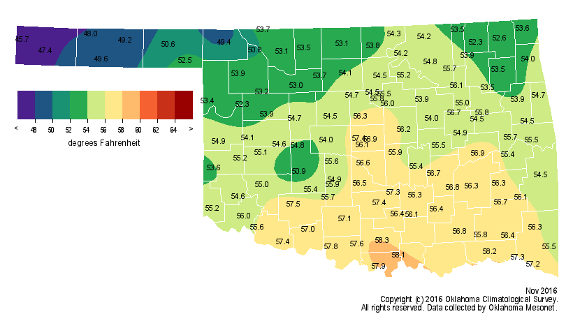
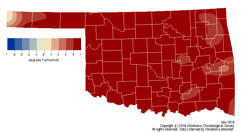
High temperatures rose into the 70s and 80s with unusual regularity well into
the month. Buffalo topped the Mesonet with a reading of 90 degrees on the 16th
breaking the all-time statewide high for that date. The previous record high
for Nov. 16 was 89 degrees set at Ft. Reno more than a decade before statehood
in 1894. Periodic cold fronts meant occasional forays into freezing weather,
especially in the dry air across northwestern Oklahoma. Hooker and Beaver
reached 12 degrees on the 19th for the lowest readings. The Mesonet site at Eva
in Texas County fell to 32 degrees or lower for a total of 100 hours to lead
the state. Nearly the entire state had experienced a hard freeze of at least 28
degrees by the end of the month.

The near historic warmth of October and November pushed climatological fall to
end as the 2nd warmest on record at 65.6 degrees, 4.8 degrees above normal,
still well below 1931?s 66.4 degrees. The first 11 months of 2016 rose 2.6
degrees above normal, the third warmest such period on record.
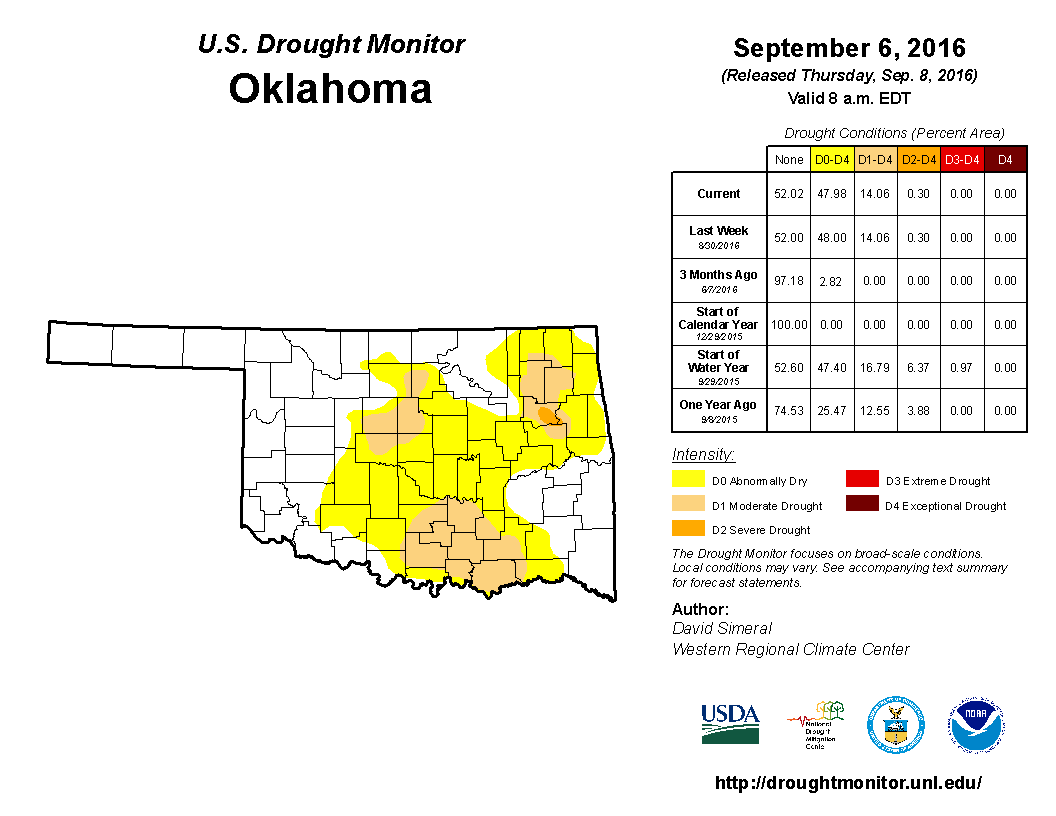
Drought erupted and intensified from the beginning of the month according to
the U.S. Drought Monitor, rising from 36 percent of the state on Nov. 1 to
nearly 48 percent of the state by month?s end.
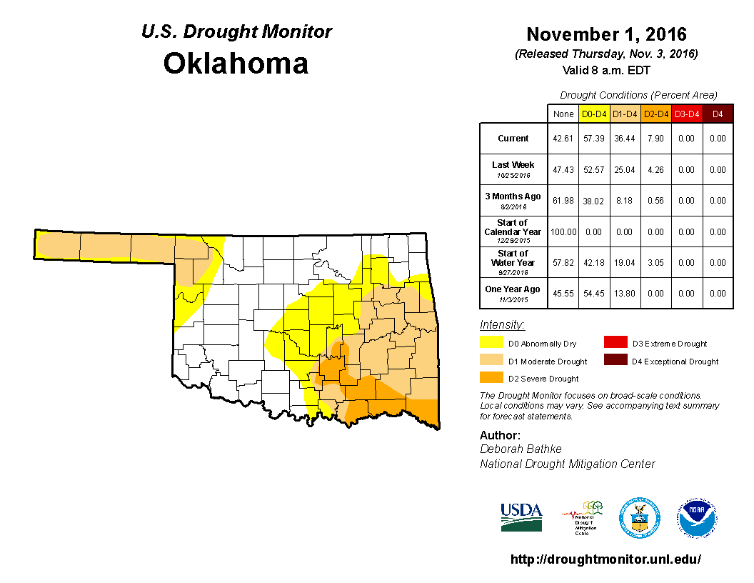
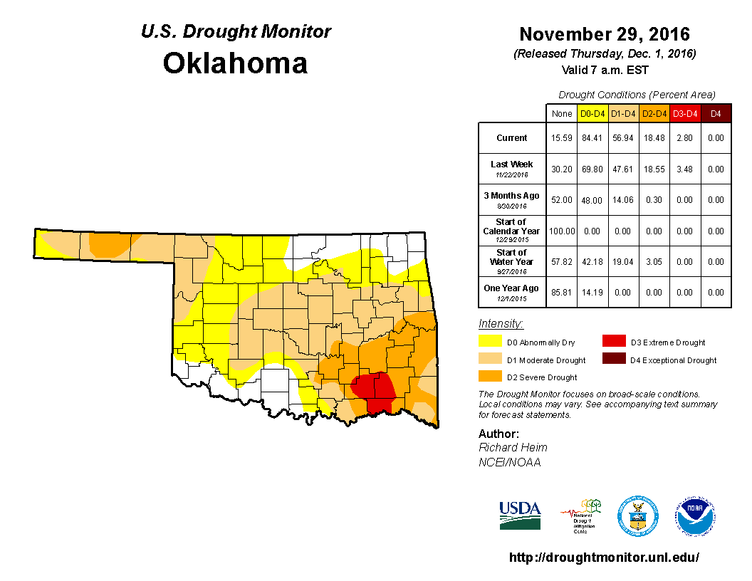
That is the highest percentage of the state in drought since 59 percent on May
5, 2015. The biggest increase came in the more intense drought categories, with
severe drought increasing from 8 percent to more than 15 percent and extreme
drought emerging 3 percent. The Drought Monitor?s intensity scale
slides from moderate-severe-extreme-exceptional, with exceptional being the
worst classification. Drought increased from 14 percent of the state to 48
percent during autumn. Oklahoma was drought free at the beginning of 2016.
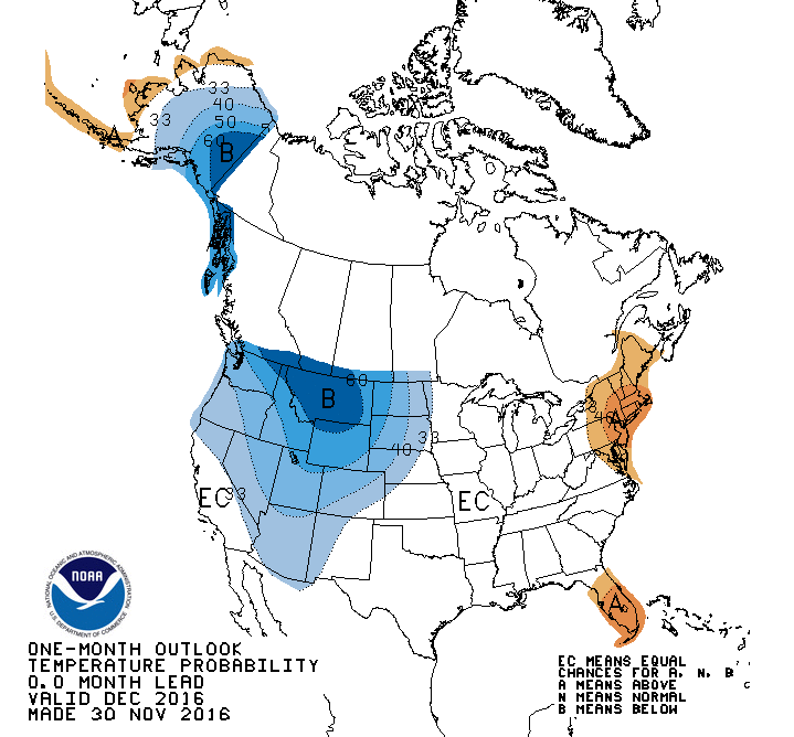
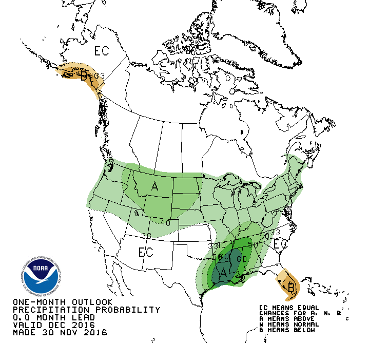
The December temperature and precipitation outlooks from the Climate Prediction
Center (CPC) were noncommittal for Oklahoma save for slightly increased odds of
above normal precipitation across far southeastern Oklahoma.
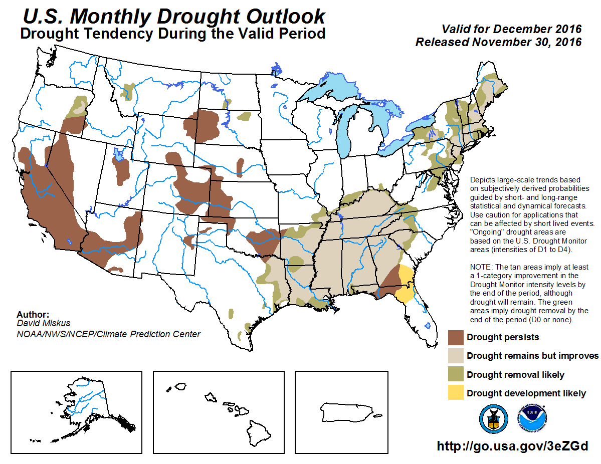
CPC?s U.S. Monthly Drought Outlook for December therefore showed some drought
improvement across far southeastern Oklahoma. Otherwise, drought is expected to
persist in the state where it currently exists. No drought development is
forecast.
Gary McManus
State Climatologist
Oklahoma Mesonet
Oklahoma Climatological Survey
(405) 325-2253
gmcmanus@mesonet.org
December 1 in Mesonet History
| Record | Value | Station | Year |
|---|---|---|---|
| Maximum Temperature | 86°F | HOLL | 2012 |
| Minimum Temperature | 0°F | SEIL | 2006 |
| Maximum Rainfall | 0.75 inches | WATO | 2015 |
Mesonet records begin in 1994.
Search by Date
If you're a bit off, don't worry, because just like horseshoes, “almost” counts on the Ticker website!