Ticker for November 1, 2024
MESONET TICKER ... MESONET TICKER ... MESONET TICKER ... MESONET TICKER ...
November 1, 2024 November 1, 2024 November 1, 2024 November 1, 2024
One tornado more
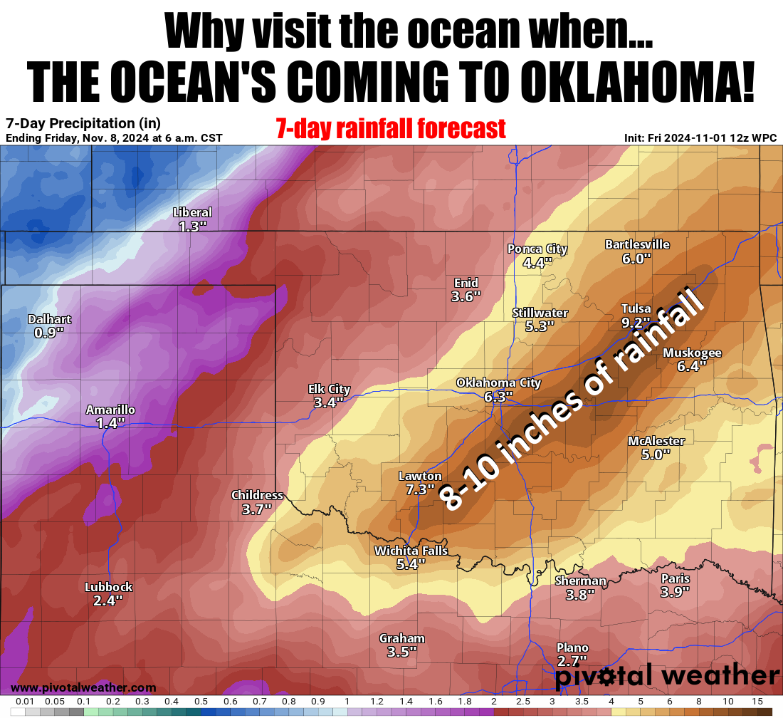
I'm thinking that 8-10 inches of rainfall would not be good on top of drought-
baked ground, no? Well, most times I trying to think and nothing happens, but
that thought broke through. Maybe the rain a couple of days ago softened the
soil a bit? Made it more amenable (English to Okie translation: "open") to
allowing some of that rain to soak in?
You know that sound the Martian lasers made in the old movie "War of the Worlds"?
That's what I'm hearing in my head right now thinking of that much rainfall. The
good news is that would end the drought in a lot of places. The bad news is
that's gonna cause flooding, if it verifies. It doesn't HAVE to verify...we are
talking 7 days out. Well, shrink that to 5 days and you don't lose much of
that forecast rainfall.

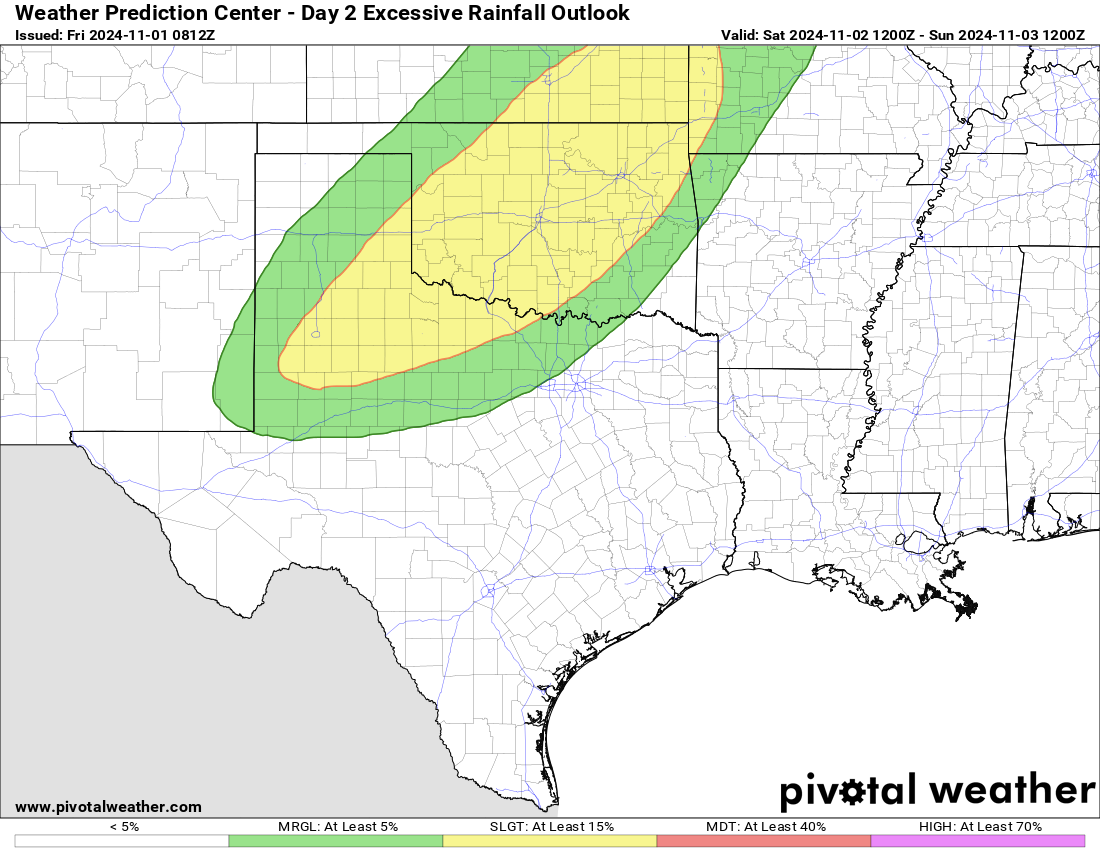
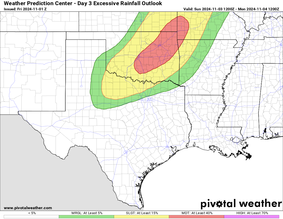
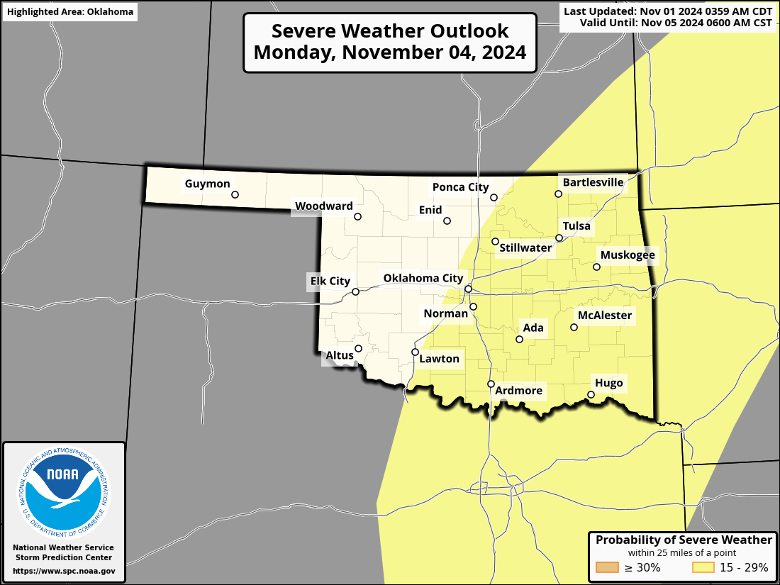
OH! I almost forgot...it will also come with the threat of severe weather. All
hazards possible on Sunday, with severe winds and hail the biggest worry on
Monday.

I'm thinking a tornado would not be good either. Did you know we had a tornado
on Oct. 30? I didn't either, until I did. It was an EF1 up in Ottawa County, near
Fairland (scroll below to the October summary for more info).
In typical Okie fashion...all of this in one week after NOTHING for two straight
months.
----------------------------------------------------------------------------------
October Avoids Record Dry Mark
Nov. 1, 2024
As October drew to a close, much of Oklahoma had gone over a month without
significant moisture—and for some areas, over two months. A new record for the
all-time driest October seemed inevitable. However, a remarkable storm on
October 30 changed that trajectory, bringing much-needed rain and a severe
weather threat. A confirmed EF1 tornado touched down near Fairland in Ottawa
County, damaging homes and destroying outbuildings along an 8-mile path,
according to a preliminary report from the National Weather Service. This event
brought Oklahoma's 2024 tornado count to 113, the fourth-highest annual total
since records began in 1950, with 2019 holding the record at 149. The annual
average is 57.5.

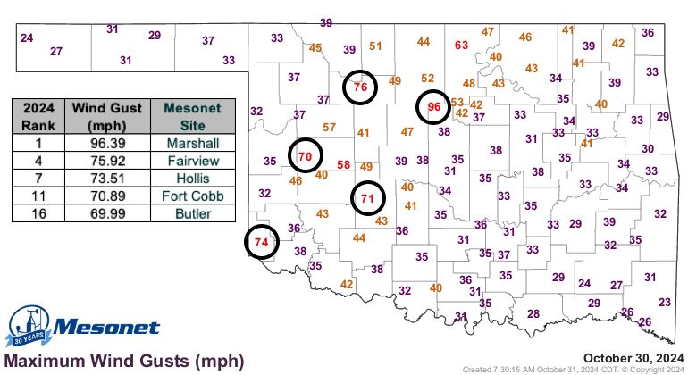
The storm also generated powerful winds, with a gust of 96 mph recorded at the
Oklahoma Mesonet site in Marshall, and several other sites clocking gusts over
70 mph. Numerous reports of downed power lines, damaged roofs, and fallen trees
surfaced from impacted areas. Despite these impacts, the rain was the storm's
most valuable contribution, with parts of northern and eastern Oklahoma
receiving 1–2 inches overnight.
A cold front associated with the system ushered in more seasonable weather,
helping alleviate the spread and intensification of flash drought that had
flourished during an unusually warm and dry October. Southwestern Oklahoma
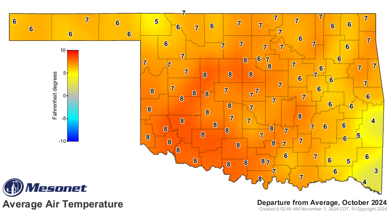
endured its warmest October on record, with temperatures averaging 7.5 degrees
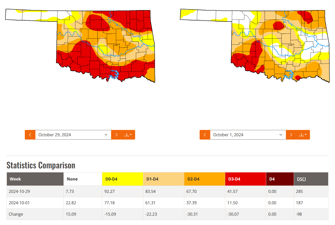
above normal, alongside its seventh-driest October. Drought coverage statewide
rose from 61% to 84% during the month according to the U.S. Drought Monitor,
with the higher intensify drought area increasing from 37% to 68%. Typical
drought impacts emerged, including reports of dry farm ponds, withered crops,
and delays in winter wheat planting. Wildfires broke out in late October,
fueled by gusty winds over 50 mph, scorching more than 15,000 acres. In Logan
County, a fire forced evacuations and destroyed at least six homes near the
Twin Lakes Community. Kingfisher County saw four homes lost to fire, with
evacuations in its southeast corner, while a large fire in the Wichita
Mountains Wildlife Refuge burned over 12,000 acres.
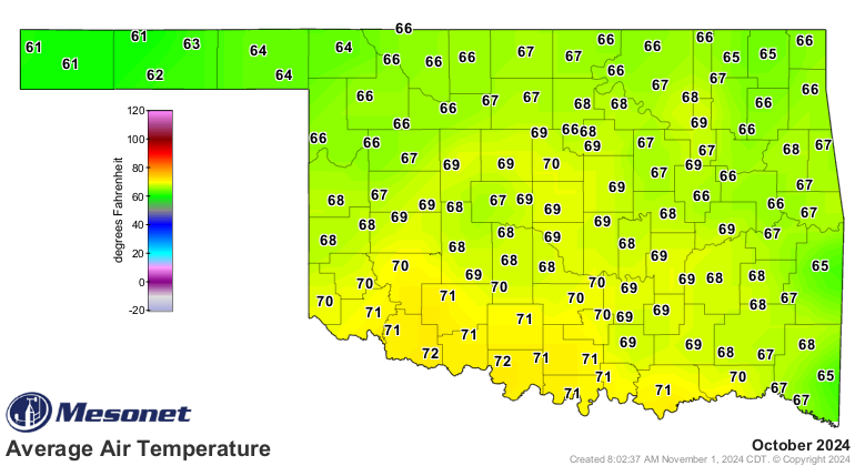
The statewide average temperature for October, based on preliminary Oklahoma
Mesonet data, was 67.8 degrees—6.5 degrees above normal—ranking as the third-
warmest October on record. Temperatures ranged from 99 degrees at Mangum on
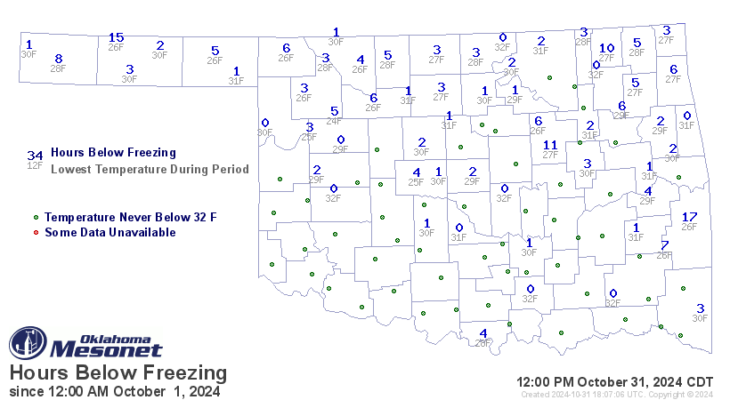
Oct. 3 and 12, to 24 degrees at Seiling on Oct. 16. That date also saw the
season’s first freeze, as a strong cold front pushed temperatures below 32
degrees at Mesonet sites across northern Oklahoma. Despite this seasonal shift,
nearly half of the 120 Mesonet sites stayed above freezing for the month, with
Eva spending the most time below freezing at 15 hours. While October saw
temperatures at or above 90 degrees recorded 1,037 times at Mesonet sites, the
freezing mark was only reached 85 times. The January–October period ranked as
Oklahoma’s third-warmest on record, averaging 66 degrees—2.5 degrees above
normal.
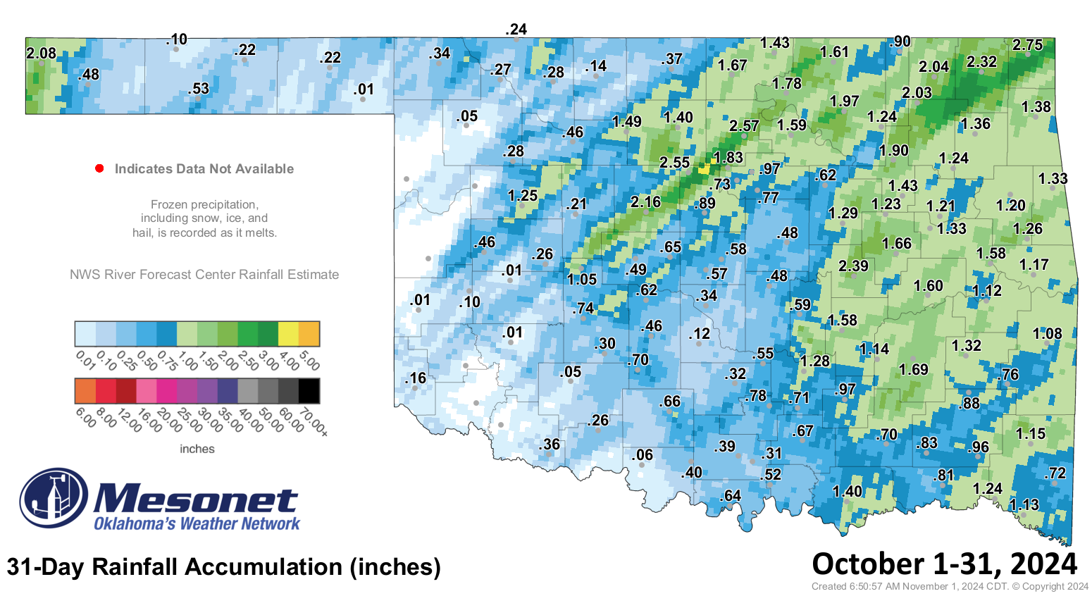
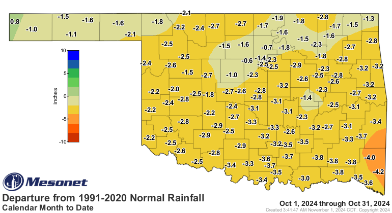
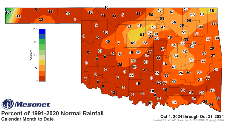
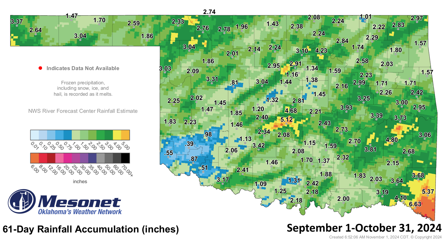
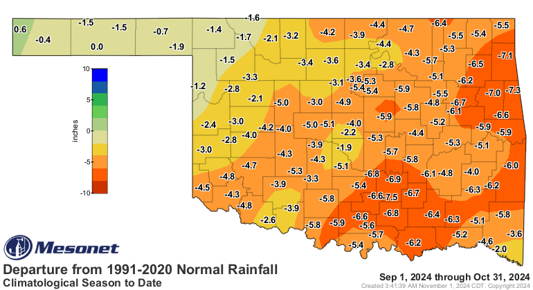
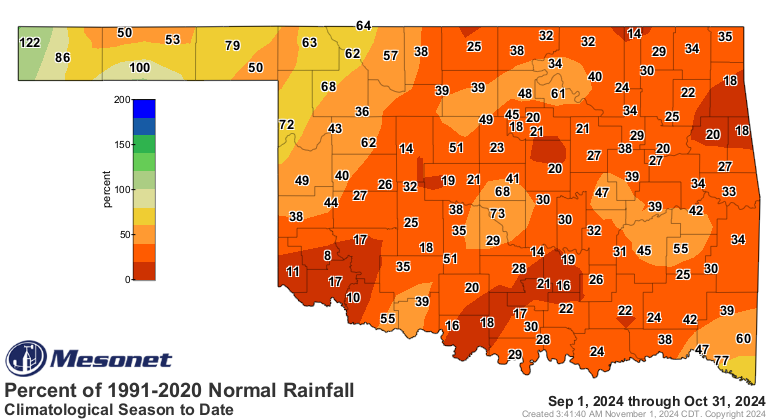
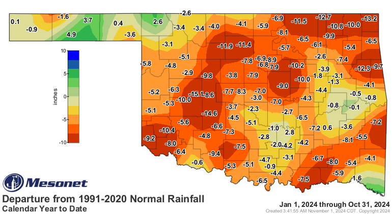
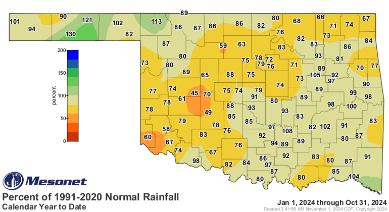
Statewide precipitation for October averaged 0.84 inches, 2.52 inches below
normal, ranking it as the 11th-driest October since records began in 1895.
Rainfall totals ranged from 2.75 inches in Miami to no rain at all at six
western Mesonet sites. An additional 66 sites recorded an inch or less, and
only nine sites reported at least 2 inches, leaving much of the state with
precipitation deficits of 2–5 inches. Only Kenton reported a surplus, with 2.08
inches—0.9 inches above normal. The September–October period was exceptionally
dry, ranking as the fifth-driest with an average of 2.41 inches—4.27 inches
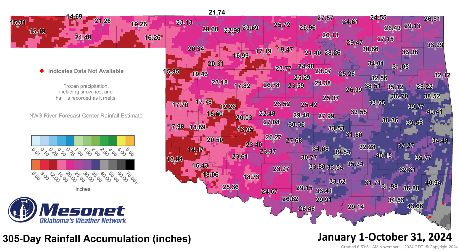
below normal. For January–October, the statewide average precipitation was
26.96 inches, 4.97 inches below normal, ranking as the 40th-driest period on
record.
The Climate Prediction Center’s November outlooks offer hope, with increased
odds for above-normal precipitation, especially across north-central and
northeastern Oklahoma, bolstered by forecasts of heavy rain early in the month.
The temperature outlook indicates a higher probability of above-normal
temperatures, particularly in the southeastern half of the state. The CPC’s
November drought outlook foresees drought improvement, with potential
elimination in some areas currently experiencing drought.


###
Gary McManus
State Climatologist
Oklahoma Mesonet
Oklahoma Climatological Survey
gmcmanus@ou.edu
November 1 in Mesonet History
| Record | Value | Station | Year |
|---|---|---|---|
| Maximum Temperature | 90°F | ALTU | 2001 |
| Minimum Temperature | 16°F | VINI | 2023 |
| Maximum Rainfall | 3.65 inches | NEWK | 1998 |
Mesonet records begin in 1994.
Search by Date
If you're a bit off, don't worry, because just like horseshoes, “almost” counts on the Ticker website!