Ticker for October 31, 2024
MESONET TICKER ... MESONET TICKER ... MESONET TICKER ... MESONET TICKER ...
October 31, 2024 October 31, 2024 October 31, 2024 October 31, 2024
Grand slam
Oh, you like old TV shows? Well here's a new one!
(sung to the tune of "The Beverly Hillbillies")
Come and listen to a story 'bout a man named Gary,
A weather-worn fella, and his outlook’s gettin’ scary.
One day he's sweatin' like a hog at the fair,
Next day he's freezin' in the icy morning air!
Cold snap, that is — straight from the Arctic freeze!
Well, the first thing you know, ol’ Gary's shiverin' too,
His morning’s hot coffee turns to iced coffee brew.
Folks said, "Move away! Head where the weather’s tame!"
But he said, "This is Oklahoma; crazy’s our middle name!"
Wild fronts, that is — big dips, hot flips!
Yes, it's cold. And about last night...
What if you threw a tornado party and nobody showed up? You throw ANOTHER party.
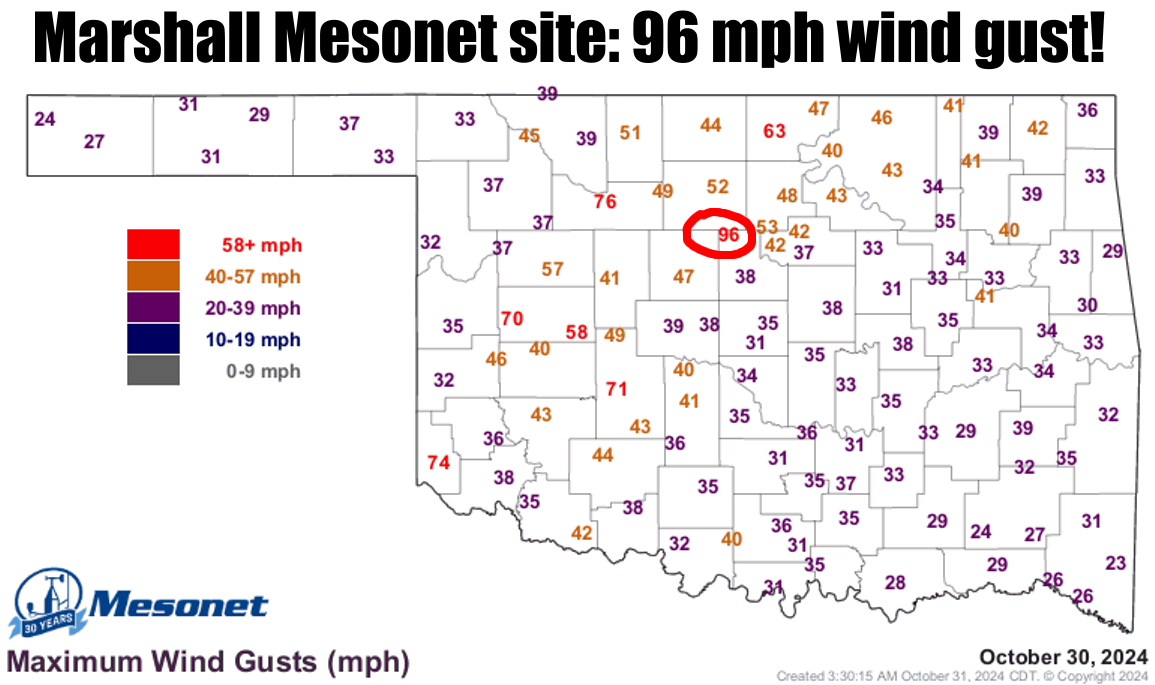
That's not to say we didn't have some pretty intense severe weather last night,
of course. There are those damaging winds, INCLUDING the 96 mph gust at Marshall
last night at 6:50pm (as well as other quite severe gusts).
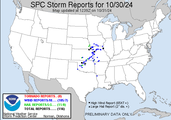
The lack of green triangles on that map also tells us there wasn't much in the
way of damaging hail, either, which is another reason to celebrate. The BIGGEST
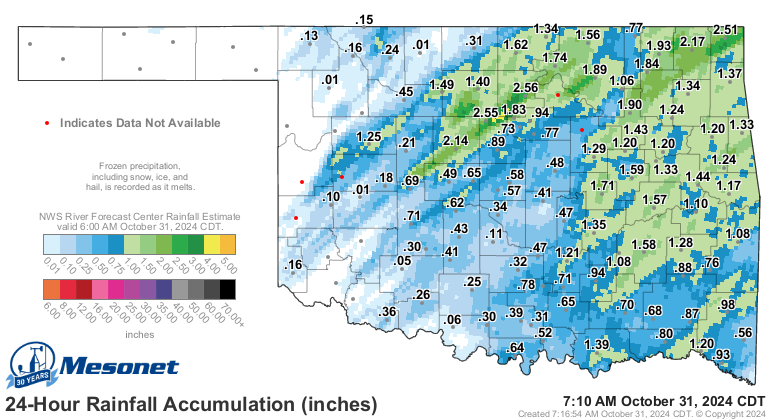
reason to celebrate is the rain, and this first round gave us a great dose of
moisture across *SOME* of the hardest-hit drought areas of the state. We really
could have used more in SW OK.
Heck, it's raining right now for crying out loud (I *FINALLY* get to say that
again)!
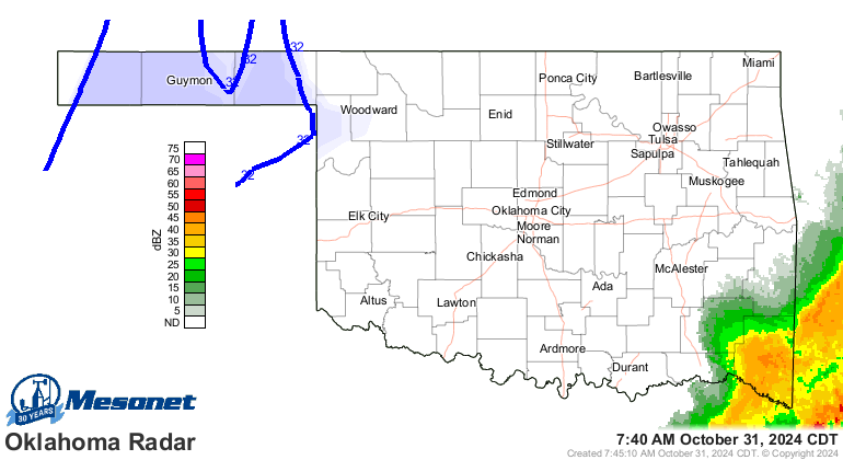
Yep, we do have some freezing weather on that map. It's cooooooold outside. I
even had to wear a jacket this morning. Oh, the agony.
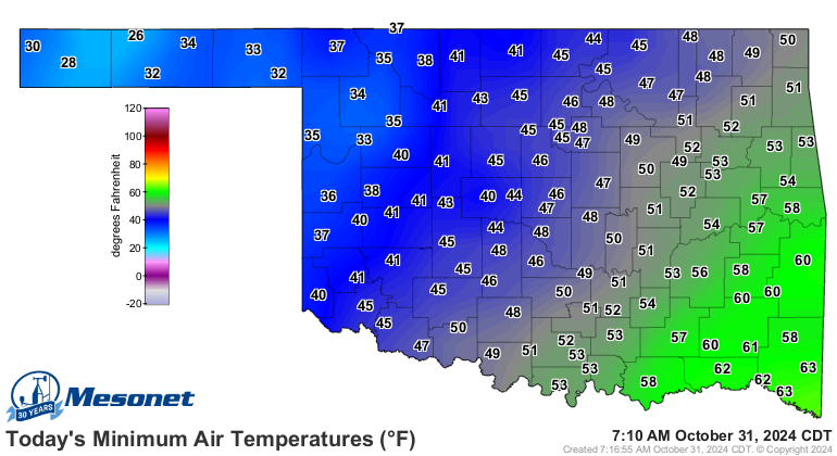

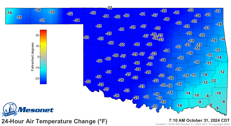
I'm not sure I'm on board with the return to late-fall temps, but it was bound
to happen sooner or later. Holy frijole, look at that change from yesterday at
this time!
But like you were saying (or was that me??), the rain we DID get was certainly
welcomed, especially when we see an already-outdated-but-nasty-looking drought
map just released this morning.

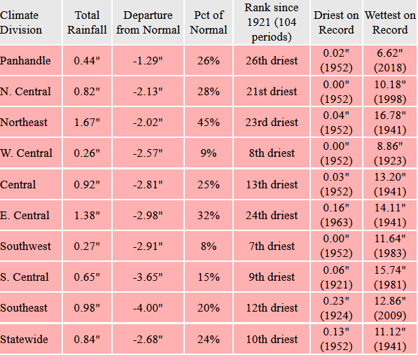
And it also made our October 2024 rainfall map look not-quite-so-bad (but still
bad), and the stats for October also back that up.

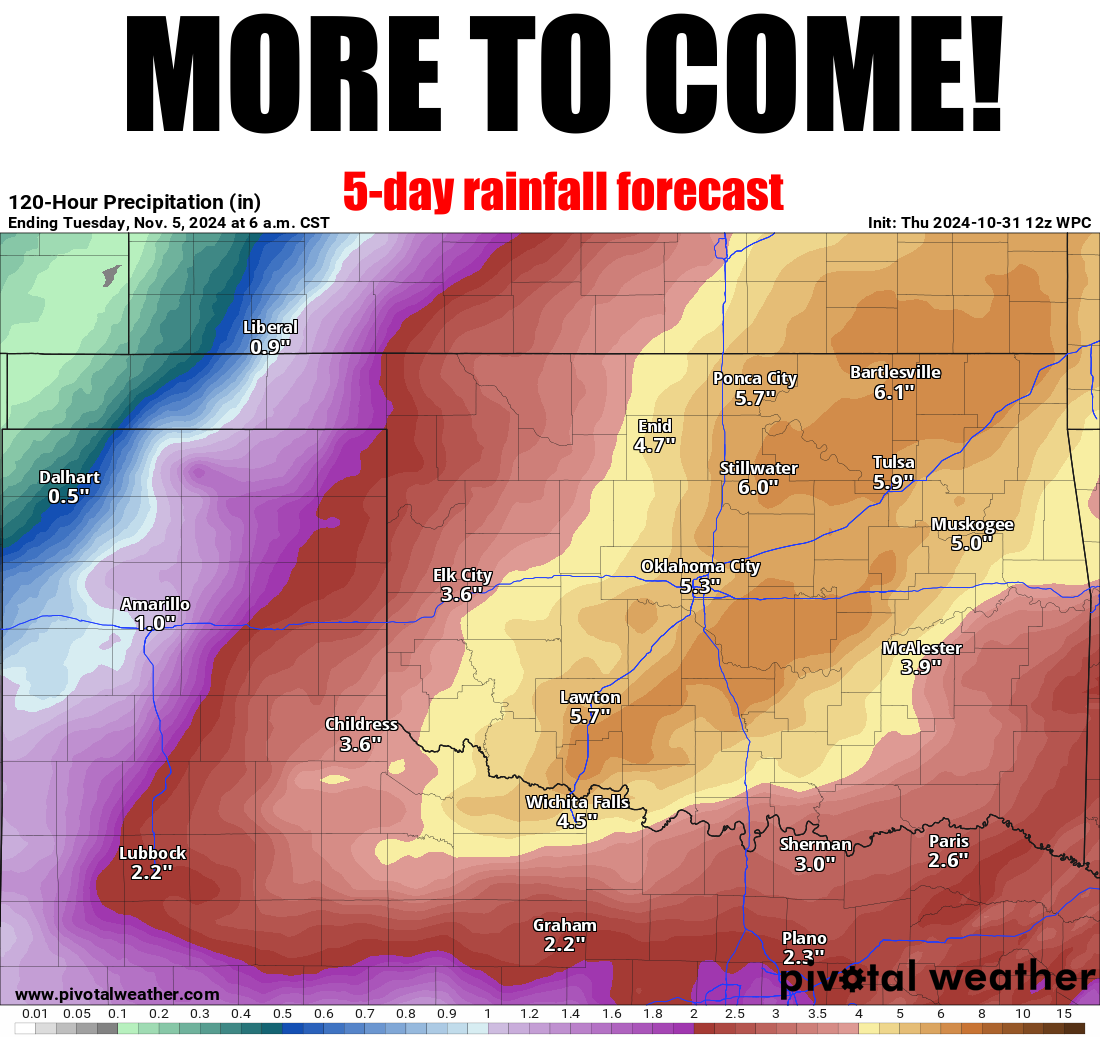
More rain will help, obviously, but just like last night, it might come with
the bad stuff, especially Sunday into Monday.
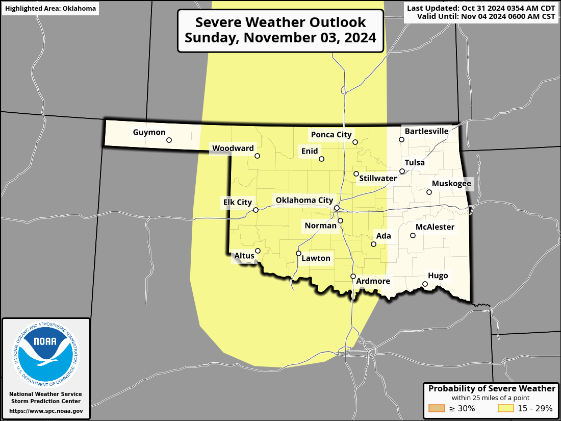
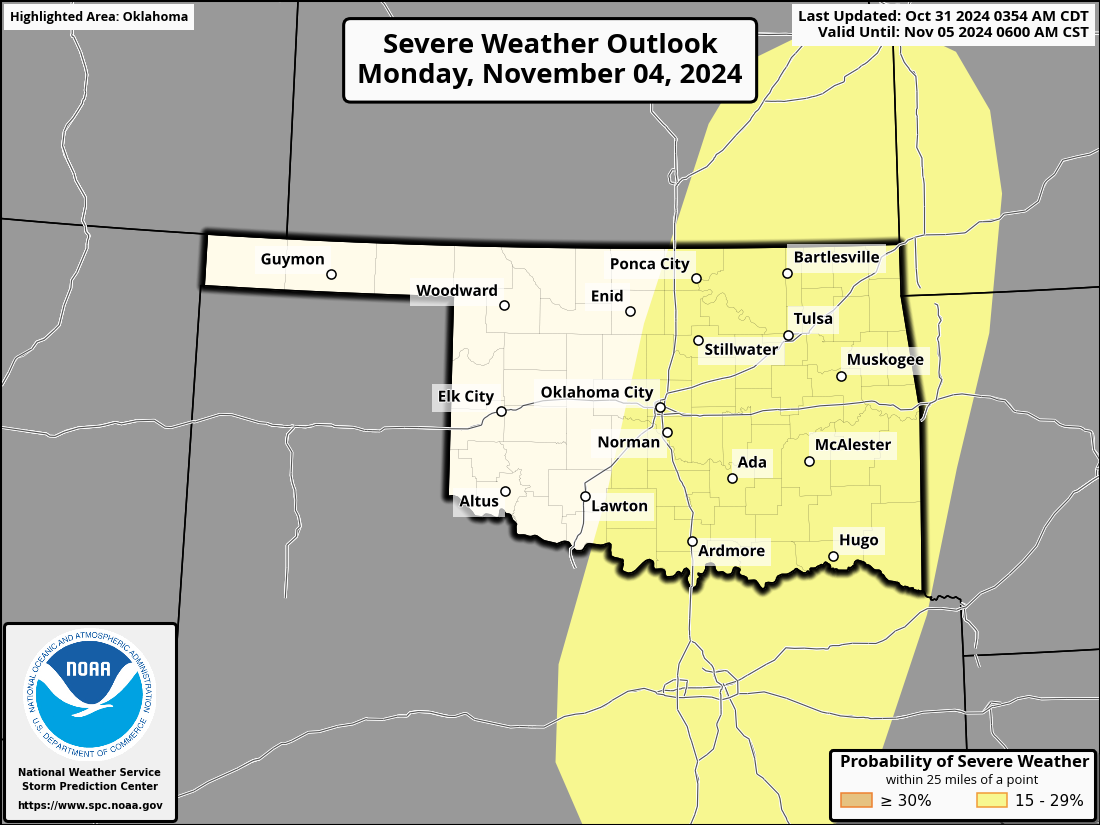
Maybe a bit of a tornado threat Sunday (don't send the invites!), but a hail
and wind threat (hey, Hail and Wind Threat was my band's name in the Seminary!)
on Monday.
Speaking of resets (just work with me), how about THIS change!

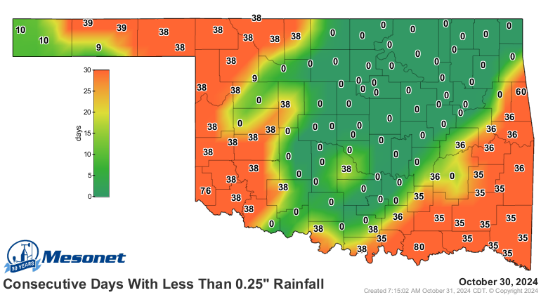
It's a start!
Gary McManus
State Climatologist
Oklahoma Mesonet
Oklahoma Climate Survey
gmcmanus@ou.edu
October 31 in Mesonet History
| Record | Value | Station | Year |
|---|---|---|---|
| Maximum Temperature | 92°F | BEAV | 2016 |
| Minimum Temperature | 0°F | KENT | 2019 |
| Maximum Rainfall | 4.64 inches | KING | 1998 |
Mesonet records begin in 1994.
Search by Date
If you're a bit off, don't worry, because just like horseshoes, “almost” counts on the Ticker website!