Ticker for October 1, 2024
MESONET TICKER ... MESONET TICKER ... MESONET TICKER ... MESONET TICKER ...
October 1, 2024 October 1, 2024 October 1, 2024 October 1, 2024
Whither?
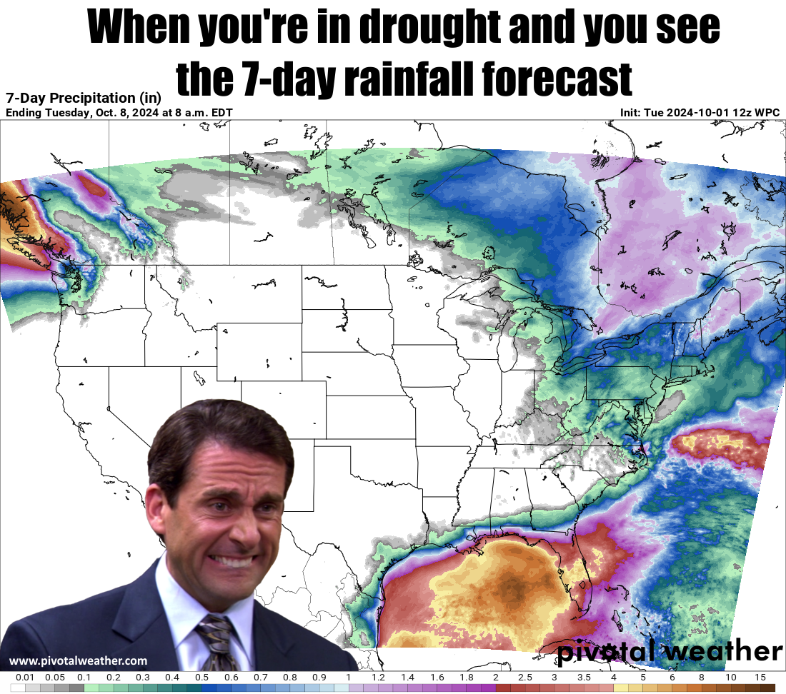
What do you do when you're having stomach cramps? Besides contact Taco Bell
customer service, that is? Well you make an Office meme, of course. What, you'd
rather see this stinker?
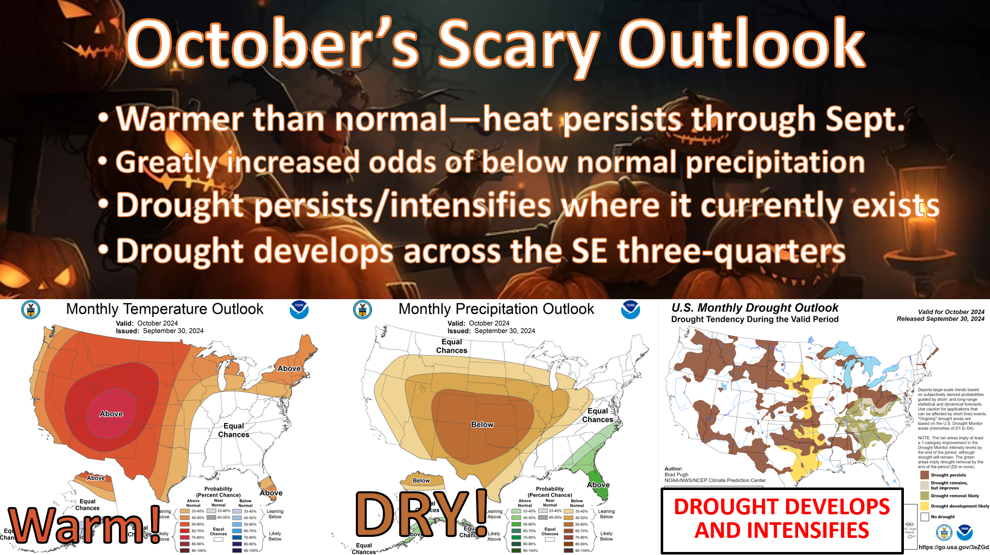
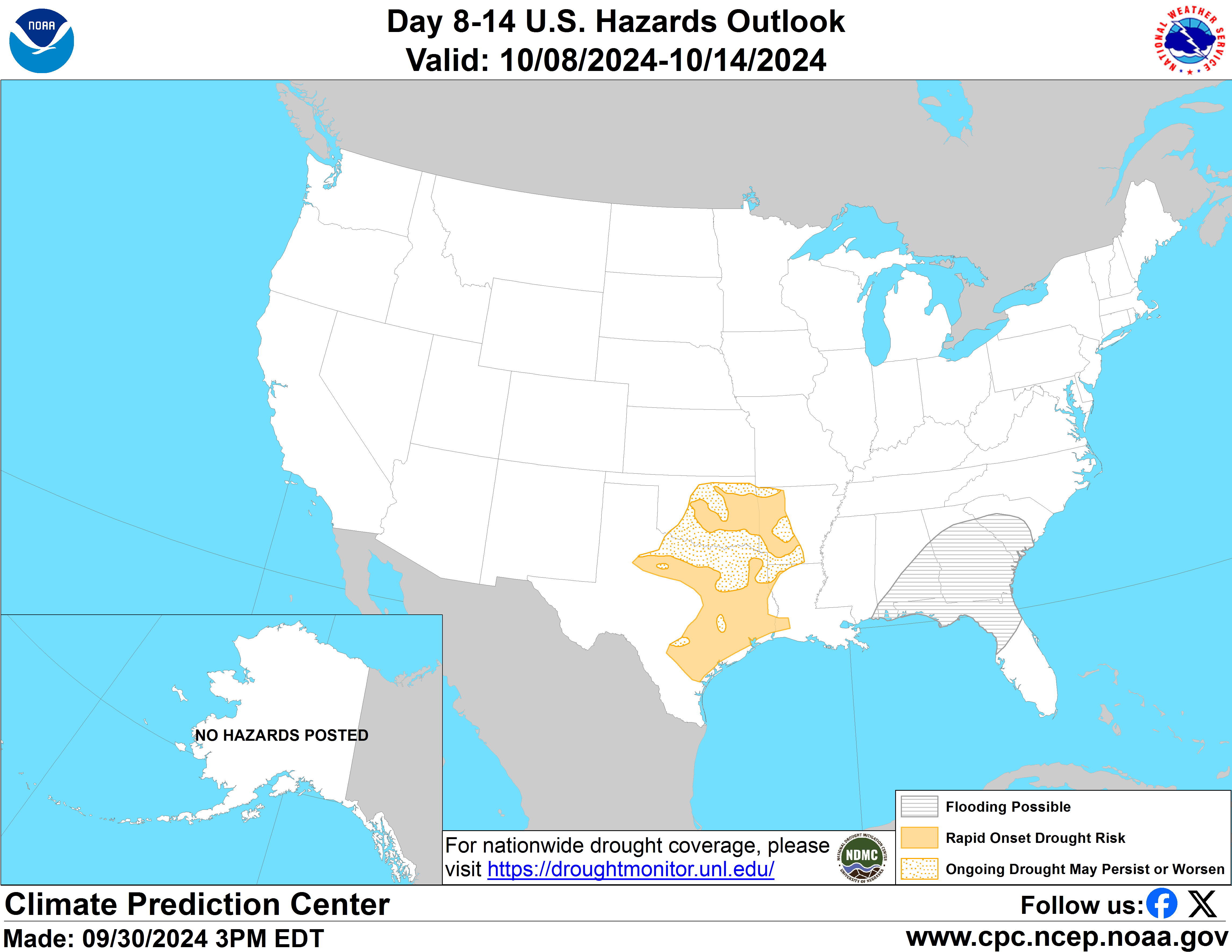
It's apparent that Mother Nature isn't going to allow us rain in the next
couple of weeks or so, at least nothing significant showing up on the extended
forecast just yet. CPC has put much of Oklahoma in the "Sudden Onset Drought"
risk, although I don't think it's sudden and I don't think it's a risk. I think
it is an "is," or something like that. In other words...it's not a risk if it's
already happened.
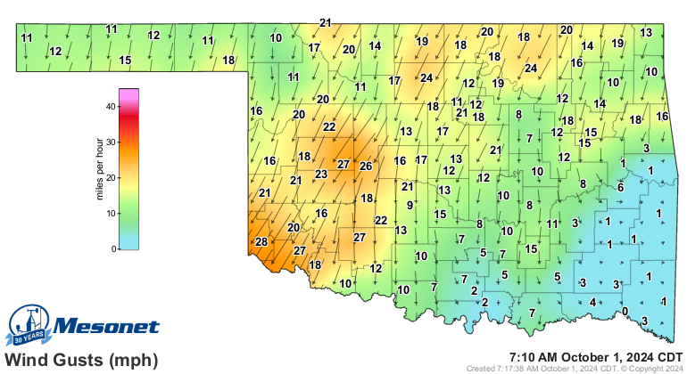
At least we're seeing a nice cool front this morning that's even producing
wind chills out in the Panhandle (and a blustery morning for all).
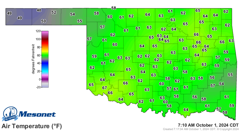
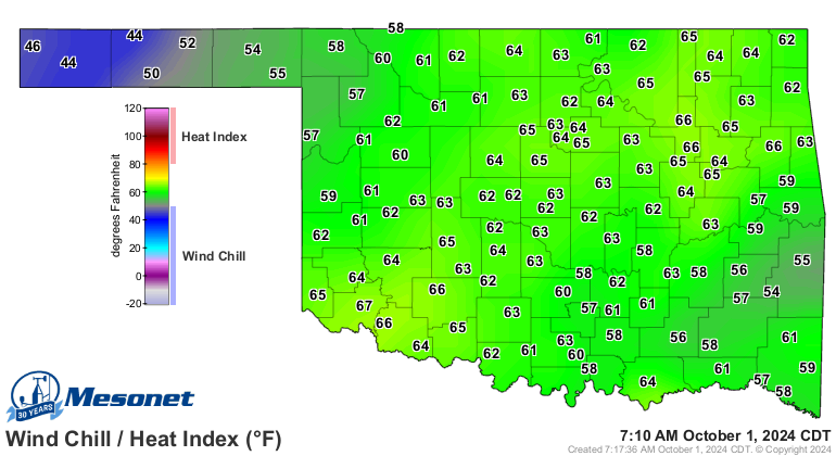
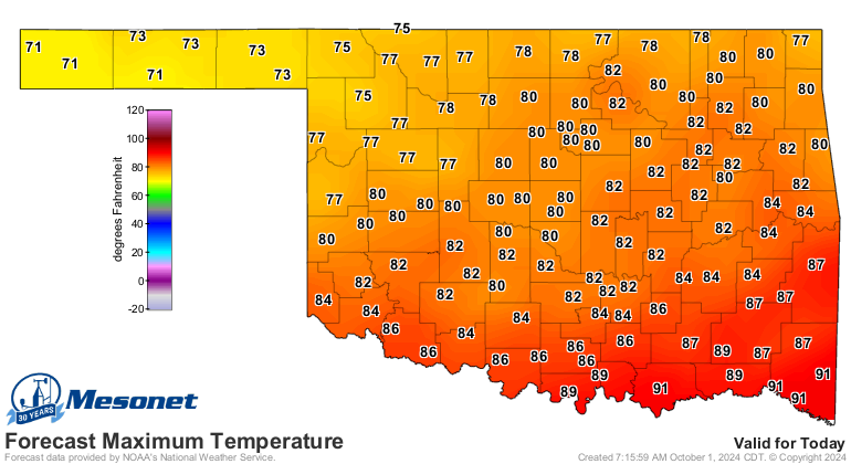
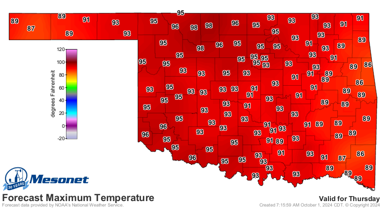
That'll give us a cooler day today, but the heat comes roaring back in the next
couple of days. I wouldn't be shocked if we saw a triple-digit temperature on
Thursday!
Things could be worse. It could be freezing out! We'll get there soon enough.
Speaking of soon, if you scroll down you'll soon find yourself reading about
September's weather.
See ya soon!
----------------------------------------------------------------------------------
Drought and Hail Create Havoc During September
Oct. 1, 2024
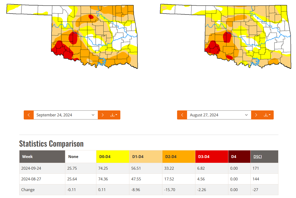
September's weather story was dominated by two of Oklahoma’s most damaging
hazards—severe drought and a devastating hailstorm. Drought had been spreading
and intensifying in the state since early summer according to the U.S. Drought
Monitor, and increased even further during September from 48% at the end of
August to 57% by the end of the month. The area considered to be in more
intense drought nearly doubled, from 18% to 33% over the same period. The worst-
hit areas stretched from southwest Oklahoma to the northeast, reaching into far
northeastern parts of the state. Drought was also spreading and intensifying
east along the Red River toward the Arkansas border. The Oklahoma
Climatological Survey received numerous reports from agricultural producers of
dry farm ponds, dead or dormant grass, and withered crops.
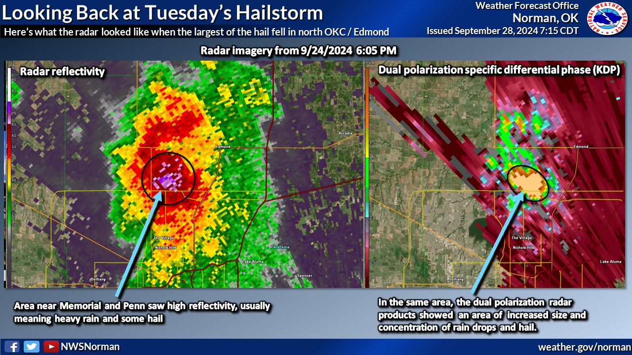
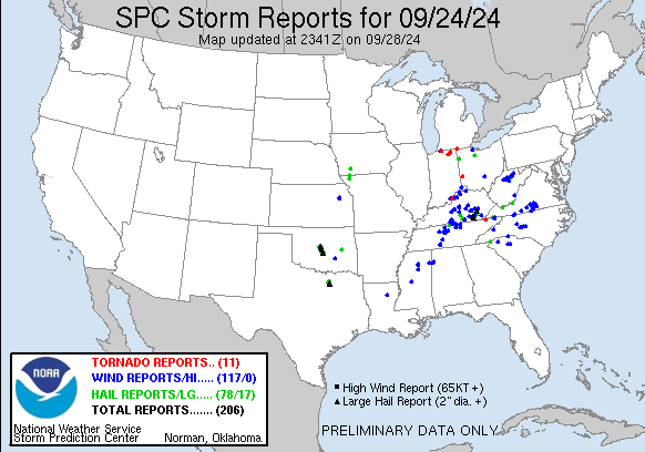
The hailstorm dropped golf ball- to nearly baseball-sized hail from northwest
of Oklahoma City, through Edmond, to southeast of Norman. The hailstones—at
times driven by winds exceeding 60 mph—destroyed roofs and shattered windows in
homes, businesses, and automobiles.
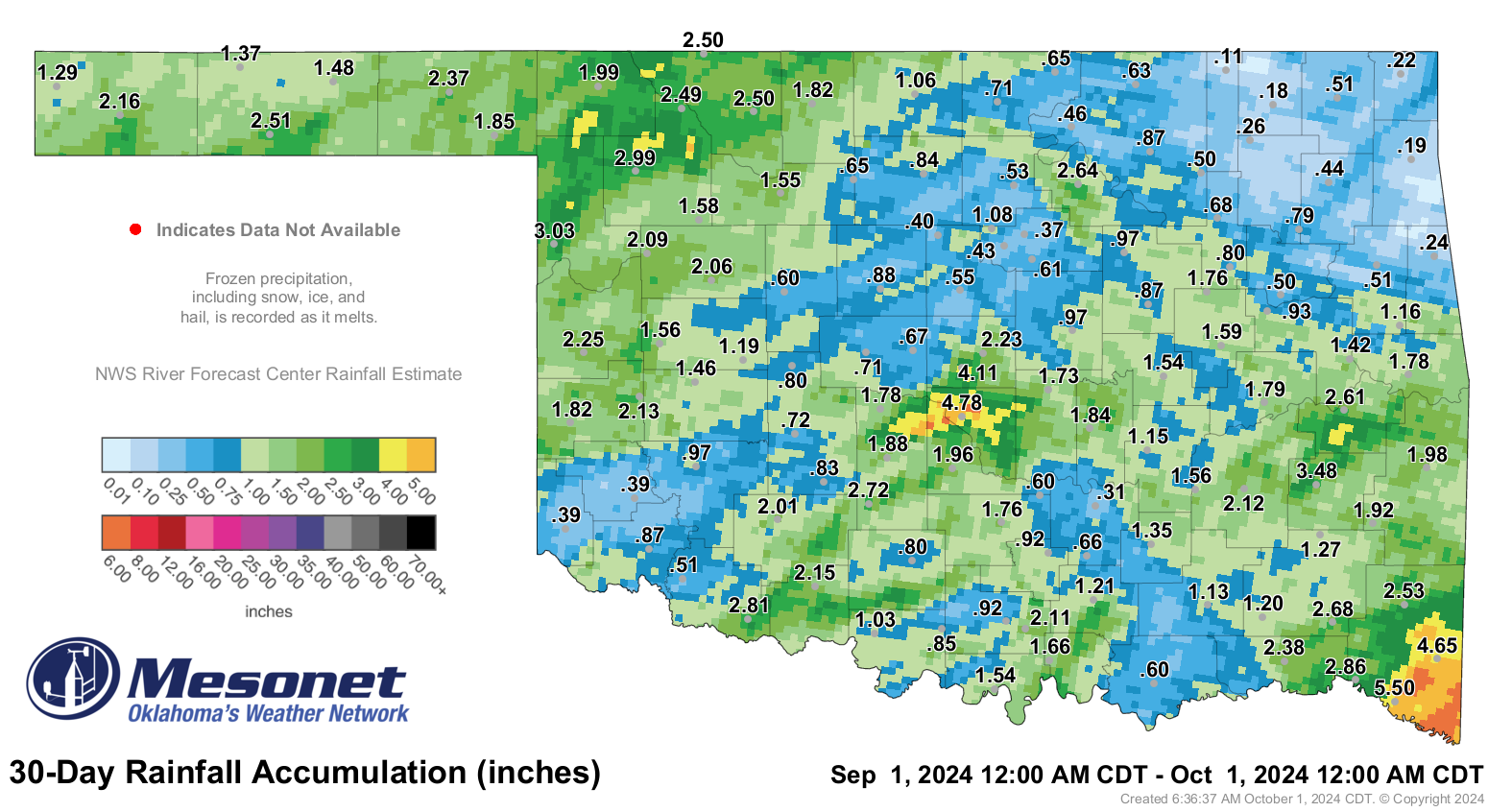
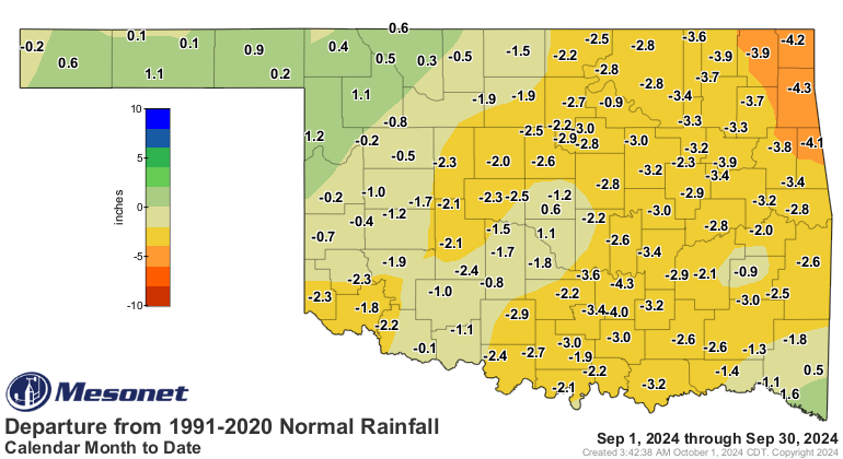
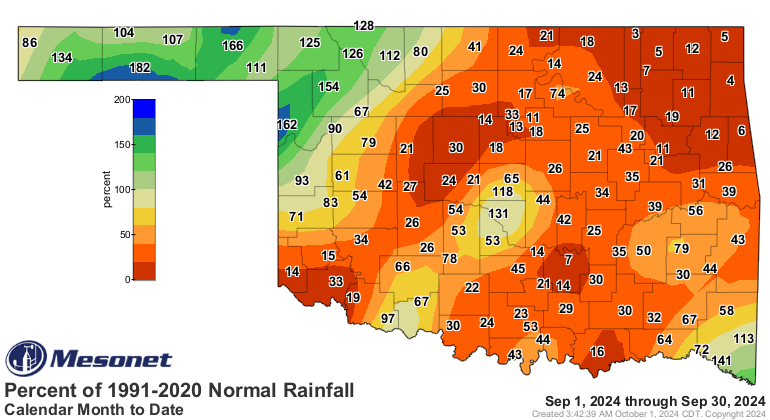
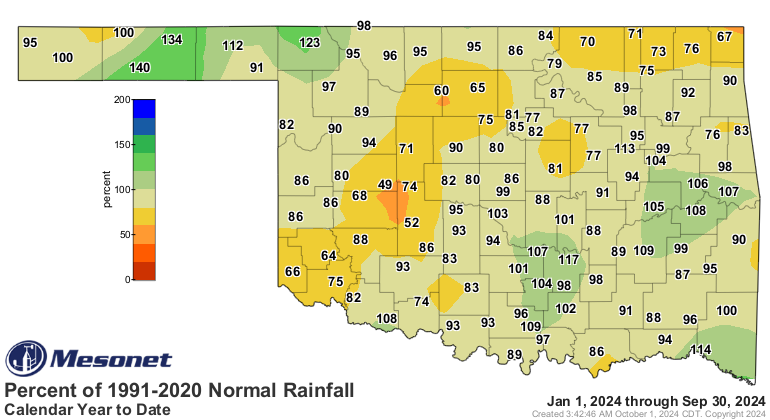
Rain was scarce across most of the state during September. According to
preliminary data from the Oklahoma Mesonet, the statewide average rainfall
total was 1.49 inches—1.83 inches below normal—ranking as the 20th-driest
September since records began in 1895. The northeast corner of the state was
particularly dry, with an average of 0.61 inches, making it the fifth-driest
September on record for that region, with a deficit of 3.35 inches. Deficits of
2 to 4 inches were common across much of the southeastern two-thirds of
Oklahoma, while surpluses of about an inch were typical in the far northwest
and the Panhandle. Rainfall totals ranged from 5.5 inches at Idabel to 0.11
inches at Copan. Fifty-one of the Mesonet’s 120 sites recorded less than an
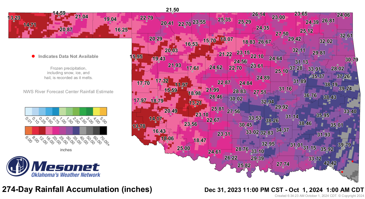
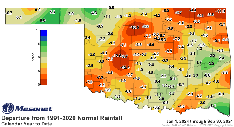
inch for the month, and 16 of those sites reported a half-inch or less. The
first nine months of the year ended as the 61st-driest on record, with 26.14
inches of rain—2.43 inches below normal.
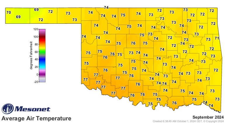
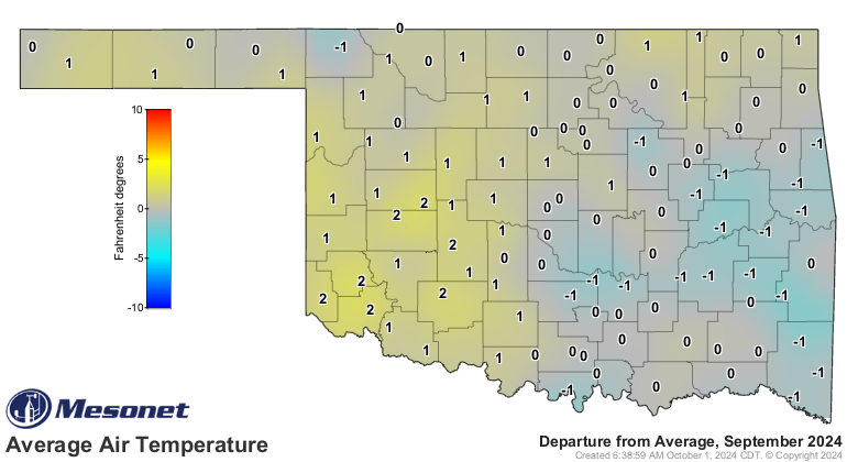
The statewide average temperature for September was 74.5 degrees, 1.6 degrees
above normal, ranking as the 42nd-warmest on record. That ranking was bolstered
by a mid-month heat wave, which saw temperatures soar into the triple digits
after a brief respite during the first 10 days of the month. Temperatures
ranged from 107 degrees at Freedom on Sept. 20 to 41 degrees at several stations
on Sept. 9, 10, and again on the 23rd. Summer-like humidity made an unfortunate
return during the mid-month hot spell, driving the heat index as high as 110
degrees at Foraker on the 19th. There were 154 instances of heat index values
reaching at least 105 degrees during September, and another 229 readings of at
least 100 degrees. The warmer-than-normal month added to an already hot year;
the first nine months of 2023 ranked as the fifth-warmest statewide, with an
average temperature of 65.7 degrees—2 degrees above normal.
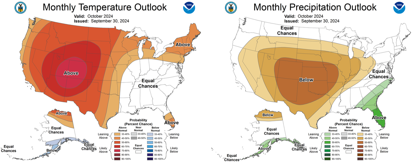
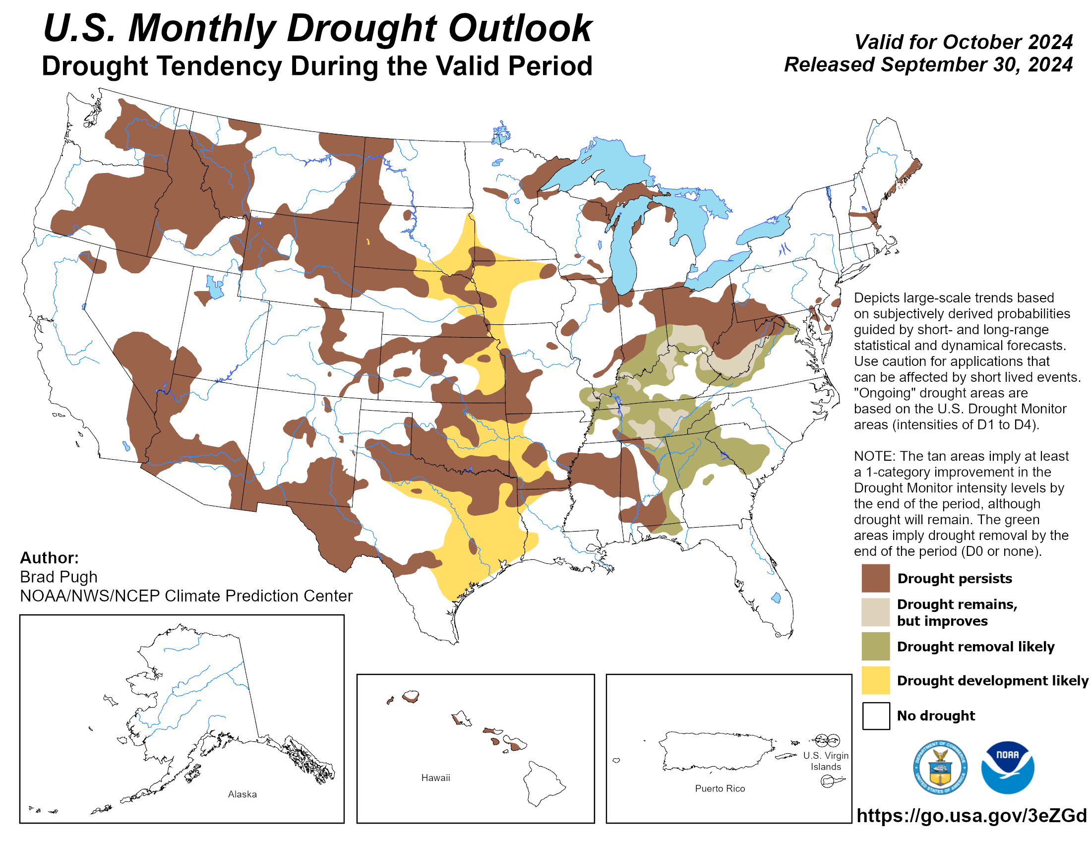
The Climate Prediction Center's outlook for October is bleak, with greatly
increased odds of below-normal precipitation across the entire state and
increased odds of above-normal temperatures, especially in the western half.
With those two key drought ingredients in the forecast, the CPC's drought
outlook calls for the hazard to spread across most of the southeastern
three-fourths of Oklahoma, while persisting and possibly intensifying in areas
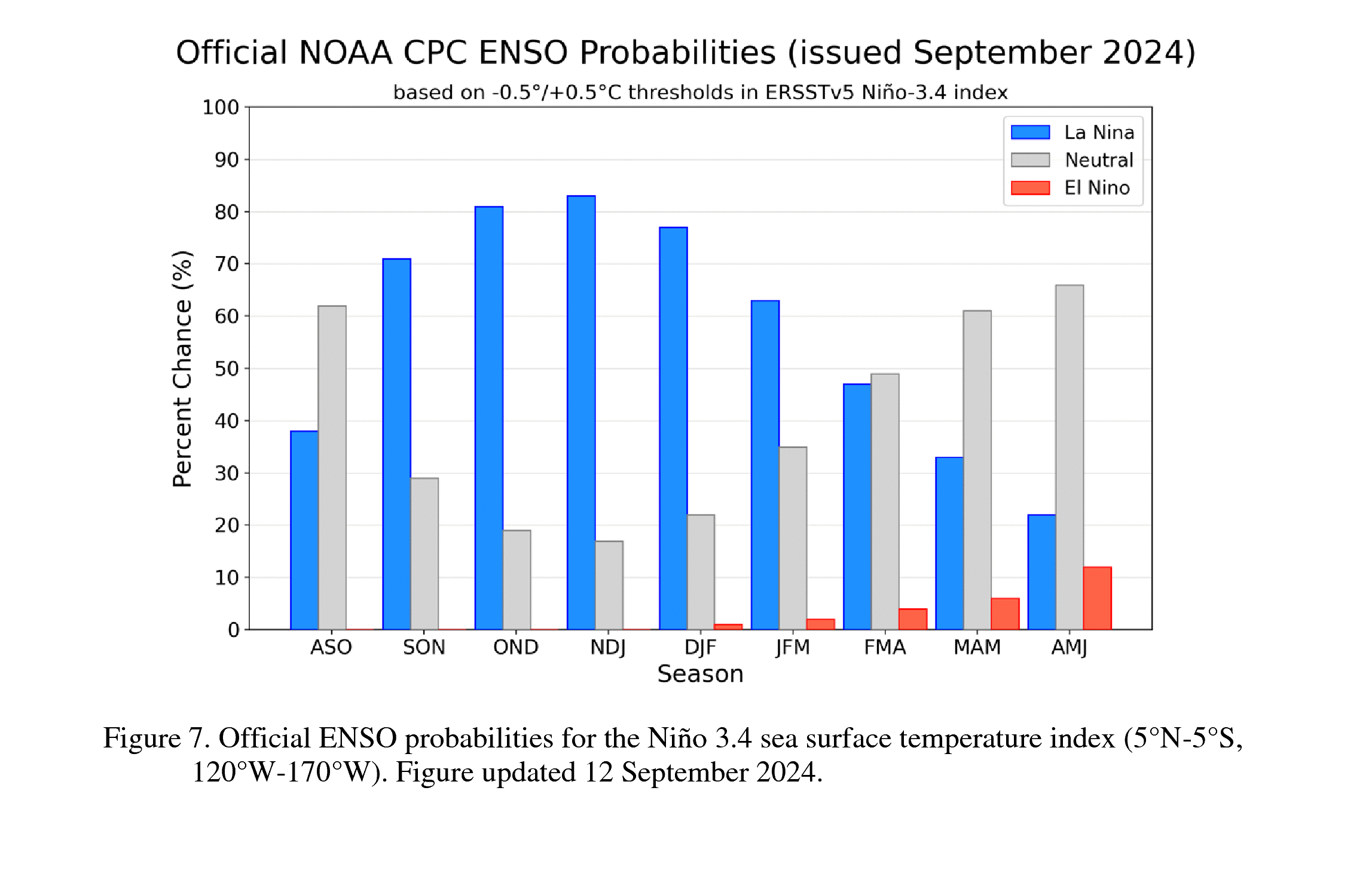
where drought already exists. To compound the dismal forecast, La Niña is given
at least a 70% chance of developing during the October-November period and
persisting through the winter. This cooling of the waters in the equatorial
Pacific off the coast of South America, along with its associated changes in
atmospheric circulation, shifts the odds toward warmer and drier conditions
across the Southern Tier of the United States, including Oklahoma.
###
Gary McManus
State Climatologist
Oklahoma Mesonet
Oklahoma Climate Survey
gmcmanus@ou.edu
October 1 in Mesonet History
| Record | Value | Station | Year |
|---|---|---|---|
| Maximum Temperature | 99°F | SLAP | 2000 |
| Minimum Temperature | 34°F | KENT | 2009 |
| Maximum Rainfall | 3.52″ | ERIC | 1998 |
Mesonet records begin in 1994.
Search by Date
If you're a bit off, don't worry, because just like horseshoes, “almost” counts on the Ticker website!