Ticker for August 1, 2024
MESONET TICKER ... MESONET TICKER ... MESONET TICKER ... MESONET TICKER ...
August 1, 2024 August 1, 2024 August 1, 2024 August 1, 2024
Meltage
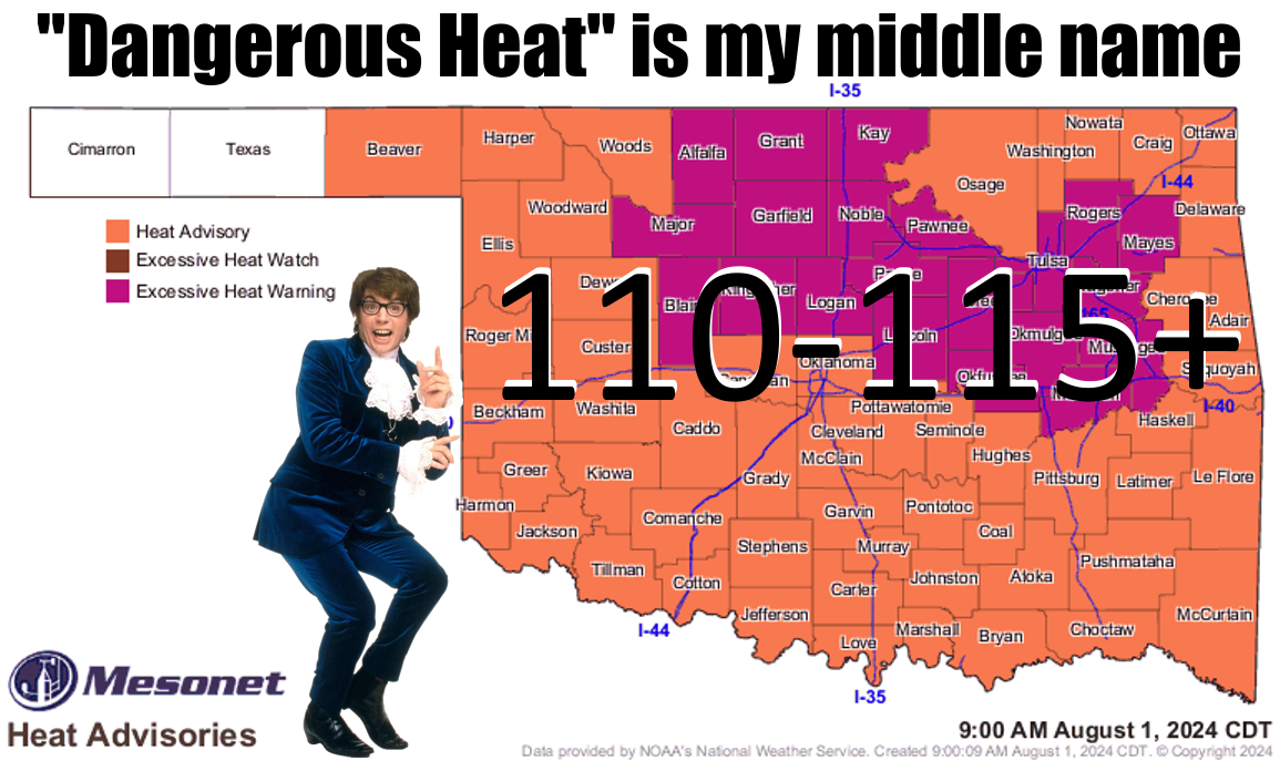
Yeah baby, yeah!
Fourth time's a charm, right? After yesterday's pressure cooker, might as well
go again today so we're all just a TAD more miserable.
But this is the fourth day in a row with these miserably hot AND DANGEROUS
conditions across most of the state. And it's gonna continue as we go through
the next week, with just a bit of a break over the weekend with a cold (LOL!)
front.
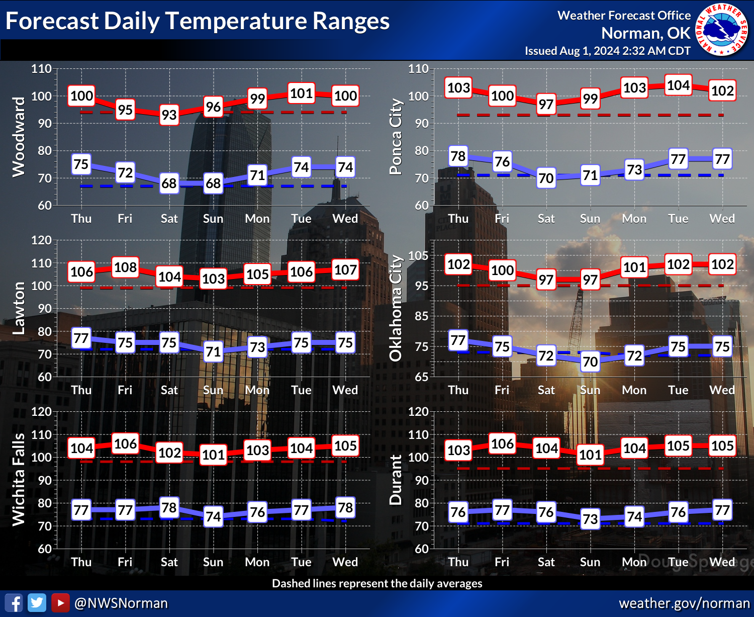
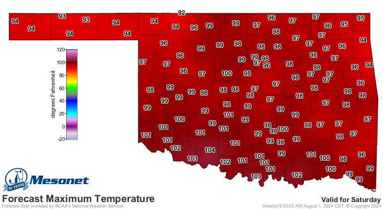
Here is Saturday's forecast after that front. BRRRRRR!!
Now we are still looking at possible relief down the line just after day 10,
but I'm still not sold on that fantasy-cast. I still think the mild air might
stay just to our north or maybe clip northern OK.
Rain chances are still pretty meager, but at least there's something out there.
Now if you want a look back at July, take a gander below. Otherwise, feel free
to melt.
Does anybody else feel like a birthday candle?
---------------------------------------------------------------------------------
July Provides Summer Roller Coaster
Aug. 1, 2024
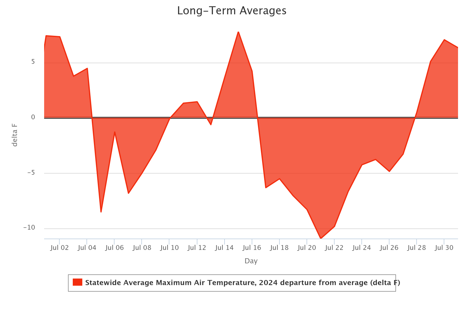
Oklahomans enjoyed two stretches of mild weather during July, providing brief
respites from the otherwise hot conditions and a tantalizing taste of fall
weather to come. Two substantial cold fronts brought cooler temperatures and
moisture, keeping high temperatures 10-15 degrees below normal during these
periods. Oklahoma City experienced seven consecutive days with highs below 90
degrees from July 17-23, and 10 days overall during the month. Tulsa had 11 days
below 90 degrees, including six consecutive days from July 17-22. Despite these
cooler periods, there remained 15 days with triple-digit temperatures in the
state, and heat index values exceeded 105 degrees on 14 days in July. There was
sporadic severe weather throughout the month, with severe winds being the
predominant hazard. Possibly the most significant event was eastern Oklahoma’s
encounter with the remnants of Hurricane Beryl. The former Category 5 hurricane
had diminished to a tropical depression as it passed over far southeastern
Oklahoma and moved to the northeast, dropping 4-8 inches of rainfall across
parts of McCurtain and Le Flore counties. No tornadoes were spotted in Oklahoma
during July, and the preliminary total for the year remains at 110, according
to National Weather Service reports.
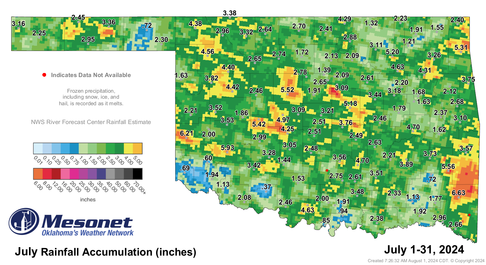
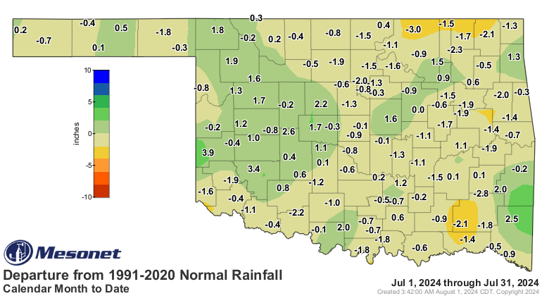
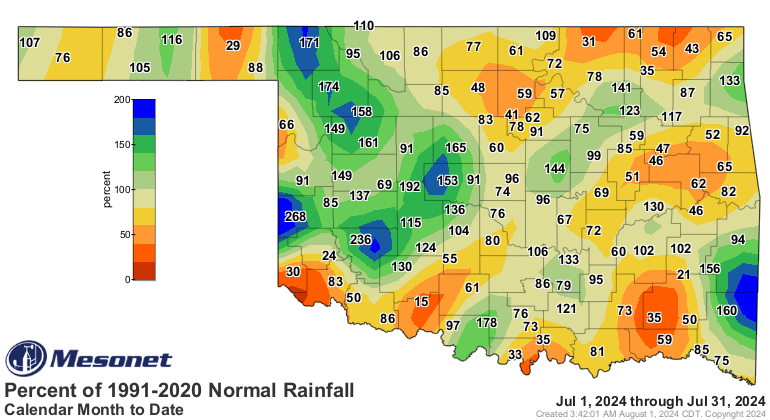
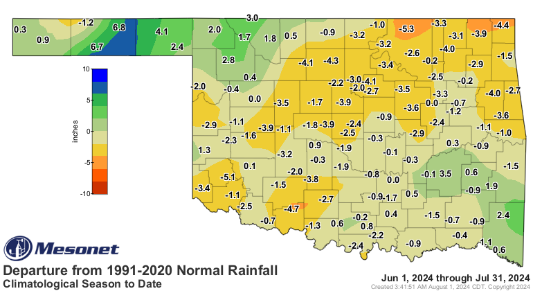
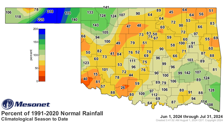
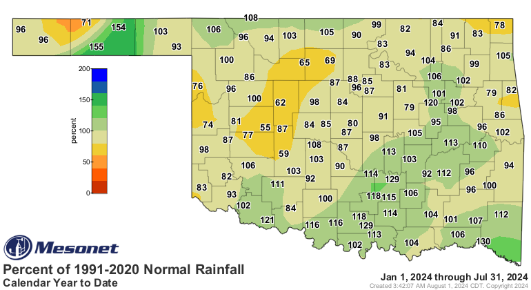
Rainfall averaged across the state was 2.86 inches, 0.34 inches below the
established normal, ranking as the 62nd-wettest July since records began in
1895. Oklahoma Mesonet totals ranged from 6.63 inches at Mt. Herman to 0.37
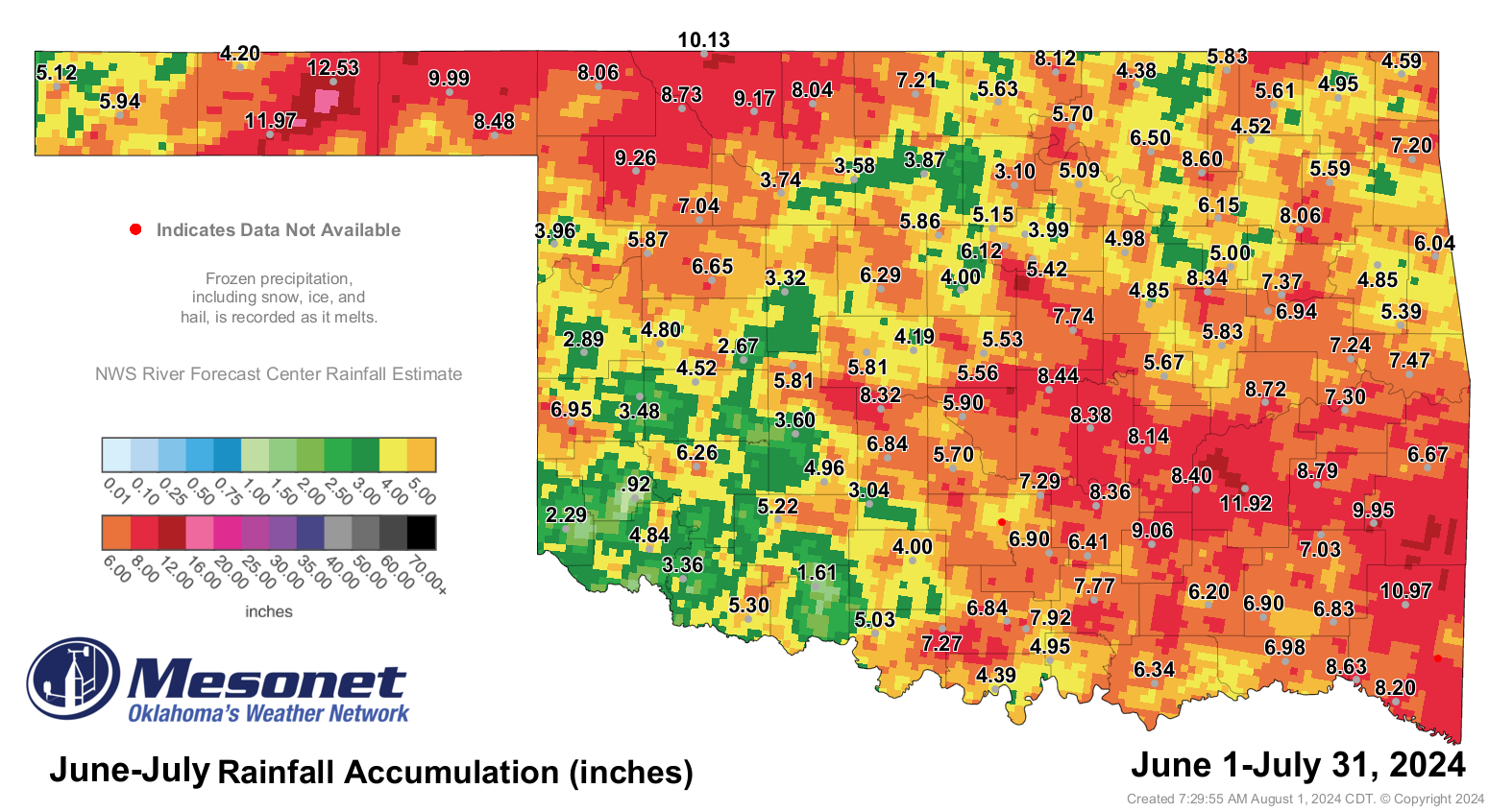
inches at Walters. The first two months of climatological summer, which runs
from June 1 through Aug. 31, were also on the dry side, with a statewide average
of 6.09 inches, 1.37 inches below normal, ranking as the 52nd-driest June-July
on record. In a rare feat for Oklahoma, the Panhandle stations of Hooker and
Goodwell led the period with 12.53 and 11.97 inches, respectively, while the
federal site at the Guymon airport recorded 13.32 inches. The latter two
readings are new records at those locations for the June-July period. The
Mangum Mesonet site held the opposite side of that extreme with a scant 0.9
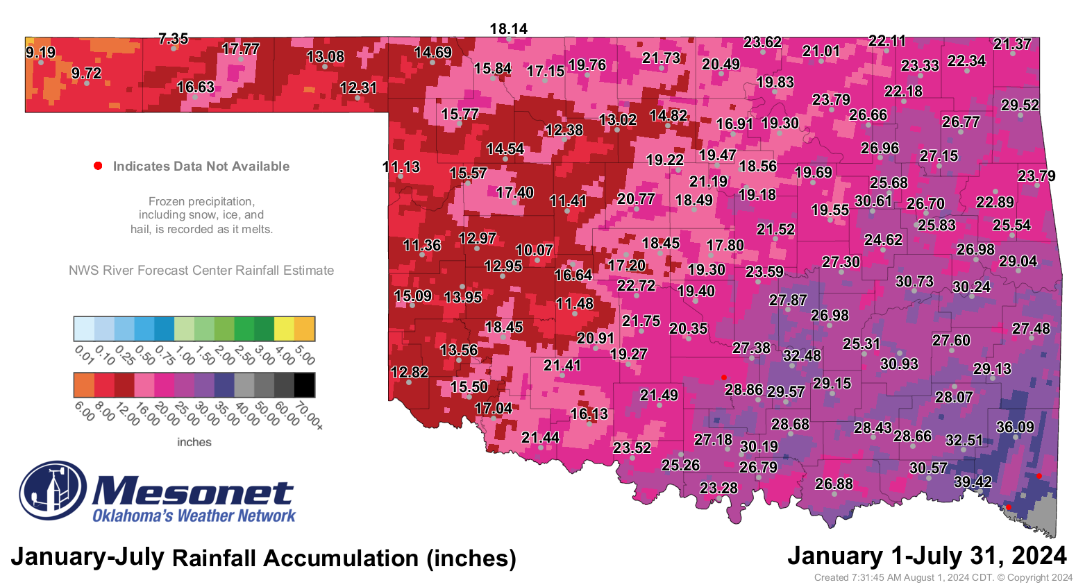
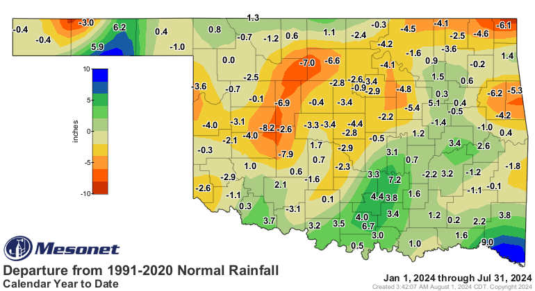
inches. The first seven months of the year were the 56th-wettest, with a
statewide average of 21.4 inches, a deficit of 0.62 inches.
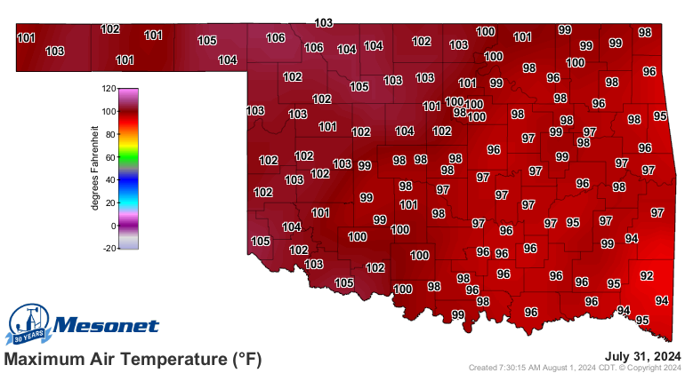
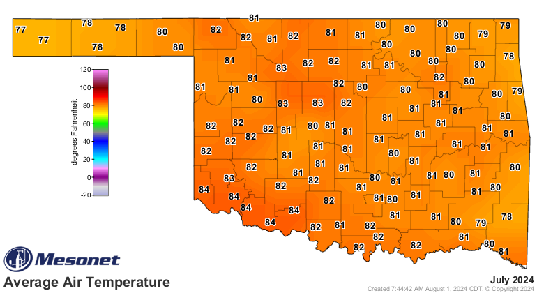
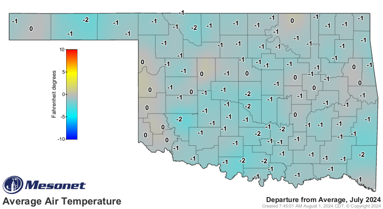
The statewide average temperature for the month was 81.1 degrees, 0.8 degrees
below normal, ranking as the 54th-coolest July since records began in 1895.
Temperatures ranged from 109 degrees at Buffalo on July 15 to 54 degrees at
Bristow on July 19. The Mesonet’s 120 sites recorded a triple-digit temperature
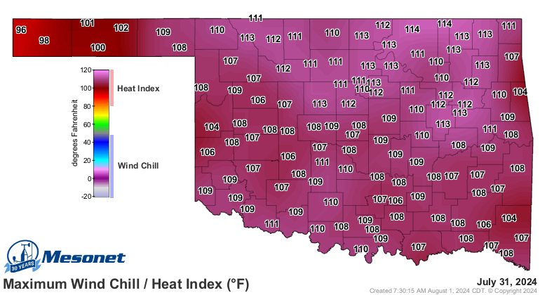
484 times during the month, and heat index values of at least 105 degrees
908 times, culminating in a high heat index for the month of 118 degrees at
Porter on Independence Day. The first two months of summer finished at one
degree above normal, ranking as the 35th-warmest June-July on record in the
state. The first seven months of the year were 1.9 degrees above normal at 61.9
degrees, the sixth-warmest such period on record.
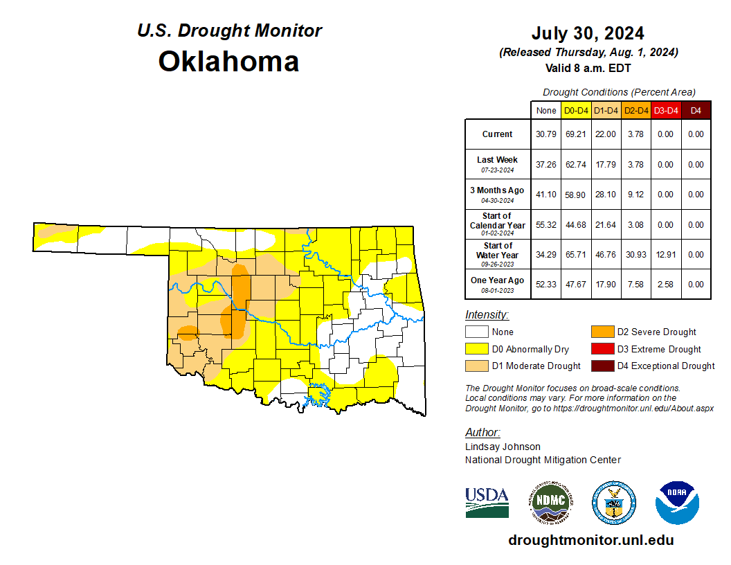
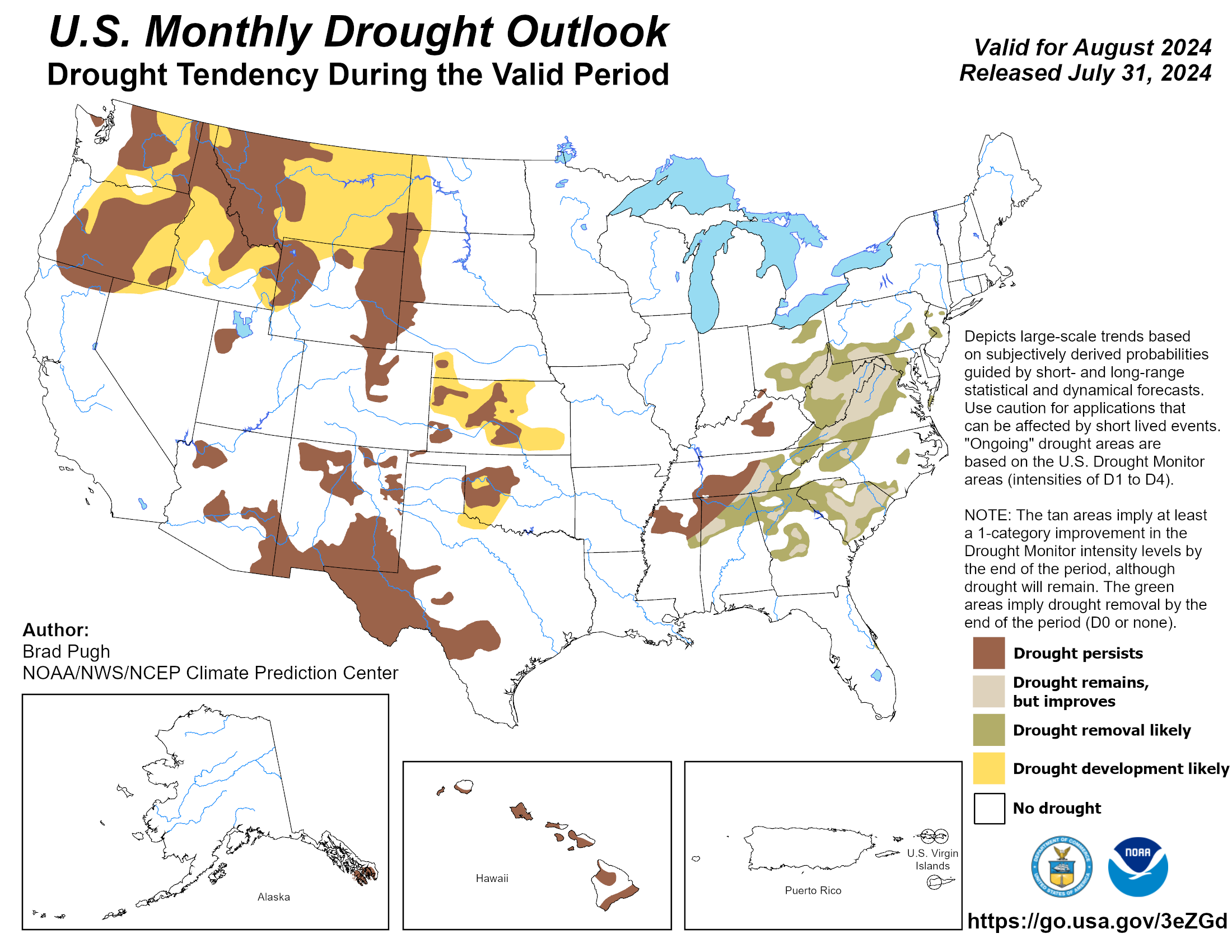
The flash drought that had flirted with the state for several months struggled
to flourish during July thanks to the milder weather and some timely rains,
although a return of extreme heat at the end of the month fueled another
intensification. Twenty-two percent of the state was considered in at least
moderate drought at the end of July, according to the U.S. Drought Monitor,
nearly all of which was in western and central Oklahoma. The Climate Prediction
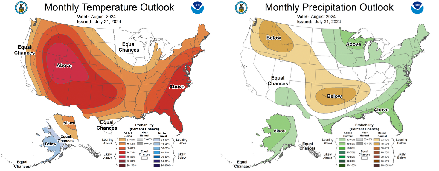
Center’s outlooks for August indicate increased odds of both above-normal
temperatures and below-normal precipitation for all of Oklahoma, with drought
expected to develop and persist across southwestern and central Oklahoma.
###
Gary McManus
State Climatologist
Oklahoma Mesonet
Oklahoma Climate Survey
gmcmanus@ou.edu
August 1 in Mesonet History
| Record | Value | Station | Year |
|---|---|---|---|
| Maximum Temperature | 115°F | KIN2 | 2012 |
| Minimum Temperature | 53°F | KENT | 2018 |
| Maximum Rainfall | 5.04″ | NOWA | 1995 |
Mesonet records begin in 1994.
Search by Date
If you're a bit off, don't worry, because just like horseshoes, “almost” counts on the Ticker website!