Ticker for May 1, 2023
MESONET TICKER ... MESONET TICKER ... MESONET TICKER ... MESONET TICKER ...
May 1, 2023 May 1, 2023 May 1, 2023 May 1, 2023
Sprung
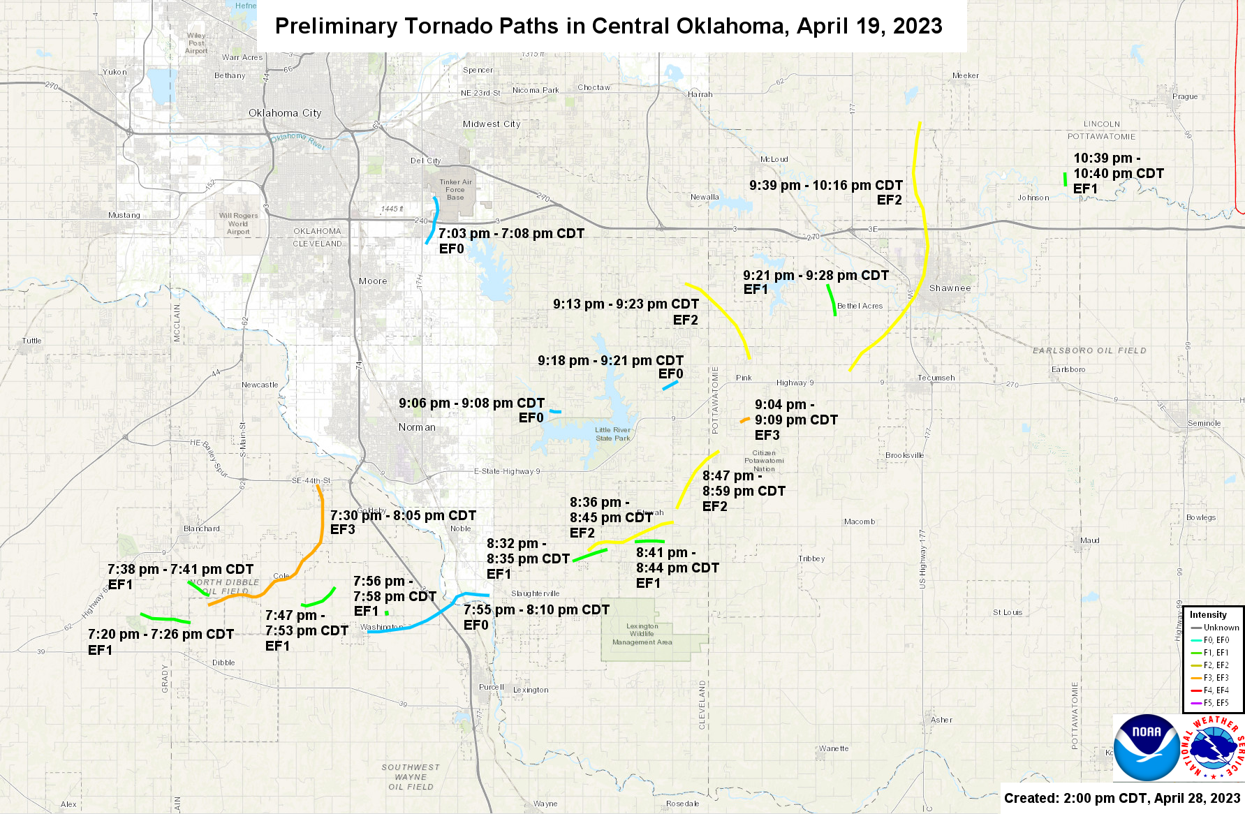
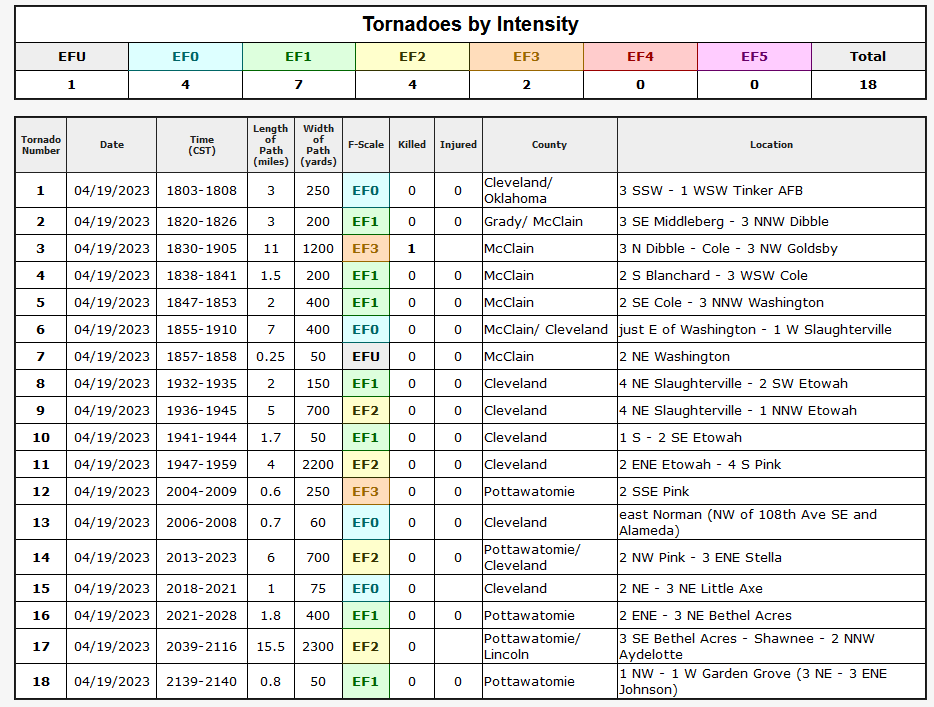
Wow, 18 tornadoes have now been confirmed by the Norman NWS folks from the April
19 outbreak! I originally said/thought that about a dozen had dropped down, but
as a climatologist I reserve the right to be vaguely correct (or correctly
vague). I re-post the map down below in the April summary (hint hint: stock
around!), but here is NWS Norman's list of tornadoes they have pinpointed (also
re-posted below...hint hint again).
I was asking several of you that had relayed your experiences living in communal-
type spaces (i.e., apartments, dorms) about what you do when tornadic weather
threatens. I lived mostly in apartments throughout college (save for that year
I lived on that billboard over by I-35 trying to win a year's worth of Burger
King...long story) and I can't remember a time I had to take cover, flee, or
panic. Normally I would chalk that up to a my own denseness, but after perusing
all the tornado accounts for Cleveland County, for the late 1980s through the
1990s, there just weren't any tornadoes hitting Norman then (much different
lately, of course).
WAIT, DON'T GO! I do have a point. Two actually, including the one on top of my
head. It does look like we are primed to go into classical Oklahoma spring, where
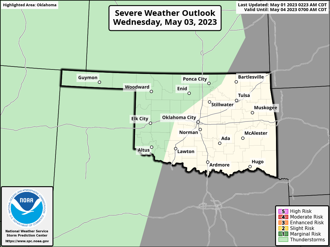
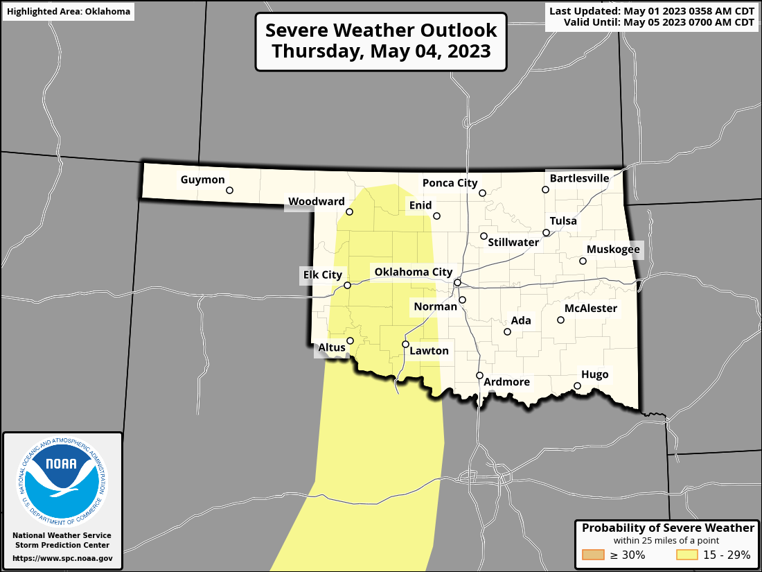
we get a couple or three severe weather chances each week. This week, it looks
like Wednesday we have a marginal chance according to SPC, but then again on
Thursday and Saturday.
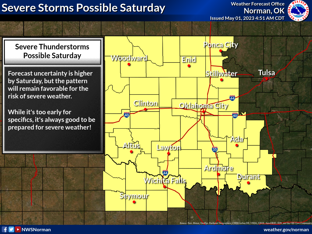
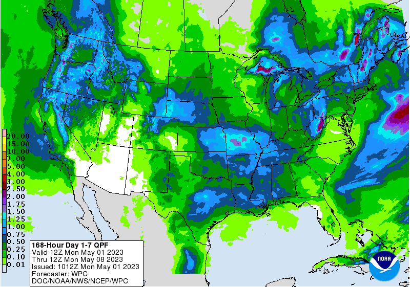
The bright side? Well, the side of my head in the sun, but also the chances of
severe weather should come with some rain.
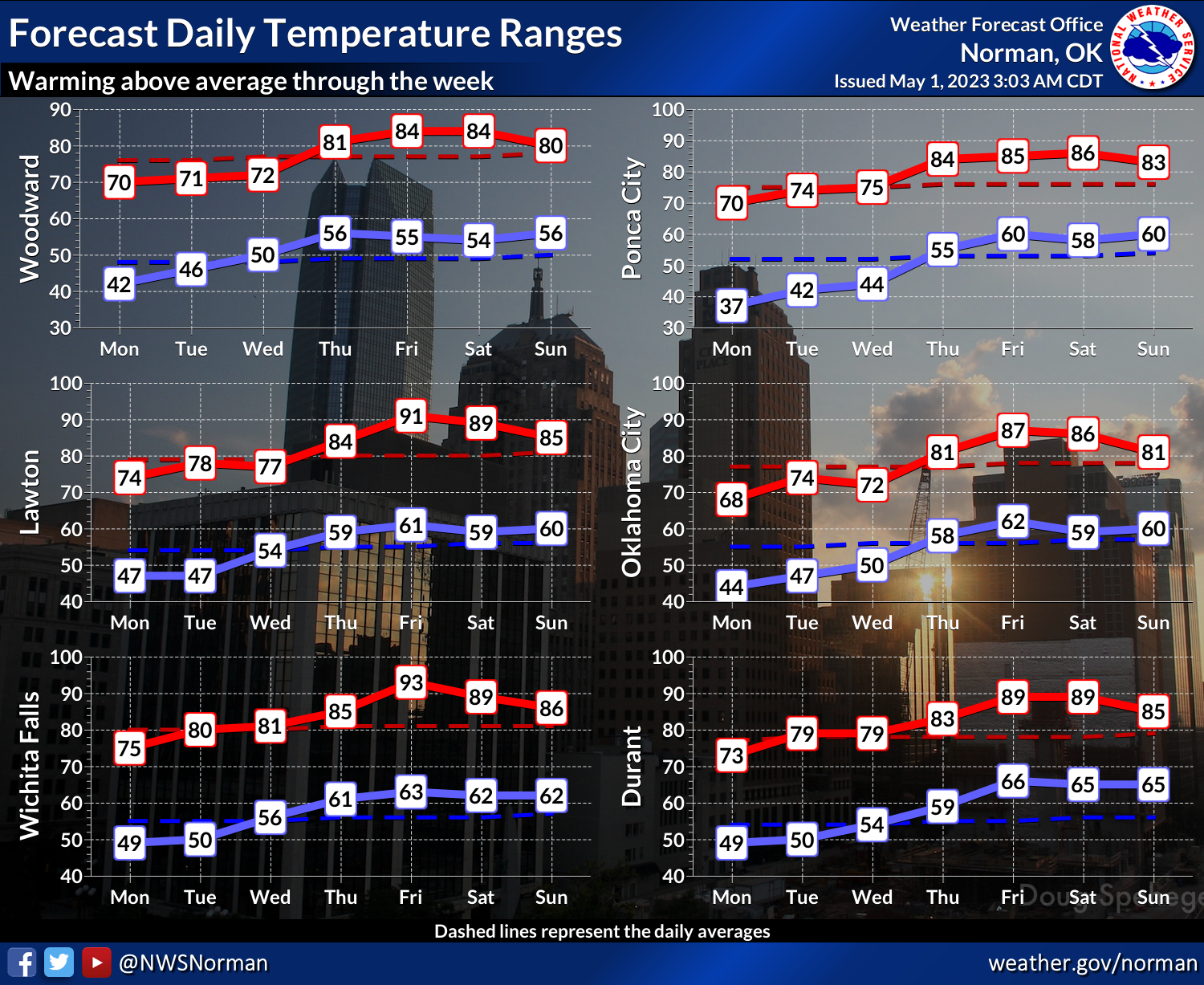
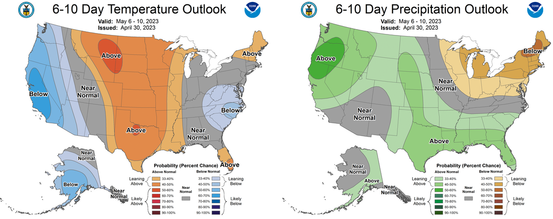
ANOTHER bright side (okay, enough with the bald jokes), temperatures are also
going into classical spring mode, which should help all the vegetation green up.
And maybe even MORE precip coming early next week (and more warm weather).
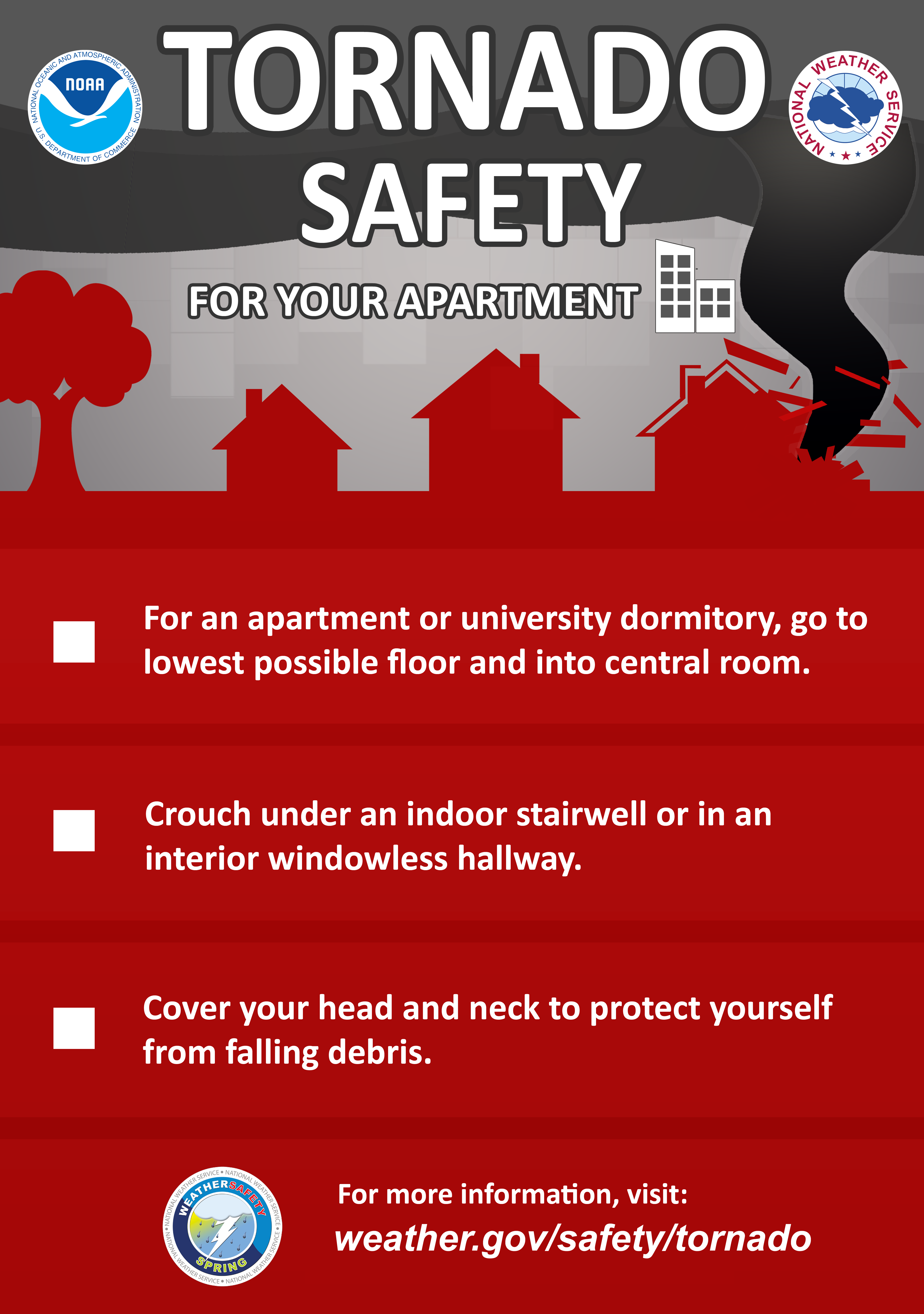
Now if you are ever IN an apartment when a tornado threatens, here are a few
safety tips from the NWS.
Now, back to April and on to spring!
----------------------------------------------------------------------------------
April Sees Tornado Outbreak and Drought Relief
May 1, 2023
Drought relief and severe weather topped April’s weather headlines with a parched
northwest Oklahoma seeing its first significant moisture in months and central
Oklahoma enduring a tornado outbreak. Eighteen tornadoes touched down on April
19, a day when severe weather was thought to be limited by a warm atmospheric
lid above the surface. High temperatures over 90 degrees combined with a potent
dryline to break that lid and initiate the storms that would eventually spawn
the twisters.


Of the 18 tornadoes, six were considered “strong”—EF2 or greater—with four rated
at EF2 and two more considered EF3. All the tornadoes struck within 3 hours and
37 minutes, between 6:03 p.m. and 9:40 p.m. One EF3 struck the small community
of Cole and damaged homes while destroying mobile homes. Another EF3 that touched
down near Pink was only on the ground for 5 minutes and 6 tenths of a mile, but
still damaged multiple homes and outbuildings. Possibly the most damaging
tornado was an EF2 that traveled from southeast of Bethel Acres through the
western and northern portions of Shawnee, including Oklahoma Baptist University
and the Shawnee Mall. This multiple vortex tornado was on the ground for 15.5
miles with a maximum width of 1.3 miles and produced an 84 mph wind gust at the
Shawnee Mesonet site as it passed close by. April’s tornadoes brought the
preliminary 2023 total to 37, more than double the 1950-2022 January-April
average of 16.5. In addition to the 18 tornadoes, large hail to the size of
baseballs was reported with the storms throughout central Oklahoma. Oklahoma
Emergency Management officials estimate that there were more than 34,000 power
outages at the height of the storm. The Oklahoma State Dept. of Health reported
188 weather-related injuries from the event, including three fatalities.
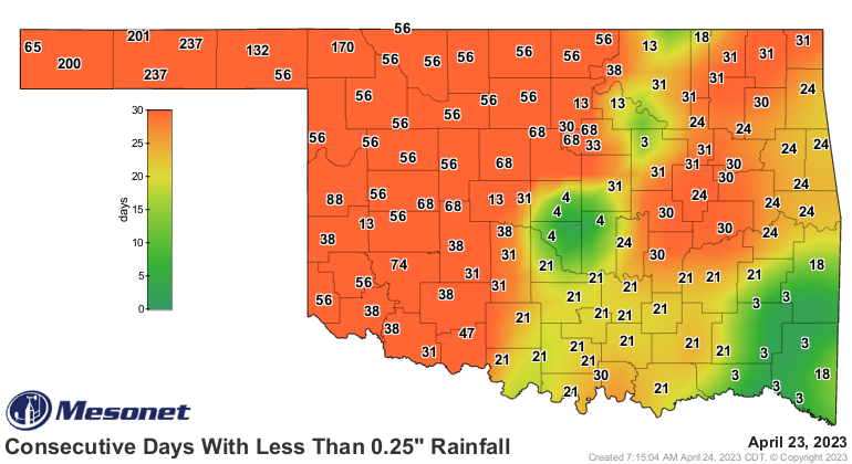
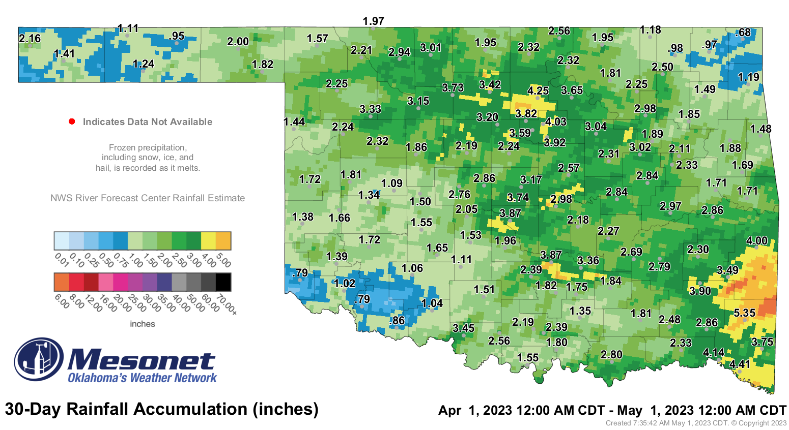
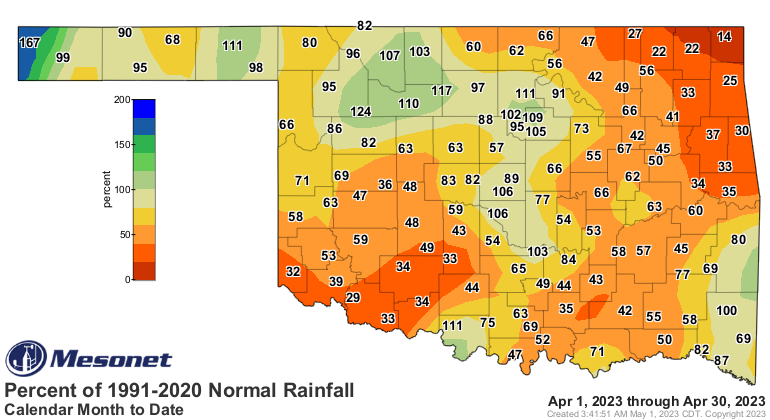
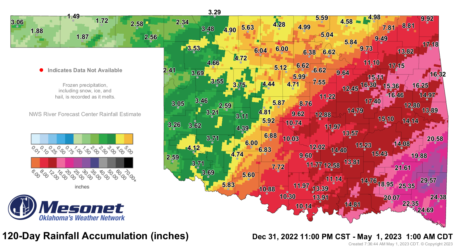
The month’s other significant weather event had a much happier ending when a
77-county soaking rainfall broke a months-long dry spell across northern and
western Oklahoma. The rain began in earnest on April 25, at which point some
areas of the Panhandle had gone without significant moisture for nearly 240
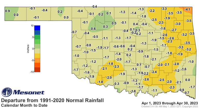
days, dating back to August 2022. The statewide average precipitation total
still came up short at 2.26 inches, 1.33 inches below normal and ranked as the
29th driest April since records began in 1895. April’s highest total of 5.35
inches was recorded at the Mt. Henry Mesonet site. Miami brought up the rear
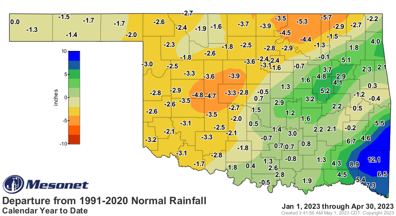
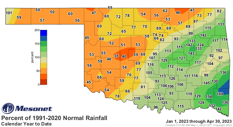
with 0.68 inches. Fifty-four of the Mesonet’s 120 sites finished with 2 inches
or less for the month. The first 4 months of the year were still hampered by
long-term deficits to the north and west of Interstate-44, with that disparity
producing the 20th driest January-April in west central Oklahoma versus the 14th
wettest such period in the southeast. Statewide, the average finished at 8.96
inches, 0.67 inches below normal and ranked as the 61st wettest January-April
on record.
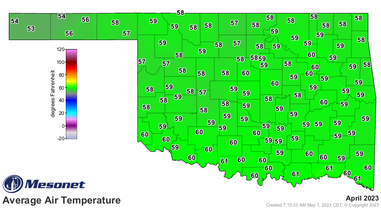
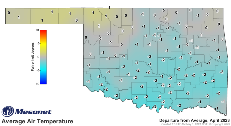
April temperatures seemed to have two possible modes—either 5 to 10 degrees
above normal through the first 20 days, or 10 to 20 degrees below normal to
finish out the month. The cooler weather eventually won out and the statewide
average temperature finished at 58.1 degrees to rank the month as the 40th
coolest April on record at 1.4 degrees below normal. The month’s highest
temperature was 96 degrees at Mangum on April 3, and the lowest came in at 14
degrees at Eva on April 6. The January-April statewide average temperature was
48.6 degrees, 0.8 degrees above normal and ranked as the 53rd coolest such
period on record.
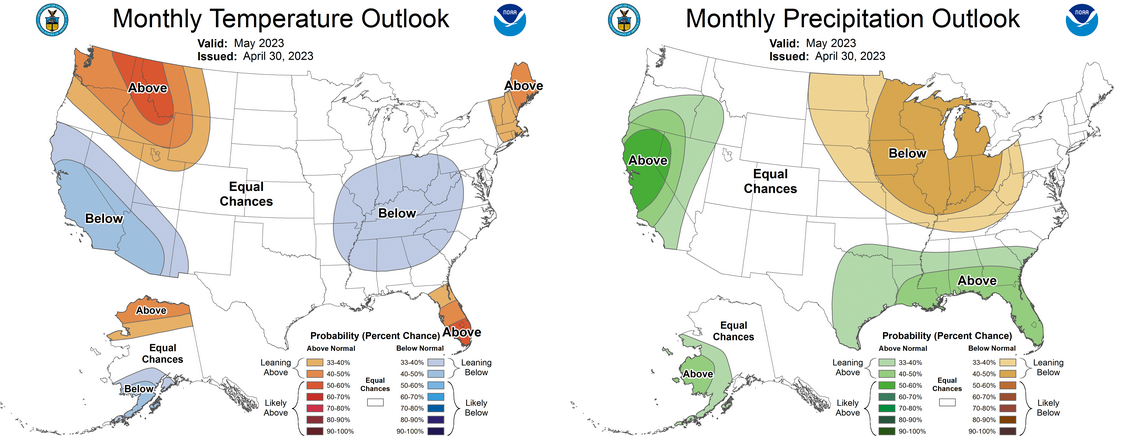
The Climate Prediction Center’s May temperature and precipitation outlooks were
mostly noncommittal for Oklahoma other than increased odds of above normal
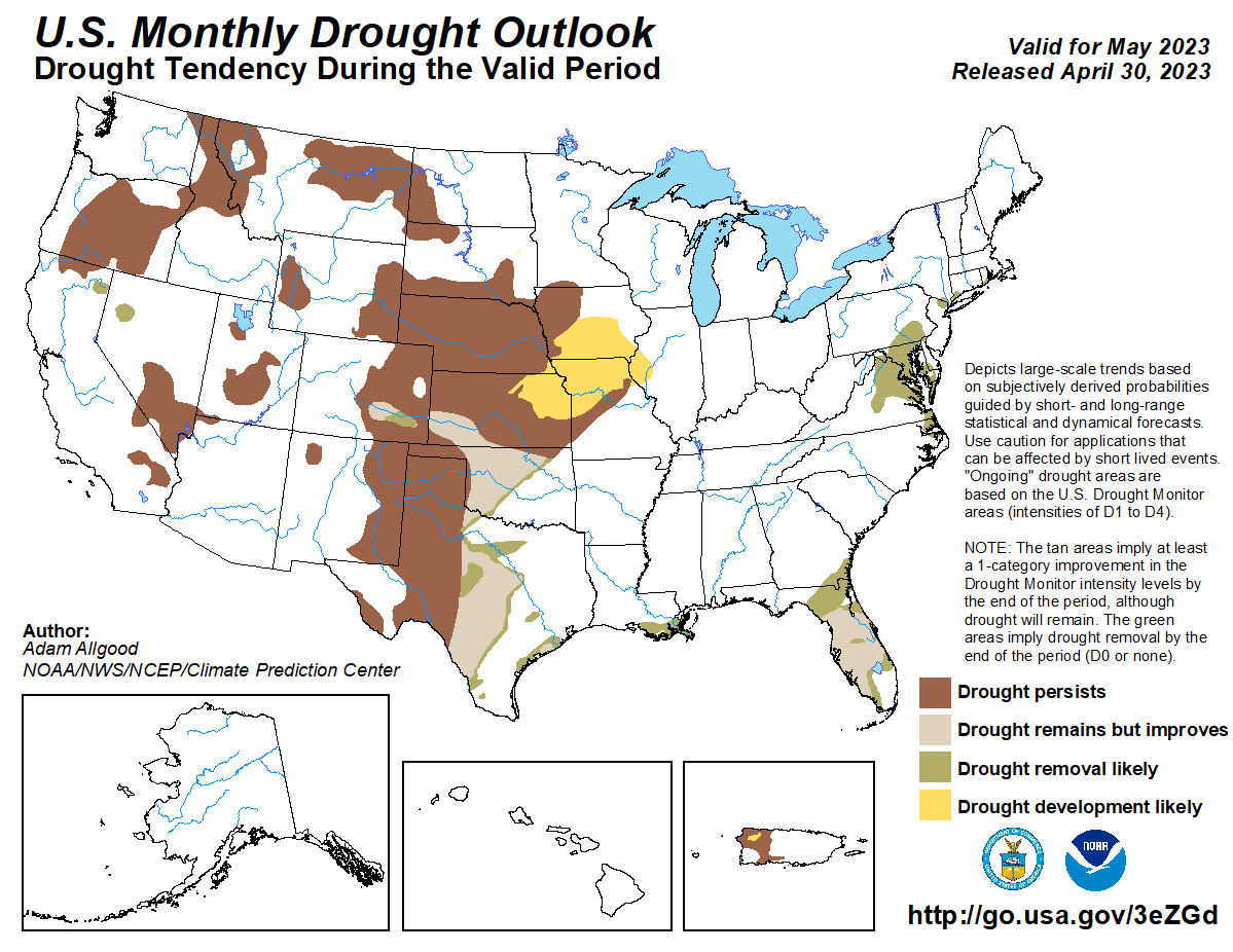
precipitation across south central and southeastern Oklahoma. CPC’s May drought
outlook did call for a reduction in intensity over areas to the north and west
of I-44, although some of that improvement was due to the rains that fell in
April. Drought is expected to persist through May in the Panhandle and far
northeastern Oklahoma.
###
Gary McManus
State Climatologist
Oklahoma Mesonet
Oklahoma Climatological Survey
gmcmanus@mesonet.org
May 1 in Mesonet History
| Record | Value | Station | Year |
|---|---|---|---|
| Maximum Temperature | 101°F | ALTU | 2002 |
| Minimum Temperature | 28°F | BOIS | 2011 |
| Maximum Rainfall | 7.70 inches | PRYO | 2009 |
Mesonet records begin in 1994.
Search by Date
If you're a bit off, don't worry, because just like horseshoes, “almost” counts on the Ticker website!