MESONET TICKER ... MESONET TICKER ... MESONET TICKER ... MESONET TICKER ...
December 23, 2015 December 23, 2015 December 23, 2015 December 23, 2015
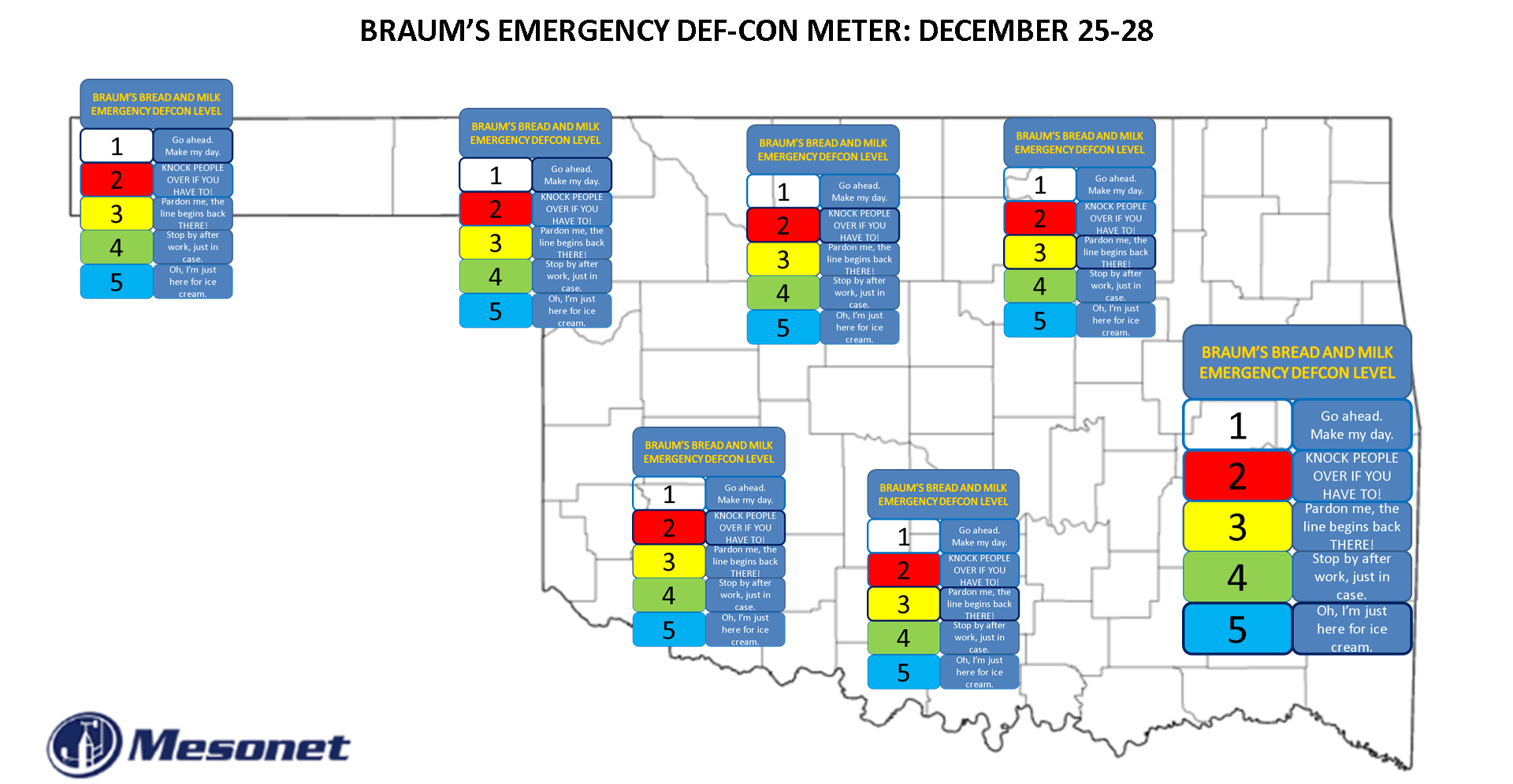
This ain't gonna be pretty
http://ticker.mesonet.org/archive/20151223/Statewide-Braums.png
Yes, a new unofficial-yet-official BRAUM'S EMERGENCY BREAD AND MILK DEF-CON map
has been posted. Some say I trivialize the weather, but I say the weather
trivializes us. Just wait until after this storm and you'll get the picture.
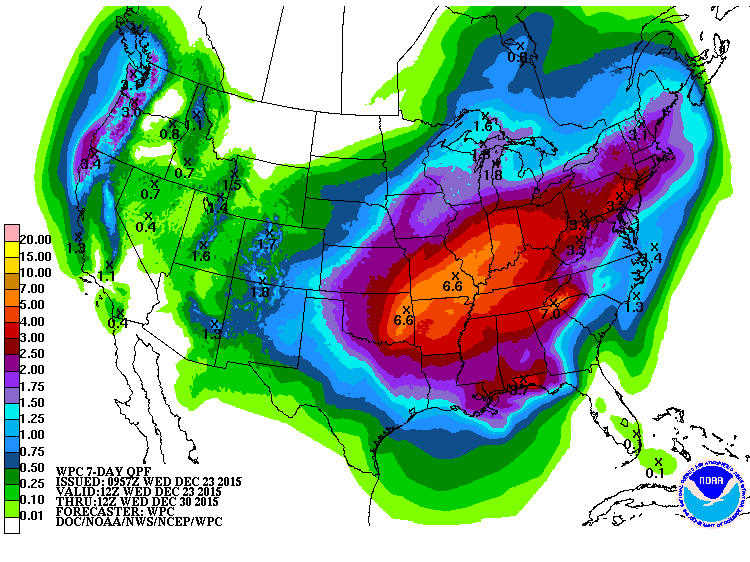
This storm is shaping up to be on of the powerfulest (so powerful I'm making up
words) and definitely wettest in December in recent memory. Just look at all the
moisture it has to work with!
http://ticker.mesonet.org/archive/20151223/7day-moisture-forecast.gif
I don't want to scare anybody here, but that 2+ inches you see out in the far NW
of OK would translate into a lot of snow in the forecast temperature environment.
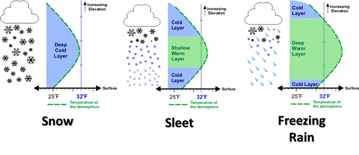
But alas, the certainty of uncertainty is still certain, and the track of the
CLOSED LOW that is coming out of the SW is going to be the key, as well as how
quickly the associated cold air can impact the vertical temperature profile of the
atmosphere. We've used this graphic quite a bit, but unfortunately, it's still
the key.
http://ticker.mesonet.org/archive/20131125/winter-precip-types.png
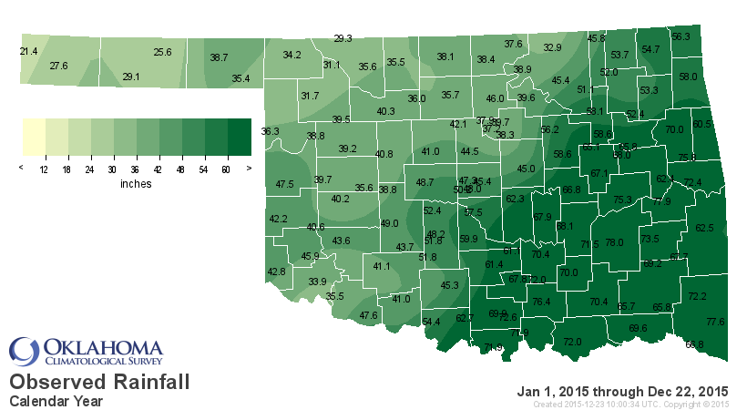
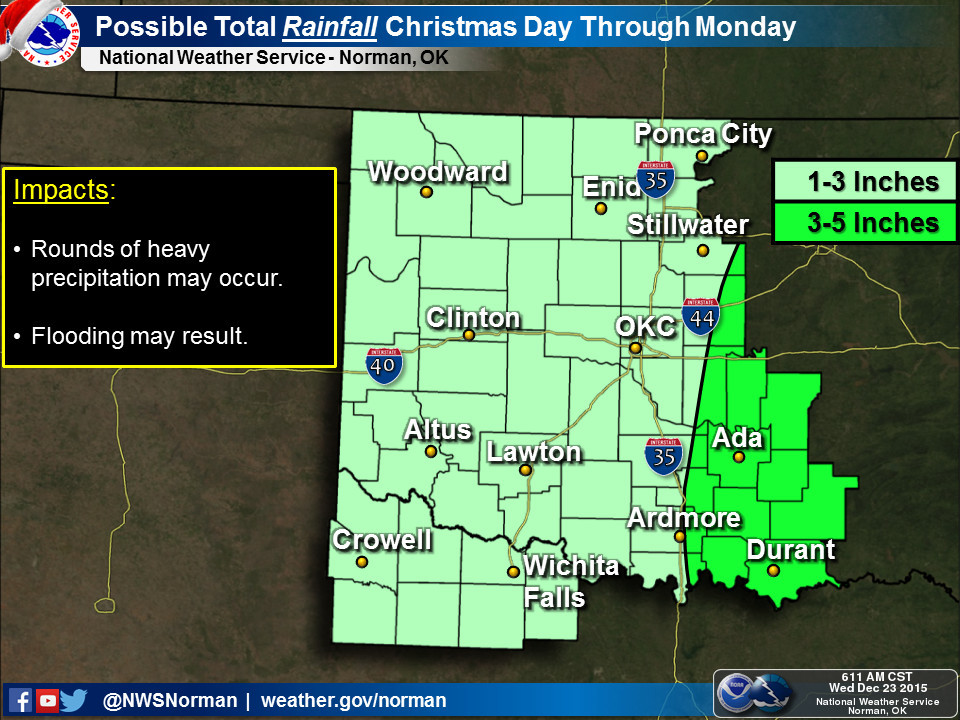
And don't forget that 6+ inches forecast to fall as mainly rain across eastern
Oklahoma. That will bring some flooding. Dangerous flooding. And one certainty
is that 2015 will end up as the wettest on record for the state of Oklahoma.
Not only will we beat 1957's record of 47.88 inches (heck, we're already at
48 inches through November so we've already beaten it), we will absolutely
decimate it. Blast it. Destroy it.
Another record I never thought possible was the annual total for a single
location, Tuskahoma's 88.27 from 1990. The NWS COOP station in Daisy has
80.75 inches for the year thus far and is in the heavy precip forecast area.
The Mesonet station at McAlester is not far behind at 78 inches.
http://ticker.mesonet.org/archive/20151223/caltot.png
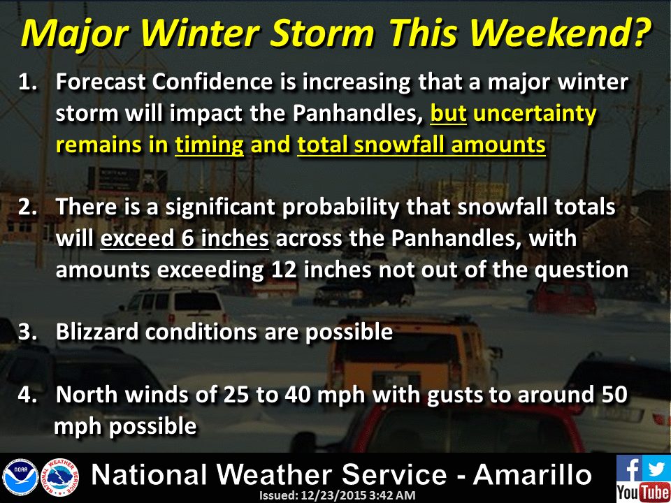
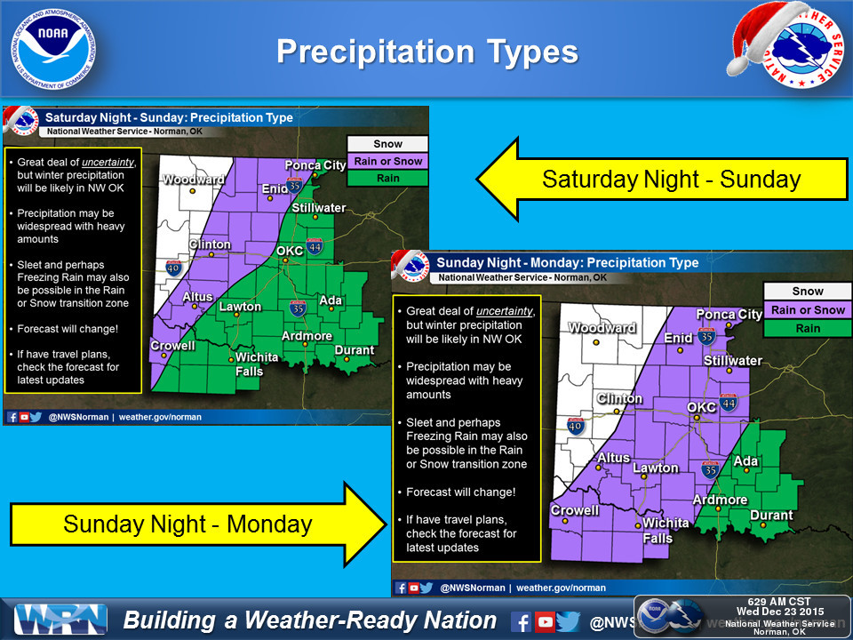
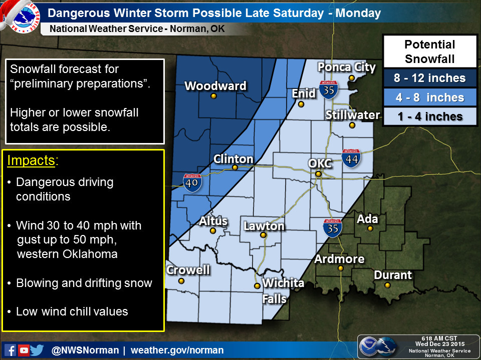
Here are some graphics from the local NWS offices detailing the impending
storm system. Notice the mention of uncertainty a lot? Certainly you do.
http://ticker.mesonet.org/archive/20151223/nws-amarillo.gif
http://ticker.mesonet.org/archive/20151223/nws-norman-precip.types.jpg
http://ticker.mesonet.org/archive/20151223/nws-norman-snow.totals.jpg
http://ticker.mesonet.org/archive/20151223/nws-norman-rain.totals.jpg
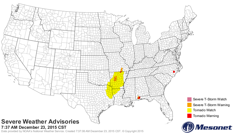
On top of that, severe weather has broken out to our south and east with
the tornadoes and the hail and the wind and the whatnot!
http://ticker.mesonet.org/archive/20151223/latest.severe.gif
Final words...prepare now. If you have to travel to the west after Christmas...
don't? If you have to travel to the east after Christmas...turn around don't
drown. Stay weather aware. Media, NWS, your local Emergency Manager on social
media...whatever source you know to be trustworthy in your experience. We use
them all here at the Ticker.
We're prepared. Are you?
Gary McManus
State Climatologist
Oklahoma Mesonet
Oklahoma Climatological Survey
(405) 325-2253
gmcmanus@mesonet.org
==================================================
The OCS/Mesonet Ticker
https://ticker.mesonet.org/
To subscribe or unsubscribe from the Ticker
or for questions about the Ticker or its content
Phone or Email the Ticker Manager at OCS
Phone: 405-325-2253 Email: ticker@mesonet.org
---------------------------------------------------
-C- Copyright 2024 Oklahoma Climatological Survey
===================================================
|


 Tweet
Tweet