MESONET TICKER ... MESONET TICKER ... MESONET TICKER ... MESONET TICKER ...
November 17, 2016 November 17, 2016 November 17, 2016 November 17, 2016
Drought for the Holidays, COME ON DOWN!
http://ticker.mesonet.org/archive/20161117/Dec-Feb-drought.outlook.png
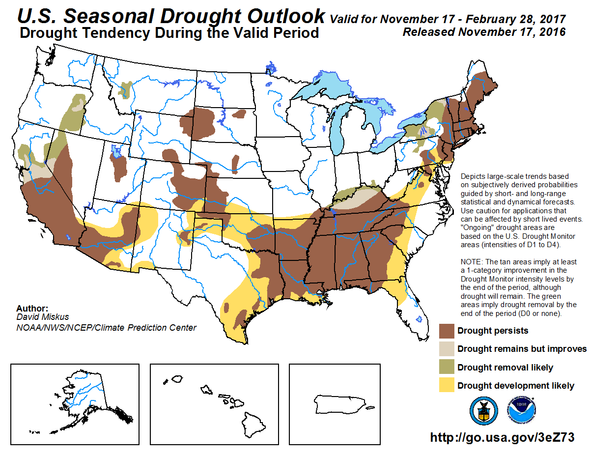
That new U.S. Seasonal Drought Outlook from CPC paints a really nasty picture for
the SE U.S. through Oklahoma into the High Plains. Where drought exists in
Oklahoma, it's expected to persist (brown). And then drought development is
considered likely across much of the rest of Oklahoma (yellow). This builds off
of the new U.S. Drought Monitor map released this morning showing more
intensification across SE through NW OK.
http://ticker.mesonet.org/archive/20161117/20161115_OK_trd.png
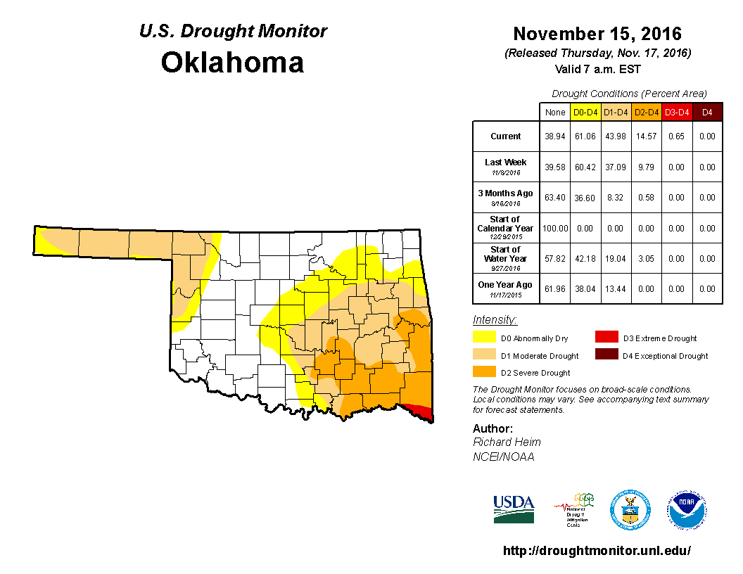
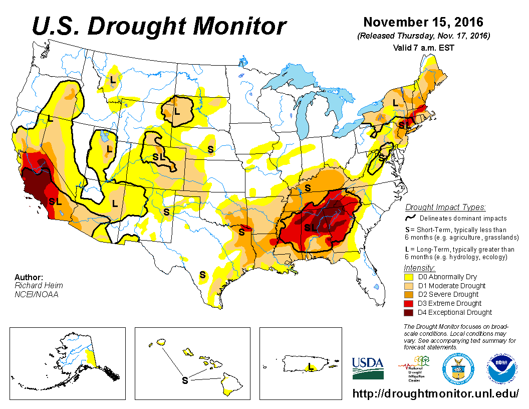
A very unwelcome visitor, Extreme (D3) drought has made an appearance in the state
for the first time since Oct. 20, 2015. Granted, it's but a small sliver across
far southern McCurtain County, but this connects to the area in the SE U.S. where
bigtime drought is going strong, becoming one of their worst drought's in history.
http://ticker.mesonet.org/archive/20161117/20161115_usdm_home.png
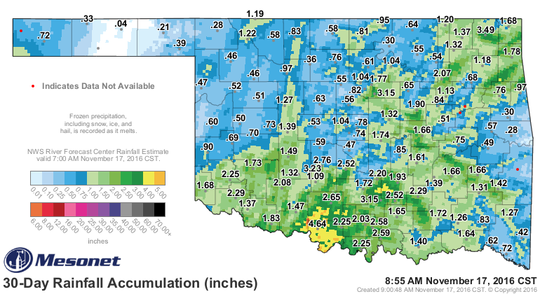
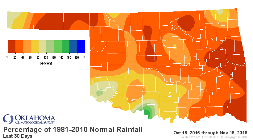
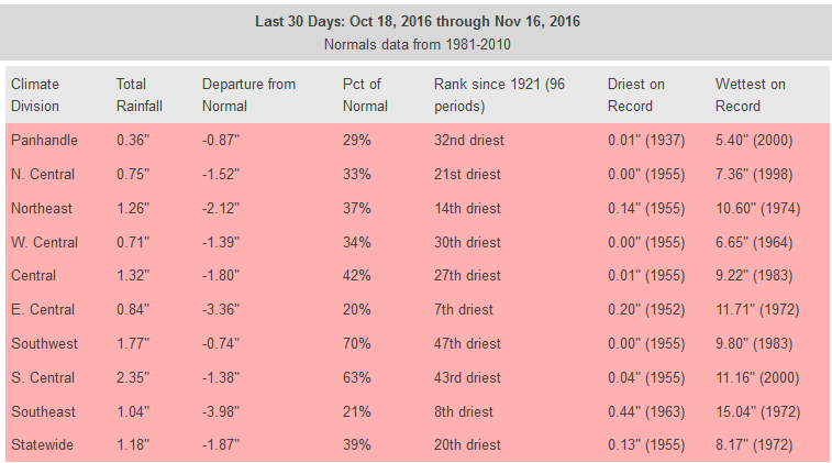
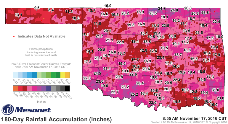
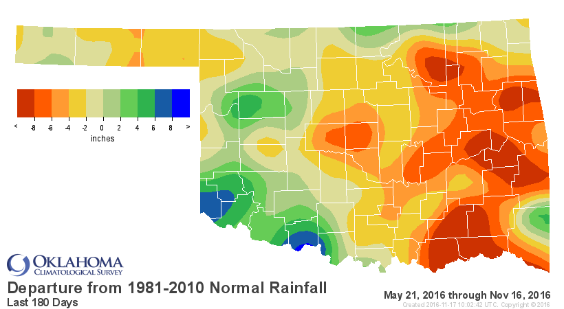
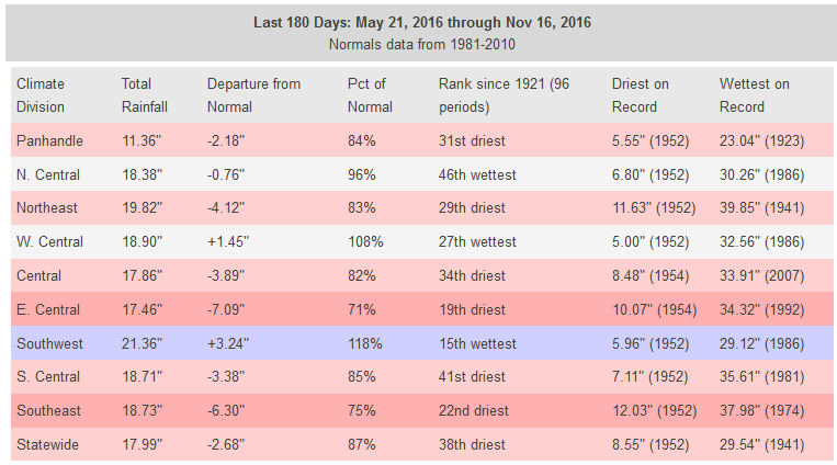
Our drought is fueled by rainfall deficits that date back to summer, but again,
we can just show you the last 30 days to 180 days to get the gist of what's
going on.
http://ticker.mesonet.org/archive/20161117/last30days-totals.png
http://ticker.mesonet.org/archive/20161117/last30dayspct.png
http://ticker.mesonet.org/archive/20161117/last30days-stats.png
http://ticker.mesonet.org/archive/20161117/last180days-totals.png
http://ticker.mesonet.org/archive/20161117/last180daysdepart.png
http://ticker.mesonet.org/archive/20161117/last180days-stats.png
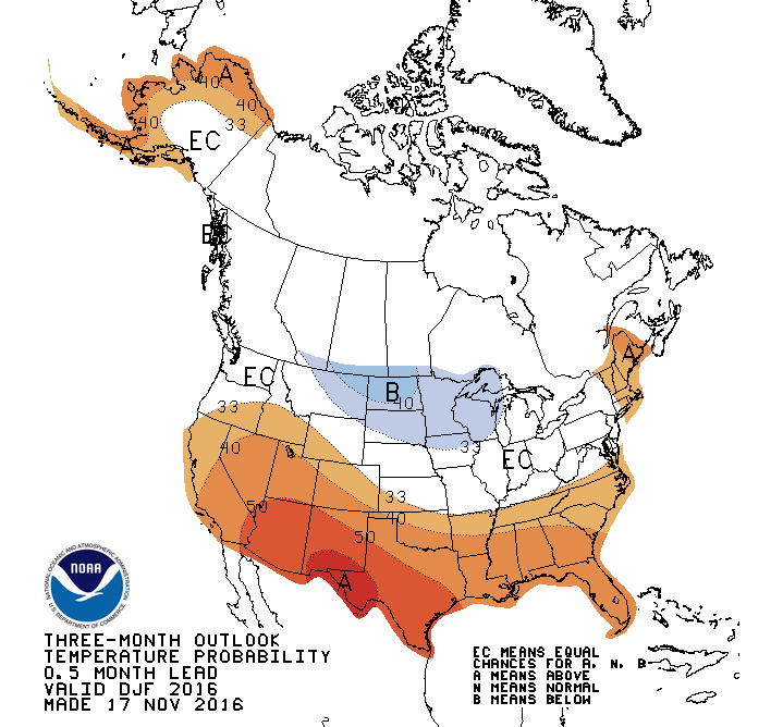
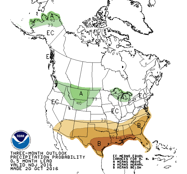
Now the poor outlook for winter, at least as far as drought goes, is being
driven by the La Nina-fueled December-February outlooks, where increased odds
of above normal temperatures and below normal precipitation are the rule.
http://ticker.mesonet.org/archive/20161117/dec-feb-temp-outlook.gif
http://ticker.mesonet.org/archive/20161117/dec-feb-precip-outlook.gif
Now I'm going to give you the same caution that I've given many times during
these types of outlooks. Even if we DO have a warmer- and drier-than-normal
winter, and intensifying drought, that does not mean no snow. What it means is
that at the end of February when we average up all the highs and lows and weather
events, over that three months we were warmer and drier than normal.
No duh, right? So it's an amalgam of all the separate weather events over that
three month time frame. So you might have warmer days on average more often than
not, but that overwhelms a few mighty cold and mighty snowy weather systems.
And THAT doesn't have to happen either. It's just a possibility despite the
outlooks.
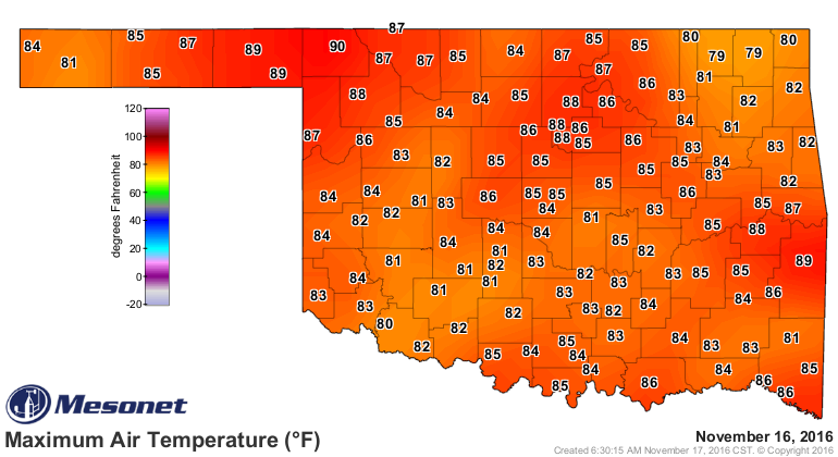
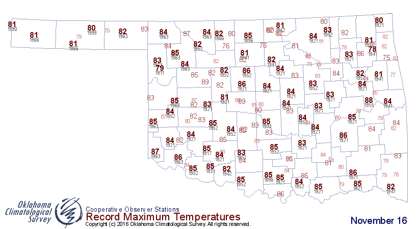
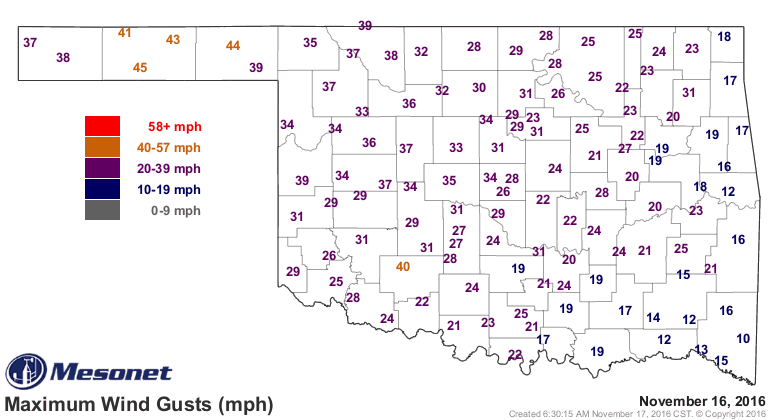
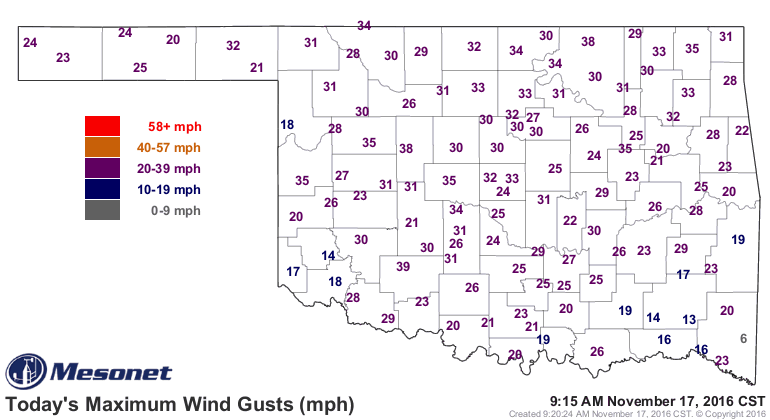
Well the types of days we had yesterday don't help the drought situation. We
set records all over the place, with Buffalo's 90 degrees on the Mesonet being
the highest temperature EVER recorded on a Nov. 16 in Oklahoma, beating Ft. Reno's
89 degrees wayyyyyy back on Nov. 16, 1894. Oakwood also reached 89 degrees back
in 1921. Then there was the wind. All of that saps moisture from the soil,
desiccates crops and evaporates flagging farm ponds.
http://ticker.mesonet.org/archive/20161117/yesterdays-highs.png
http://ticker.mesonet.org/archive/20161117/nov16-record-highs.png
http://ticker.mesonet.org/archive/20161117/yesterday.gust.gif
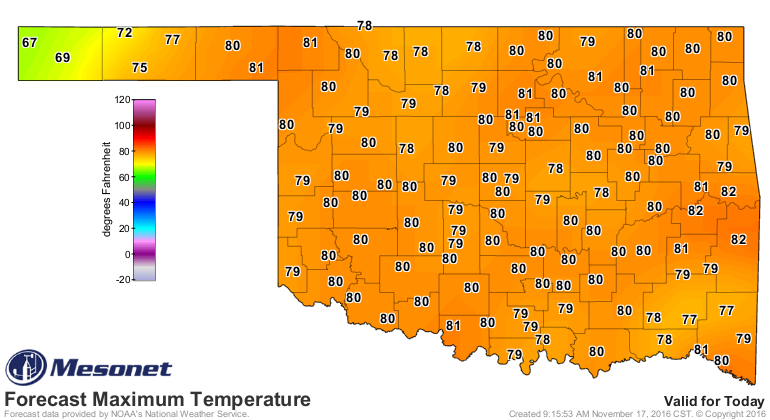
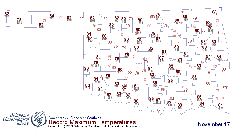
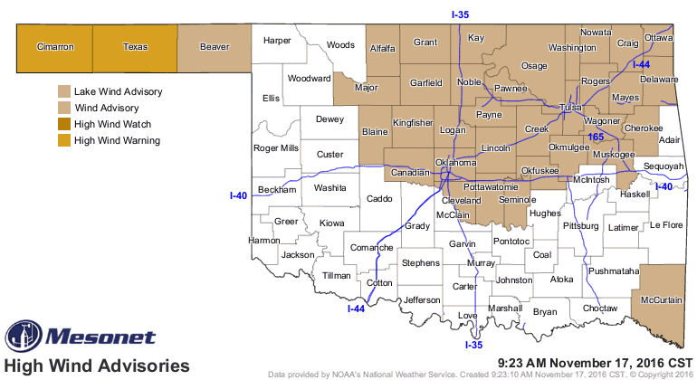
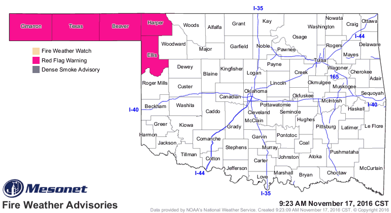
And we'll see more of the same today, with more high fire danger (and drought
intensification). Maybe no temperature records, but well above normal
nonetheless.
http://ticker.mesonet.org/archive/20161117/todays-forecast-highs.png
http://ticker.mesonet.org/archive/20161117/nov17-record-highs.png
http://ticker.mesonet.org/archive/20161117/today.gust.gif
http://ticker.mesonet.org/archive/20161117/todays-forecast-highs.png
http://ticker.mesonet.org/archive/20161117/nov17-record-highs.png
http://ticker.mesonet.org/archive/20161117/today.gust.gif
http://ticker.mesonet.org/archive/20161117/latest.oklahoma.winds.gif
http://ticker.mesonet.org/archive/20161117/latest.oklahoma.fire.gif
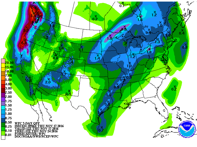
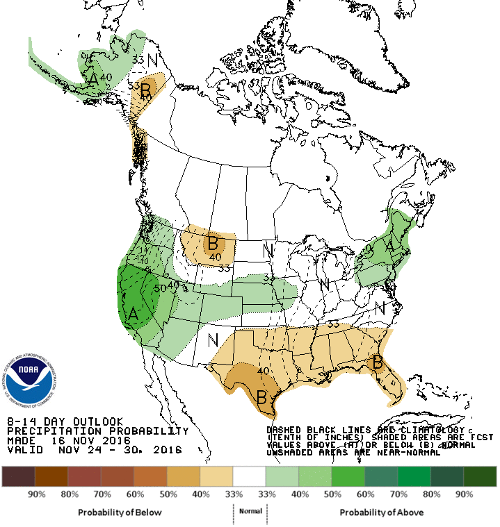
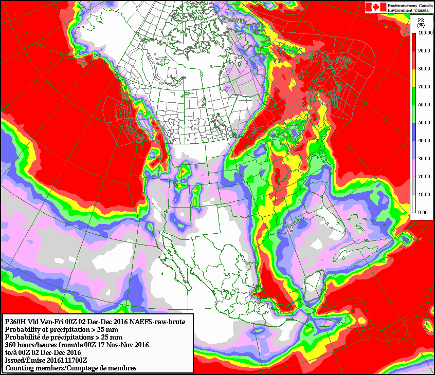
As for drought relieving rains? No.
http://ticker.mesonet.org/archive/20161117/7day-rain-forecast.gif
No.
http://ticker.mesonet.org/archive/20161117/nov24-30-precip-outlook.gif
No.
http://ticker.mesonet.org/archive/20161117/chances-accum-inch-thru-dec2.gif
Hey, you want a Yes Man, give me a different forecast, no?
Gary McManus
State Climatologist
Oklahoma Mesonet
Oklahoma Climatological Survey
(405) 325-2253
==================================================
The OCS/Mesonet Ticker
https://ticker.mesonet.org/
To subscribe or unsubscribe from the Ticker
or for questions about the Ticker or its content
Phone or Email the Ticker Manager at OCS
Phone: 405-325-2253 Email: ticker@mesonet.org
---------------------------------------------------
-C- Copyright 2024 Oklahoma Climatological Survey
===================================================
|


 Tweet
Tweet