MESONET TICKER ... MESONET TICKER ... MESONET TICKER ... MESONET TICKER ...
August 24, 2010 August 24, 2010 August 24, 2010 August 24, 2010
Oklahoma Wets Its Whistle
Just as flash drought began to take hold over the southern half of the state,
Mother Nature came through in the clutch and provided some nice relief in the
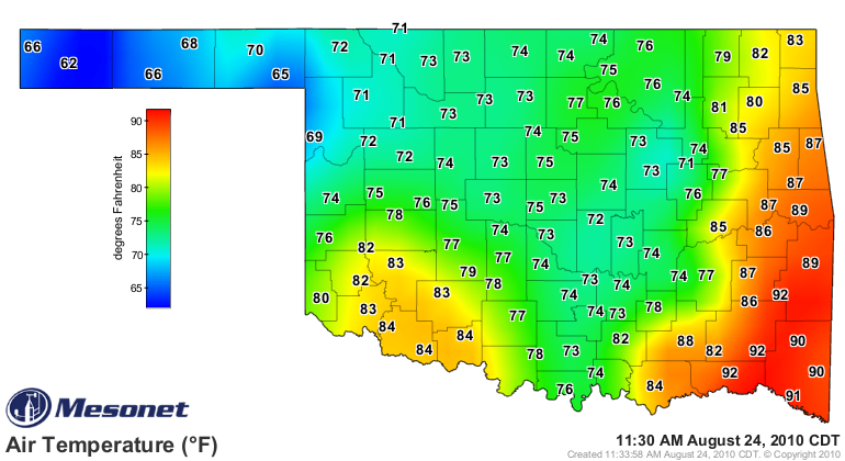
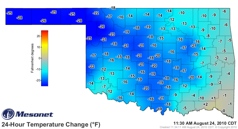
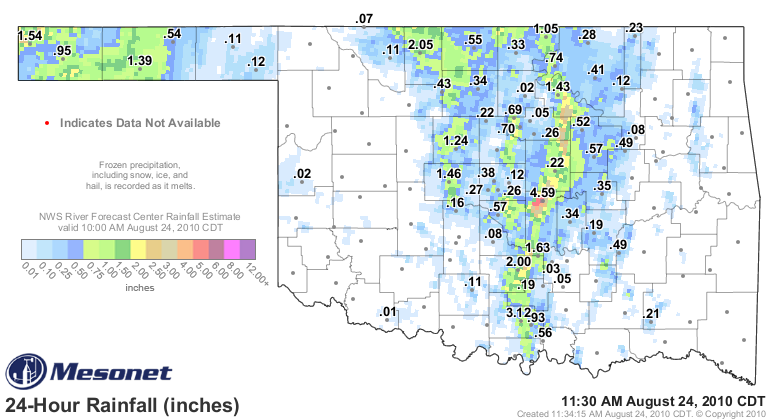
way of rain and cooler temperatures. The three maps from the Oklahoma Mesonet
below tell the story:
http://ticker.mesonet.org/archive/20100824/current.TAIR.grad.png
http://ticker.mesonet.org/archive/20100824/current.TAIR_24H.grad.png
http://ticker.mesonet.org/archive/20100824/rainrfc.24hr.png
As you can see from that last figure, flash drought has become flash flooding in
some parts of Pottawatomie and Carter counties. Unfortunately, the rain has been
fairly localized along the I-35 corridor so areas in the southwest and east
central haven't had much help yet. Beating the proverbial dead horse here, but
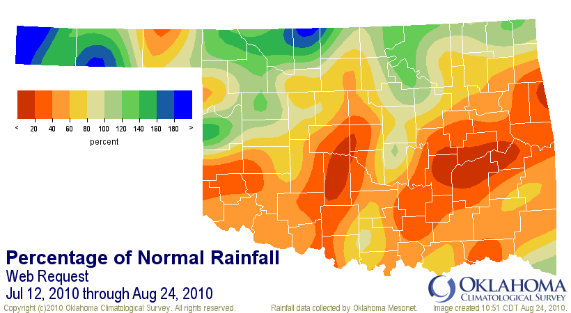
our bi-polar summer began its manic heat phase on July 12 when the widespread
rainfall stopped. When you combine a month and a half of triple-digit temperatures
with less than 20% of normal rainfall, you have flash drought.
http://ticker.mesonet.org/archive/20100824/flash_drought_conditions.png
So enjoy the cool weather for a few days. A word of warning to those wanting
to write an epitaph to summer with this latest cold front: that might be just
a tad premature. We're an upper-level ridge away from the heat again.
Oklahoma City, for instance, has had 74 September days with highs of 100 degrees
or greater since 1896, and averages 11 days over 90. The latest 100-degree
temperature ever recorded in Oklahoma City occurred on September 30, 1977. The
highest ... 108 degrees on September 2, 2000 (football fans at the UTEP/OU game
will remember that day not so fondly).
And the numbers are worse in other parts of the state, judging by the top-20
highest September temperatures(again, 2000 is not good company to keep):
114 EUFAULA 2 SW 9/1/2000
114 WAURIKA 9/4/2000
113 CHATTANOOGA 3 NE 9/5/2000
113 HOLDENVILLE 9/2/1951
113 WILBURTON 9/4/1998
112 ALVA 9/4/2000
112 ATOKA DAM 9/8/1985
112 BUFFALO 9/4/2000
112 BUFFALO 9/5/2000
112 BUFFALO 9/6/2000
112 CENTRAHOMA 2 ESE 9/4/2000
112 COALGATE 1 WNW 9/2/1951
112 GUTHRIE 9/2/1998
112 MANNFORD 6 NW 9/2/2000
112 MCGEE CREEK DAM 9/2/2000
112 MCGEE CREEK DAM 9/4/2000
112 PAULS VALLEY 4 WSW 9/4/2000
112 TUSKAHOMA 9/4/1998
112 WAURIKA 9/3/2000
112 WEBBERS FALLS 9/5/1998
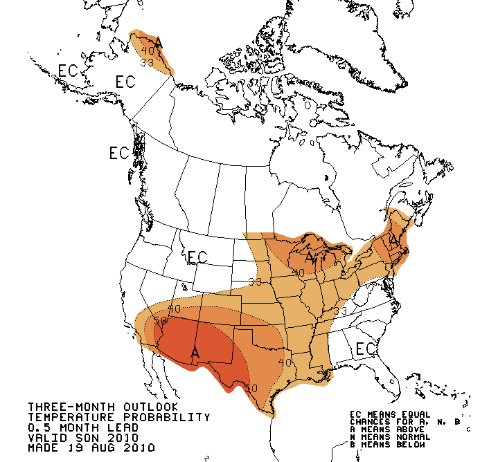
So skip the epitaphs for now and stick with epithets. But above all, enjoy our
cool break.
And hey, we can always hope for short-sleeve weather for Halloween!
http://ticker.mesonet.org/archive/20100824/sep-nov_outlook.gif
Gary McManus
Associate State Climatologist
Oklahoma Climatological Survey
(405) 325-2253
==================================================
The OCS/Mesonet Ticker
https://ticker.mesonet.org/
To subscribe or unsubscribe from the Ticker
or for questions about the Ticker or its content
Phone or Email the Ticker Manager at OCS
Phone: 405-325-2253 Email: ticker@mesonet.org
---------------------------------------------------
-C- Copyright 2024 Oklahoma Climatological Survey
===================================================
|


 Tweet
Tweet