MESONET TICKER ... MESONET TICKER ... MESONET TICKER ... MESONET TICKER ...
August 23, 2017 August 23, 2017 August 23, 2017 August 23, 2017
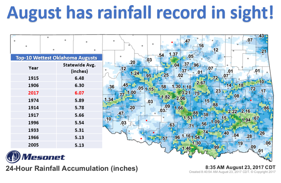
Gunning for 1915!
http://ticker.mesonet.org/archive/20170823/august-rain-records.png
Ooh, we're so close! Last night's scattered but ridiculously heavy rainfall left
the statewide average total for August thus far at 6.07 inches according to
preliminary data from the Oklahoma Mesonet. That's a mere 0.41 inches from 1915's
top August rainfall mark of 6.48 inches. This is all on the graphic above...the
moose out front should have told ya.
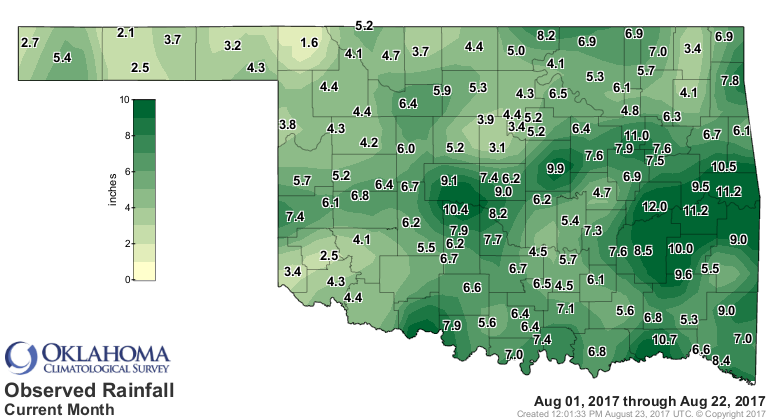
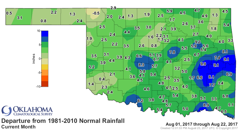
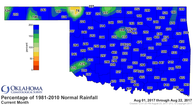
Anyway, the maps say it all as we've gone from feast to famine across the state
in little more than three weeks.
http://ticker.mesonet.org/archive/20170823/aug-totals.png
http://ticker.mesonet.org/archive/20170823/aug-depart-normal.png
http://ticker.mesonet.org/archive/20170823/aug-pct-normal.png
That's worth of a ZOUNDS! Minco in Grady County is sitting pretty at 10.4 inches,
but Eufaula has the prize for August thus far with a hefty foot of rainfall,
about 10 inches above normal. Oddly enough, even though it's the shining jewel
of the state...nay, the world!, Buffalo remains the only spot in Oklahoma below
normal for the month with a deficit of 0.5 inches.
The quest for the record continues with nine days left in the month. It's gonna
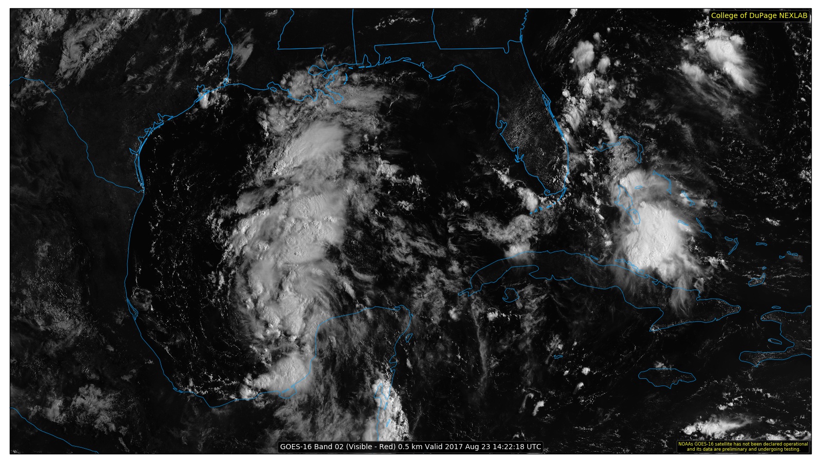
be close unless our non-friend Harvey, once a tropical storm now a disturbance
but almost certain to re-intensify into a tropical storm again or even a
Hurricane, heads a bit farther NW into SE OK. As of now, it's expected to curve
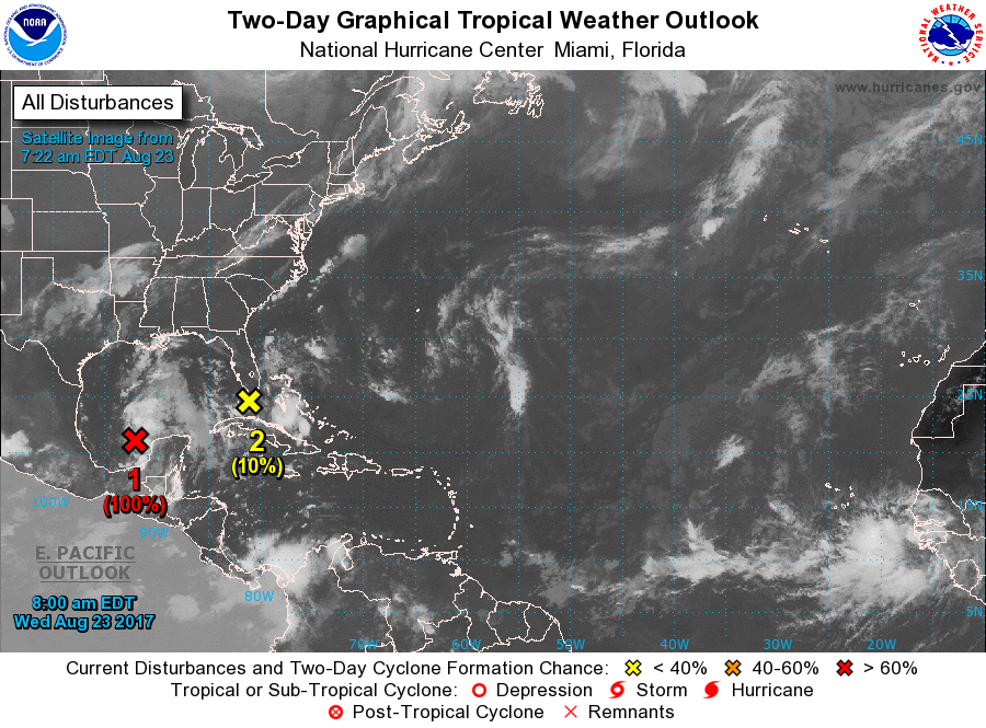
off to the NE just shy of the Arklatex region. Notice in the tropical outlook
from the National Hurricane Center that the remnants of Harvey (given by the
red "X") have a 100% chance for re-intensification into a cyclone within the
next two days, and bringing a ton of rainfall to the Gulf Coast.
http://ticker.mesonet.org/archive/20170823/NHC-tropical-outlook.png
http://ticker.mesonet.org/archive/20170823/harvey-GOES16-satellite.jpg
http://ticker.mesonet.org/archive/20170823/7day-rain-forecast.gif
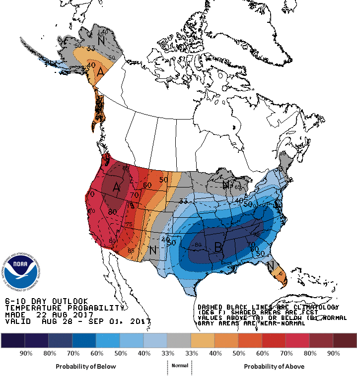
Is summer done? Too early to say because it can get hotter'n something I can't
say on here in September. But the rest of August is looking good!
http://ticker.mesonet.org/archive/20170823/Aug28-Sept1-temp-outlook.gif
Gary McManus
State Climatologist
Oklahoma Mesonet
Oklahoma Climatological Survey
(405) 352-2253
gmcmanus@mesonet.org
==================================================
The OCS/Mesonet Ticker
https://ticker.mesonet.org/
To subscribe or unsubscribe from the Ticker
or for questions about the Ticker or its content
Phone or Email the Ticker Manager at OCS
Phone: 405-325-2253 Email: ticker@mesonet.org
---------------------------------------------------
-C- Copyright 2024 Oklahoma Climatological Survey
===================================================
|


 Tweet
Tweet