MESONET TICKER ... MESONET TICKER ... MESONET TICKER ... MESONET TICKER ...
July 18, 2019 July 18, 2019 July 18, 2019 July 18, 2019
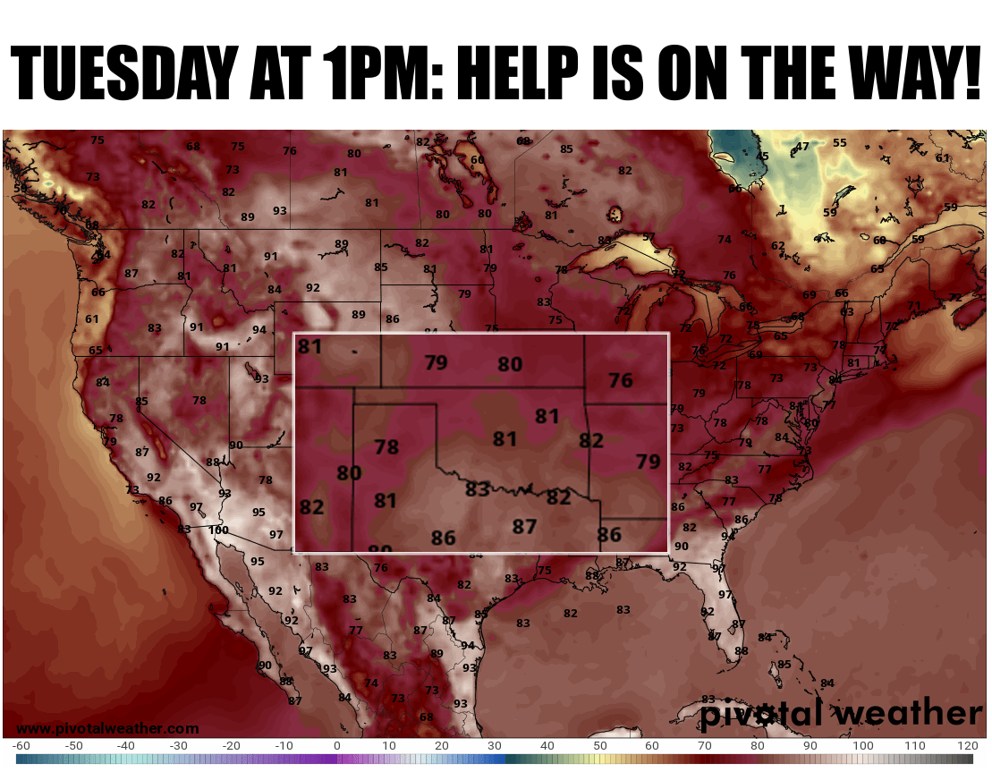
Cold front magic!
http://ticker.mesonet.org/archive/20190718/tuesday-1pm-temps.png
Heat got ya down? Do ya feel like somebody put 50lbs of chewed bubblegum on your
shoulders, then draped a gigantic sweaty sock over your head? If so, seek help.
I mean, it's just really hot out. But if you're just really hot and sick of it,
be prepared for a deliciously cool, refreshingly dry blast of air early next week.
An unusually strong front for this time of year will cool us down into the 80s
for highs on Tuesday, with lows in the 60s. I wouldn't be shocked to see a low
temperature or two in the 50s, either. At least according to this forecast model,
but this visit by cooler air looks pretty darned likely at this point. Part of
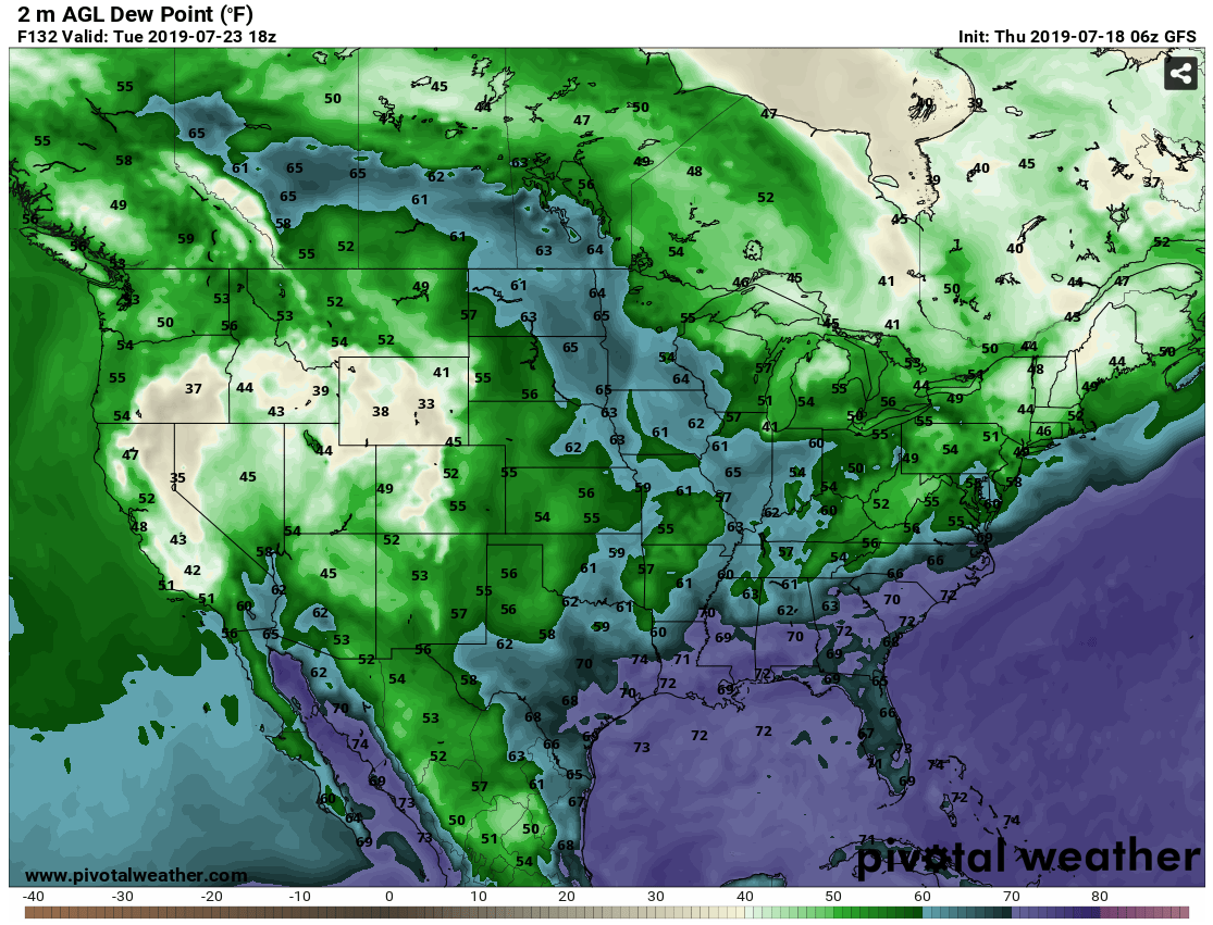
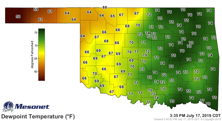
the good news is the much drier air expected to wash in from the north. Check out
the forecast dewpoint temperatures for 1pm next Tuesday (again, according to one
model), vs. what we've been seeing lately. Using current dewpoints, but keep in
mind they're generally a little lower in the mornings.
http://ticker.mesonet.org/archive/20190718/tuesday-1pm-dewpoints.png
http://ticker.mesonet.org/archive/20190718/current-dewpoints.png
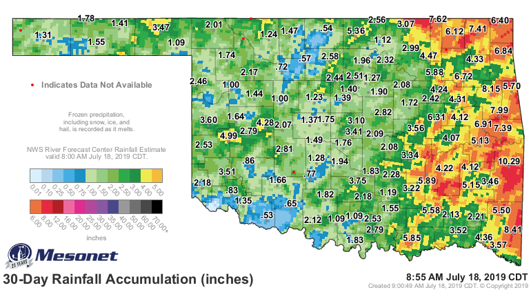
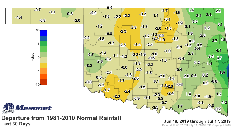
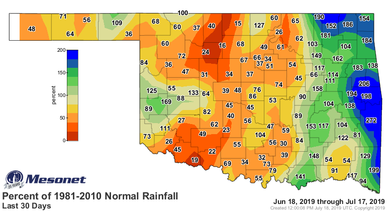
So that's the good news. The bad news is a possible flash drought building across
SW Oklahoma. A look at the 30-day rainfall spells trouble when coupled with the
heat we've started seeing in the last week.
http://ticker.mesonet.org/archive/20190718/30day-rain-totals.png
http://ticker.mesonet.org/archive/20190718/30days.norm_dep.png
http://ticker.mesonet.org/archive/20190718/30days.norm_pct.png
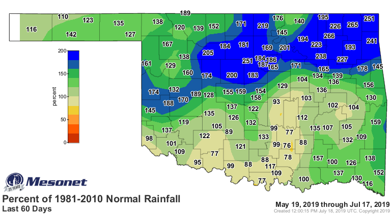
Some fairly substantial deficits building across western Oklahoma. Looks bad up
into north central Oklahoma as well, but remember they're still holding on to
plenty of moisture as you go further back into spring.
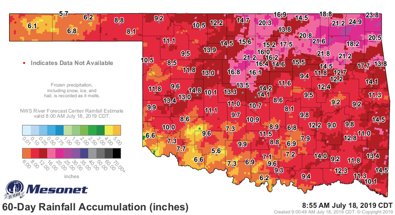
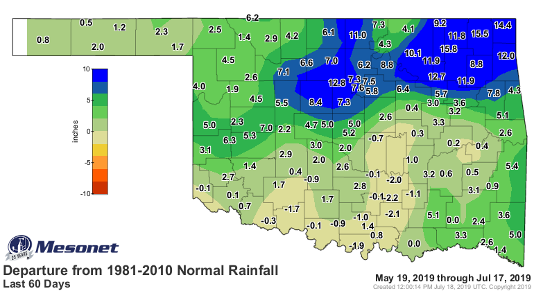
http://ticker.mesonet.org/archive/20190718/60day-rain-totals.png
http://ticker.mesonet.org/archive/20190718/60days.norm_dep.png
http://ticker.mesonet.org/archive/20190718/60days.norm_pct.png
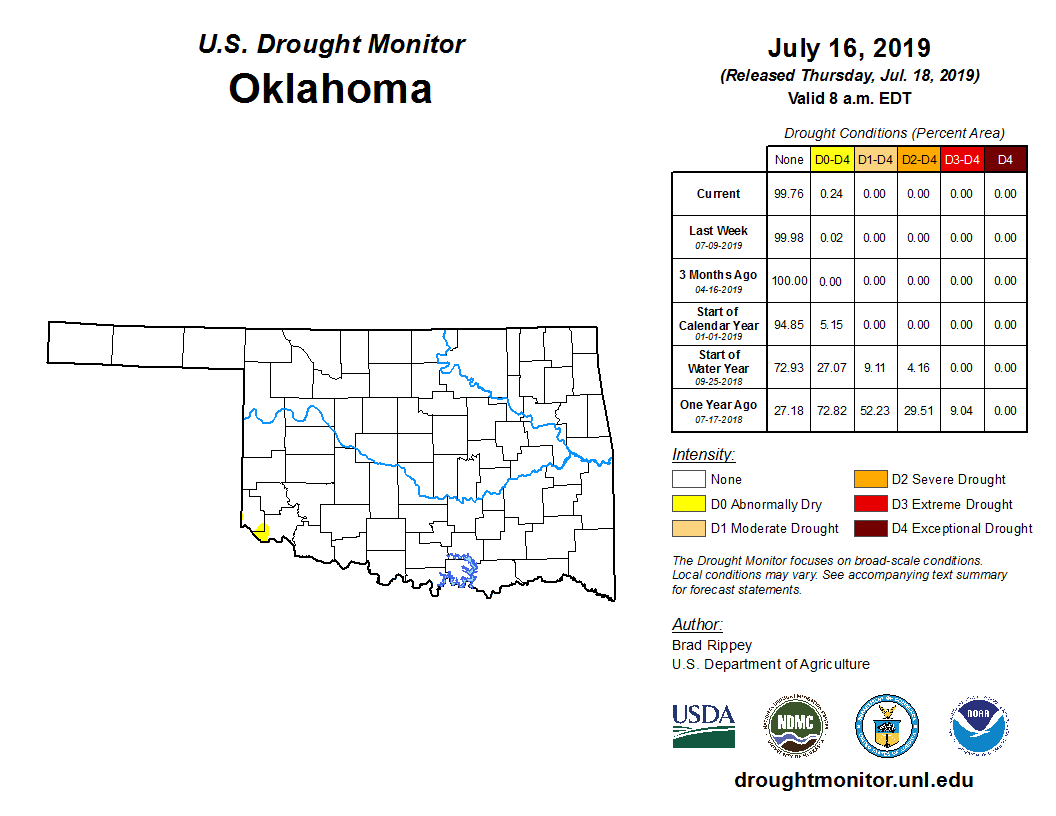
The result, however, is just a teensy-weensy bit of abnormally dry conditions
painted onto the latest U.S. Drought Monitor map. You have to really squint,
but if you look down into far southern Harmon and Jackson counties, you can see
that yeller.
http://ticker.mesonet.org/archive/20190718/20190716_OK_trd.png
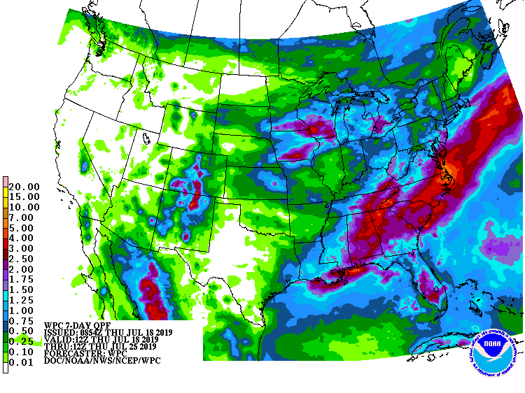
Now the trick is to keep more of that color from appearing, and especially to
keep it from turning into those more unsightly colors actually designating
drought conditions. The cooler weather will help a bit, but that's still 4 days
away, and we're gonna bake until then. And this 7-day rain forecast is not
too promising.
http://ticker.mesonet.org/archive/20190718/7day-rain-forecast.gif
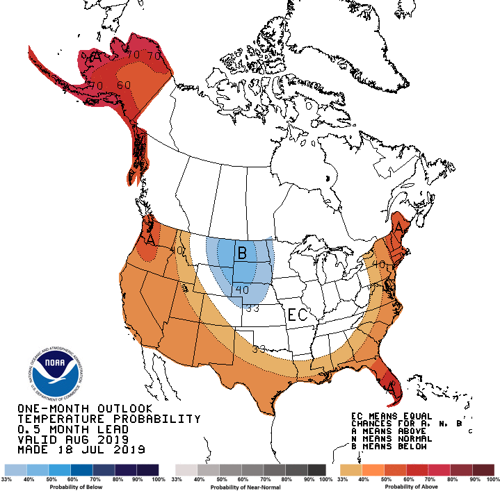
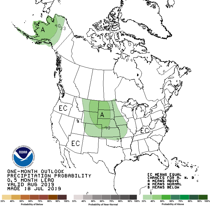
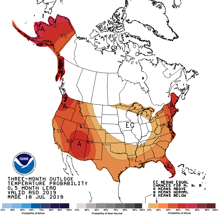
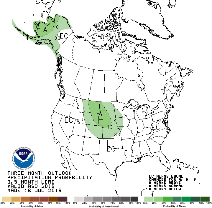
Looking into the future, August and then the 3-month August-October period,
the Climate Prediction Center's temperature and precipitation outlooks don't
show many strong signals for our region. We get the dreaded "Equal Chances" for
most of our area, signalling equal chances (DUH!) of above-, below-, and
near-normal temps and precip. The only exception is slightly increased odds of
above normal temperatures for the August-October time frame.
http://ticker.mesonet.org/archive/20190718/august-temp-outlook.gif
http://ticker.mesonet.org/archive/20190718/august-precip-outlook.gif
http://ticker.mesonet.org/archive/20190718/aug-oct-temp-outlook.gif
http://ticker.mesonet.org/archive/20190718/aug-oct-precip-outlook.gif
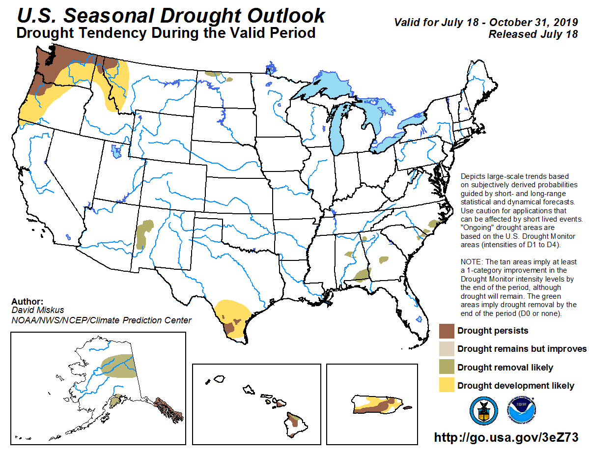
Still no drought seen developing then persisting through October. That doesn't
mean drought can't come and go during that time frame, but none is expected
to still be here at the end of October according to CPC's Seasonal Drought
Outlook.
http://ticker.mesonet.org/archive/20190718/aug-oct-drought-outlook.png
That's it. Go sweat in whatever way you deem proper. Tuesday will be here
before you know it.
Gary McManus
State Climatologist
Oklahoma Mesonet
Oklahoma Climatological Survey
(405) 325-2253
gmcmanus@mesonet.org
==================================================
The OCS/Mesonet Ticker
https://ticker.mesonet.org/
To subscribe or unsubscribe from the Ticker
or for questions about the Ticker or its content
Phone or Email the Ticker Manager at OCS
Phone: 405-325-2253 Email: ticker@mesonet.org
---------------------------------------------------
-C- Copyright 2024 Oklahoma Climatological Survey
===================================================
|


 Tweet
Tweet