MESONET TICKER ... MESONET TICKER ... MESONET TICKER ... MESONET TICKER ...
July 6, 2017 July 6, 2017 July 6, 2017 July 6, 2017
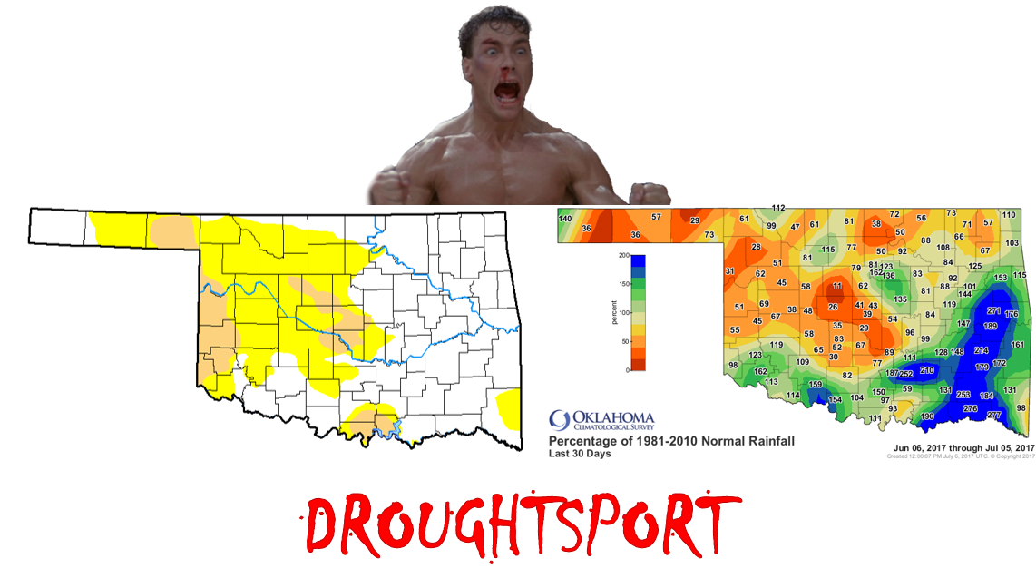
Jean-Claude Van Droughtte
http://ticker.mesonet.org/archive/20170706/droughtsport.png
Yes, I thought it was dead too. Although I was out of the state (and generally
out of my mind) during the weekend's rains, I was following along on radar and
the Mesonet rainfall maps. SURELY this will free up my Sunday-Tuesdays for awhile,
and I won't have to mess with the Drought Monitor? I mean, just look at this
lovely rainfall map?
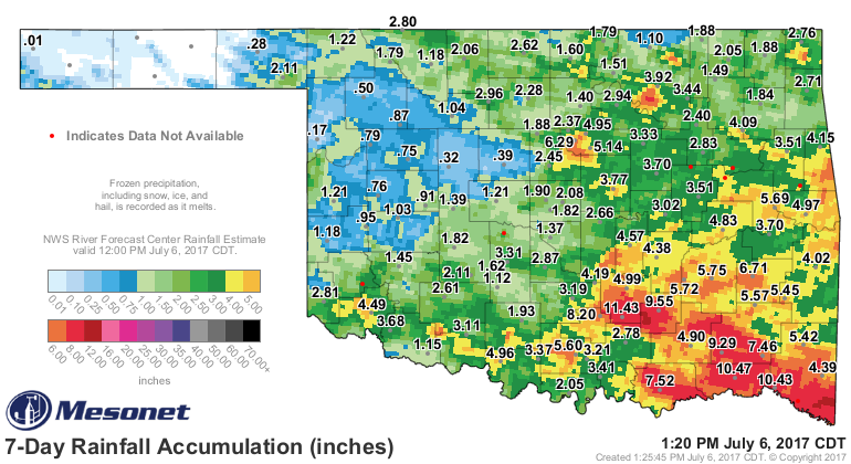
http://ticker.mesonet.org/archive/20170706/7day-rain-totals.png
Lots of lovely reds, oranges and yellows, and even the dark greens, signaled some
pretty darned hefty storms. I understand things got quite testy around these parts
at times. But unfortunately, as you look back at my homage to one of the best
Jean-Claude Van Damme movies ever made (I mean, come on, we're choosing between
such masterpieces as "Maximum Risk," "Sudden Death," and "Timecop"), most of the
heavy rains fell in areas that weren't in the flash drought area. The question
for areas like central Oklahoma is...did 2" of rain end two-month deficits of more
than 8 inches? Well, the Drought Monitor didn't think so.
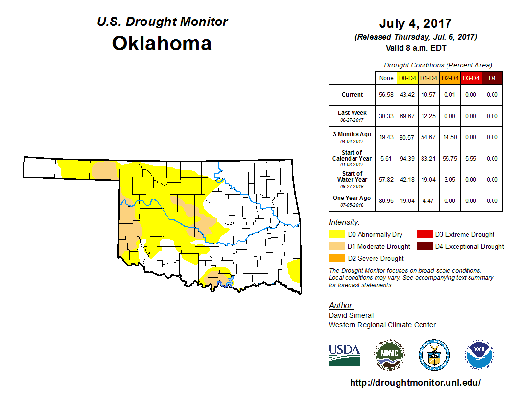
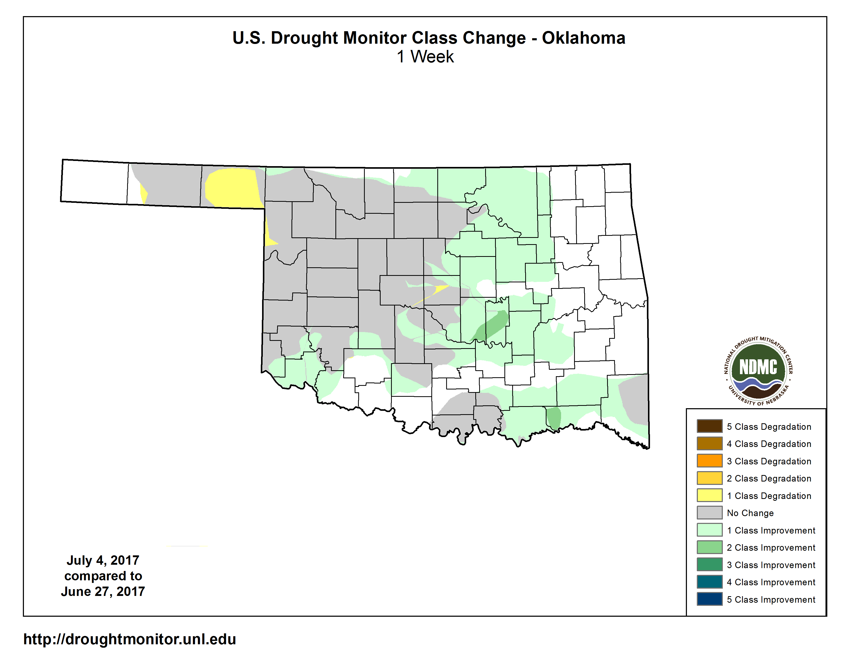
Check out the new map, this time with the statistics, and the one-week change
map as well to see just how things, uh...changed.
http://ticker.mesonet.org/archive/20170706/20170704_OK_trd.png
http://ticker.mesonet.org/archive/20170706/1week-change.png
So there were pretty widescale 1-category improvements across Oklahoma, and even
a few forbidden 2-category improvements (shhh...don't tell). But there were
also lots of areas across central and western OK that didn't improve at all, and
even some areas (yellow) where it got worse.
This isn't to say that we won't re-evaluate the impacts next week...see if they
improved more than we think, and then re-evaluate the map itself after that. But
for now, despite the best JCVD scissor kick Mother Nature was able to apply,
the drought is still fighting back in Oklahoma.
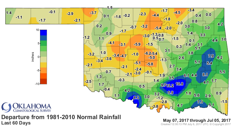
http://ticker.mesonet.org/archive/20170706/60day-depart-normal.png
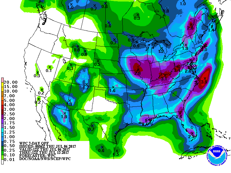
Other than a chance of rain this weekend, and not a great one at that, things
are starting to look very summery again.
http://ticker.mesonet.org/archive/20170706/7day-rain-forecast.gif
Maybe, just maybe, the NW will get the lion's share of that rainfall this
time? Other than that, summer's gonna do what summers do.
Gary McManus
State Climatologist
Oklahoma Mesonet
Oklahoma Climatological Survey
(405) 325-2253
gmcmanus@mesonet.org
==================================================
The OCS/Mesonet Ticker
https://ticker.mesonet.org/
To subscribe or unsubscribe from the Ticker
or for questions about the Ticker or its content
Phone or Email the Ticker Manager at OCS
Phone: 405-325-2253 Email: ticker@mesonet.org
---------------------------------------------------
-C- Copyright 2024 Oklahoma Climatological Survey
===================================================
|


 Tweet
Tweet