MESONET TICKER ... MESONET TICKER ... MESONET TICKER ... MESONET TICKER ...
June 14, 2010 June 14, 2010 June 14, 2010 June 14, 2010
Dangerous Flooding Event Occurring in OKC Metro Area
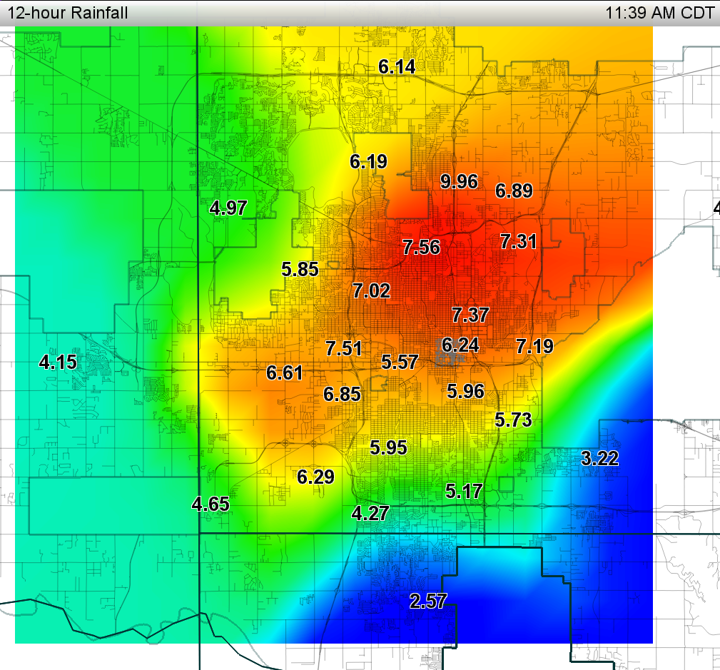
Oklahoma's 24-hour rainfall record of 15.68 inches, set at Enid on October 11,
1973, is in jeopardy with over 9 inches falling so far in Oklahoma City.
In fact, as of 11:49 a.m. with rain still falling, the Oklahoma City North (OKCN)
Mesonet station has recorded 9.96 inches of rainfall. Totals across the Oklahoma
Mesonet and Oklahoma City Micronet indicate the seriousness of this flooding
event with widespread rains of 5-10 inches thus far.
http://ticker.mesonet.org/archive/20100614/OKC_storm-total-rainfall.png
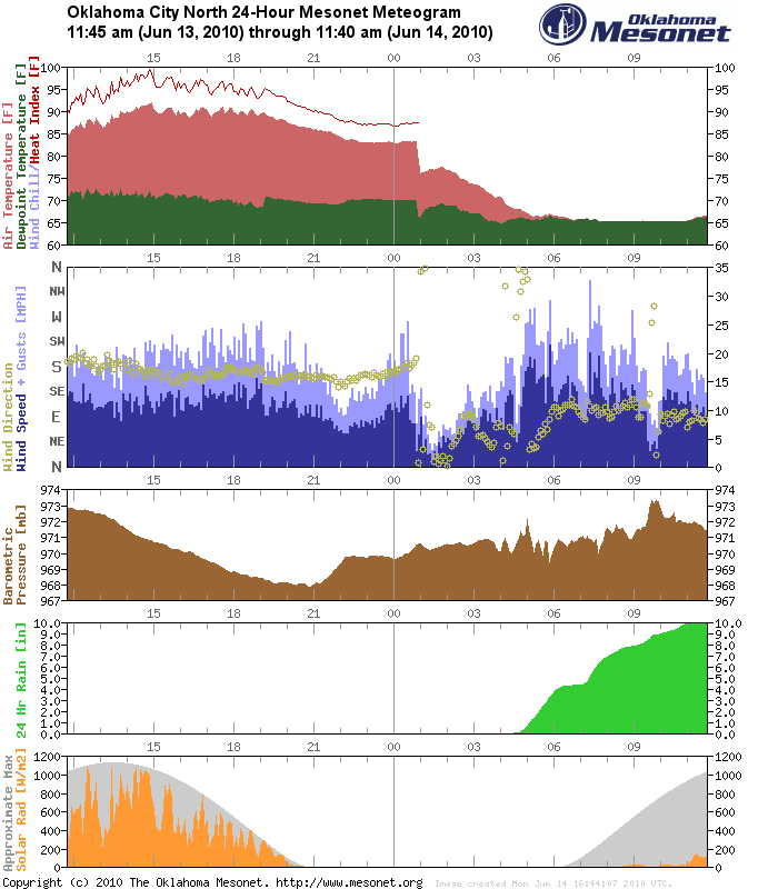
Keep in mind that most of this rainfall has fallen in the past 6 hours. The
first drops fell around 4:15 a.m. at OKCN (located on the campus of the
"Oklahoman" at I-235 and Britton Rd.):
http://ticker.mesonet.org/archive/20100614/OKCN.met.gif
Between 4:45-10:45 a.m., 9.58 inches of rainfall fell, which surpasses the
500-year 6-hour maximum rainfall event of about 8.0 inches. In other words, for
that 6-hour period, we surpassed the most that would be expected every 500
years (i.e., we've beat the 500-year rainfall event for OKC). In fact, it has
also bested our 500-year 12-hour event already, which is about 9.2 inches AND
the 100-year 24-hour event, which is also about 9.2 inches. The 500-year 24-hour
event for OKC is about 12 inches, so that mark is also up for grabs today.
These values for the OKCN location are taken from Tortorelli's "Depth-Duration
Frequency of Precipitation for Oklahoma" publication.
Recurrence Interval Tortorelli Total
500-Year 1-Day 11.60 9.96
500-Year 24-Hour 12.00 9.96
500-Year 12-Hour 9.20 9.96
500-Year 6-Hour 8.00 9.58
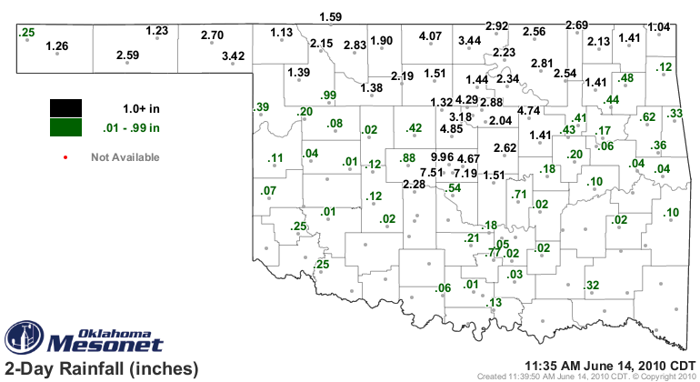
Other parts of the state have had prodigious amounts of rain over the last
couple of days as well:
http://ticker.mesonet.org/archive/20100614/rain48.hour.gif
Those rains in north central Oklahoma have the potential to be disastrous as
wheat harvest was just approaching full-speed in that area. The longer ripened
wheat sits in the field in moist conditions, the greater the chance for damage
from diseases such as rust and powdery mildew. And let's not forget that 17 tons
of combine doesn't take to muddy fields too well.
For continuing updates of this record rainfall event, follow us on Twitter and
Facebook at:
http://twitter.com/ocsticker
http://twitter.com/OKCNET
http://www.facebook.com/mesonet
http://www.facebook.com/pages/Oklahoma-City-Micronet/108107256598
Gary McManus
Associate State Climatologist
Oklahoma Climatological Survey
(405) 325-2253
gmcmanus@mesonet.org
==================================================
The OCS/Mesonet Ticker
https://ticker.mesonet.org/
To subscribe or unsubscribe from the Ticker
or for questions about the Ticker or its content
Phone or Email the Ticker Manager at OCS
Phone: 405-325-2253 Email: ticker@mesonet.org
---------------------------------------------------
-C- Copyright 2024 Oklahoma Climatological Survey
===================================================
|


 Tweet
Tweet