MESONET TICKER ... MESONET TICKER ... MESONET TICKER ... MESONET TICKER ...
July 26, 2024 July 26, 2024 July 26, 2024 July 26, 2024
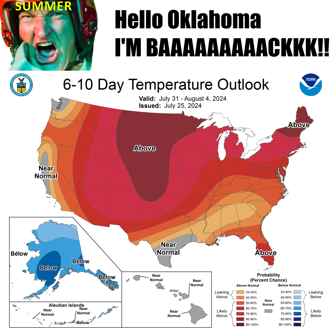
It's back!
https://ticker.mesonet.org/archive/20240726/july31-aug4-temp-outlook.png
Hey now, nobody said I was the smartest tool in the shed, nor am I the words with
greatest, but even I know the bamboozle I managed to pull off over the last week
was a doozy. See, not everybody has the lack of foresight and bad luck to go on
vacation to the Alabama Gulf Coast, leaving Oklahoma's summery foray into the 80s
for Gulf Shores' heat indexes into the 100s, then manage to come back right when
Oklahoma is headed back to the 100s itsownself.
Sheer genius!
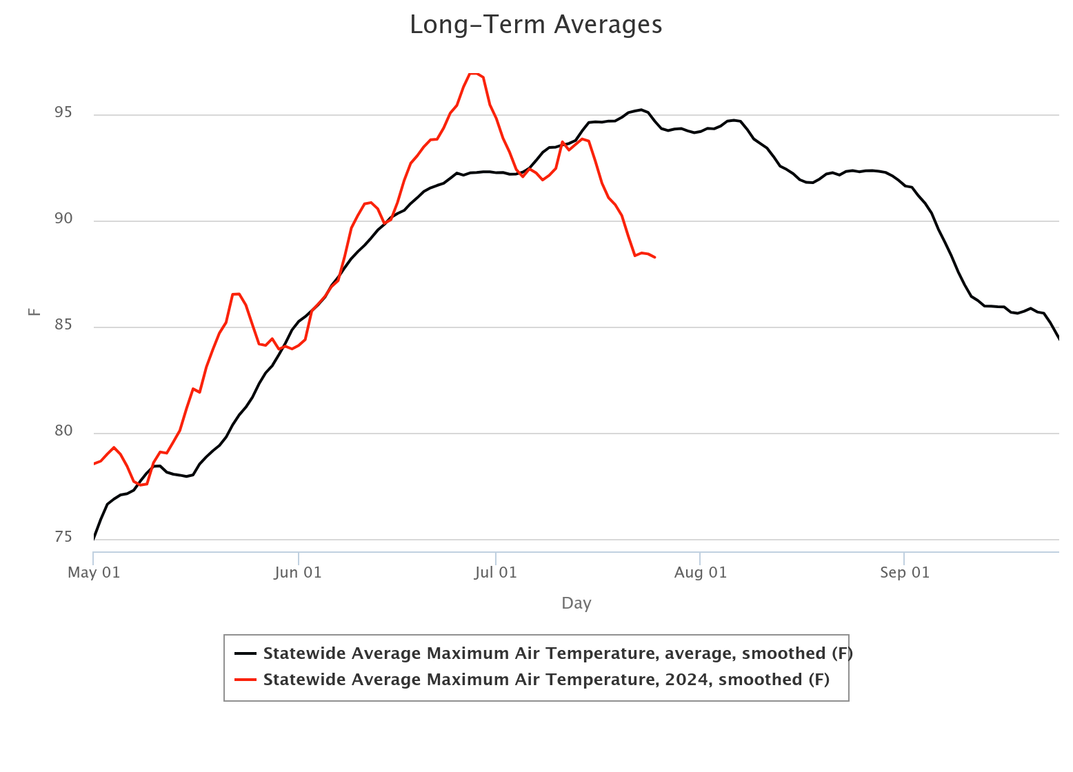
These types of summer swoons don't happen often, but when they do, you have to
take advantage of them. If you look at the statewide Mesonet high temperature
data for the past 15 years (black line), you can see that we are in peak summer
heat territory over this last week, then we dip down again just a tiny bit, then
have a secondary flare up during the first week of August. All hot, of course,
but two very noticeable crowns of hot Oklahoma. Again, that's what happens ON
AVERAGE over the last 15 years. This year, however, we can see that lovely dip
(watch it...besides, I'm not lovely) right at the beginning of July and that has
lasted for the majority of the month thus far (red line). This data is smoothed
for display purposes, to the extremes are muted a bit, but you don't need data
to know it's been deliciously mild for most of July.
https://ticker.mesonet.org/archive/20240726/summer-swoon.png
Again, on average, we stay hot for most of August, then right around that last
week, we take a noticeable dive which accelerates in September. Like I said
in several Tickers this month, the longer you can stay below normal in
temperature during July, the better your summer experience will be. Also, almost
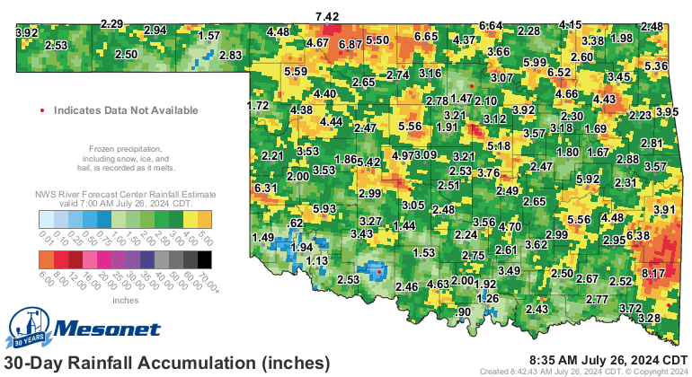
invariably true, if summer is cool, it's probably wet, too. And that's what
we've seen for July with most folks getting their fair share of moisture. Still
some hefty deficits here and there, but not widespread.
https://ticker.mesonet.org/archive/20240726/30day-rain-totals.png
https://ticker.mesonet.org/archive/20240726/pct30day_rain.current.png
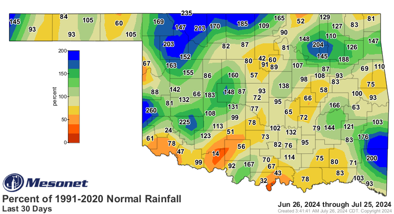
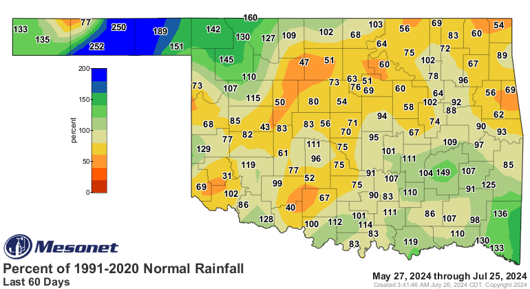
However, you extend that out through June, and more widespread deficits crop
up.
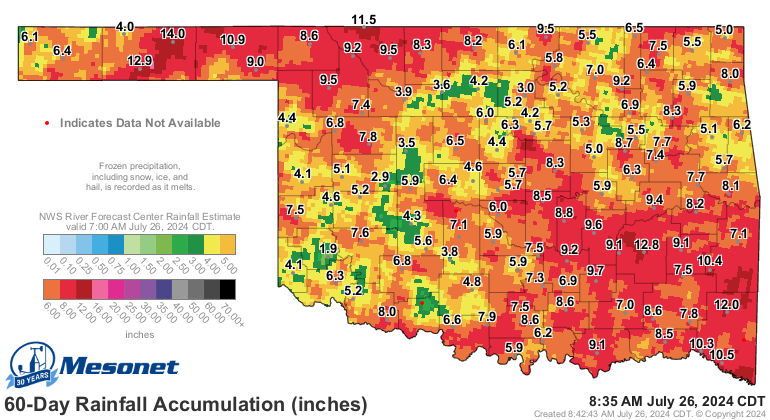
https://ticker.mesonet.org/archive/20240726/60day-rain-totals.png
https://ticker.mesonet.org/archive/20240726/pct60day_rain.current.png
It's for that reason that we still see drought and abnormally dry conditions
over 63% of the state.
https://ticker.mesonet.org/archive/20240726/20240723_ok_trd.png
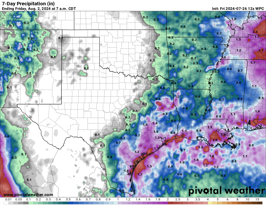
With extreme heat coming back, also almost invariably true...that comes with a
distinct lack of rainfall.
https://ticker.mesonet.org/archive/20240726/7day-rain-forecast.png
So we've muted our "normal" July heat, now let's see what we can do with August.
Gary McManus
State Climatologist
Oklahoma Mesonet
Oklahoma Climate Survey
gmcmanus@ou.edu
==================================================
The OCS/Mesonet Ticker
https://ticker.mesonet.org/
To subscribe or unsubscribe from the Ticker
or for questions about the Ticker or its content
Phone or Email the Ticker Manager at OCS
Phone: 405-325-2253 Email: ticker@mesonet.org
---------------------------------------------------
-C- Copyright 2024 Oklahoma Climatological Survey
===================================================
|


 Tweet
Tweet