MESONET TICKER ... MESONET TICKER ... MESONET TICKER ... MESONET TICKER ...
April 16, 2015 April 16, 2015 April 16, 2015 April 16, 2015
Rain on the return, drought on the run
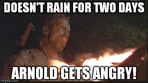
http://ticker.mesonet.org/archive/20150416/torch1.jpg
Calm down Arnold, it will rain again. You just concentrate on GETTING TO THE
CHOPPAH! In fact, that rain should begin again today out west and overspread the
state over the next few days, bringing with it a chance for severe weather and
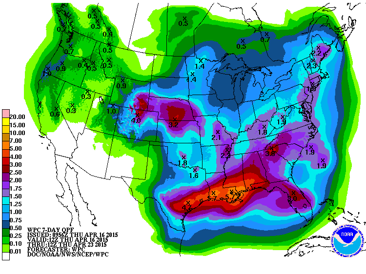
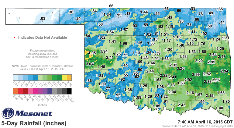
lots and LOTS of moisture. Check out the 7-day rainfall forecast totals. If this
happens, drought will suffer a significant dent when combined with the rain that
has already fallen.
http://ticker.mesonet.org/archive/20150416/7day-rain-forecast.gif
Keep in mind these totals were about doubled on yesterday's map, so these amounts
can and will change as the whole mess evolves from today through the weekend. The
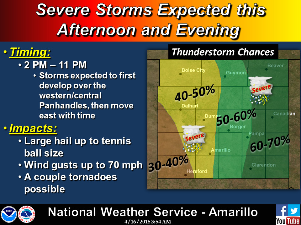
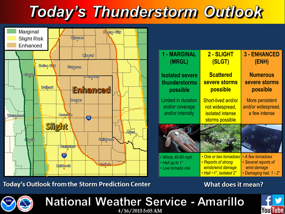
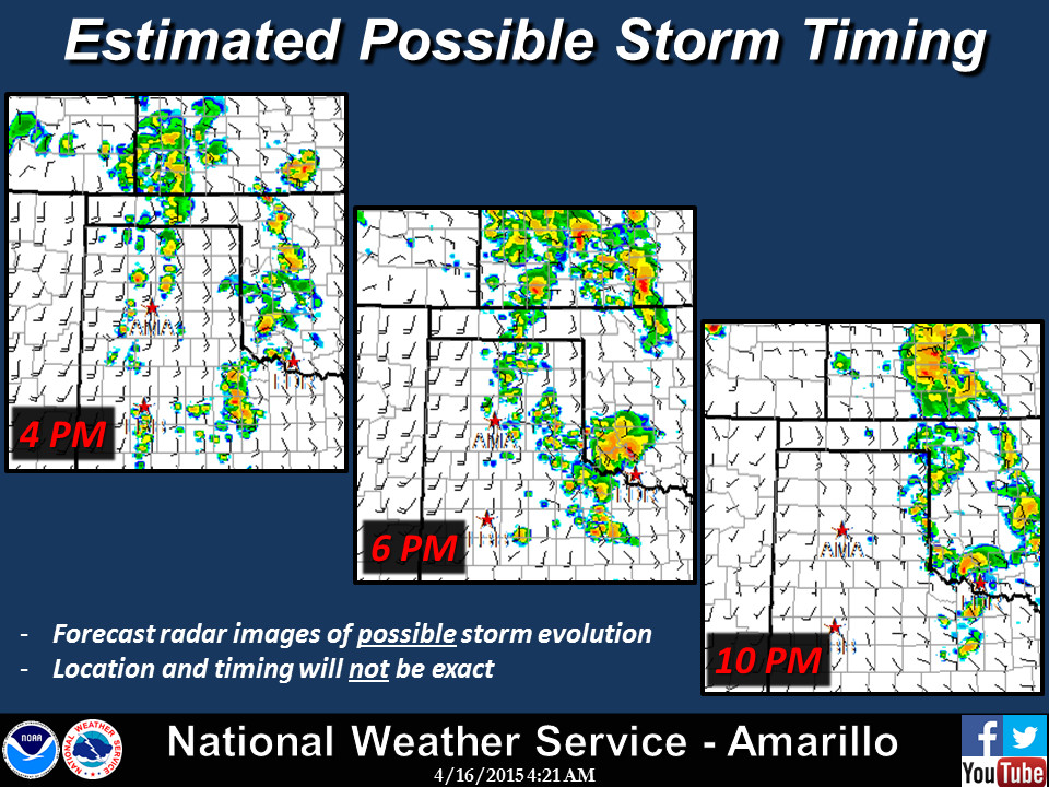
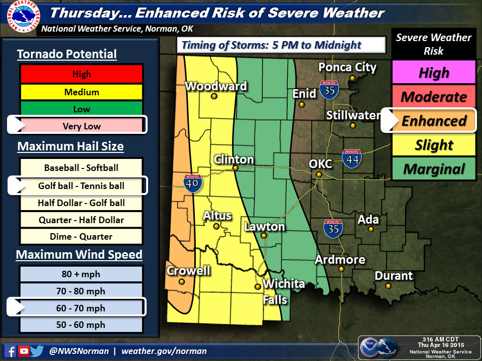
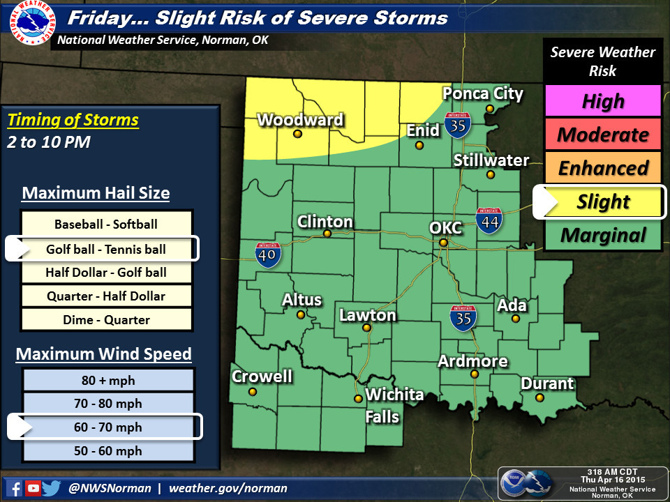
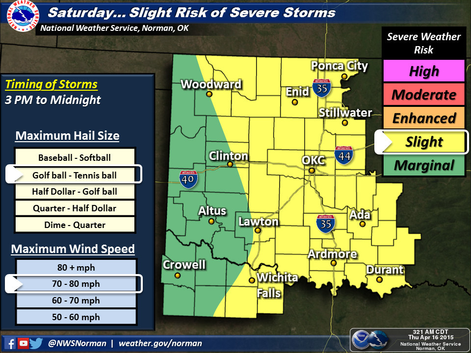
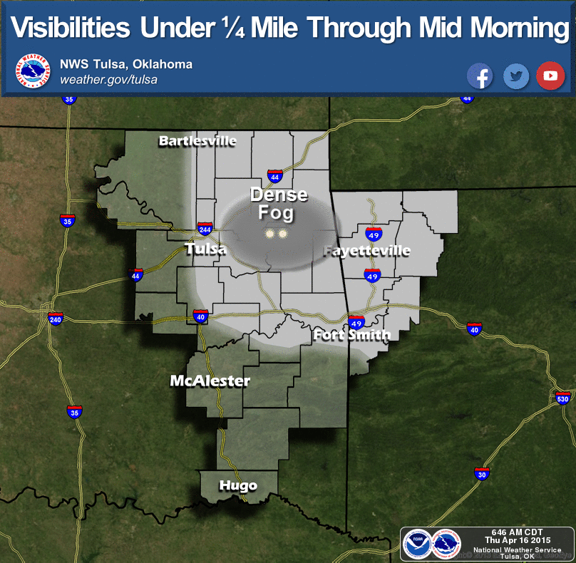
NWS offices give us the story on the severe risk and whatnot, so take a look at
their graphics. Tulsa clues us in on fog this morning across eastern Oklahoma. As
the Amarillo NWS graphics point out, there will be the possibility for a few
tornadoes out across the OK and TX Panhandles with an "enhanced" risk by the
Storm Prediction Center, so best to stay weather aware out that way.
http://ticker.mesonet.org/archive/20150416/nws-amarillo-svr1.jpg
http://ticker.mesonet.org/archive/20150416/nws-amarillo-svr2.jpg
http://ticker.mesonet.org/archive/20150416/nws-amarillo-svr3.jpg
http://ticker.mesonet.org/archive/20150416/nws-norman-svr-thur.jpg
http://ticker.mesonet.org/archive/20150416/nws-norman-svr-fri.jpg
http://ticker.mesonet.org/archive/20150416/nws-norman-svr-sat.jpg
http://ticker.mesonet.org/archive/20150416/nws-tulsa-fog.png
The NWS advises that the situation will have to be watched closely over the
next few days for the severe threat to increase, so as per usual, keep a close
eye on the forecasts from your favorite NWS office, media outlet or Arnold
Schwarzenegger movie.
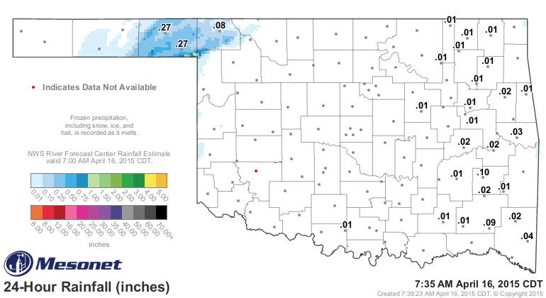
Speaking of Arnold and mud, it did rain in the Panhandle last night with some
pretty hefty storms. The totals were spotty, but that's better than what
they've been getting out that way. Most of the rain fell in Beaver and Harper
counties. Harper County is home to Buffalo, of course, the greatest place on
the planet. That 8 hundredths probably evaporated as soon as it fell.
http://ticker.mesonet.org/archive/20150416/rainrfc.24hr.png
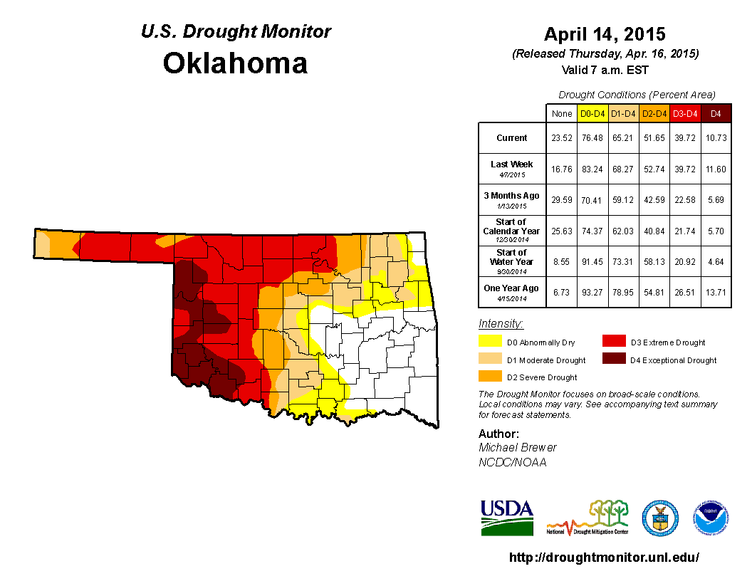
That will do little to help the more intense drought out in that area, but as
we continually say, it's a start! The new U.S. Drought Monitor released this
morning shows improvements from eastern Oklahoma now extending all the way
west into Oklahoma County, and as far north as Tulsa and Rogers counties. Those
counties now see "abnormally dry" D0 conditions replacing areas of moderate D1
drought. Remember, D0 is not a drought designation, but a precursor to drought,
or as in this case, an area coming out of drought.
http://ticker.mesonet.org/archive/20150416/20150414_OK_trd.png
Notice also that notch in the D4 out west in Roger Mills and Beckham counties.
That is a result of that 4-5 inches of rain that fell from the Texas Panhandle
through that area in Oklahoma earlier this week.
http://ticker.mesonet.org/archive/20150416/rainrfc.120hr.png
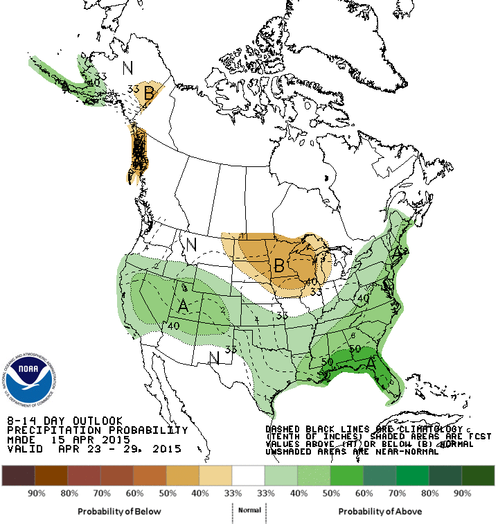
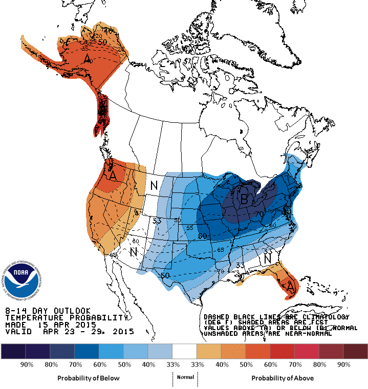
How about this next 7 days, which all appear to have chances (some bigger than
others, and for different areas) of rain? It does appear that there will be
increased chances for some rainy conditions across Oklahoma through the rest
of April, but also a bit cooler. Maybe that will reduce the risk for the severe
stuff?
http://ticker.mesonet.org/archive/20150416/apr23-29-precip-outlook.gif
http://ticker.mesonet.org/archive/20150416/apr23-29-temp-outlook.gif
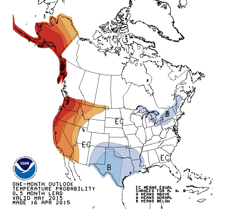
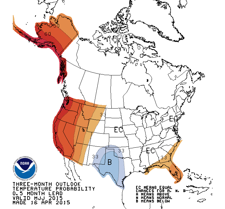
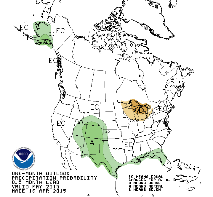
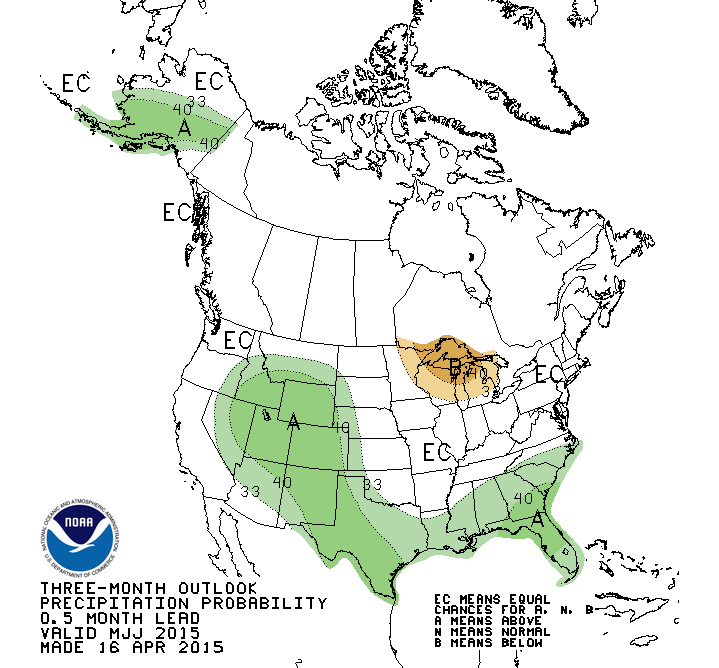
The May and May-July temperature outlooks give us increased odds of below normal
temperatures, which would also be a great thing. Cooler than normal weather
means less drought stress.
http://ticker.mesonet.org/archive/20150416/may-temp-outlook.gif
http://ticker.mesonet.org/archive/20150416/may-july-temp-outlook.gif
Combine that with increased odds of above normal precipitation for far western
Oklahoma and the Panhandle
http://ticker.mesonet.org/archive/20150416/may-precip-outlook.gif
http://ticker.mesonet.org/archive/20150416/may-july-precip-outlook.gif
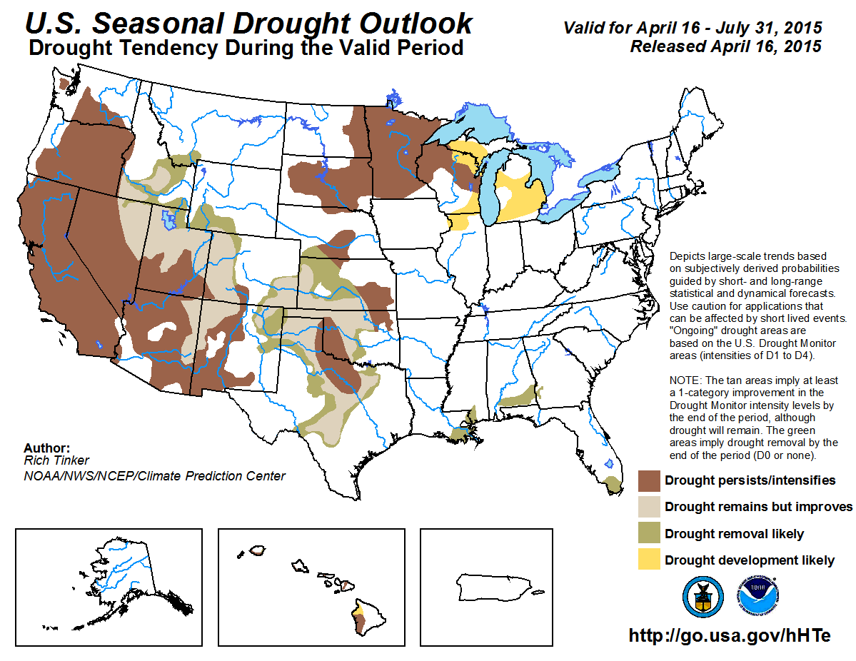
in addition to the fact that we are approaching the wettest part of the year
for Oklahoma climatologically, and you get a really nice looking Seasonal Drought
Outlook map.
http://ticker.mesonet.org/archive/20150416/season_drought.png
The forecasters at CPC think that we'll see drought improvement and even some
removal across much of Oklahoma. Unfortunately (only if it comes true), they
see that "core" area of drought in the Southern Plains, west central OK down
through NW Texas, as seeing drought either persist or intensify through July.
So good news for some, bad news for others. That core area remains the spot with
the worst soil moisture profile down to the lower depths, as well as the worst
reservoir problems.
We'll see. This is all based off the assumption (presumption??) that we'll see
normal May-June rainfall amounts that will keep drought on the run. It's off
to a good head start in April for some parts of the state, so why not extend it
through the rest of the rainy season?
Gary McManus
State Climatologist
Oklahoma Mesonet
Oklahoma Climatological Survey
(405) 325-2253
gmcmanus@mesonet.org
==================================================
The OCS/Mesonet Ticker
https://ticker.mesonet.org/
To subscribe or unsubscribe from the Ticker
or for questions about the Ticker or its content
Phone or Email the Ticker Manager at OCS
Phone: 405-325-2253 Email: ticker@mesonet.org
---------------------------------------------------
-C- Copyright 2024 Oklahoma Climatological Survey
===================================================
|


 Tweet
Tweet