MESONET TICKER ... MESONET TICKER ... MESONET TICKER ... MESONET TICKER ...
February 11, 2011 February 11, 2011 February 11, 2011 February 11, 2011
Listen, I don't want to sound like a broken record here ...
(ba-dum-bump! Thanks for coming! Be sure to tip your climatologists!)
Just a bit more on our record-setting weather of the last few days. Two new
all-time state records will stand tall before the man (NCDC) next week in an
effort to get those put in the official record books. The two records that have
possibly fallen are:
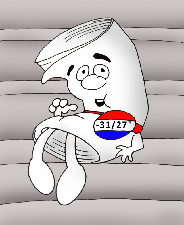
1) The state of Oklahoma's 24-hour snowfall record of 26 inches from Freedom
and Woodward, set during the blizzard of late-March 2009, has been surpassed by
the NWS COOP observing station at Spavinaw during the February 9 snowstorm.
The new record will be 27 inches.
2) The state's record low daily temperature of -27 degrees, set previously at
Vinita on February 13, 1905, and later tied at Watts on January 18, 1930, was
topped by the -31 degrees recorded at the Oklahoma Mesonet site in Nowata
February 10.
Both records will be reviewed by the State Climate Extremes Committee (SCEC).
The SCEC was created in 2006 in response to the need for proper and
comprehensive evaluation of meteorological observations which may have tied or
exceeded existing statewide all?time record values. That's a boiler-plate
explanation. Translation: to prevent multiple sets of records that have not
been fully explored and vetted.
ROLL TIDE!! (I kiddddddd, I kidddddd)
At any rate, I believe both records have an excellent chance at becoming
official. NWS folks in Tulsa have said the observer in Spavinaw is exemplary,
and the Mesonet's siting and quality-assurance measures are some of the best
in the world (we have the awards to prove it!).
So while I hope and I pray that they will, today they are still just preliminary
records.
http://ticker.mesonet.org/archive/20110211/just-a-prelim_record.jpg
*******************************************************************************
What a difference a day makes!
It's been a long time since I played with Crayons. At least a week. But let's
look at some maps and forget the numbers, just look at the colors.
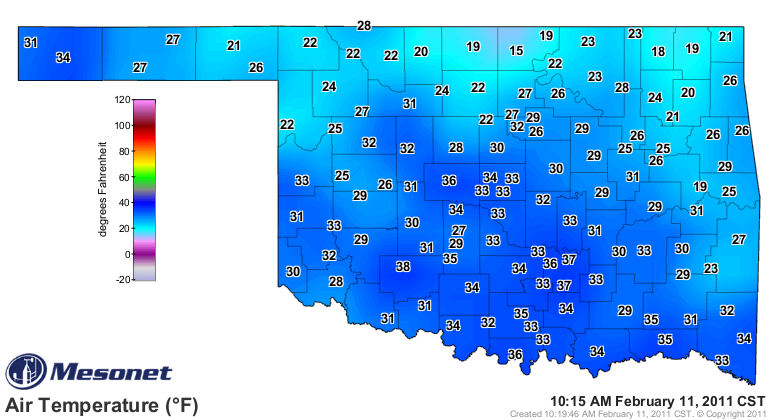
When your current temperature map is blue:
http://ticker.mesonet.org/archive/20110211/current.TAIR.grad.png
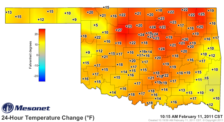
and the 24-hour temperature-change map is red:
http://ticker.mesonet.org/archive/20110211/current.TAIR_24H.grad.png
then that is a good indication that it was a tad chilly 24 hours ago.
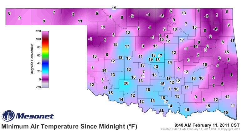
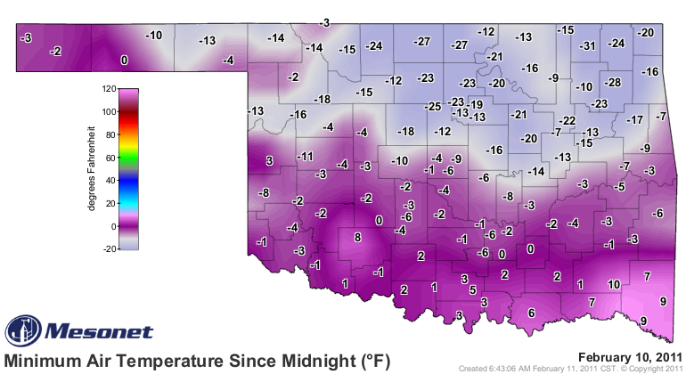
today: http://ticker.mesonet.org/archive/20110211/today.TAIR.min.grad.png
yesterday: http://ticker.mesonet.org/archive/20110211/yesterday.TAIR.min.grad.png
Gary McManus
Associate State Climatologist
Oklahoma Climatological Survey
(405) 325-2253
gmcmanus@mesonet.org
==================================================
The OCS/Mesonet Ticker
https://ticker.mesonet.org/
To subscribe or unsubscribe from the Ticker
or for questions about the Ticker or its content
Phone or Email the Ticker Manager at OCS
Phone: 405-325-2253 Email: ticker@mesonet.org
---------------------------------------------------
-C- Copyright 2024 Oklahoma Climatological Survey
===================================================
|


 Tweet
Tweet