MESONET TICKER ... MESONET TICKER ... MESONET TICKER ... MESONET TICKER ...
June 25, 2024 June 25, 2024 June 25, 2024 June 25, 2024
Summer Festivus
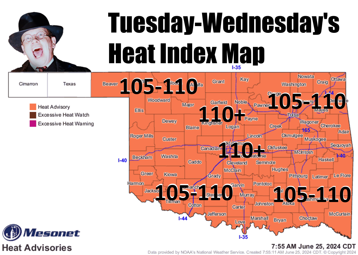
https://ticker.mesonet.org/archive/20240625/latest.oklahoma.heat.png
You know what happened to that guy right after that, right? No amount of Clearasil
in the world could help him after that. The sad thing was that he STILL had more
hair than me. That's okay, unmelted face > melted face with hair, at least in my
book. Better to NOT have hair today (keep telling yourself...I mean myself, that)
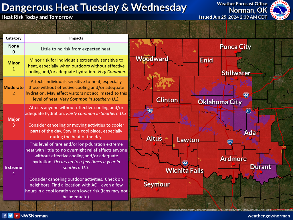
and tomorrow with the heat blazing down creating dangerous conditions for those
working or playing outside. In some cases, the heat danger will be extreme.
https://ticker.mesonet.org/archive/20240625/nws-norman-tue-wed-heat.png
https://ticker.mesonet.org/archive/20240625/nws-tulsa-heat.png
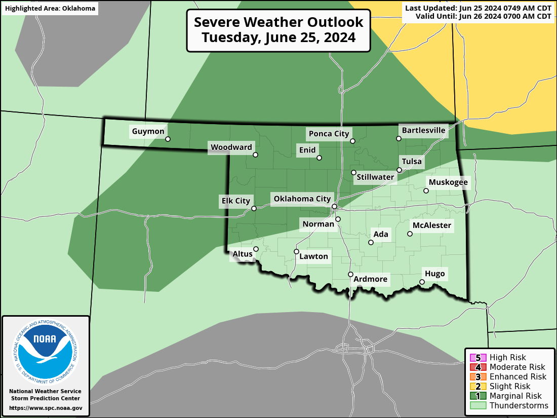
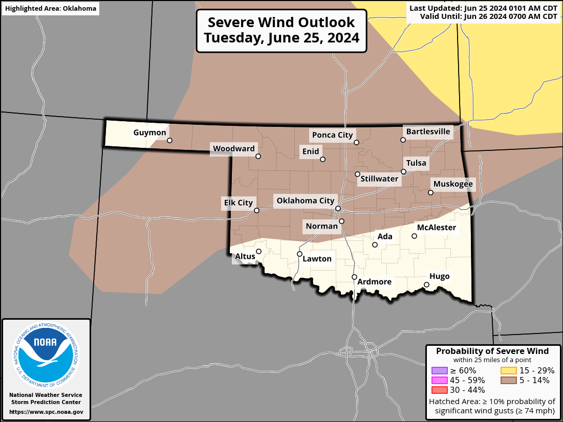
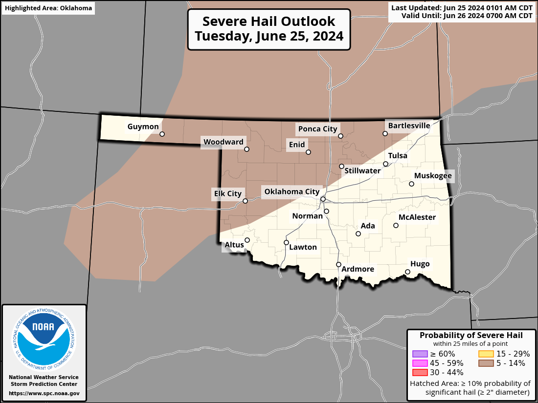
Luckily, there will be a chance of rain tonight. Unluckily, some of the storms,
mainly across northern OK, will have a chance to be severe with gusts of up to
80 mph being the biggest threat.
https://ticker.mesonet.org/archive/20240625/OK_swody1.png
https://ticker.mesonet.org/archive/20240625/OK_swody1_WIND.png
https://ticker.mesonet.org/archive/20240625/OK_swody1_HAIL.png
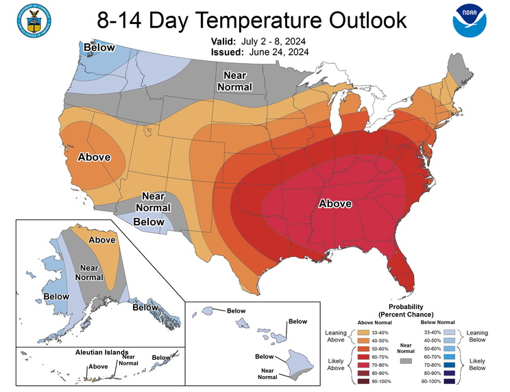
Ahhh, there's nothing more refreshing after a day of heat indexes of 110 degrees
than some 80 mph winds blowing in your face. It's like a giant hair drier (why
you gotta hurt me like that?)! Still seeing no indications of long-term
relief from the heat, at least for the next week to 10 days.
https://ticker.mesonet.org/archive/20240625/july2-8-temp-outlook.png
Minor perturbations (English to Okie dictionary: ups and downs), sure, but
not a major pattern change as long as that heat dome is camped over the Southern
U.S. Maybe a hint of more rain this weekend, then right around July 4?
No, I'm asking you. Maybe?
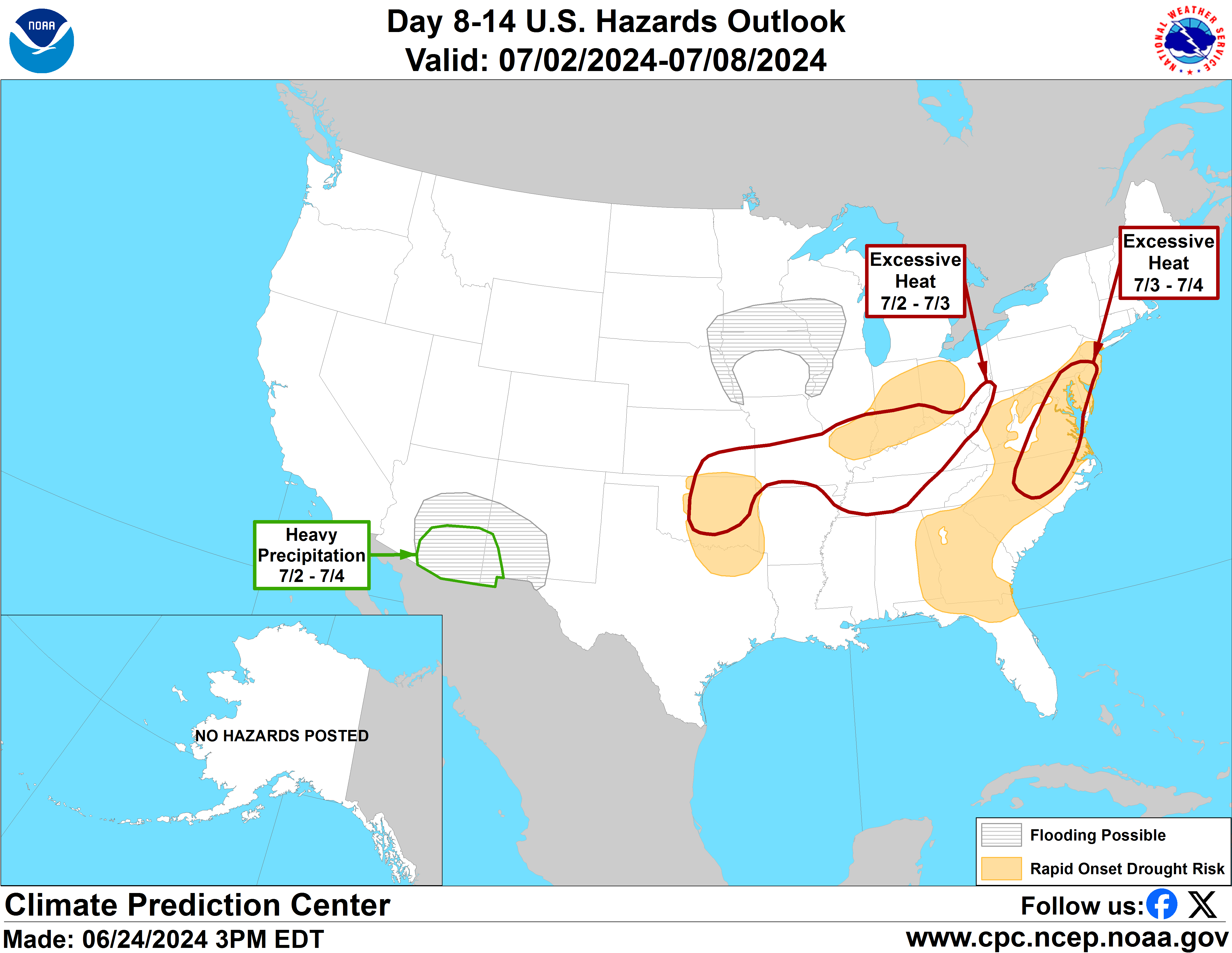
What I'm mainly concerned about is the price of Pop-Tarts. But also the
development of flash drought across the state. Even the Federal folks have
painted the eastern half of the state with a "rapid onset drought risk" (i.e.,
flash drought), although I don't believe the danger is confined to just that
area of the state.
https://ticker.mesonet.org/archive/20240625/hazards_d8_14_contours.png
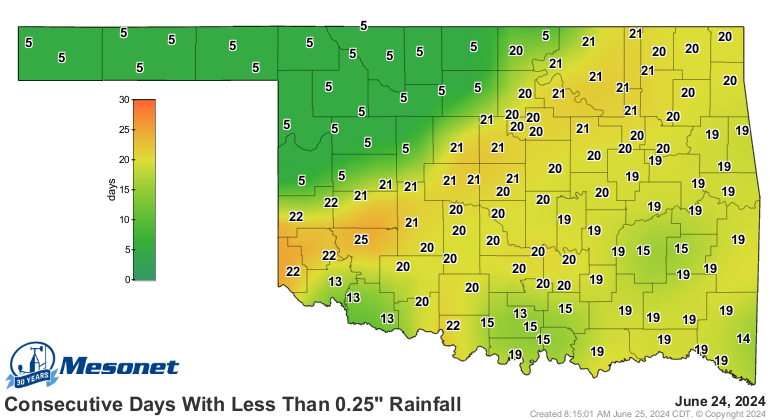
It's creeping in, alright. You can see it on the Mesonet's days without at least
a quarter-inch of rain map.
https://ticker.mesonet.org/archive/20240625/mesonet.rainfall.quarterinch.png
More on (I resemble that remark...sound it out) that in the next couple of days.
Nothing worse than early-onset swelter.
Gary McManus
State Climatologist
Oklahoma Mesonet
Oklahoma Climatological Survey
gmcmanus@ou.edu
==================================================
The OCS/Mesonet Ticker
https://ticker.mesonet.org/
To subscribe or unsubscribe from the Ticker
or for questions about the Ticker or its content
Phone or Email the Ticker Manager at OCS
Phone: 405-325-2253 Email: ticker@mesonet.org
---------------------------------------------------
-C- Copyright 2024 Oklahoma Climatological Survey
===================================================
|


 Tweet
Tweet