
Ticker for October 19, 2026
MESONET TICKER ... MESONET TICKER ... MESONET TICKER ... MESONET TICKER ...
October 19, 2026 October 19, 2026 October 19, 2026 October 19, 2026
Super or Supder Duper?
I've definitely El Nino'd you to death by now, but when the 800-lb gorilla ain't
going away, neither is the discussion. I mean, we could just talk about why
folks wait right until the movie starts at the theater to go to the concession
stand, but that's a 799-lb orangutan.
By the way, if you are one of those people...reach out. I want to know what's up.
But we're here to talk about our upcoming weather, whether that means near-term
weather, or long-term wheather. Whether. Okay, weather.
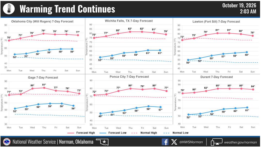
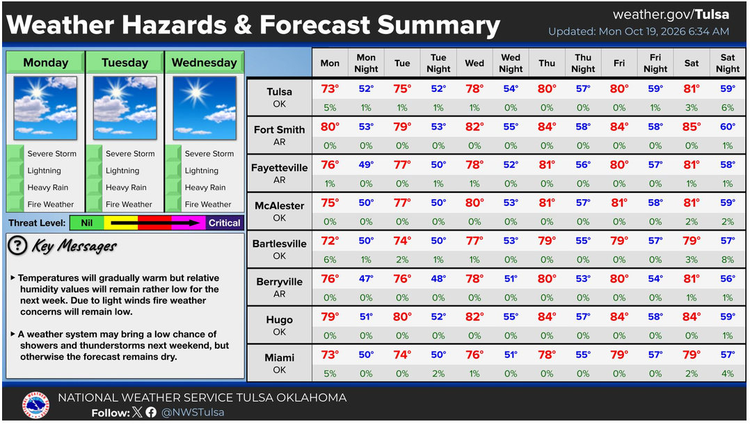
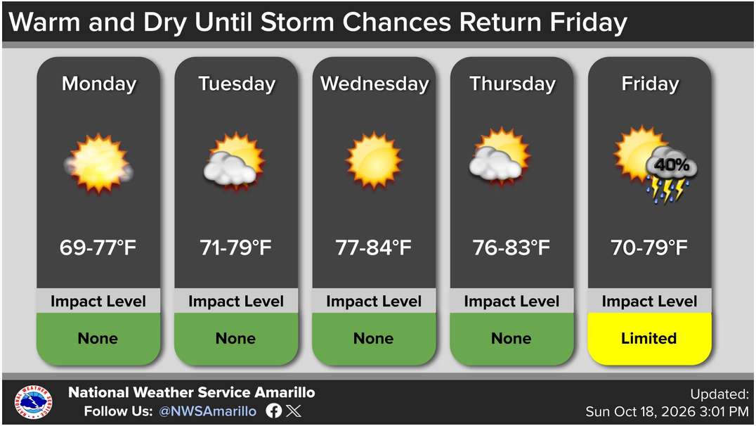
Near-term...nice and sunny with normal-to-above normal temps until our next
chance of rain with a sorta-cool front this weekend.
And of course, this is coming on the heels of our bigtime rainfall event last
week which saw gargantuan amounts of rain from west-central through central
Oklahoma.
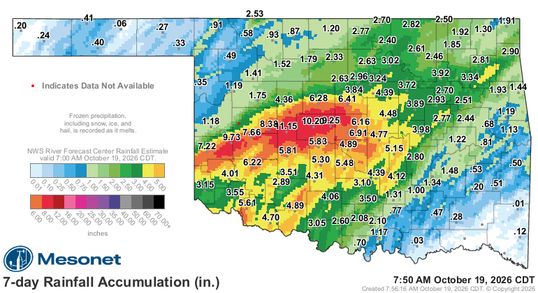
ZOUNDS, but that's a lot of rainfall. And that was WITHOUT Simon's help, which
sort of just wandered out into the Pacific and died instead of getting caught
up in that giant trough and enhancing our rainfall. Probably a good thing.
Looking ahead, one of--if not THE--biggest driver of our weather will probably
remain that very strong-to-"historic" El Nino out across the Pacific. I don't
want to get technical here, but I didn't want all that cheese last night either,
so what choice do I have??
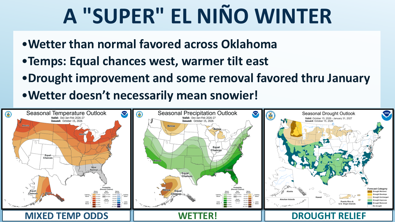
El Niño has plenty left in the tank! CPC says the tropical Pacific’s unusually
warm water extends hundreds of feet below the surface, providing more fuel for
this event. The atmosphere is responding, too, with weakened trade winds and a
shift in tropical thunderstorm activity. Forecasters expect this very strong El
Niño to heavily influence our outlooks through next spring.
For Oklahoma, the potential payoff comes through the storm track. El Niño tends
to strengthen and extend the Pacific jet stream farther south and east, giving
storm systems a more favorable route across the southern United States. That
provides more opportunities for moisture, helping explain the wetter winter
outlook and the prospects for drought improvement (well, through January). I
believe we can find a use for that!
Temperatures are a tougher call. The forecast models and past strong El Niños
show a wider range of temperature outcomes across the Southern Plains. That’s
why parts of our region get the “equal chances” treatment. There’s no clear
favorite among a colder-than-normal, near-normal or warmer-than-normal winter.
A powerful El Niño can have a strong influence without making every part of the
forecast obvious.
And yes, more opportunities for moisture can include winter storms. What falls
will depend on the track of each storm and where the cold air is when it
arrives. Snow lovers will still have to take this one storm at a time. El Niño
can help supply the ingredients, but we’ll have to see what Mother Nature cooks
up.
Want snow? Well, we're going to forget to add a bit of cold air above the
surface...you get ice. Boo.
Want rain? Oops, we added too much cold air. You get snow. Oops again, we
forgot to add it near the surface...you get an ice storm.
Remember this graphic? It's coming!
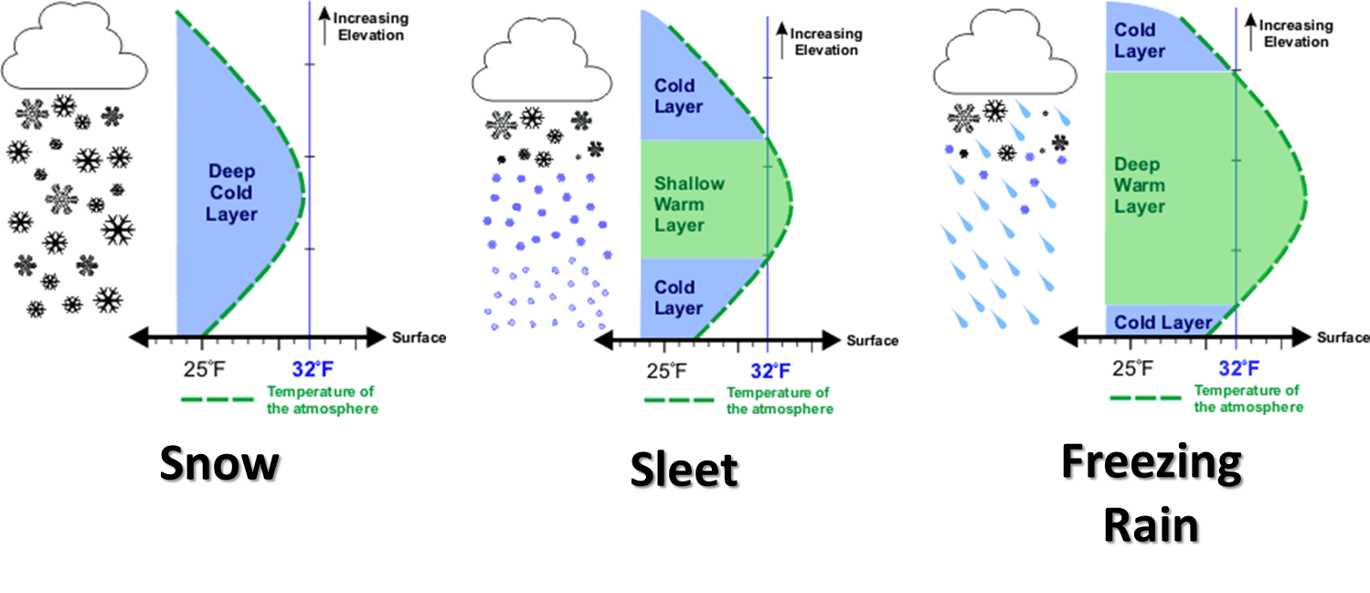
And that one will get you this one.

But we're happy to see that possible wet December-January outlook. That's
something we can work with. Probably work out better than that cheese did.
Gary McManus
State Climatologist
Oklahoma Mesonet
Oklahoma Climate Survey
gmcmanus@ou.edu
October 19 in Mesonet History
| Record | Value | Station | Year |
|---|---|---|---|
| Maximum Temperature | 94°F | BEAV | 2003 |
| Minimum Temperature | 17°F | NOWA | 2022 |
| Maximum Rainfall | 2.73 inches | WAUR | 2016 |
Mesonet records begin in 1994.
Search by Date
If you're a bit off, don't worry, because just like horseshoes, “almost” counts on the Ticker website!