
Ticker for July 29, 2026
MESONET TICKER ... MESONET TICKER ... MESONET TICKER ... MESONET TICKER ...
July 29, 2026 July 29, 2026 July 29, 2026 July 29, 2026
Red hots
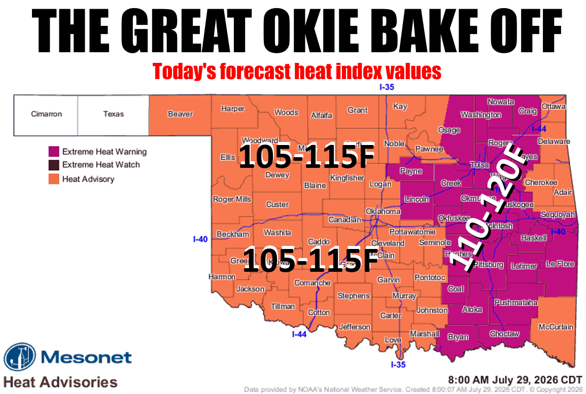
Grave danger today with the heat.
Grave danger? You said danger. I said "grave danger?" You said "Is there any
other kind?"
I could have the court reporter read it back to you...
But yes, yet another day with dangerous heat around. Much like yesterday (and
the day before that, and the day before that, and so on, and so on...buy Prell
Shampoo!).
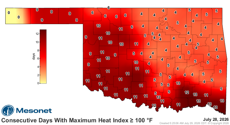
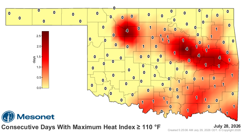
And it's gonna be that way for a few more days until we cool off this weekend.
Then back to the heat, of course. What more could you expect from August?
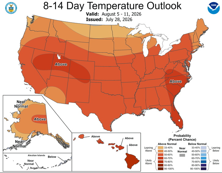
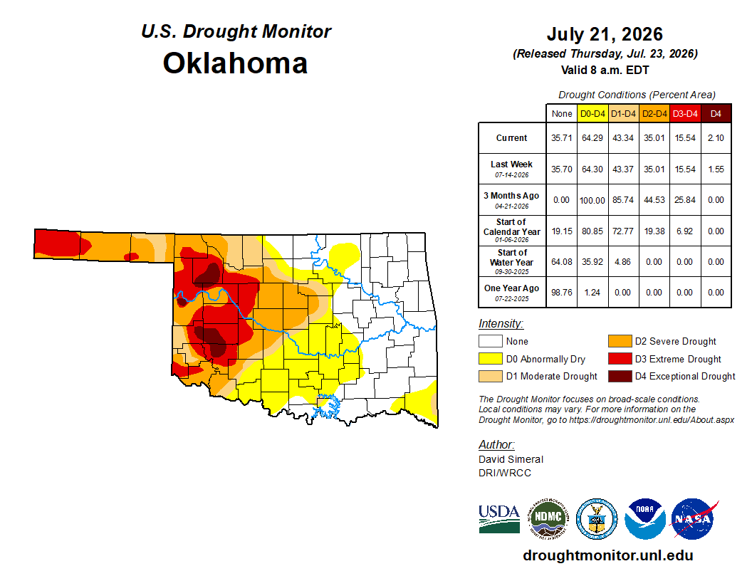
So the temperatures are what they are (SCIENCE!), but what I'm looking at is
the possibility for flash drought, at least in those areas that have been
relieved of that hazard over the last few months. You can see those areas in
the white (D-nada) and yellow (D0-Abnormally Dry Conditions...NOT a drought
designation by the Drought Monitor).
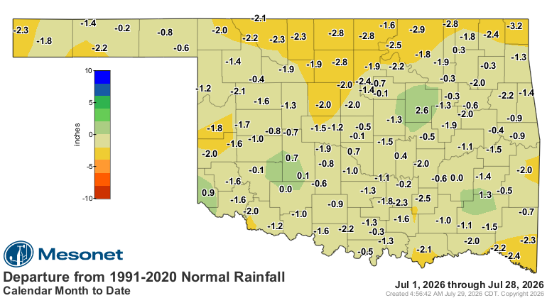
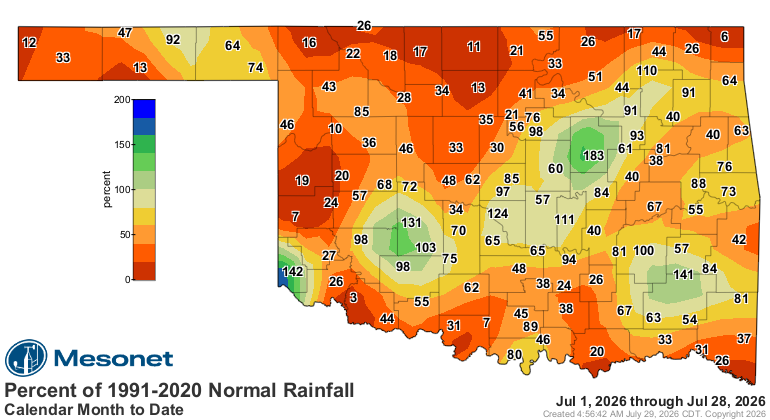
Because July has done gone all July on us. Look at these pathetic rainfall maps
for the month thus far.
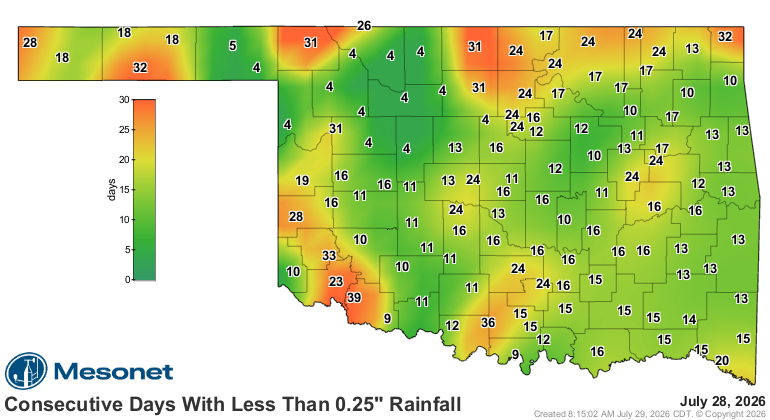
That's compounded by the significant-rainless streak we're currently seeing
across parts of the state.
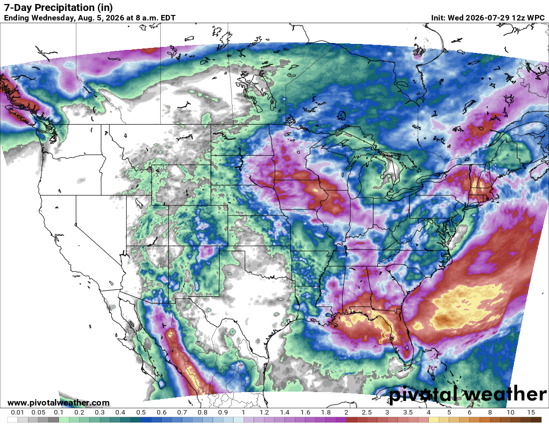
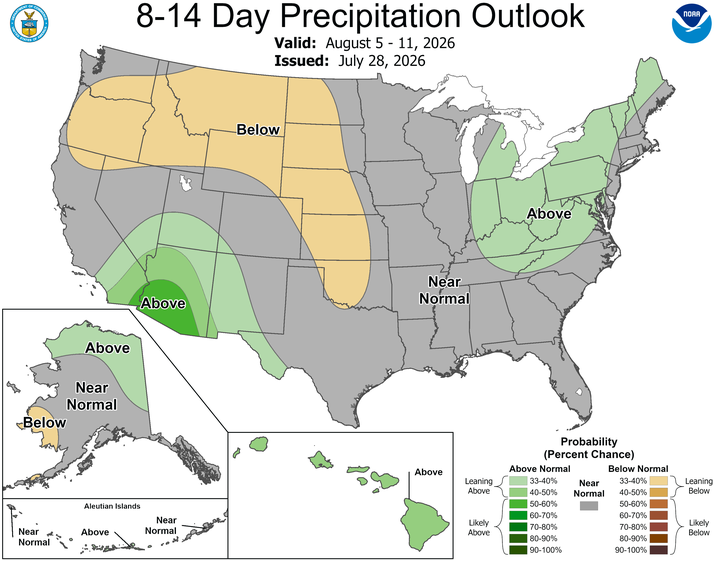
And compounded COMPOUNDED by our rainfall forecast, which for us here in
Oklahoma is still dominated by that HEAT DOME OF TERROR for now, with a few
chances for showers as it drifts to the west. But nothing major showing up.
Heck, I'd settle for something lieutenant showing up at this point!
Heat and drought go hand in hand. If only they were going away.
Gary McManus
State Climatologist
Oklahoma Mesonet
Oklahoma Climate Survey
gmcmanus@ou.edu
July 29 in Mesonet History
| Record | Value | Station | Year |
|---|---|---|---|
| Maximum Temperature | 110°F | INOL | 2012 |
| Minimum Temperature | 51°F | BEAV | 2005 |
| Maximum Rainfall | 4.67 inches | OKMU | 2020 |
Mesonet records begin in 1994.
Search by Date
If you're a bit off, don't worry, because just like horseshoes, “almost” counts on the Ticker website!