
Ticker for July 22, 2026
MESONET TICKER ... MESONET TICKER ... MESONET TICKER ... MESONET TICKER ...
July 22, 2026 July 22, 2026 July 22, 2026 July 22, 2026
Woe begone
I miss the days of my youth (and the days of my hair) growing up in the High
Plains of far NW OK where you can go out at sunset in the dry air of a fading
hot summer day and feel the beginnings of a relatively cool summer night in the
offing.
Instead, downstate here in central Oklahoma, I walk outside AFTER sunset at 10 pm
and get assaulted by air so thick you need scuba gear to breathe, with a sudden
sheen of sweat to boot.
I mean, there's gotta be a better way! And before you say "move back to Buffalo,"
well, they didn't exactly fare that much better yesterday.
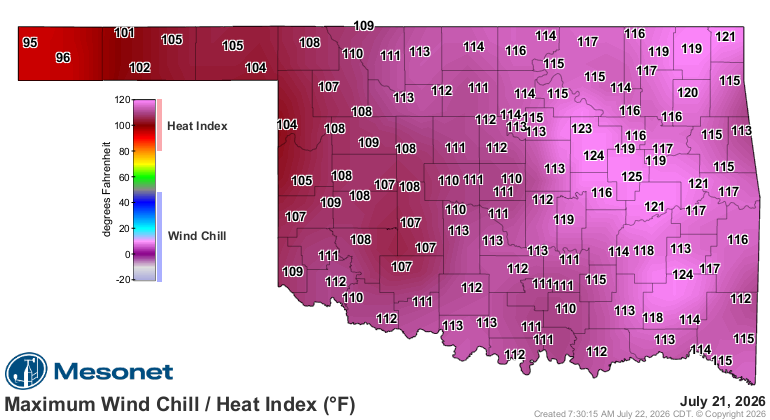
But their 108F heat index is a darn sight better than the 115-125s we saw all
across the eastern half of the state. And only slightly better than the 110+
that almost everybody had.
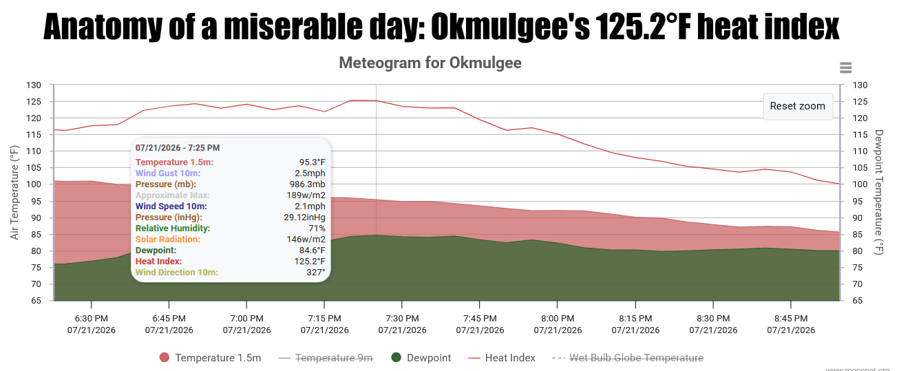
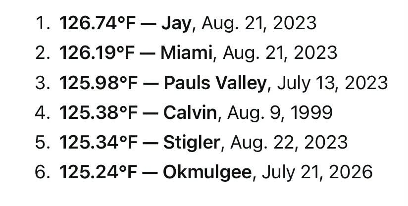
That 125.2F is significant, to say the least. Oh, you're still making your own
gravy, but that gravy is way too runny in that type of heat. Okmulgee's mark
yesterday actually ends up at settling at 125.24F, the 6th-highest daily max
heat index in Mesonet history. Tops remains Jay’s 126.74F back on Aug. 21,
2023. Mesonet heat index records go back to 1997.
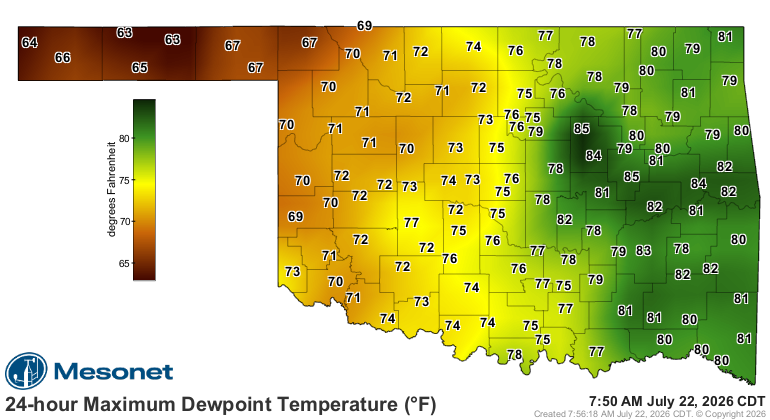
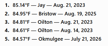
As you can see in the top graphic, that was a combination of an actual air
temp of 95.3F, and a nasty dewpoint of 84.57F, which itself becomes the fifth-
highest dewpoint on record for the Mesonet, just a smidge behind Jay's top mark
of 85.14 from Aug 21, 2023 (which was also the top heat index site and day, as
noted above).
And let's not overlook Fairview's 110F actual air temp from yesterday, which is
the highest we've seen on the Mesonet since Hooker hit 111F last Aug. 8.
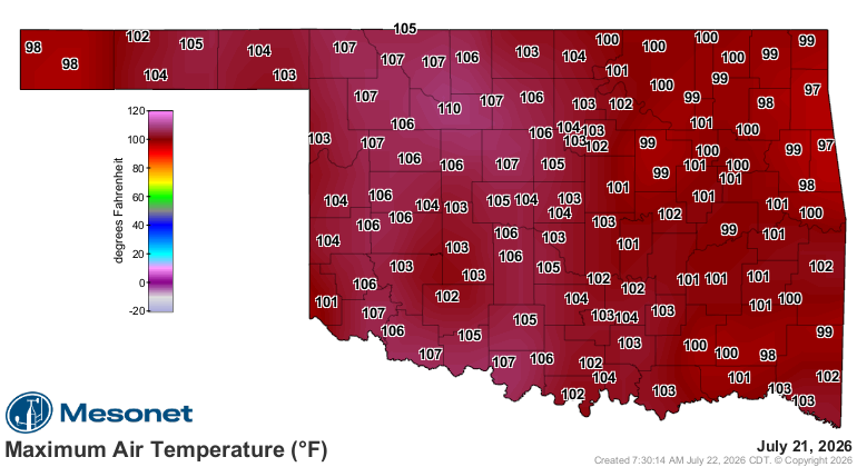
That was only good for a heat index of 113F. HA! Amateurs.
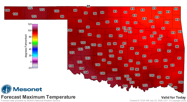
The good news is we've had a bit of a backdoor "cold" front from the northeast
that will keep NE OK much cooler than yesterday, and push the high heat index
values down to the Red River.
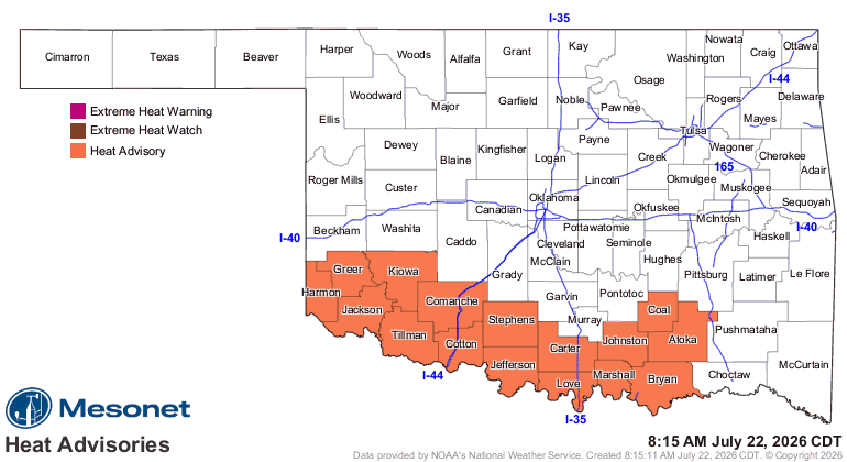
A couple of days of milder weather will have to get you by because the heat
comes quickly back by the weekend and looks to stay for at least another week.
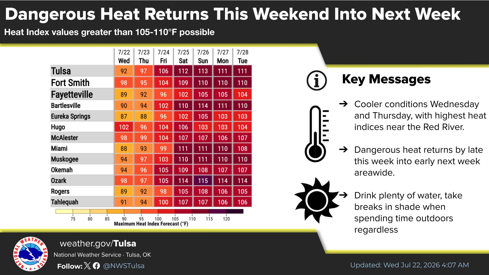
But doesn't this map look nice?
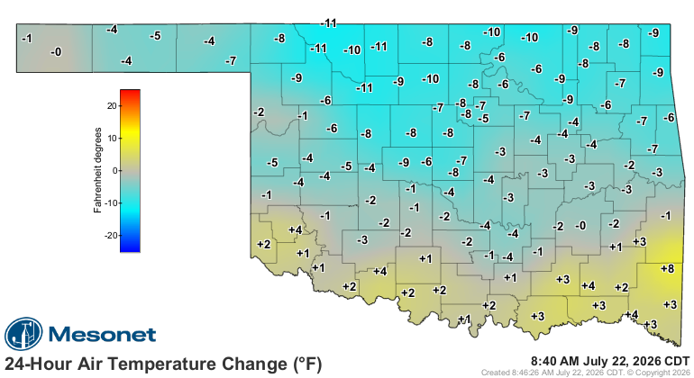
Yes. Yes it does.
Gary McManus
State Climatologist
Oklahoma Mesonet
Oklahoma Climate Survey
gmcmanus@ou.edu
July 22 in Mesonet History
| Record | Value | Station | Year |
|---|---|---|---|
| Maximum Temperature | 112°F | GRA2 | 2018 |
| Minimum Temperature | 56°F | GOOD | 2006 |
| Maximum Rainfall | 2.75 inches | BEAV | 2015 |
Mesonet records begin in 1994.
Search by Date
If you're a bit off, don't worry, because just like horseshoes, “almost” counts on the Ticker website!