
Ticker for July 16, 2026
MESONET TICKER ... MESONET TICKER ... MESONET TICKER ... MESONET TICKER ...
July 16, 2026 July 16, 2026 July 16, 2026 July 16, 2026
Thar she blows!
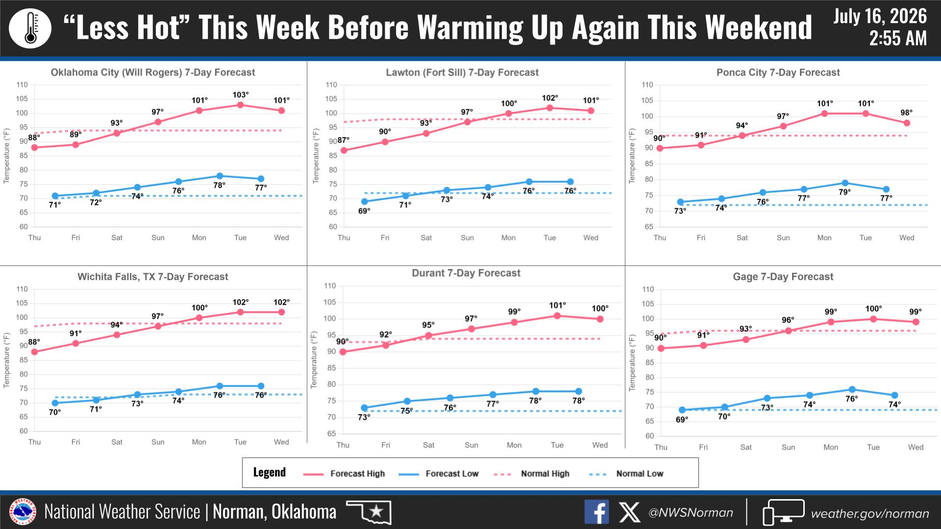
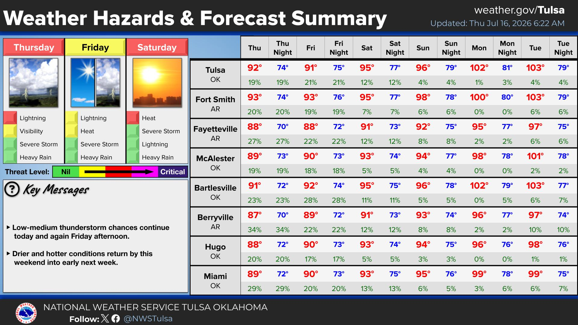
Not a lot on the current weather...it's hot and humid, but it's gonna get hotter
and humider. Humiditier. Oh, more humid. It's summer. DUH!
Now was I the only one excited enough to be sitting here all morning watching for
the new seasonal outlooks from CPC? Was I the only one, excited or non-excited?
Well, probably, but that's the life of a jet-setting (more like bus-setting),
always looking for danger (or a comfy couch more likely) State Climatologist. We
all understand by now that a strong or very strong El Nino is very likely is
coming this fall through early spring. Maybe the strongest El Nino on record.
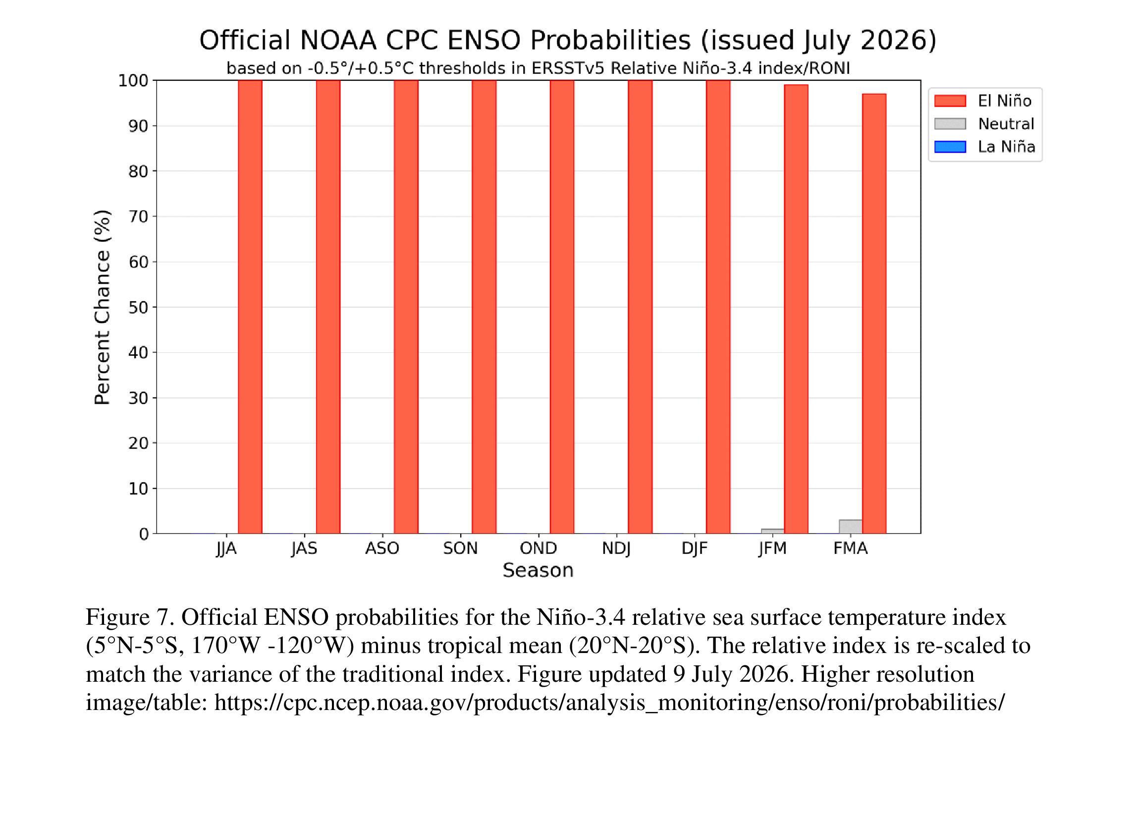
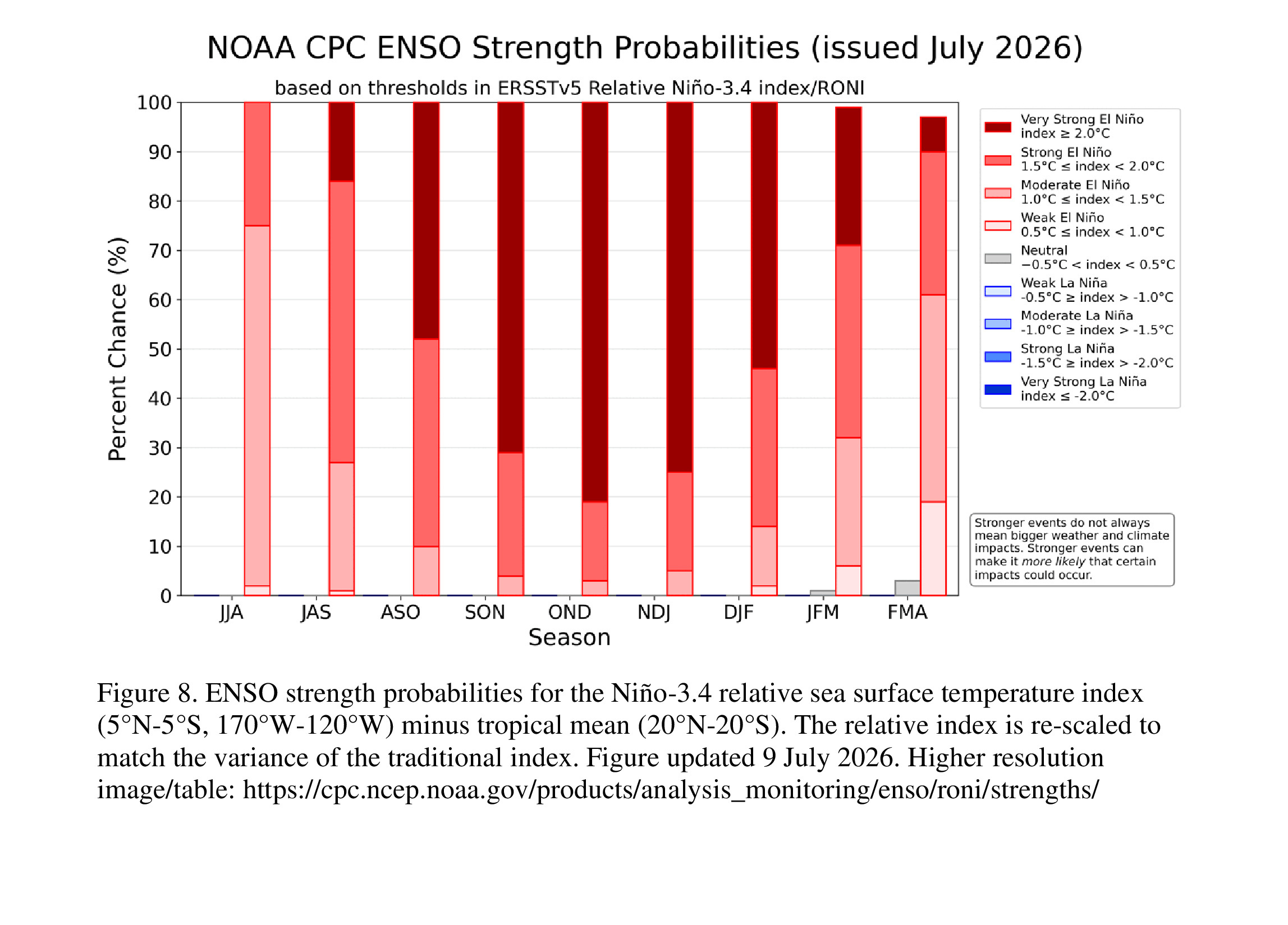
Heck, it's a moderate El Nino right now, for crying out loud! We've talked
about this a lot, but it won't have too much influence on us at this point in
the summer, but once we get back to the Land of Milk and Jet Streams point in
the fall, that's when we could see that influence, and it's starting to show
up pretty significantly in the latest outlooks released by CPC just this morning.
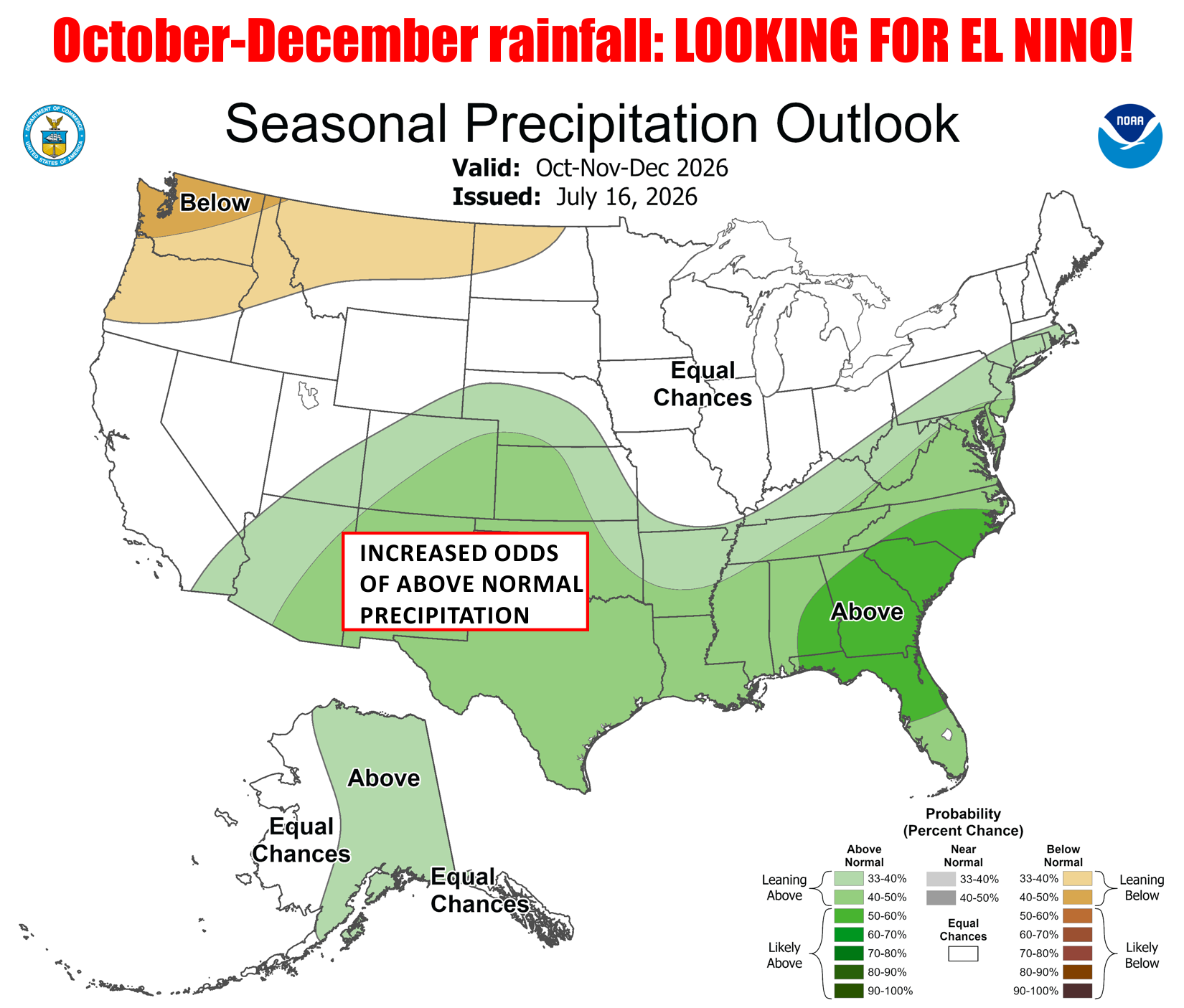
I'll just obliterate you with all the outlooks at once, starting with Sep-Nov
2026 on the upper-left to Aug-Oct 2027 on the lower right. Discount those that
go deep into next year, but check out the evolution of the green "increased
odds of above normal precipitation" areas on those coming this fall through
winter. The Sep-Nov 2026 image is dominated by a strong monsoon across the
High Plains of our Panhandle and far western Oklahoma, but then we see that
area shift through at least early spring of 2027 across parts or all of Oklahoma.
That tracks with the expected precipitation anomalies associated with a strong-
to-very strong El Nino.
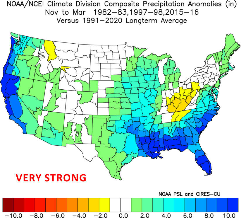
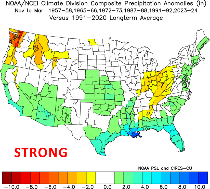
No, it's not a guarantee, even in the outlooks, but the strength of the El Nino
increases the odds of typical impacts occurring, and that's what the outlooks
reflect with regards to the last two figures.
Why's it matter? Well, because of this.
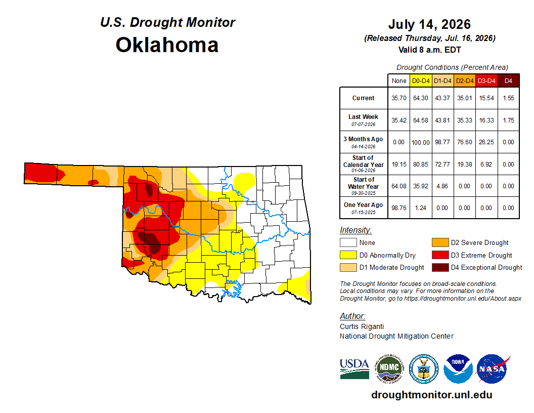
We obviously still need help in ending that drought across western Oklahoma,
even as we're cautiously watching for it to possibly spread back to the east
if we're not careful. But also to stop what we've seen with all these La Ninas
over the last 25 years being drought-starters.
Gary McManus
State Climatologist
Oklahoma Mesonet
Oklahoma Climate Survey
gmcmanus@ou.edu
July 16 in Mesonet History
| Record | Value | Station | Year |
|---|---|---|---|
| Maximum Temperature | 109°F | HOLL | 2001 |
| Minimum Temperature | 51°F | JAYX | 2014 |
| Maximum Rainfall | 3.82 inches | ALTU | 2014 |
Mesonet records begin in 1994.
Search by Date
If you're a bit off, don't worry, because just like horseshoes, “almost” counts on the Ticker website!