Ticker for April 17, 2026
MESONET TICKER ... MESONET TICKER ... MESONET TICKER ... MESONET TICKER ...
April 17, 2026 April 17, 2026 April 17, 2026 April 17, 2026
Doink
Nooooooo, it's Friday! You'll never get me to Tock! Okay, maybe this once since we
have something to Tick about. Pretty simple scenario that's really complicated.
Uh huh.
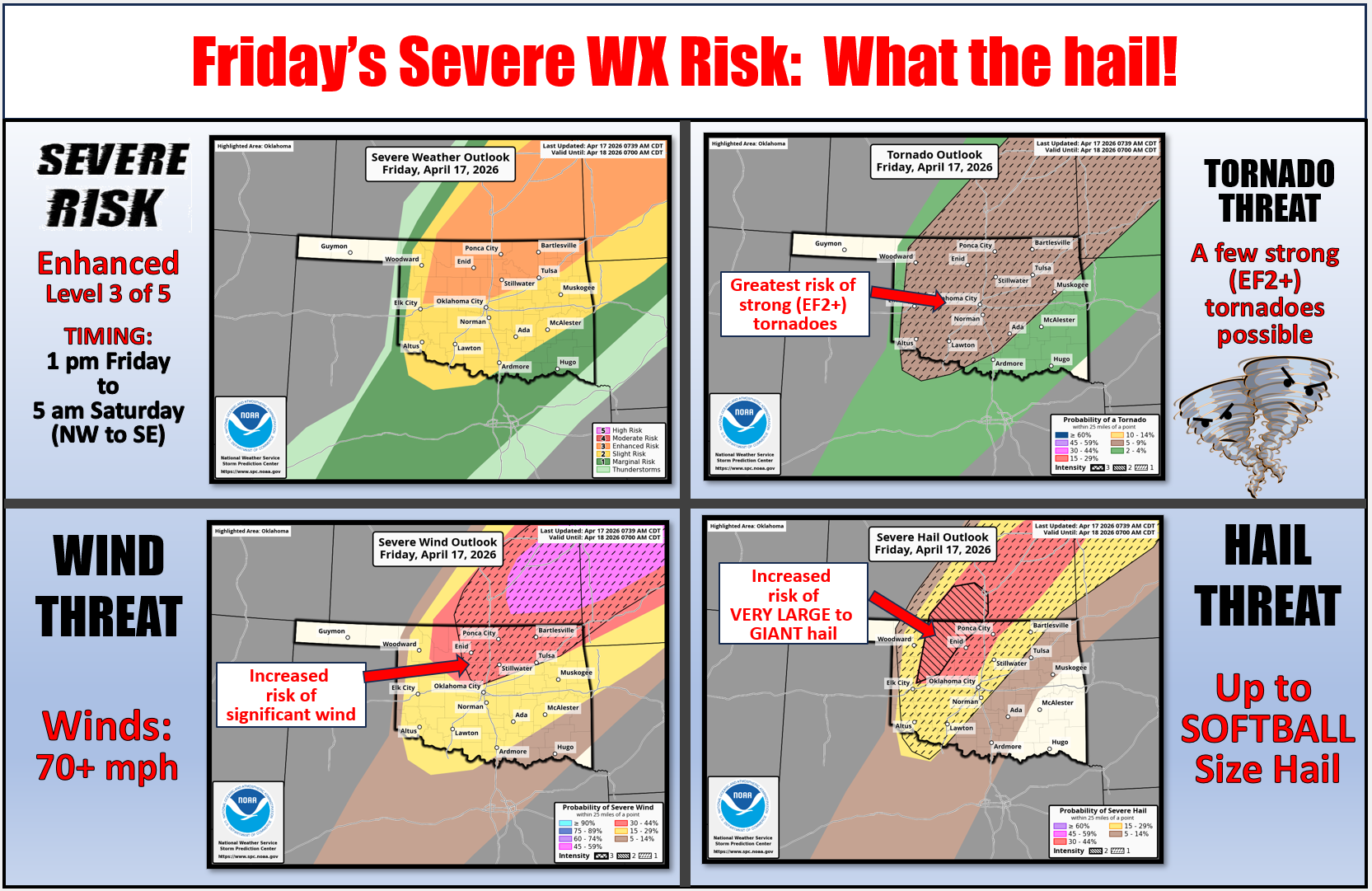
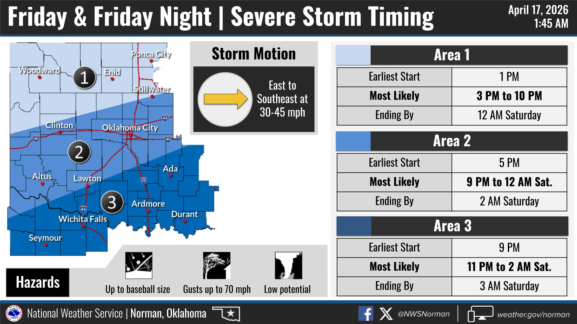
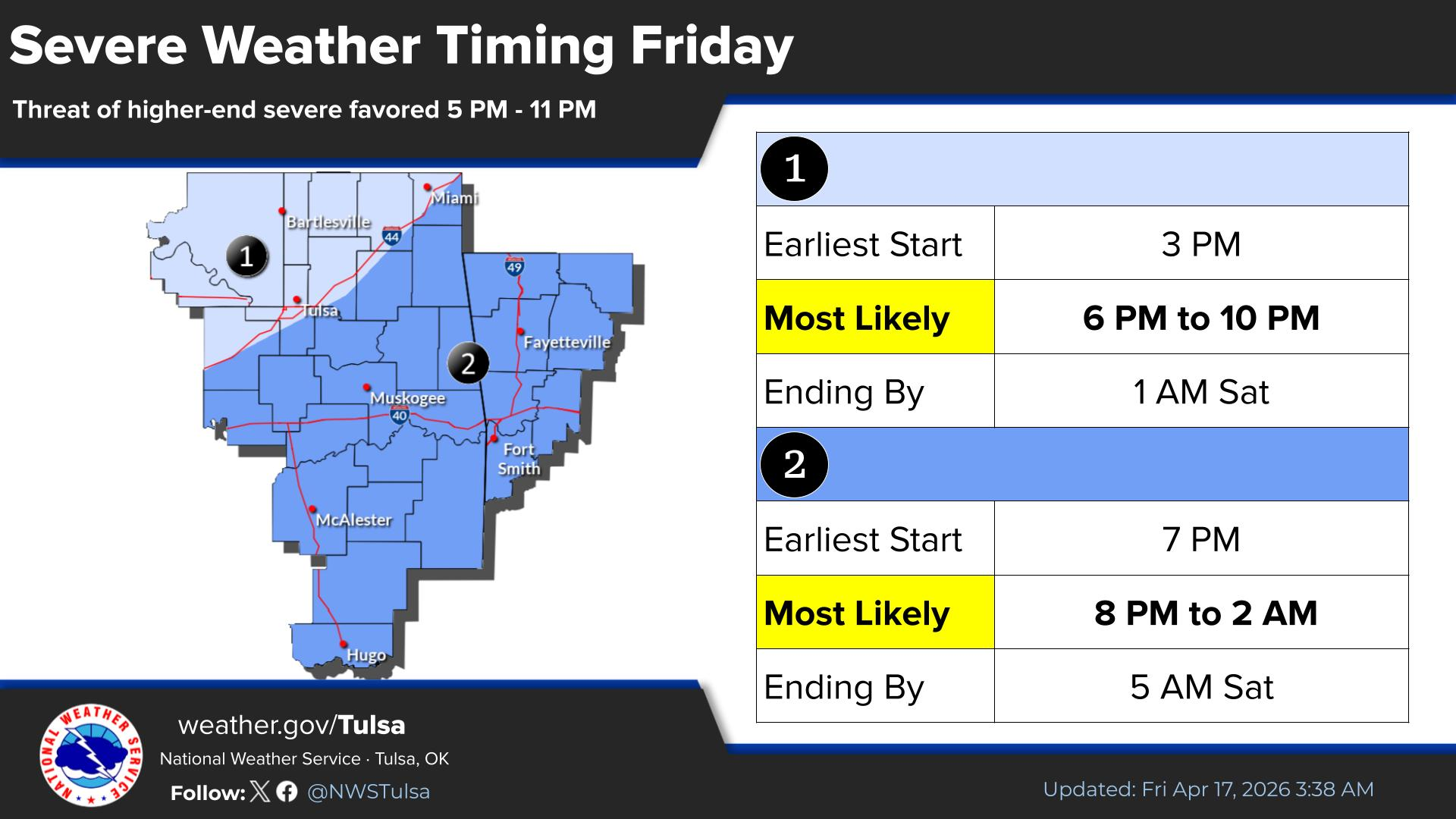
So we have a strong cold front barreling down from the NW, and a dryline to the
west, and then a possible low pressure system forming out near the Panhandle.
Close to that triple point of the dryline, cold front, and surface low associated
with that setup, we'll see an enhanced area of severe risk with some bigtime hail
risk up to the size of softballs. We'll also see a risk of EF2+ tornadoes from
NW into central OK as the day unfolds, both from supercells off the dryline to
the storms that form along the front later. The latter will be those QLCS quick
spin-up variety, but still damaging nonetheless.
Timing is early afternoon through tomorrow morning from NW to SE.
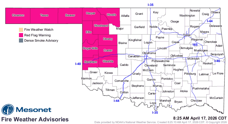
And as we've seen all week, to the west of that dryline the fire weather is
gonna be heightened so we have a Red Flag Fire warning.
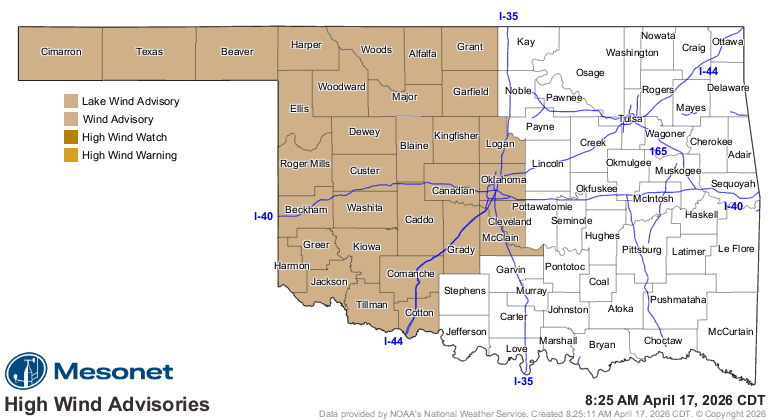
And get ready for the wind ahead of and behind the front, especially if you
were hoping for 50+ mph gusts today (weirdo!).
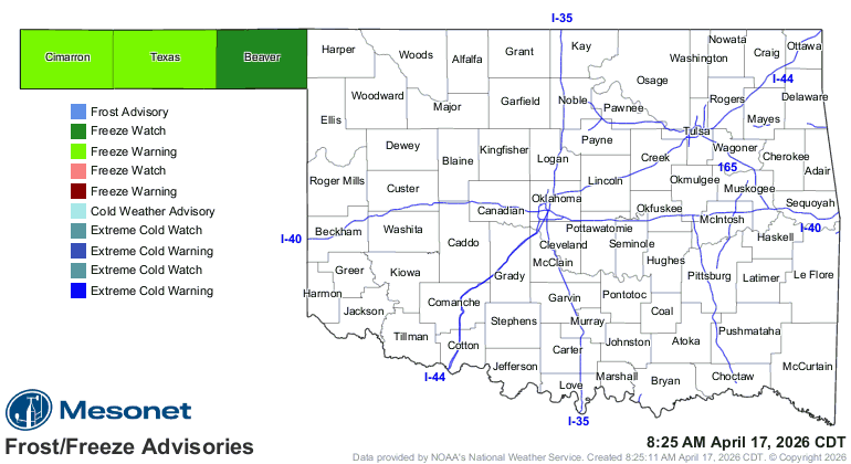
And oh (or "Oh and"), don't forget some freezing temps up in the Panhandle over
the weekend!
Everybody has some sort of risk today, from wildfires to hail to tornadoes to
severe winds. And here you thought it was going to boring!
Gary McManus
State Climatologist
Oklahoma Mesonet
Oklahoma Climate Survey
gmcmanus@ou.edu
April 17 in Mesonet History
| Record | Value | Station | Year |
|---|---|---|---|
| Maximum Temperature | 102°F | GRA2 | 2006 |
| Minimum Temperature | 22°F | BOIS | 2020 |
| Maximum Rainfall | 6.57 inches | MEDI | 2013 |
Mesonet records begin in 1994.
Search by Date
If you're a bit off, don't worry, because just like horseshoes, “almost” counts on the Ticker website!